

1. Introduction
This project examines the historical transformation of Kowloon Walled City from a Qing military outpost into a densely populated “ungoverned” enclave and, eventually, its clearance in 1993–94. The phenomenon deserves attention because it condenses wider tensions between state authority, capitalist urban development and everyday survival strategies of marginalized residents in a tiny piece of urban space. We treat Kowloon Walled City as a cultural trace: a material and symbolic outcome of how ambiguous sovereignty, refugee inflows and informal economies interacted over time. Geographically, the case is shaped by its liminal position between British Hong Kong and mainland China, chronic housing shortage and weak formal governance. Culturally, it is rooted in Chinese clan networks, triad organizations and a strong sense of belonging. Analytically, the project draws on cultural geographical concepts of place, sense of place, social norms, economy–culture relations and hegemony to link geographical context, culture and this urban enclave.
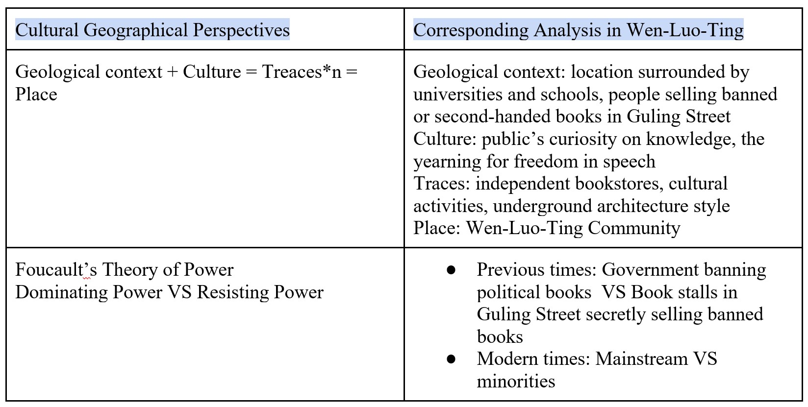
2. Cultural Geographical Perspective in Use
Geographical perspective states the rules, norms and physical features of a specific place, and cultural perspective states the common values and attitude of the people in the place. Cultural geographical perspective is an intersection of geographical and cultural perspective, accounting for both material and non-material traces. Hence, the perspective is to explain the formation of geographical features with cultural perspective, and vice versa.
“History forms social norms” is one concept to be discussed in the analysis, social norms refer to both the self-identity of individual, and common values, memories of the people in the place. History provides common memories to the society, and shows consequences of choices that have been made (Significance of History for the Educated Citizen | Public History Initiative), providing common values and responsibility to individuals.
“Economy and culture are closely related” is another concept to be discussed, when researching people's values in the place, historical economic data plays a huge role in explanation, evidenced by the poor economic conditions post WW1 induced Germans into valuing Nazism (Aftermath of World War I and the Rise of Nazism, 1918–1933 - United States Holocaust Memorial Museum).
The concept of “Three constituent parts of place” will be analyzed. It shows how a “space” can become a “place” by fulfilling location(the coordinate), locale(the environment both natural and historical) and sense of place(social connection to the place). The history of how the locale and sense of place is formed will be discussed in the following research.
The concept of “Sense of belonging” is hinted as a force of cultural purification, in which local cultures are accepted while foreign cultures are rejected.
The concept of “Dominating power and hegemony” is applied in the research. Dominating power can be government, foreign countries or community. New power tends to alter the place’s norms to create new values to stabilize their powers, as evidenced by Hitler turning German’s frustration from unemployment to Jews and other races (From Citizens to Outcasts, 1933–1938 - United States Holocaust Memorial Museum).
The history of Kowloon Walled City’s original military position forms the locale of the place and explains part of the social norms, in which the constituent parts of place explain how Kowloon Walled City becomes a place. Economic factors shape social norms, and sense of belonging shows resistance to change in norms. In which social norms explain how Walled City became a criminal haven.
3. Empirical Analysis
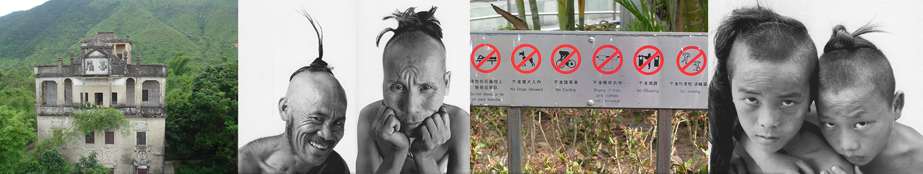
In the past, Kowloon Walled City was a densely populated, ungoverned urban area, filled with a mixture of culture and people in the area. Kowloon city was an area that is already a populated area itself. This historical place’s sovereignty is quite ambiguous with its historical treaties (Girand & Lambot, 1993), hence it creates an environment that cannot be ruled by any governing body, allowing multiple job opportunities in the grey area of the law, such as unlicensed doctors, prostitution, and even gambling (Fraser & Li, 2017). Although this seems to shine a very negative light on the area, there is another side to the city. The City’s dense population allow words to spread through the neighborhood quickly, creating a sense of order among each other in order not to be bullied by the rest of the neighbors. People in turn, created their own social law without official authorities (Sinn, 1987). If argument were to break out, situation would mostly dominated by local triads and informal networks, rather than official state power.
However, the City’s geography became a symbol of defiance. The reason for more people coming into the city and why local triad were in power is that refugees, migrants, and those seeking to escape the reach of formal law seek shelter in the Walled city due to it being an ‘ungoverned’ part of Hong Kong (Wesley-Smith, 1973). People with a degree of knowledge, skill, or capital can easily set up their business as it is still an easily accessible part of Hong Kong. Due to the convenience in location, materials can easily be transported into the area and there is also populated area outside the walled city. People with less resource then tends to join local triads in order to make a quick living (ALSuwaidi et al., 2024).
Another geographical factor of why Kowloon walled city has such diverse culture is that Hong Kong is near China. Back in the civil wars days, many Chinese people flee to Hong Kong in order to escape the war between the Nationalist party and the Communist party (Fraser & Li, 2017). However, as Hong Kong has law with refugees and officials doesn’t take in people unlimitedly, people started smuggling into Hong Kong. As smugglers are illegal immigrants, they need the shelter from Kowloon Walled City in order to stay in Hong Kong, away from the war in mainland.
The triads’ control over gambling, prostitution, and protection rackets, whereas family or clans will take up a more usual day to day aspects of the economy such as food and retailing, creating Kowloon Walled City’s own underworld culture.
As there was overcrowding and lack of infrastructure. Residents built and modified their homes with little regard for official regulations, creating a unique architectural landscape. This grassroots urbanism reflected a collective resistance to external control and a pragmatic approach to daily life, creating the culture of grassroots urbanism in an unique area of the vibrant and modern Hong Kong (Wesley-Smith, 1973).
Situated within Hong Kong but distinct from its regulated urban environment, the Walled City developed a hybrid identity. Residents navigated between Chinese traditions and the cosmopolitan influences of Hong Kong, resulting in a cultural blend that shaped local norms, values, and attitudes toward authority. This hybrid identity culture gives the residents a deeper sense of belonging to their turf and therefore they were often very strong and united against external powers trying to use their city as a place for external use.
The most obvious issue was the mess of no official control. Fraser & Li (2017) said those unofficial businesses ran wild: some people set up “clinics” without being real doctors, and houses were built however people wanted—some had three floors stacked on top of a tiny shop, with no windows or fire exits. It was a world away from Hong Kong’s clean, regulated streets, and it put people in real danger. There were also fights over power: the rules from clans and triads often clashed with the Hong Kong government’s orders. Worse, most people there were left out of Hong Kong’s basic help—they couldn’t go to public hospitals for cheap or send their kids to regular schools, which made the gap between them and other Hong Kong residents even bigger.
These problems finally made things shift. Between 1993 and 1994, the government tore down the Walled City. It was a clear sign that a “place with no rules” just couldn’t exist in a modern city—so the area started following official laws, with proper houses and shops built later. But something else changed too: people stopped seeing the Walled City as just a “bad spot.” Its jumbled, self-built houses and the way neighbors stuck together became part of Hong Kong’s history. That mix of Chinese traditions and Hong Kong culture even showed how diverse Hong Kong really was. It also made people think differently about managing cities—clans and triads had kept a crowded community from falling apart, which made officials realize that local groups could help too. Later, when building new neighborhoods, some officials asked residents to join in planning—something they might not have thought of without the Walled City’s example.
4. Conclusion
This project shows that Kowloon Walled City was a cultural trace of the interaction between a liminal geopolitical position, refugee-driven urban pressure and Chinese cultural institutions such as clans and triads. Using a cultural geographical perspective on place, sense of place, social norms and hegemony allows us to link its extreme built form and informal economy to deeper histories of ambiguous sovereignty, housing scarcity and grassroots self-governance. The concepts of “history forms social norms” and “economy–culture relations” are particularly useful for explaining why the City became both a criminal haven and a tightly knit community. However, they need to be complemented by attention to state power and demolition policies to capture later transformations. Our findings suggest that contemporary urban policy should recognize local networks as potential partners in governance while avoiding the neglect and exclusion that produced such extreme environments in the first place.
References
Aftermath of World War I and the Rise of Nazism, 1918–1933 - United States Holocaust Memorial Museum. (n.d.). https://www.ushmm.org/learn/holocaust/aftermath-of-world-war-i-and-the-rise-of-nazism-1918-1933
From Citizens to Outcasts, 1933–1938 - United States Holocaust Memorial Museum. (n.d.). https://www.ushmm.org/learn/holocaust/from-citizens-to-outcasts-1933-1938
Fraser, A. & Li, M. (2017). Underworld and Order: The Social Ecology of Kowloon Walled City. Hong Kong University Press. https://www.hkupress.org/
Girand, P. & Lambot, J. (1993). Sovereignty Ambiguity in Historical Treaties: The Case of Kowloon Walled City. Journal of Hong Kong Studies, 8(2), 45-62. https://www.jhks.hku.hk/
Significance of History for the Educated Citizen | Public History Initiative. (n.d.). Public History Initiative. https://phi.history.ucla.edu/nchs/preface/significance-history-educated-citizen/
Sinn, E. (1987). Informal Governance in Unregulated Zones: Clans and Triads in Kowloon Walled City. Modern China, 13(3), 321-340. https://journals.sagepub.com/home/mcx
Wesley-Smith, P. (1973). Refugees and the "Ungoverned Zone": Kowloon Walled City 1949-1970. Bulletin of Concerned Asian Scholars, 5(4), 38-45.http://onlinebooks.library.upenn.edu/webbin/serial?id=bcas
1. Introduction
The Historic Centre of Macao, as one of the oldest and largest existing architectural complexes in China that blends Eastern and Western cultures, offers a unique subject of study for exploring colonial history and culture through its continuously evolving spatial form and cultural landscape. The Historic Centre of Macao embodies the dynamic balance achieved by East Asian and European civilizations through spatial practices over four centuries. If this area is viewed as a cultural trace, its street layout, the juxtaposition of religious buildings, and the forms of residential architecture are texts reflecting the mutual permeation of Eastern and Western aesthetic concepts, power relations, and daily life. The formation of cultural traces is influenced by Macao's unique geographical location, the governance model during the colonial period, and the socio-economic structure shaped by trade. Following its 1999 return to China, this cultural landscape has entered a new phase. Its preservation is now framed within a national narrative of "One Country, Two Systems," Macao's ongoing role as a global cultural bridge within a unified China.
This article seeks to underline the political forces that have shaped Macau’s landscape, focusing on the Historic Centre of Macau and its gambling industry, and covers the Portuguese colonial authorities, the Chinese central government and the government of Macau SAR.
2. Cultural Geographical Perspective in Use
According to the theory of representation of space by Lefebvre, power holders, such as the government, would create places. (Lefebvre, 1974/1991) For example, in the case of Portuguese Macau, colonial government’s policies shaped Macau into a town of divine presence and worldly temptation at the same space. Also, the theory of spatial practice stated the actual use of space reflect the social structure and the pattern of daily life. In Macau, the gambling industry and the heritages created huge employment and routines, and numerous hotel casinos were established, generating substantial revenue for the government which affected the social structure and pattern of Macau heavily, this can clearly explain the theory.
3. Empirical Analysis
Portuguese Macau: Divine Presence and Worldly Temptation
The history of the Historic Centre of Macau can be traced back to the period of Portuguese rule. During the Portuguese colonial era, Macau’s urban area had a strong Catholic atmosphere; however, Macau’s gambling industry also began during this period. Therefore, a curious phenomenon of the coexistence of the sacred and the secular occurred in Macau.
Firstly, Macau was a town with strong Catholic atmosphere. In today’s Historic Centre of Macau, Igreja de Santo António, Igreja de Santo Agostinho and Seminário e Igreja de São José are still cultural heritage sites. As Portugal was a traditionally catholic nation, her colonial empire also centered around the Catholic Church, which could explain the many Catholic institutions present in Macau. In fact, the town itself was closely associated with missionary activities. Matteo Ricci and Robert Morrison also came to Macau to spread the Christian religion. As a result, Macau was praised as “Cidade do Santo Nome de Deus de Macau, Não Há Outra Mais Leal,” which can be translated as “City of the Holy Name of God of Macau, there is none more Loyal.” (胡鸝藻與許貝文,2023,頁68)Therefore, Macau has strong connections with Catholicism and the Christian religion, even God Himself.
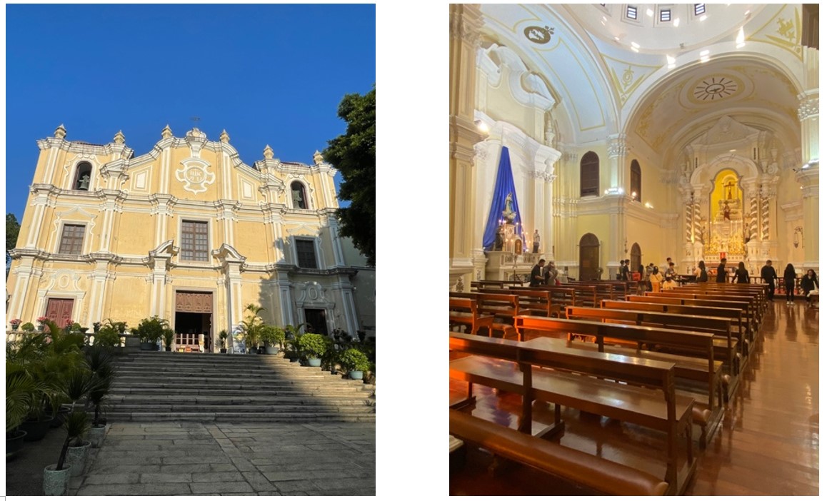
Figure 1: Seminário e Igreja de São José (Filmed by the author, 22/11)
Nevertheless, Macau is also known for its gambling industry. In 1847, the Portuguese colonial authorities legalized gambling. In 1864, the government even officially promoted and taxed the industry. These measures greatly fostered Macau’s gambling industry as well as significantly increased government revenue. In the 1870s, there were around 200 gambling houses in the town. As aforementioned, Portugal was a Catholic nation and she would have reservations about, even discourage the gambling industry. In fact, the Portuguese government herself banned gambling in 1896. However, interestingly, Macau did not follow suit and granted patent to the gambling house. The reason behind was most likely that the industry produced great revenue for the colonial government and boosted the economy. In 1911, the Portuguese governor acknowledged that without gambling industry, Macau would be in a serious crisis. From 1937, taxes from gambling house became the largest source of revenue for the colonial authorities. Moreover, in 1961, the Portuguese government decreed that Macau was a tourist site and granted special permission to the gambling industry. From that time on, gambling industry in Macau was completely legalized and acknowledged by the metropolitan Portuguese authorities.(徐永勝,2000)As a result of these historical developments, Macau became a town of worldly temptation, “The Monte Carlo of the East”.
Political forces significantly shaped the town landscape of Portuguese Macau. Portugal was a Catholic nation, and they built churches and monasteries in the town. As a result, there is a religious aura in Macau even until now. However, by the 19th century, as the colonial government’s needs for revenue grew, Macau started to develop its gambling industry, turning the town into a worldly temptation for people around the world. Therefore, political forces shaped Macau into a curious mixture of a divine and worldly town at the same time.
Chinese Communist party (CCP) in Macau: political and economic forces
In terms of heritage culture in Macau, these areas being used after handover to China. The central government has redefined Macao's cultural role, emphasizing its role as part of Chinese culture and positioning it as "an important window for the exchange and mutual learning between Chinese and Western civilizations". Beijing tried to be diminishing local characteristics. Senior cultural workers have pointed out that Macao's unique Chinese and Western cultural characteristics have not been valued or maintained since the handover of sovereignty and are being weakened. As usual, official discourse emphasizes that Chinese culture is the lifeblood of Macao and promotes Chinese culture through various cultural activities and education to counteract the cultural influence left over from the colonial period. Macau's education authorities are actively utilizing spaces in the Historic Centre to promote patriotic education. The Macau Museum, under the Cultural Affairs Bureau, has launched guided cultural tours in the Historic Centre to deepen public understanding of Macau's modern history and culture and cultivate patriotism. Nowadays, government encourage teachers to use the Historic Centre as a teaching resource to inspire their patriotism and national pride. It is clearly aimed to serve the ideology of the Chinese nation and to downplay the colonial history.
Macao SAR Government: Polices that created the appearance of two different culture
In 2001, the SAR government enacted Law No. 16/2001, which liberalized the gaming industry. It aligned with the Macau SAR government's policy direction of "establishing the tourism and gaming industry as the leading sector, with the service industry as the main body, and promoting the coordinated development of other industries. " Under the influence of this policy, Macau gradually developed its image as a "gaming city." During this period, underground industries such as prostitution and drugs also rapidly expanded, transforming Macau into a city of extravagance and decadence. Macau is a city of desires and lavish indulgence. Beneath its dazzling exterior, it is often a place that leads people astray, where one can easily find themselves trapped in dire circumstances.(自由時報 劉慶侯/特別報道 2005)
At the same time, the Macau government has also been committed to transforming Macau into a diversified leisure and tourism city. In 2005, the Historic Centre of Macau was officially inscribed on the UNESCO World Heritage List. Furthermore, in 2014, the Macau government passed the "Cultural Heritage Protection Law" to preserve historically significant buildings and sites, such as the Ruins of St. Paul's, A-Ma Temple. These cultural heritage sites embody the religious and architectural characteristics of both Eastern and Western cultures. Macau attracts numerous tourists with its streetscapes reflecting cultural integration, thereby forming the unique cultural landscape seen in Macau today.
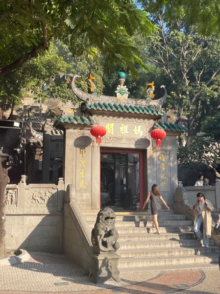
Figure 2: A-Ma Temple (Filmed by author 23/11)
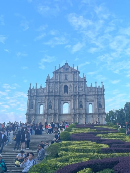
Figure 3: The Ruins of St. Paul's (Filmed by author 23/11)
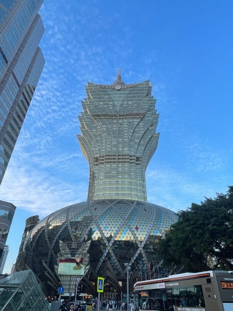
Figure 4: Casino Grand Lisboa (Filmed by author 23/11)
Macau's culture is both historical and unique, serving as a model of the fusion and interaction between Chinese and Western cultures. Cultural endeavors in Macau are primarily privately run. Its distinctive blend of Chinese and Western cultures is unparalleled worldwide(錢朝陽, 孫金灧 上海大學學報: 社會科學版, 15-20, 1999).
In recent years, as the government plans to promote diversified development, reduce dependence on the gaming industry, and build a cultural capital, the Macau government has vigorously promoted the cultural and creative industries and preserved the historic district to cultivate Macau's image as a city of diverse cultures. This shift in development direction has allowed Macau to simultaneously embody the luxury of a gaming city and the cultural ambiance of history.
4. Conclusion
This report demonstrates how a cultural geographical perspective reveals the profound links between political power, economic context, and cultural formation in Macau's urban landscape. By applying Lefebvre's theory of the "representation of space," the analysis illuminates how the dominant power holder (CCP), strategically produced a space that simultaneously embodied nationalism and worldly temptation. This was not a spontaneous cultural development but a calculated spatial strategy to reconcile Chinese identity with fiscal necessity. The resulting coexistence of churches and gambling houses is a direct cultural trace of this colonial logic. Following the 1999 return to China, this dynamic has persisted and intensified, with the gambling industry's expansion now framed within a new nationalistic context of economic contribution to the CCP. To manage this unique heritage, policy should focus on zoning regulations to protect the sanctity of religious sites from commercial encroachment and promote critical heritage education that interprets this juxtaposition not as a contradiction, but as an authentic narrative of Macau's complex historical geography. We can see how the power holder constructed a space in Macau by using urbanisation and heritage interpretation.
References
胡鸝藻與許貝文(2023)。見證澳門 : 22個故事,澳門歷史城區地標為你娓娓道來。澳門:澳門人出版有限公司
徐永勝(2000)。澳門經濟概論。澳門:澳門基金會/虛擬圖書館電子出版。https://www.macaudata.mo/macaubook/ebook006/html/index.htm
澳門博彩監察協調局。https://www.dicj.gov.mo/web/cn/history/index.html
劉慶侯 (2005年4月18日)。〈澳門,賭色的慾望城市> 。《自由時報》。取自https://news.ltn.com.tw/amp/news/society/paper/11881
澳門特別行政區政府旅遊局。https://www.macaotourism.gov.mo/zh-hant/sightseeing/macao-world-heritage
田中泓 (2025年7月27日)。〈十年立法波折重重〉。《澳門日報》。取自https://www.macaodaily.com/html/2025-07/27/content_1847454.htm
錢朝陽與孫金灧(1999)。〈不是 “沙漠” 是 “绿洲”——漫谈澳门文化〉。《上海大學學報》: 社會科學版, 15-20
Lefebvre, H. (1991). The production of space (D. N. Smith, Trans.). B. Blackwell. (Original work published 1974)
Retrieved from https://www.gov.mo/zh-hant/news/1067709/
Sheng, E. L., Zhang, A., &Yin, Y. (2023). A city profile of Macau—the rise and fall of a casino city. Cities, 140, 104431.
1. Introduction
This project explores how Mei Ho House, the last remaining “Mark I” building was preserved and revitalized under “Partnership Scheme”. It would briefly introduce the reasons for the preservation and conversion of purpose after the revitalisation project. Some concepts from Cultural Geography would be discussed and applied to the case of Mei Ho House, trying to understand how the preservation would contribute to the preservation to the spirit of Hongkongers. We hope the case study would be the best way to comprehend the revitalisation project and thus promote the approach to another declared monument.
2. Cultural Geographical Perspective in Use
Drawing from Anderson’s framework (2021), a cultural geographical perspective investigates how places are dynamically ordered and given meaning through the ongoing composition of material and symbolic traces. The “material traces” are the tangible elements – the architecture of a building, or the functions of the place. Meanwhile, the “symbolic traces” are the intangible layers – the stories told about a place, the values it represents, the memories it holds. The coexistence between these two traces gives a place of meaning. It focuses on the interplay of power, memory, and identity in transforming a physical space into a meaningful place. This perspective examines how landscapes become culturally significant to a community where successive layers of cultural meaning are inscribed, erased, and reinterpreted through social practices and power relations.
Mei Ho House, originally constructed as an urgent response to the Shek Kip Mei fire in 1953, providing shelter for more than 50,000 refugees who once inhabited in the squatter, underwent revitalization and re-opened to public as YHA Mei Ho House Youth Hostel and Museum in 2013. This transformation actively constructs what Anderson (2021) described as “sense of place” by symbolically linking the building to cultural significance. As traces of resilience and community are reflected in times of adversity, Mei Ho House mirrors the Lion Rock Spirit (獅子山精神) and the Hong Kong identity. In Michel Foucault’s concept of power/knowledge, Mei Ho House represents “truth” as the “origin of Hong Kong public housing” and the symbol of “community spirit”. The conversion of the building into a museum and youth hostel is an act of governmentality and disciplinary technology, where the public is subtly disciplined to embrace the collective identity. This reflects Foucault’s idea of power as productive – it creates a place of public memories to foster social cohesion. In a nutshell, this project would apply the cultural geographical perspective by drawing several core concepts for its empirical analysis.
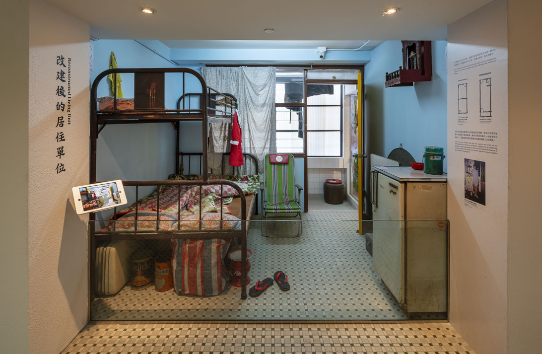
Picture 1 Demonstration of Mei Ho House flat in “Mei Ho House of Livelihood” (Time Out)
3. Empirical Analysis
Site Analysis
In 2004, Hong Kong Government has introduced a social public–private partnership named “Revitalising Historic Buildings Through Partnership Scheme”. NGOs were invited to submit proposals and become the service provider. The successful application required the service provider to engage resources on revival and maintenance work. Mei Ho House, the only remaining Mark I resettlement blocks, was the one listed on the first batch in the Scheme (Cheung & Chan, 2014).
Mei Ho House was one of the resettlement blocks after the Shek Kip Mei Fire. And the public estate building marks the origin of the Hong Kong public housing and was listed as Grade II historic buildings in Hong Kong in 2010 and proposed to revitalize the site into Youth Hostel (Antiquities and Monuments Office, 2010).
Under
the “Revitalising Historic Buildings
Through Partnership Scheme”, HKYHA tried to establish the significance and
preserve the site with new function, the association at last decide to keep the original use of it – to become a hostel,
which is like what it was.
Mei Ho House is now converted and renovated into 129 rooms for backpackers and solo travellers; the shared room would welcome everyone in the community (HKYHA, n.d.). Moreover, the Hostel remains its function from past to present: Communal place is offered for people to interact around the world. In the past, the bonding and the social connection in the community was strong. The Hostel aims to restore the tradition and the spirit of old Hong Kong.
Furthermore, part of Mei Ho House would be converted into a mini museum called “Mei Ho House of Livelihood”, aiming to promote the history and the neighborhood culture of the estate (HKYHA, 2020).
The idea of setting up the museum and preserving the building is highly related to the “The Sense of Place”, which is defined by Agnew and Duncan in 1989. The idea is that human, culture and environment are connected as network and how space becomes place (Agnew & Duncan, 2014, pp. 174–176). Mei Ho House symbolized the origin of public housing for refuges and squatter, and the sense of community: The residents pull together in times of trouble and support each other, which is the Lion Rock Spirit. The project preserved the collective memory, reminding the visitors how society and became “the witness of the housing development, a living archive of the community spirit and the history behind it, which Anderson (2021) has mentioned as a trace to ‘express collective will and collective thought’.
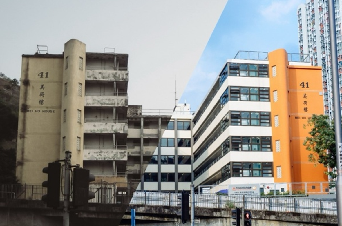
Picture 2 Mei Ho House before and after. (HKYHA)
Different Stakeholder Involved
There were different stakeholders
involved in Mei Ho House renewal, under revitalising historic buildings through
partnership scheme besides the government who mainly provided the financial
support, promoted public participation in the protection of historical
buildings, and guidelines for the project (Development Bureau, 2025), the
community and NGOs were also critical for the project.
First, the NGOs- Hong Kong Youth
Hostels Association (HKYHA) was being chosen by the Advisory Committee on
Revitalization of Historic Buildings (ACRHB) for providing service for the Mei Ho
House in 2009 (Lam et al., 2022). It also responsible for future maintenance,
engaged consultants ‘(including architects, structural engineers, building
services engineers, quantity surveyors and heritage conservation consultants)
to undertake tender assessment, contract administration and site supervision of
the project’ (Legislative Council, 2010).
Next, for the community, generally
members in Sham Shui Po District Council, Legislative Council and Antiquities
Advisory Boardon supported the projects (Legislative Council, 2010). Hong Kong
Housing Authority (n.d.) have mentioned that sustainable housing development
cannot be achieved without the participation and support of residents in our
estates and district councils. To solicit public opinion and explore how to
revitalize the building and better serve the community, the Hong Kong
Development Bureau held a competition for various professional organizations
(Hong Kong Housing Authority, n.d.).
Moreover, Chinney Construction Co. Ltd. was commissioned to transform the Mei Ho House. They preserved as many original historical elements as possible, such as metal grilles, metal doors, and kitchen countertops. Their effort for trying the best to preserve the historical value in Mei Ho House was recognized by the Chartered Institute of Building (Chinney Construction Co. Ltd., 2025).
4. ConclusionTo conclude, the “Partnership Scheme” would be the best way to preserve the building itself and the value behind it. From a cultural geographical perspective, Mei Ho House powerfully illustrates the interplay of material and symbolic traces. The preservation stands as tangible witnesses to the community, reaffirming the Lion Rock Spirit. Through subtle mechanisms of memory-making, the site reinforces a collective narrative of community and endurance. The project would be the way to explain the idea of sense of place. The renovated public estate building is the epitome of old Hong Kong, showing how they were striving in the society. Its success strongly advocates extending the “Partnership Scheme” to other monuments, ensuring that Hong Kong’s shared stories continue to resonate with present and future generations.
References
Agnew, J., & Duncan, J. (Eds.). (2014). The Power of Place (RLE Social & Cultural Geography) (pp. 174–176). Routledge. https://doi.org/10.4324/9781315848617
Anderson, J. (2021). Understanding cultural geography: Places and traces (3rd ed.). Routledge. https://doi.org/10.4324/9780367814816
Antiquities and Monuments Office. (2010). Revitalisating Historic Buildings Through Partnership Scheme Batch I Project Conservation Management Plan prepared for Heritage Impact Assessment for Adaptive Re-use of Mei Ho House as Youth Hostel Conservation Management Plan Content. https://www.amo.gov.hk/filemanager/amo/common/form/MHH-HIA.pdf
Cheung, E., & Chan, A. P. C. (2014). Revitalizing Historic Buildings through a Partnership Scheme: Innovative Form of Social Public–Private Partnership. Journal of Urban Planning and Development, 140(1), 04013005. https://doi.org/10.1061/(ASCE)UP.1943-5444.0000161
Chinney Construction Co. Ltd. (2025). PROJECTS-REVITALISATION OF ME HO HOUSE-SHEK KIP MEI. https://www.chinneyconstruction.com.hk/mei-ho-house/
Development Bureua. (2025). The Government of the Hong Kong Special Administrative Region.https://www.devb.gov.hk/filemanager/tc/content_85/Annex_3.pdf
HKYHA. (n.d.). Background Information - Mei Ho House Revitalisation Project. YHA – Hong Kong Youth Hostels Association. https://www.yha.org.hk/en/our-services/mei-ho-house-revitalisation-project/significance-and-design/
HKYHA. (2020). Heritage of Mei Ho House - YHA – Hong Kong Youth Hostels Association. YHA – Hong Kong Youth Hostels Association. https://www.yha.org.hk/en/our-services/mei-ho-house-revitalisation-project/heritage-mei-ho-house/
Hong Kong Housing Authority. (n.d.). STAKERHOLDER ENGAGEMENT. https://www.housingauthority.gov.hk/hdw/en/aboutus/publications/ehs0708/stakeholder01.html
Lam, E. W. M., Zhang, F., & Ho, J. K. C. (2022). Effectiveness and Advancements of Heritage Revitalizations on Community Planning: Case Studies in Hong Kong. Buildings, 12(8), 1065. https://doi.org/10.3390/buildings12081065
Legislative Council. (2010). 7QW–Revitalisation Scheme–Revitalisation of Mei Ho House as City Hostel. https://www.legco.gov.hk/yr0910/english/fc/pwsc/papers/p10-10e.pdf
1. Introduction
Tai O is located on the northwest coast of Lantau Island, at the mouth of the Pearl River. A natural bay provides a protective barrier for the local ecosystem. The intertidal wetlands and abundant marine resources have nurtured unique stilt houses, water village imagery, and the cultural brand of "the Venice of the East" (Tai O Fishing Village, n.d.).
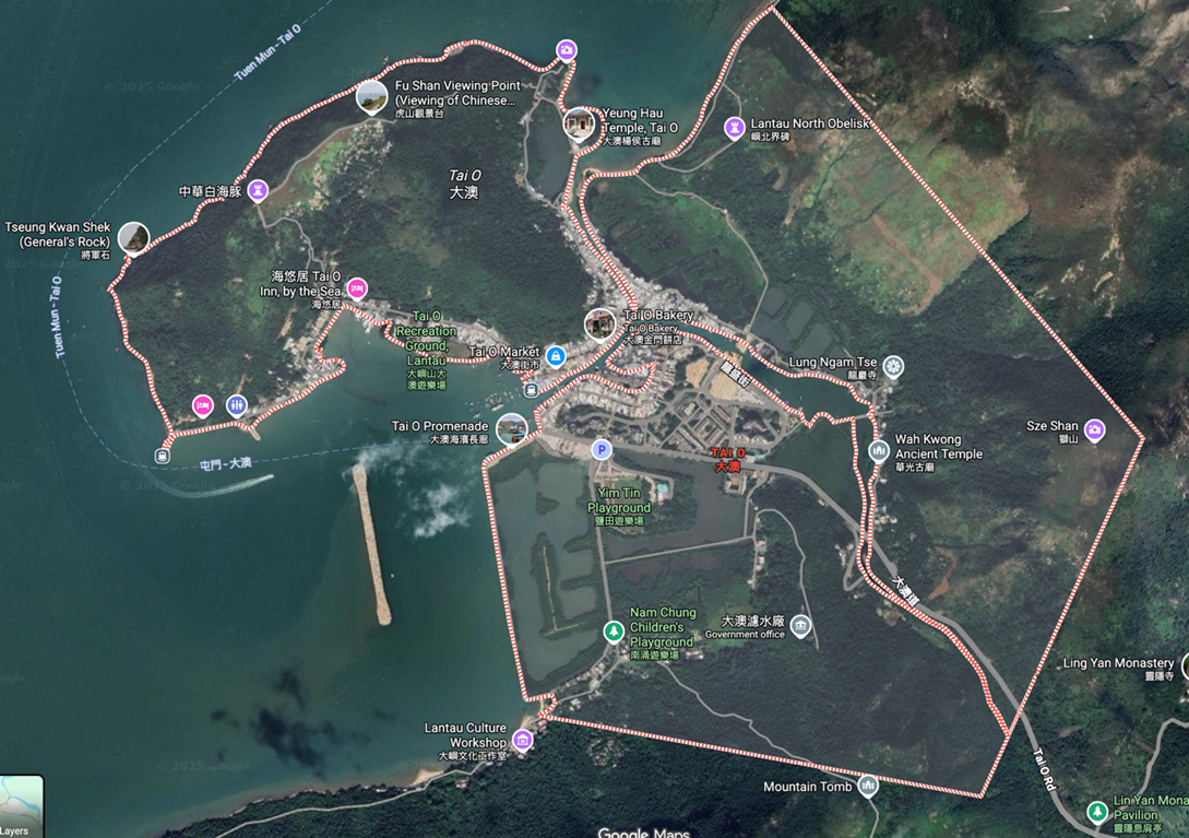
Figure
1: Map of Tai O (Sources: Google map)
Best known as one of the existing fishing villages in Hong Kong, Tai O’s history can be traced back to 800 years ago. It was the home of the Tanka people, one of the earliest groups to emigrate to Hong Kong. The population was around 10,000 in the early 20th century. Yet, the number has been dropping since then (Mak, 2011).
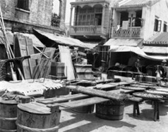
Figure 2: 1930s Tai O (Source: Gwulo)
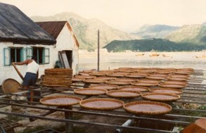
Figure 3: 1981 Drying shrimps (Source: Andrew Suddaby)
The
residents earned for a living by mostly fishing and salt farming, others worked
in the fields of agriculture and trading (Kwan & Tam, 2021).

Figure 4: 1981 Stilt warehouses (Source: Andrew Suddaby)
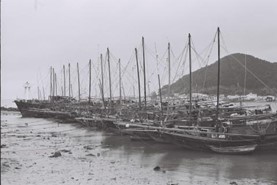
Figure 5: 1978 Fishing craft at anchor (Source: gordonvr)
2. Cultural Geographical Perspective in Use
Research Question
How does tourism development and power affect the
spatial triad and shape Tai O’s cultural landscape from a fishing village to a
tourist hotspot?
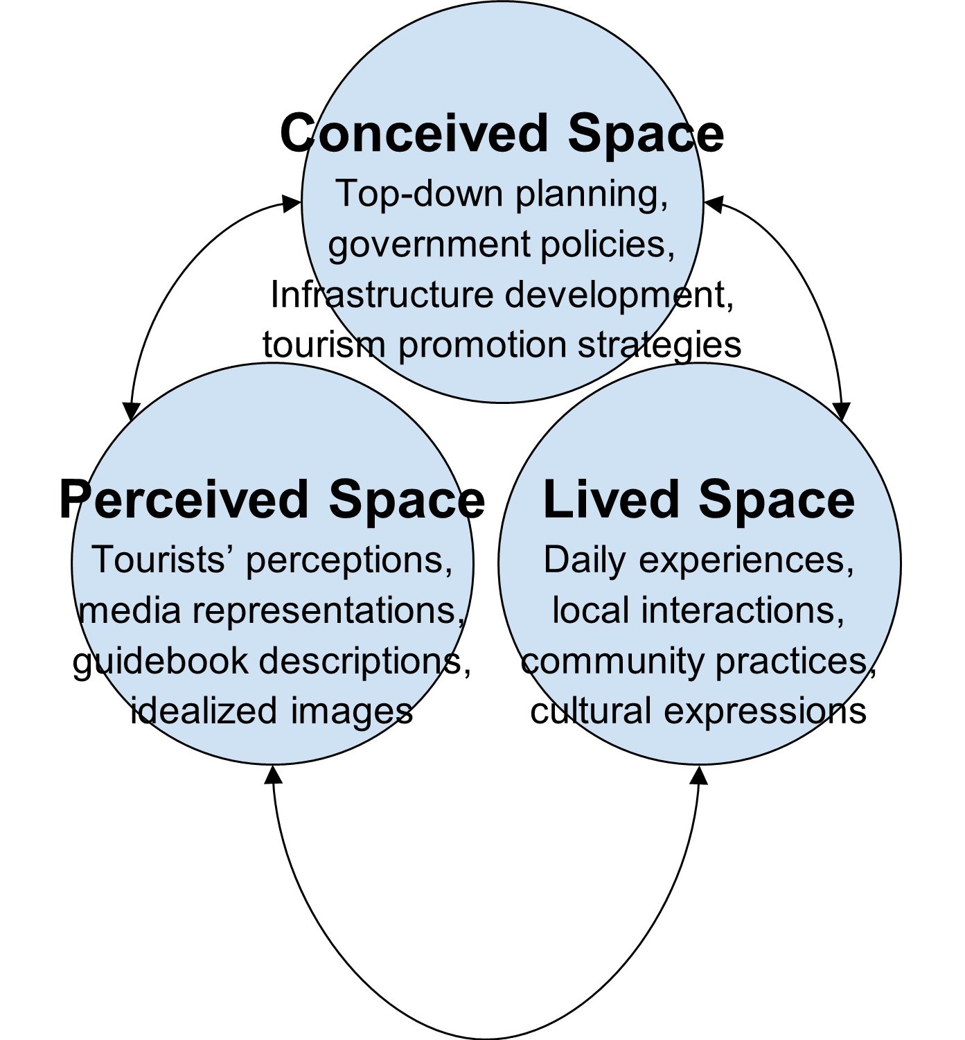
Figure 6: Conceptual framework
In this
study, Henri Lefebvre’s spatial triad is employed to analyze how tourism
development transforms Tai O’s cultural landscape from a functional fishing
village to a commodified tourist site. The triad includes: conceived space
which covers top-down planning and tourism strategies, perceived space that
includes tourists’ perceptions and media image, and lived space which focuses
on local interactions and cultural expressions(Lefebvre, 1991). The arrows show
how these 3 aspects affect each other .
In Foucault‘s power, everyone has the capacity to act, the power is not repressive, instead it is productive. Power is the relationship between people when they act on the actions of others (Lynch, 2011). The power structure is absent in society. But for the Political economy theory, power is a tool for ruling the state, and also a means of violence and coercion by the ruling class to carry out exploitation and oppression. In this project, we are combining both theories:
Within the power structure, individuals also seek to consolidate their own power simultaneously.
This is to explain the power struggle between the government and tourism agencies on the one hand and Tai O residents on the other hand in the process of turning Tai O from a fishing village to a tourist spot.
Another approach is the Lefebvre’s Spatial Triad. We are using the concepts of spaces to show how they influence one another, and most importantly, they explain why Tai O is not merely a fishing village or a tourist spot, but a socially produced space (Lefebvre, 1991).
3. Empirical Analysis
Conceived Space: How did the government turn Tai O to a tourist spot?
Turning Tai O from a fishing village to a tourist spot, the government implemented some projects, with the primary aim of alleviating traffic congestion and enhancing tourism capacity. These plannings of the use of Tai O’s space are categorized as the conceived space in the spatial triad, in which power is primarily exercised through top-level government planning and brand narratives of “Venice of the East” by tourism agencies. One consideration is that this power dynamic manifests where the government and large tourism stakeholders dominate resource allocation and spatial transformation, while local residents passively accept policy outcomes (South Development and Sustainable Lantau Office - Improvement Works at Tai O, n.d.).
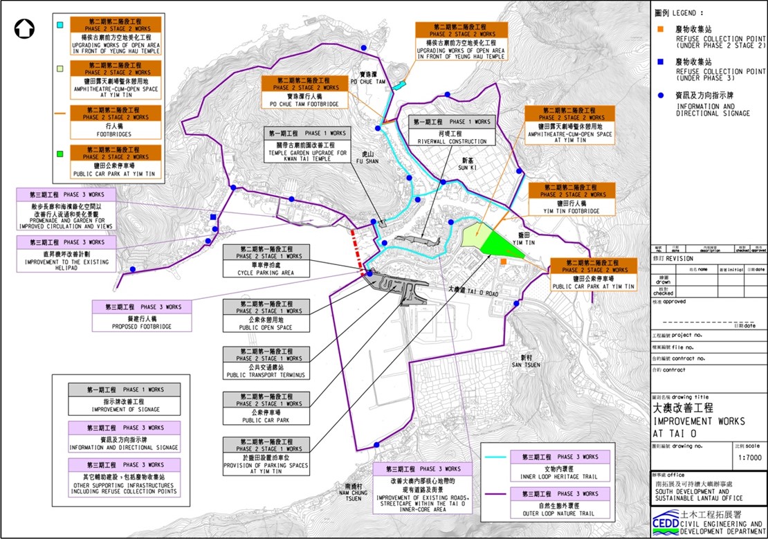
Figure 7 : Improvement Works at Tai O – Project Scope (Source: Civil engineering and Development Department)
To begin with, it is vital to understand the role of the government throughout the transformation of Tai O. Research indicated that the government exercised absolute power over the definition and allocation of spatial resources by designating conservation areas and implementing the “Tai O Improvements Project” in phases, including bridge construction, transportation improvements (South Development and Sustainable Lantus Office, n.d.). While this aims to protect cultural and natural heritage, it also fundamentally restricts residents’ autonomy in land use and reinforces the dominant position of national administrative agencies in the allocation of spatial resources (Du Cros & Lee, 2007).
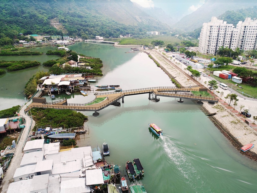
Figure 8: Artist Impression – Proposed Footbridge at Yim Tin
(Source: Civil engineering and Development Department)
Secondly, how does this dominant power shape the conceived space of “Venice of the East” (Leung et al, 2021)? From our observation, the more productive power is reflected in the branding of “Venice of the East”. The government and tourism-organizations have redefined Tai O from a functional fishing village into a tourist attraction, offering exotic experiences for consumption. This government wields decision-making authority (top-down), which produces a new spatial reality and tourist expectations, laying the foundation for subsequent commercialization and the spatial practices in living space. For example, they have proposed the phased implementation of the “Tai O Improvement Works”, including elements like bridge construction, traffic enhancements, and additional parking facilities, to meet the demands of increased visitor traffic.
This conceived space from the top level profoundly reshapes the daily practices (lived space) and perceptions of residents and tourists (perceived space) in Tai O, thus entering our next analytical dimension—lived space.
Lived Space: What tensions arise for Tai O residents as tourism transforms both livelihoods and cultural heritage?
In Lefebvre’s spatial triad, lived space constitutes the experiential and symbolic dimension where inhabitants imbue the environment with personal and collective meanings, often resisting dominant conceptions through imaginative overlays and embodied practices (Lefebvre, 1991). In Tai O, this manifests as a palimpsest of traces—layered inscriptions of Tanka heritage and adaptive identities—that emerge dialectically amid the village’s transformation from a fishing enclave to a tourist site. For instance, residents imbue spaces like stilt houses with nostalgic traces of nomadic livelihoods, linking daily rhythms to ancestral adaptability (Kwan & Tam, 2021). Temples of Guan Yu and Tin Hau, traditional festivals like dragon boat races are not only tourist attractions but also spiritual value to the residents which carries community unity and maritime worldview, maintaining oral history and traditional rituals (Ma, 2015).
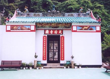
Figure 9: Tai O San Tsuen Tin Hau Temple (Source: Home Affairs Department)
However, when these elements are incorporated into tourism promotion by the government to maintain attractiveness, it objectively contributes to the preservation of cultural heritage, but its intrinsic meaning faces the risk of being hollowed out. For example, privately owned stilt houses are converted into guesthouses, residents’ privacy and daily rhythms (lived space) are forced to give way to the gaze and experience of tourists (perceived space of tourists). Another example is the symbolic meaning of the Sun Ki Bridge, a profound imprint of community agency, which is also facing challenges with tourism. This bridge was built with funds raised by residents using traditional “Kun Dian” wooden pillars, which carries the collective memory of solidarity and symbolizes resistance against bureaucratic neglect (Wan & Chan, 2017). However, its primary function has now shifted to serving tourists, diluting its former symbolic meaning as a source of community pride. This transformation has introduced noise and pollution to Tai O, and created a complex emotional dissonance among residents. The autonomy of residents and their living space are being eroded by tourist spaces which led to residents’ emotional dissonance and discomfort.
Although some residents express opposing reactions, there is pragmatic acceptance of changes like stilt house repurposing for homestays, which disrupts privacy but sustains livelihoods, highlighting affective dissonances in lived space (Wan & Chan, 2013). Therefore, we would like to say that Tai O’s “lived space” is like a rewritten book, covered with the new strokes of tourism commercialization, while stubbornly preserving and constantly reproducing the ancient inscriptions of ethnic identity and community memory, forming a dynamic and tense field of resistance.
Perceived Space: How do locals and tourists differently construct meaning and attachment to Tai O’s space?
The blueprint for “conceived space” inevitably reshapes the “perceived space” of residents and tourists - their daily activities and economic practices (Lefebvre, 1991).
In responding to tourism demands, residents’ traditional livelihood strategies have undergone profound transformations: backyard shrimp paste marketing has become street performances, and fishing skills have been packaged as paid experiences (Elkin et al., 2021). This confirms the productive nature of power, it produces new behavioral patterns and economic relations by connecting modern identities to traditional fishing economies (Ma, 2015).
Figure 10: Residents teaching how to make fishing net (Source: Tai O Travel eFun)
Also, tourism yields economic revitalization, such as income from boat tours and dried seafood markets. It poses environmental threats like waterway pollution from increased boat traffic and waste, eroding ecological traces tied to traditional practices. However, this is not a one-way domination. Under the challenges, the residents demonstrate the agency emphasized by Foucault, actively transforming their life skills and cultural knowledge into economic capital. This provides a chance to fight for their livelihood and voice within this power structure, demonstrating the dialectical nature of power dynamics and the idea that individuals have their own power rather than remaining passive (Lynch, 2011).
For the tourists, before the intervention of power, tourists’ perception of Tai O remained superficial-static images of stilt houses and fishing boats captured on cameras due to the relatively closed cultural environment of Tai O. After the power dynamic reshapes the sensory experience in Lefebvre’s spatial triad, tourists shift from purely visual consumption to multi-sensory engagement (Ma, 2015). For instance, the tactile act of making shrimp patties over charcoal evokes the sense of smell while the kinesthetic learning of weaving fishing nets enables visitors to physically enter the fishing village waterways which were previously accessible only from afar, and to experience Tai O from the perspective of the locals while on a swaying boat.
All these new commercial
interactions create entirely new ways of perceiving place. This transforms
still photography into dynamic, immersive experiences, enhancing their
imagination and understanding of “life on the water”. This process raises
emotional resonance, cultural identity, and even an attachment to memories.
Through the analysis of the Lefebvre’s triad, this study shows that conceived space drives branding and infrastructure; perceived space adapts routines for economic survival; lived space resists via symbolic heritage. This interplay writes the complex narrative of Tai O’s transformation from a fishing village to a tourist attraction, yields benefits like preservation but tensions in identity and sustainability. Future policies should enhance community participation for equitable transformation.
References
Du Cros, H., & Lee, Y. S. F.
(2007). Heritage tourism and community participation: A case study of Tai O,
Hong Kong. Journal of Heritage Tourism, 2(1), 1–17. https://doi.org/10.2167/jht031.0
Elkin, D. K., Leung, C. Y., Wang, X., & Wernli, M.
(2021, May 7). Data Commoning in Tai O Village: History, the urban
periphery, and technology in spatial agency practice. PolyU Scholars Hub. https://research.polyu.edu.hk/en/publications/data-commoning-in-tai-o-village-history-the-urban-periphery-and-t/
Google. (n.d.). Google Map of Tai O.(2025, November 23) https://maps.app.goo.gl/7xtotzSZXgC4u7kZ9?g_st=ipc
Gwulo. (n.d.). 1930s Tai O [Photograph]. https://gwulo.com/media/19451
Gwulo. (n.d.). Drying shrimps [Photograph]. https://gwulo.com/media/22566
Gwulo. (n.d.). Fishing craft at anchor, Tai O, 1978 [Photograph]. https://gwulo.com/media/30261
Gwulo. (n.d.).Stilt warehouses [Photograph]. https://gwulo.com/media/22560
Hong Kong fun in 18 districts - Tai O San Tsuen Tin Hau Temple. (n.d.). [Photograph]. https://www.gohk.gov.hk/en/spots/spot_detail.php?spot=Tai+O+San+Tsuen+Tin+Hau+Temple
Kwan, C., & Tam, H. C. (2021). Ageing in place in disaster prone rural coastal communities: a case study of Tai O Village in Hong Kong. Sustainability, 13(9), 4618. https://doi.org/10.3390/su13094618
Lefebvre, H. (1991). The production of space (D. Nicholson-Smith, Trans.). Blackwell Publishing. (Original work published 1974)
Leung, C., Elkin, D. K., Norah, W.
X., & Suntikul, W. (2021, August 20). Inequality in Development Futures:
Tourism Economies Construction Technology in Tai O, a Village near Hong Kong.
Association of Collegiate Schools of Architecture. https://www.acsa-arch.org/chapter/inequality-in-development-futures-tourism-economies-construction-technology-in-tai-o-a-village-near-hongkong/
Lynch, R. A. (2011). Foucault's theory of power. In D. Taylor (Ed.), Michel Foucault: Key concepts (pp. 13-26). Acumen Publishing. https://www.cambridge.org/core/books/abs/michel-foucault/foucaults-theory-of-power/FDBA0D73DFE14C6AEE665C14FB26DAA2
Ma, E. (2015). The 'unbearable' beauty of a cultural village: Performing and negotiating heritage in Hong Kong's Tai O. Tourist Studies, 15(1), 58–77. https://doi.org/10.1177/1468797614561025
Mak, K. (2011). Community participation in tourism : a case study from Tai O, Hong Kong. https://doi.org/10.5353/th_b4642931
South Development and Sustainable Lantau Office - Improvement works at Tai O. (n.d.).https://sslo.cedd.gov.hk/en/our-projects/local-improvement-works/tai-o/index.html
Tai-o.com.hk. (n.d.). Fishing
culture and activities in Tai O [Photographs]. https://www.tai-o.com.hk/fishing-culture
Tai O Fishing Village. (n.d.). Lantau Island. https://www.lantau-island.com/tai-o-fishing-village
Wan, Y. K. P., & Chan, S. H. J. (2013). Social capital and community participation in tourism planning in Tai O, Hong Kong. Journal of Sustainable Tourism, 21(6), 836-854. https://doi.org/10.1080/09669582.2012.750369
1. Introduction
Taipei’s Wen-Luo-Ting, is an area surrounded by Wenzhou street, Roosevelt Road, Tingzhou Road and Xinsheng South Road, and it is a community with numerous bookstores, literary events, and historical underground architecture. With the characteristics of second-hand book stalls in Guling Street in the 1960s and after relocations over time, it consisted of the political idea of anti-intellectualism and identity in Taiwan, making it a compelling case for cultural geographical analysis.
To start with the cultural characteristics of Wen-Luo-Ting, the community is formed by traces including ideological literature, underground spaces with historical political background, and cultural activities successively resisting against dominant power. With the intersection of the university-surrounded location, changing importance of second-hand books, and historical state repression under Japanese colonial rule, Martial Law, White Terror, the community continuously affected by the cultural values of freedom and marginal knowledge.
Based on cultural geography and Foucault’s theory of power, this paper will analyse how dominating and resisting political and social powers continually create, erase, or change traces, and so reshaping the community’s meaning from covert revelation centre to modern cultural innovation site.
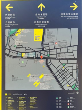
Map photo taken by groupmate at Wen-Luo-Ting
2. Cultural Geographical Perspective in Use
Investigation on a place in a cultural geographical perspective is not only describing the view, but also seeking the path of development behind all the appearing elements. A place is constituted by an imbroglio of traces, which are marks, residues or remnants made by the intersections of culture and context (Anderson J., 2010).
Wen-Luo-Ting is geographically located in the centre of the school-town atmosphere, acting as a diverse cultural community flourishing by different independent bookstores and literature-related activities. Its precursor as an area concentrated with second-handed book stalls in Guling Street paved the road for its transformation to the Wen-Luo-Ting community. Apart from traces including independent bookstores in different themes and various cultural activities, underground architecture style representing the freedom of speech also shape the unique place and attract many visitors.
While existing traces keep changing under the influence of power proposed by Foucault (Christensen, 2024), the place is regarded as a dynamic entity. During the confrontation between dominating power and resisting power, traces are either disappeared or created to modify the significance and role played by the place, thus forming a complex culturally-distinctive enclave.
In the study, we can see the role of the Wen-Luo-Ting community evolving from a place of cultural enlightenment to a popular landscape where cultural innovation and new wave ideas are provoked by resisting dominating power. From literati’s resisting power on secretly selling banned political books against the government’s dominating power on restricting the political views received by the public during the Martial Law Period to the minority groups’ resisting power on protecting their rights against the mainstream’s dominating power on defining the ‘normal’ and ‘abnormal’ in the modern days, the place has precisely showed the struggle of knowledge and rights between the two parties. Throughout the struggles, the bookstores representing each party present a phenomenon of creating and constructing new communities, new culture and new identity, thus enriching the significance behind the Wen-Luo-Ting community.
3. Empirical Analysis
Intersection of Culture and Context by an Imbroglio of Traces
The formation of Wen-Luo-Ting can be traced back to the 1960s. In the 1960s, Guling Street was famous for street second-hand stalls all over the street. At that time, due to the rise of stalls, local police officers would like them to make a change from placing all the goods on land to placing the goods on shelves next to the walls for the sake of road safety. Till 1974, to address the traffic issues at the level crossing of the North-South Railway Line, the Guanghua Bridge was constructed, with an integrated market beneath it. Vendors from Guling Street were relocated to operate in Guanghua Mall, with the basement level primarily housing used bookstores. However, Guanghua Mall was removed afterwards, some second-generation bookstore owners relocated their shops near universities. This is the predecessor of Wen-Luo-Ting. It shows a natural transformation of the sense of place according to time. Wherever the second-hand book vendors relocate, that will become the book hub, attracting book lovers or treasure diggers to gather there, demonstrating the spatial practice of a cultural landscape. Besides, it is an event-controlled space, the vendors and book stores are significant to the mentioned spaces, the core value of the geographical meanings is based on people’s activities and footprint, constituting a socially produced space. With different roles, people will view them or these districts with different views, the government saw them as the ones causing chaos, while the general public saw them as a treasure box, reflecting a process of place-making and the politics of space.
Talking about Wen-Luo-Ting nowadays, it has a high density of book stores and cafes, and also a university hub (Hsu, 2007). Through time, the image of these book stores have a huge difference, from a place where poor people love to buy books from, to a highbrows’ hub due to the relocation and people’s perspective on second-hand books. The most famous bookstore there is Tangshan Bookstore, also known as the “underground book kingdom”, selling books in the humanities and social sciences. Back the June 12 Restriction (六一二大限) in 1992, when foreign copyrights became legally protected in Taiwan, they also published many unauthorised translations of scholarly works in these fields. It was once a hub for banned books, a key platform for student works, including both written and audiovisual pieces, that were not viable for mass production (Multitude.asia, 2017). Therefore, to hide from the government’s checking, they chose to locate the store underground. Its underground architectural style has not changed till today, after the recreation of the district by the government. It is a reflection of the values of the Taiwanese government, which would like to emphasise freedom of speech and would like to alert people to the difficult time by keeping its original design, a form of counter-geography. This explores how power produces knowledge and normalizes standards, and how resistance is inherent to power, manifesting itself through the struggle over discursive power, embodying the tension between space and power.
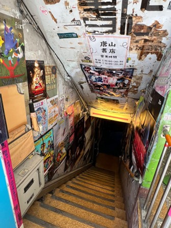
Photo of 唐山書店 taken by groupmate at Wen-Luo-Ting
Representative of Resisting Power Throughout the Time
During the Japanese rule from 1895, Taiwan was politically and socially suppressed by Japan. As the goal was to turn Taiwan into an industrial hub for supplying various resources to Japan (Xiu, 2018), multiple attempts were made to forcefully adapt Taiwan to the "Japanese style", thus the heavy suppression of opposing ideas. This included the Taipani Incident in 1915 which massacred hundreds of Taiwanese who attempted to rebel (Chen, 2012); and the publication of the Chian-keisatsu-hou (1900) which seriously infringed the freedom of assembly and freedom of speech of the locals. Due to the heavy suppression, the urge for oppression has heightened.
Afterwards, the Kuomintang retreated to Taiwan and since then, Taiwan has entered a period of white terror under the authoritarian rule of the Kuomintang (Chen, 2012). Meanwhile, the National Taiwan University has been a hub for elites and intellectuals, creating an academic neighbourhood around the university. Therefore, the Wan-Luo-Ting area in the neighbourhood has become essentially a safe haven for these intellectuals to gather. Bookstores in the community have also started to sell books that are censored, or those which are considered avant-garde around the community of political elites.
The Wan-Luo-Ting area has become a symbol of political rebellion and free-thought since and therefore has been a place filled with independent bookstores with their respective ideologies. These ideologies often differ from the mainstream, for instance the Feminist bookstore Fembooks, Left-wing Ton San Bookstore and Christian Campus Books (Lam, 2007). These bookstores have maintained to be the symbols of free-thought since the formation of the district.
4. ConclusionThis study reveals Wen-Luo-Ting as a complex cultural community which identifies emerging geological factors ,and cultural resistance with the unrelenting pursuit of forbidden knowledge and marginalised voices. The concept of place as an “imbroglio of traces” (Creswell, 2006) and Foucault’s theory illuminate how traces—underground bookstores, banned-book legacies, feminist and left-wing shelves—are actively showing that resisting power is everlastingly challenging the dominating power, from Martial Law-era secret sales to contemporary minority struggles.
This paper shows the social construction process of the modern urban cultural landmark. To safeguard the vitality of such a unique community, the government should protect independent bookstores through providing financial support or strengthening the heritage status, resisting modern gentrification that might affect counter-hegemonic traces. Besides, it is essential to actively support minority-run spaces, ensuring the district remains a living laboratory of freedom. Only by preserving its traces can Wen-Luo-Ting continue to produce new identities and knowledge for Taiwan’s future.
Anderson, J. (2010). Understanding Cultural Geography: Places and Traces. New York and Oxon: Routledge.
Christensen, G. (2024). Three concepts of power: Foucault, Bourdieu, and Habermas. Three Concepts of Power: Foucault, Bourdieu, and Habermas, 16(2), 182–195. https://doi.org/10.1177/17577438231187129
Creswell, T. (2006).《地方:記憶、想像與認同》.(王志弘、徐苔玲譯). 台北:群學.
陳信安. 2012.《以文化觀光思維建構「1915 年焦吧哖事件」文化路徑紀念場域之研究 》. 行政院國家科學委員會專題研究計劃.
陳銘城,2012,秋蟬的悲鳴:白色恐怖受難文集,新北市,國家人權博物館籌備處.
大蔵省印刷局(官報). 1900. 法律治安警察法. 日本マイクロ写真出版, 東京. 10.11501/2948297
林欣靜. (2007, September). 溫羅汀獨立書店風景. 台灣光華雜誌 Taiwan Panorama | 國際化,雙語編排,文化整合,全球華人的雜誌. https://www.taiwan-panorama.com/Articles/Details?Guid=ef5801d7-e6ce-4291-b7da-e7c1a82bcb41&CatId=8&postname=%E6%BA%AB%E7%BE%85%E6%B1%80%E7%8D%A8%E7%AB%8B%E6%9B%B8%E5%BA%97%E9%A2%A8%E6%99%AF&srsltid=AfmBOorp0XW1DrPyHFpDlgND8atixtl5tHvwZgDyVh_NuMHSqBcTB_FV
Multitude.asia. (2017, September 22). 如果我盜版到一百種的時候…| 唐山書店陳隆昊訪談 (二) [Video].
王 泰升. 2004. 植民地下台湾の弾圧と抵抗 日本植民地統治と台湾人の政治的抵抗文化. 札幌学院, 訳者 鈴木敬夫.
Xiu, C. (2018, April 20). A Multi-Perspective Analysis of the Japanese Factor in the Taiwan Issue. Interpret: China. https://interpret.csis.org/translations/a-multi-perspective-analysis-of-the-japanese-factor-in-the-taiwan-issue/
徐詩雲. (2007). 當代文化階層的地方認同競逐:「公館�溫羅汀」〔碩士論文,國立臺灣大學〕. 華藝線上圖書館. https://doi.org/10.6342/NTU.2007.03053
1. Introduction
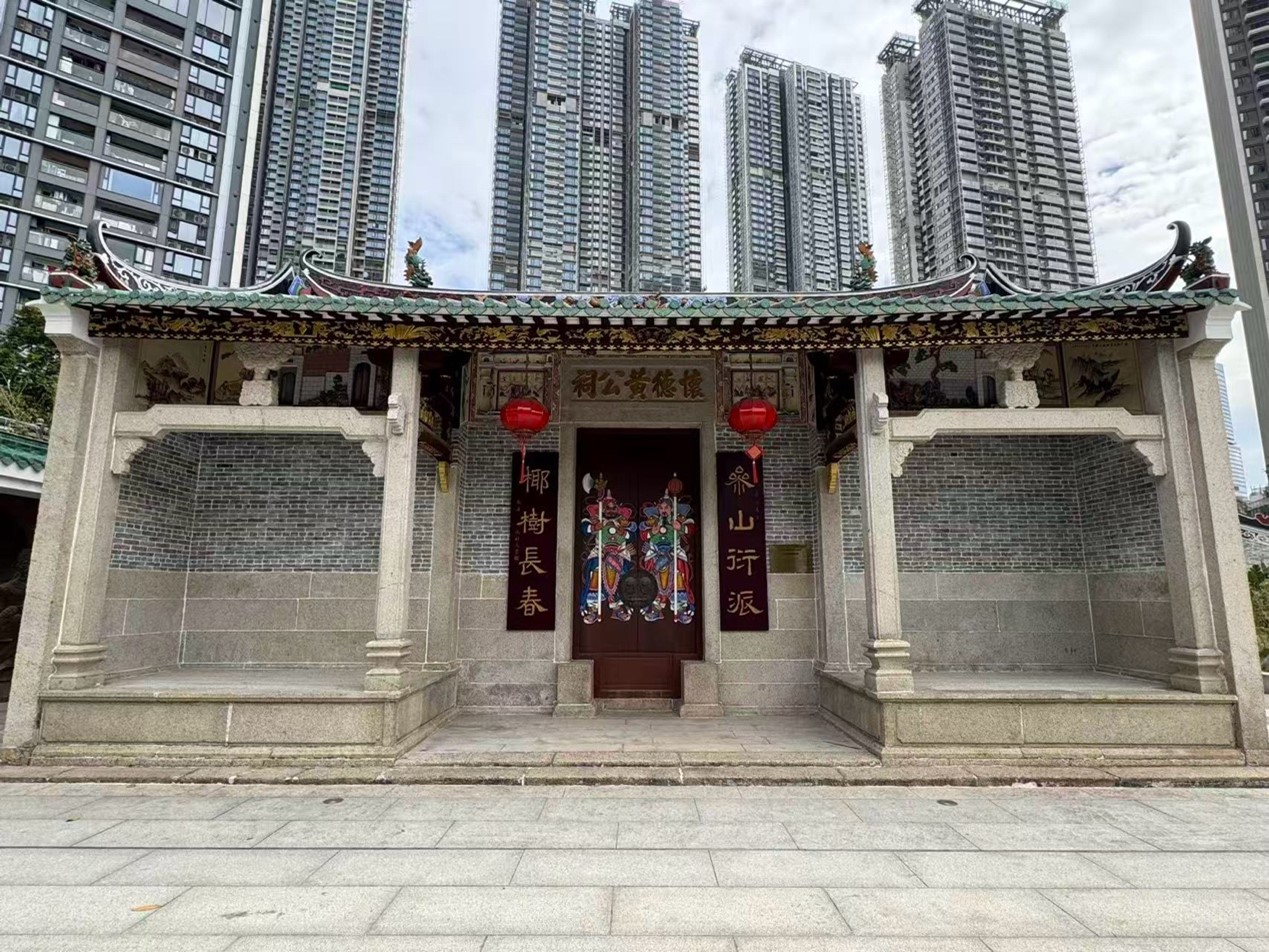
This project examines the Huang Gong Temple (怀德祠), an ancestral temple in Shangxia village, which now sits encircled by the soaring high-rises of the Zhongzhou Binhai Huafu residential complex in Shenzhen. This phenomenon deserves attention because it represents a profound and increasingly common cultural trace in China’s rapidly urbanizing landscape: the physical preservation but contextual transformation of sacred, historical sites. The temple, as a cultural trace, manifests the dramatic interaction between the grassroots, lineage-based culture of the original village and the powerful forces of state-led urban redevelopment. This project draws upon the cultural geographical concepts of spatial encapsulation and the everyday production of space to analyze how this unique spatial arrangement reconfigures the temple's meaning, transforming it from an exclusive site of clan worship into a contested, shared public space for the new urban community.
2. Cultural Geographical Perspective in Use
Cultural geography posits that space is not a neutral container but a social product, constantly being shaped by power relations, cultural practices, and everyday life. It focuses on how meaning is inscribed onto space, turning abstract "space" into meaningful "place." This project employs two key concepts to analyze the Huang Gong Temple:
- Spatial Encapsulation: This refers to the process whereby a traditional cultural space is physically preserved but simultaneously dominated and re-contextualized by a new, dominant spatial form—in this case, the modern residential complex. It is not merely being nearby, but being physically and visually surrounded and dominated. This process exerts a powerful symbolic force, often marginalizing the original significance of the encapsulated space and subjecting it to a new visual and functional logic (D. Harvey, 2002).
- Everyday Production of Space: Drawing on Henri Lefebvre's (1991) theory, space is continuously produced through everyday practices and social interactions. The meaning of a place is not fixed but is constantly negotiated through how people use it. The act of residents bringing children to play, of neighbors socializing, or of the elderly exercising in the temple grounds constitutes a form of "spatial practice" that actively produces new meanings, potentially challenging or layering over the temple's original sacred function.
Our analytical framework illustrates how the temple's meaning changes. First, its traditional atmosphere is weakened as it becomes physically surrounded by towers. Then, the daily activities of the community inject new, mundane functions into it. Together, these two processes create an internal tension between the temple's sacredness and its secular, everyday role.
3. Empirical Analysis
The Geographical Context: From Village Enclave to Urban Island
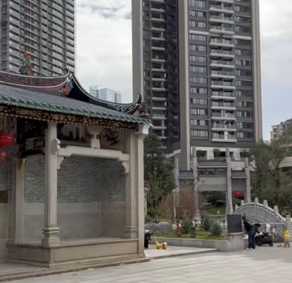
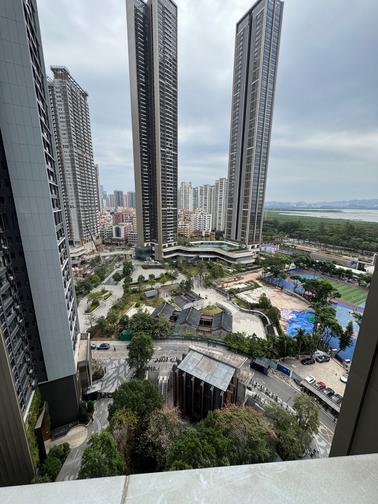
The Huang Gong Temple is located in the Futian District of Shenzhen, a city synonymous with hyper-speed urbanization. The geographical context crucial to this phenomenon is not just the city, but the specific process of "urban village" (城中村) redevelopment. Shangxia village was once a distinct entity, with the temple at its social and spiritual core. The construction of the Zhongzhou Binhai Huafu complex represents the latest and most physically overwhelming phase of this redevelopment. The temple was not demolished; instead, it was strategically preserved and isolated as a green-space centerpiece within the master plan. This has radically altered its context: once the heart of a horizontal villagescape, it is now a low-rise, traditional-form island in a vertical sea of modernity, accessible only by passing through the gates and curated landscapes of the private residential estate.
The Cultural Strands: Clan Lineage vs. New Urban Community
Two primary strands of culture interact at this site. The first is the clan-based lineage culture of the indigenous Huang family. For them, the temple is a "place" in the Yi-Fu Tuan (1977) sense—a space filled with profound meaning, history, and emotional attachment through generations of ancestor worship and collective memory. It represents continuity, identity, and sacred order.
The second is the culture of the new, heterogeneous urban community residing in the high-rises. This community, largely composed of middle-class professionals and migrant families, lacks historical ties to the temple. Their culture values amenities, leisure, and convenient communal spaces. For them, the temple ground is primarily a "space"—a accessible, aesthetically pleasing "central park" that serves practical needs for recreation and socialization.
Source: Photo by author, 2025.11.19
The Cultural Trace: Negotiated Sacredness in an Everyday Landscape
The preserved Huang Gong Temple is a clear trace of the negotiation between the original geographical context (the village) and the cultures that shaped it, and the new context (the luxury estate) and its culture. The preservation itself is a testament to the resilience of clan identity and possibly the developer's strategy to add cultural capital. However, the trace now tells a more complex story.
The temple's aura is fundamentally altered by its spatial encapsulation within the high-rises. These towering structures constantly dwarf it, serving as an overwhelming reminder of a new socio-spatial order. This power dynamic pressures its sacredness, potentially reducing it to a mere decorative artifact in the eyes of the new community.
Concurrently, the everyday production of space by the new residents actively rewrites the temple's script. When children use the courtyard as a playground, the primary sound is no longer of chanting but of laughter and games. When parents and domestic helpers gather there to socialize, the space functions as a living room for the community. These practices, while not intentionally disrespectful, impose a layer of secular, mundane meaning onto a space designed for reverence and ritual. This creates a quiet but palpable tension. One might observe clan members during Qingming Festival performing solemn rites amidst the casual comings and goings of residents, a stark illustration of the coexistence and collision of two different "place-making" processes.
This case reflects a modern urban dilemma: how to preserve a heritage site's soul, not just its shell. The temple stands intact, yet its original function and emotional impact are being gently yet profoundly altered. We witness its identity shifting from being a vessel of collective memory to an amenity for collective consumption.
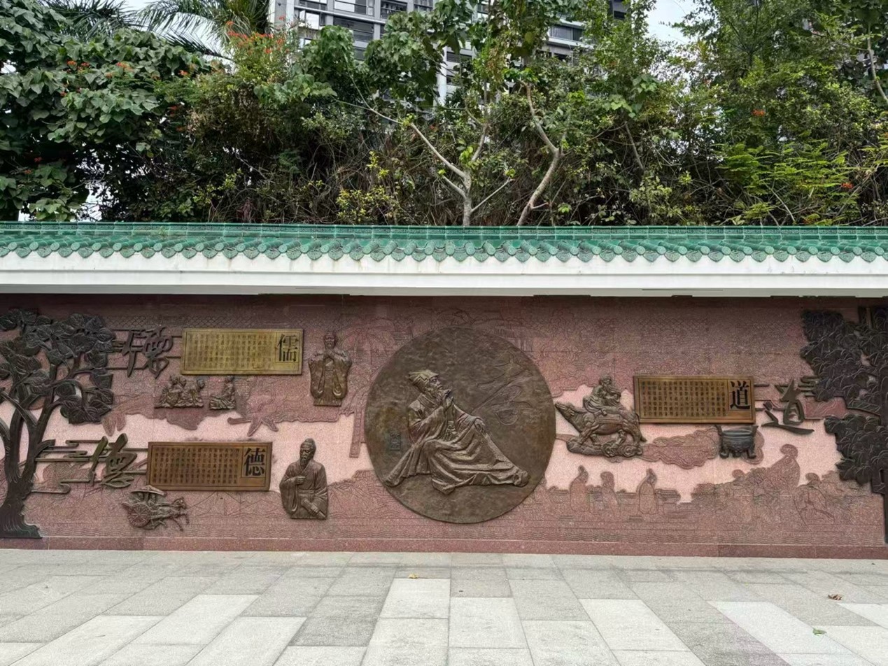
Figure 5. A bronze moral lecture artwork in the temple compound.
Source: Photo by author, 2025.11.19
4. Conclusion
This project's application of a cultural geographical perspective reveals that the preservation of the Huang Gong Temple is only a partial victory for cultural heritage. Its meaning is not static but is dynamically and continuously reshaped by its new spatial and social context. We found that spatial encapsulation symbolically marginalizes the temple, while the everyday production of space by the new community overlays it with a secular identity, leading to a negotiated and layered "place meaning" that balances between sacredness and secularity. Reflecting on the concepts used, Lefebvre's triad proved invaluable in highlighting the conflict between the "representation of space" (the planner's and developer's vision of a preserved relic) and "representational space" (the lived, everyday experience of the residents). A key policy recommendation would be to move beyond mere physical preservation. Facilitating dialogue between the Huang clan and the new residents, and perhaps co-creating interpretive signage or shared cultural events, could foster mutual understanding and a more conscious, collaborative production of this unique space's future meaning, ensuring its historical depth is not entirely erased by its new everyday life.
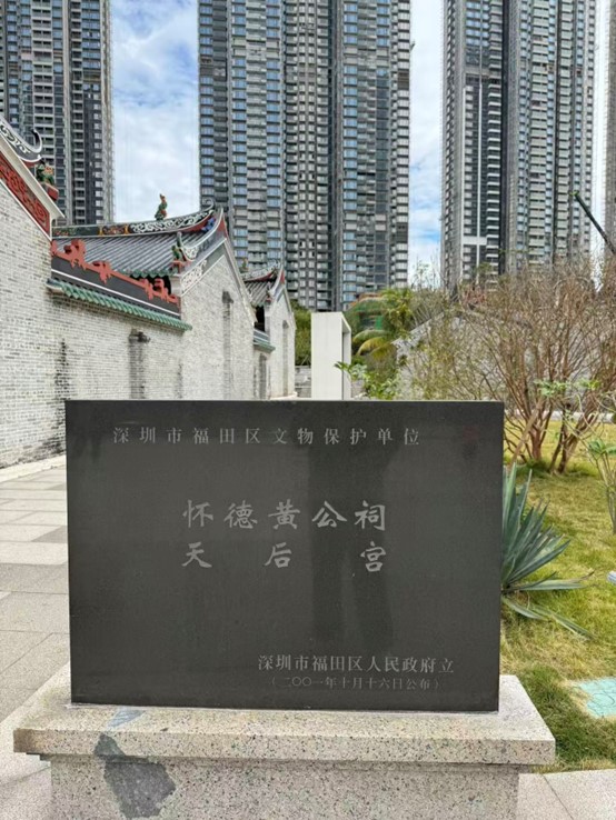
Figure 6. The government-issued heritage placard.
Source: Photo by author, 2025.11.19
References
Harvey,
D. (2002). Spaces of capital: Towards a critical geography. Routledge.
Lefebvre, H. (1991). The Production of Space. (D. Nicholson-Smith, Trans.). Blackwell Publishing.
Tuan, Y. (1977). Space and Place: The Perspective of Experience. University of Minnesota Press.
1. Introduction
This project investigates how everyday economic exchanges in Chun Yeung Street in North Point generate a distinctive form of cultural hybridity between Hokkien immigrants and the average Hong Kong resident. We will be investigating the scrutiny of the hybrid linguistic, spatial and commercial order that exceeds the simple differences between Hokkien and Cantonese. The marks of past migration and ongoing contact between these two groups can be traced as it is all recorded in the buildings, shop signs, voices and foods that are found on this street.
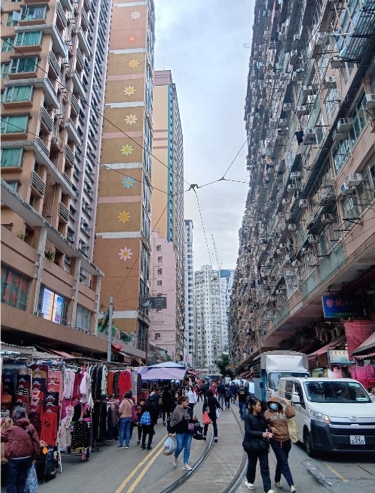
Figure 1 Chung Yeung Street
(Source: Taken by authors on 20/11/2025)
Geographically, Chun Yeung Street is located within a dense, lower income district shaped by small shops and limited public planning, the long standing Hokkien community combined with Minnan values of kinship and hard work created the conditions for frequent and repeated interaction with Hong Kong’s market oriented and Cantonese dominant urban culture.
The
project will draw on the concepts of cultural space and ethnic cultural
geography to analyze the links between place and culture. Chun Yeung Street is
treated as a contact zone where buying and selling is an everyday occurrence.
The multilingual conversations and the local adaptation of Fujian cuisine
connects geographical context with cultural ideas and value systems. Through
decades of routine practices, new hybrid cultural forms are continuously
created and maintained in the daily life of the street.
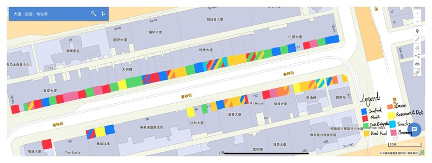
Figure 2 Type of shops on Chun Yeung Street
(Source: Geoinfo Map, 2025; noted by authors on 23/11/2025)
2. Cultural Geographical Perspective in Use
Cultural geography examines how culture and geographical context interact to produce "traces" and cultural landscapes. It focuses on the evolution of culture in space as well as how space constructs cultural identity and interaction.This project will use the following two core concepts: the first is cultural space, where Chun Yeung Street serves as a physical and symbolic arena for cultural interaction. The second is ethnic cultural geography, referring to the spatial clustering of Hokkien immigrants in North Point and the persistence of their culture. This study is based on the cultural hybridization theory by Peter Burke(1937). The core of this theory lies in posits that when different cultures meet in a specific space they do not simply assimilate one another or maintain a pure opposition, instead, they blend to create a new hybrid cultural form with its own vitality.
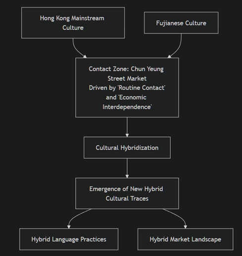
Figure 3 The research stream of the project
The analytical framework is as follows: Chun Yeung Street, rooted in the ethnic cultural geography of the Hokkien community, functions as a cultural contact zone. Through daily interactions and transactional relationships, and driven by the process of cultural hybridity, Hokkien culture and mainstream Hong Kong culture intermix here. This leads to the formation of a unique cultural landscape where both language and commercial practices exhibit distinct hybrid characteristics.
3. Empirical Analysis
The cultural integration phenomenon of Chun Yeung Street is mainly due to its unique geographical environment and cultural interaction. From a geographical perspective, this approximately 200-meter-long neighborhood located between Tong Shui Road and North Point Road in North Point is a microcosm of the about 400,000 Hokkien who are people in the Eastern District, mainly speaking the Hokkien language, who live in Hong Kong. It was developed by Fujian merchant Kwik Djoen Eng in the 1920s and 1930s. Therefore, the street is named by his first name in Cantonese spelling. (Wikipedia Contributors, 2012) The interwoven architectural form of Western-style buildings and high-rise buildings, along with the commercial ecosystem that includes clothing vendors, food shops and Hokkien cuisine restaurants, jointly form a material space that carries cultural interaction and serves as a spatial anchor point for the cultural geography of the Hokkien ethnic group.
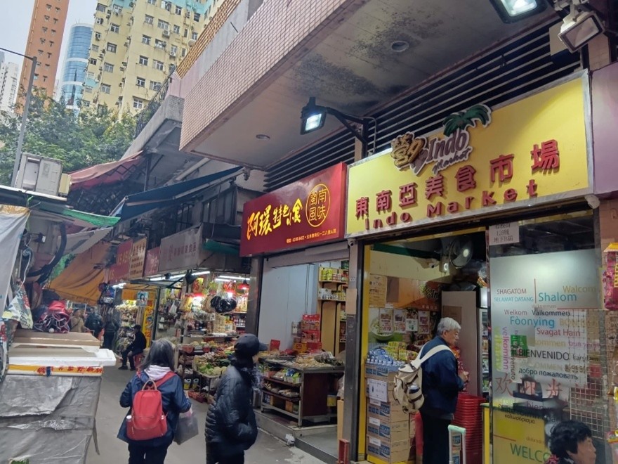
Figure 4 Multi-cultural backgrounded merchants on Chun Yeung Street
(Source: Taken by authors on 20/11/2025)
Our team visited two places run by Hokkien immigrants. Chin Chin Cuisine is a restaurant opened by a Hokkien immigrant (around 60-70 years old), and its dishes are largely similar to those from their homeland. The owner and staff communicate in Hokkien, while customers vary in their language usage. The authors visited the restaurant (November 20, 2025), and communicated in Hokkien. Four other customers were there, two speaking Hokkien, one speaking Cantonese, and one speaking both languages. The Cantonese speaker was the loudest and dominated the conversation. The authors also visited Bao Dim Tat Yan, where the owner and staff were younger (around 40-50 years old). They mainly use Cantonese, but can also use Hokkien. We also noted other shops and stalls selling Hokkien snacks on the street.
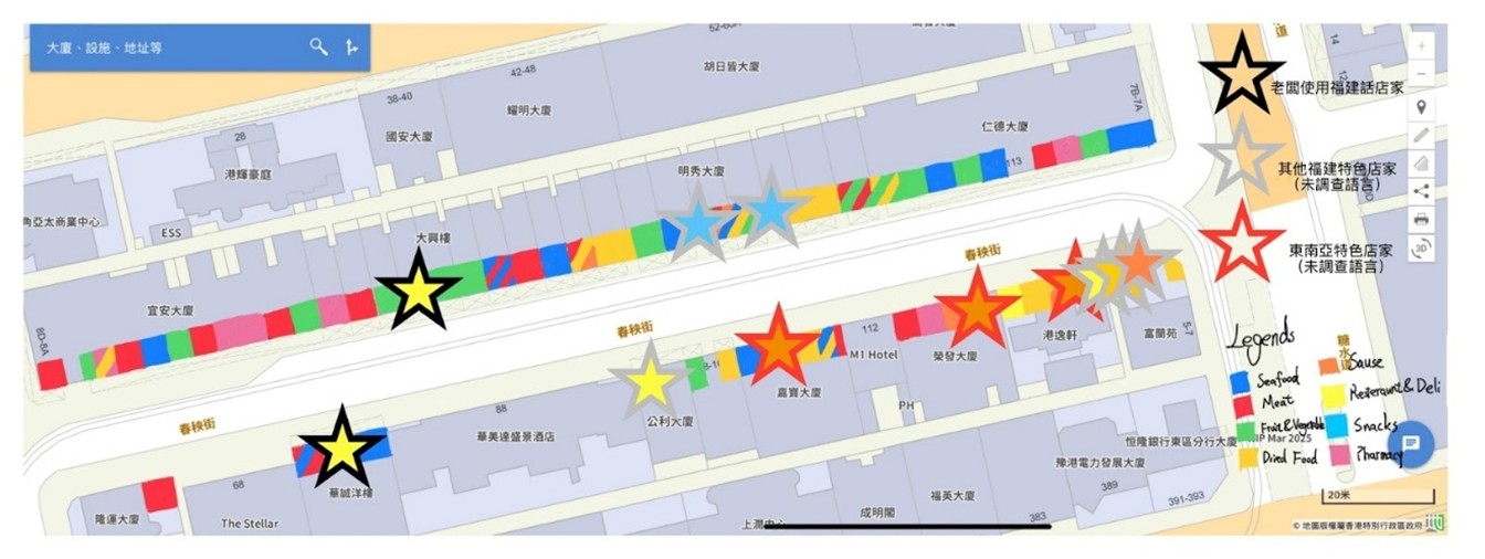
Figure 5 Language and cultural backgrounds of shops on Chun Yeung Street
(Source: Geoinfo Map, 2025; noted by authors on 23/11/2025)
In terms of cultural exchange, the interaction between the Southern Min language (Hokkien language) culture and the Cantonese culture of Hong Kong is a core factor. Immigrants from southern Fujian mostly use Hokkien, also known as Southern Min dialect, which is widely spoken in southern Fujian such as Quanzhou, Zhangzhou, Xiamen, as well as in Taiwan, Malaysia, Singapore, Indonesia and other places. In ecological research of the Southern Min dialect in Hong Kong by Xu Yuhang (2020), the Hokkien language in Hong Kong has undergone a great many special variations through long-term contact and interaction with Cantonese immigrants. Meanwhile, the restaurants and markets in Chun Yeung Street, as cultural contact areas, have become the medium for the interaction between Hokkien culture and Hong Kong culture in this environment. Trams also play an important role in the local community (Hong Kong Tourism Board, 2025), which indicates the dominant impact of Hong Kong Culture to residents.
This interaction between geographical context and culture has given rise to cultural hybridization through daily contact and economic interdependence mechanisms. Hokkien old merchants, the younger generation of Hokkien, Cantonese and consumers from other ethnic groups all participated together. In daily interactions, the older generation of merchants still use the mutated Southern Min dialect when running their shops, while younger customers or those of non-Fujian descent respond in Cantonese or Mandarin. The coexistence of the three languages on Chun Yeung street at present is the "trace" of cultural contact. As a result, the Hokkien spoken by Hokkien people in Hong Kong often bears Cantonese influences and differs from the language spoken by Hokkien people in their ancestral homeland (Xu, 2020). Many syllables are pronounced differently from those in their native region. Under the economic interdependence, Hokkien characteristic shops rely on the consumption demands of diverse ethnic groups to survive, and consumers also depend on these shops to obtain cultural products such as Minnan ingredients and Fujian cuisine. For instance, Hokkien cuisine restaurants will retain the core flavor of southern Fujian while making minor adjustments to the taste of their dishes to suit local diners, thus creating a hybrid of food cultures.
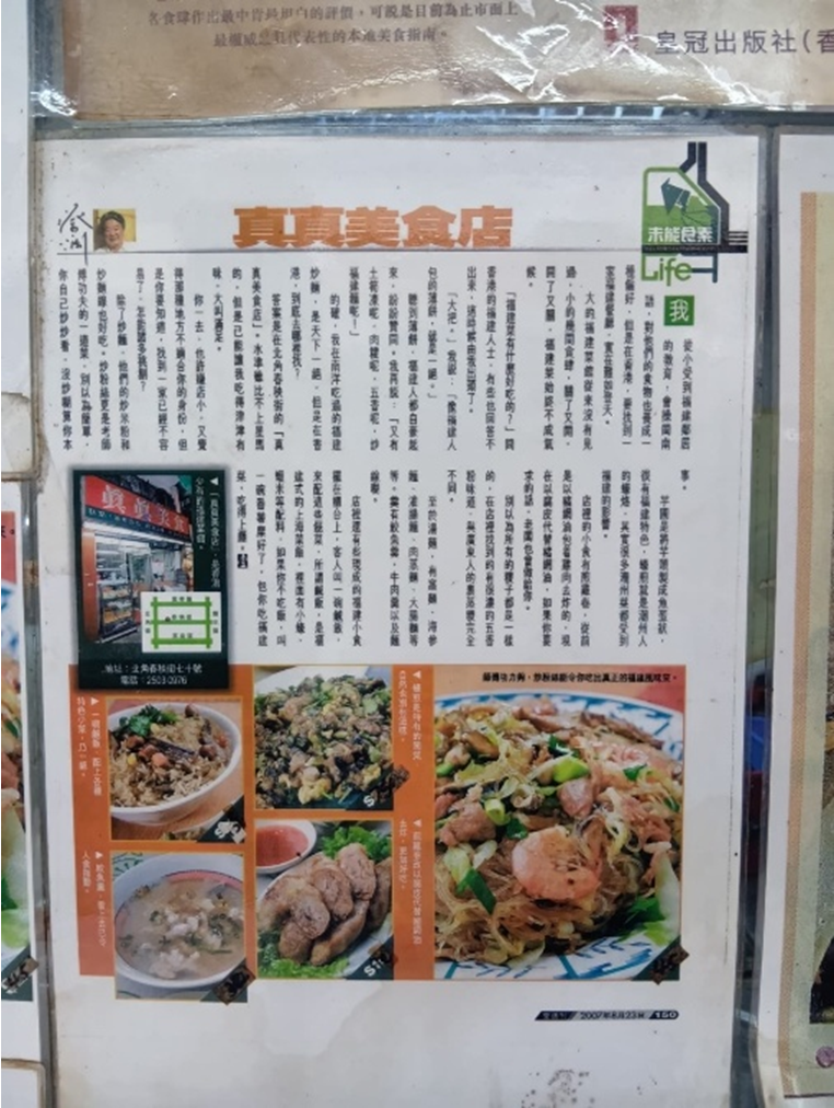
Figure 7 Introduction of Chin Chin Cuisine
(Source: Taken by authors on 20/11/2025)
The most impactful language to Hokkien, Cantonese, has dominated Hong Kong society since the establishment of Hong Kong's education system. Then, the languages of schools have been limited to English and Cantonese (Ding, 2013). During the movement to make Chinese the official language, Chinese became the official language of Hong Kong, Cantonese gained official recognition, while Hokkien did not receive enough attention and was gradually replaced by Cantonese (Ding, 2013; Ho, 2024). Hokkien characteristics were also incorporated into Cantonese, becoming one of the origins of the lazy pronunciation phenomenon (Ding, 2013).
The unique Hokkien culture of Hong Kong is also facing the challenge of being difficult to pass on. Cantonese, as the dominant language in Hong Kong, holds a dominant position in interactions. The variation and retreat of the Southern Min dialect essentially reflect the compromises made by Hokkien immigrants to adapt to mainstream society. Some linguists like Xu Yuhang believe that this imbalance in language power is manifested in the weakened understanding of the Southern Min dialect among the younger generation, which is a difficulty in the inheritance of Minnan culture (2020). Chun Yeung Street has gradually developed from a single space for Hokkien ethnic culture into a place for the exchange of diverse cultures. Its business form and cultural expression have become a model of Hong Kong's multiculturalism, and also reflect the transformation of the ethnic culture of immigrant cities from marginal to integrated.
4. Conclusion
In conclusion, Chun Yeung Street mixes Shanghai and Hokkien Culture into Hong Kong local culture. It illustrates a path of integration where cultural identity is not eliminated and transformed through negotiation and mutual adaptation. But it has encountered some problems in cultural inheritance. We use the local cultural space and ethnic cultural geography as the traces to research the history and culture of Chun Yeung Street. To enhance the cultural influence of Chun Yeung Street in Hong Kong, the government could support local cross-language transmission to resolve the problems. For example, the government may fund community-based Hokkien and Shanghai dialect programs to protect the local Minnan culture and release some advertisements of Chun Yeung Street to make more people notice and get involved in the unique colorful hybrid culture.
References
Ding, P.
S. (2013). Hong Kong as a Laboratory for Language, Nationalities
Research in Qinghai, 24(4), http://doi.wanfangdata.com.cn/10.3969%2fj.issn.1005-5681.2013.04.030
Ho, J. C.
(2024). Hong Kong Anti-colonial Nationalism during the Chinese Language
Campaign. The China Quarterly, 258, 384–399. https://doi.org/10.1017/S0305741023001534
Hong Kong
Tourism Board. (2025). Chun Yeung Street (Wet Market). https://www.discoverhongkong.com/eng/interactive-map/chun-yeung-street-wet-market.html
Peter, B.
(1937). Cultural Hybridity. Polity Press. https://archive.org/details/culturalhybridit0000burk
The
Government of the Hong Kong SAR (2025). Geoinfo Map. The Government of the Hong
Kong SAR.
Wikipedia
Contributors. (2012, August 3). 春秧街. Wikipedia.org; Wikimedia
Foundation, Inc. https://zh.wikipedia.org/wiki/%E6%98%A5%E7%A7%A7%E8%A1%97
Xu, Y. (2020). 香港閩南方言生態研究. Chung Hwa Book Company (Hong Kong) Limited, Hong Kong. https://library.hkbu.edu.hk/record/?ID=alma991026359044103409&T=L
1. Introduction
The Flower Market, or
“Fa Hui”, Hong Kong’s largest retail flower hub adjacent to Mong Kok Stadium,
is a vivid cultural trace that aggregates over 100 floral and horticultural
retail stores, connecting flower farmers with consumers (City Unseen, 2025).
Rooted in Chinese
traditional auspicious symbolism, it inherits the colonial-era “market”
concept, with flowers carrying blessings tied to major festivals—such as
kumquat plants for prosperity and daffodils for good fortune. Dating back over
130 years, flower farmers have sold blooms near the current Boundary Street
(then the Sino-British border) before the 1898 New Territories lease (Wu et
al., 2022). Its prime urban location has evolved from a spontaneous gathering
of farmers into an iconic market. Today, modern flower shops, as a
representation of space, representational space, and spatial practice
conceptualized by Lefebvre (Lefebvre, 2012), have reshaped the landscape,
including traditional wholesalers struggling amid competition from chains,
target audiences having shifted, and the market transforming from a
festival-centric spot to an all-year-round attraction, with new practices like
auctions emerging alongside domestic and overseas competition.
This study employs Lefebvre’s spatial triad and the concept of cultural traces to analyze how modernization and tradition interact in this space, exploring the cultural and geographical dynamics behind the flower market’s transformation.
2. Cultural Geographical Perspective in Use
The empreinte culturelle (文化印記) observed in the flower market reflects that the value of flowers for the people of Hong Kong has been changing over the years. The term “empreinte culturelle” is a French word meaning “cultural imprint,” which refers to the human activities, symbols, or architectures that reflect the opinions and values of humans living in a specific geographical area (Chen et al., 2025). The flower market originated by a small group of farmers who wanted to make a living by selling flowers to men looking for prostitution (City Unseen, 2025), but then changed to a site where everyone can buy plants for home decoration and a self-hobby.
Apply Lefebvre’s spatial triad (Lefebvre, 2012) in this place, the flower market is not only a perceived place that shares the majority of Hong Kong’s flower market, or a conceived place contributing to Hong Kong’s tourism, but also a lived place, which implies relaxation, blessings, and happiness for many local people. This is because giving flowers to your beloved means “wishing you a happy and fortunate future” in Chinese culture, especially in celebrating festivals or birthdays, which initiates people visiting the flower market and bringing this luck and blessings to their family, friends, or neighbours. Enjoyable memories and a sense of belonging were therefore linked to this traditional market.
3. Empirical Analysis
In the empirical
analysis section, our group identified six main differences through interviews
and observations, including the division of imported flowers, product
categories, running style, commercial methods, selling features, and space
division, which were retrospectively analyzed.
First, there are
differences in the types and styles of flowers sold between traditional flower
shops and modern ones. After the signing of the Treaty of Nanking in 1842, the
British introduced the culture of flower appreciation to Hong Kong (City Unseen,
2025). Fresh flowers such as gladioli and lilies are available throughout the
year. Most local flower farmers sell only one or two types of flowers a year.
Due to the limited living space in Hong Kong, there is insufficient space to
place New Year flowers (City Unseen, 2025). Through observation, a wide variety
of affordable small plants have been added to the flower market, such as
succulents and foliage plants. From the perspective of cultural geography, the
differences and changes in the types and styles of flowers are influenced by
foreign cultures and urban development. The limited living space has led to the
gradual decline of the flower appreciation culture, which is being replaced by
plant types that better meet modern needs.
Second, the product
categories change with market preferences. In the early 20th century, the
demand for flowers increased. The product categories in the flower market were
limited, and most stalls only sold flowers to meet the demand. Whether it was
common flowers like violets and roses, or New Year flowers like peach blossoms
and narcissus before the end of the year, the focus was mainly on flower sales.
Now, mixed businesses have emerged, combining flower shops with coffee shops,
allowing customers to appreciate flowers while enjoying coffee and desserts. In
addition, the products have also expanded to related products such as gardening
tools and decorations. From the perspective of cultural geography, the change
in the types of products is driven by consumers' needs. It is no longer limited
to the flowers themselves but places more emphasis on cultural experience and
leisure use.
Third, the running style has changed due to power. In the past, most flower
farmers sold flowers in the form of street stalls without fixed stalls.
However, in 1938, the Health Bureau required flower sellers to hold a hawker's
license, which led to the first transformation of the running style. Thus, in
1947, the running style of the flower market became a wholesale market with
fixed spaces, and a trade union was responsible for the management of the
flower market and the rent of the stalls. In the 1980s, a large number of
inexpensive fresh flowers from the Chinese mainland were imported into Hong
Kong, resulting in the second transformation of the running style. The stalls
were gradually replaced by systematic retail stores, and this situation continues
to this day. From the perspective of cultural geography, the transformation
from unplanned street stalls to a designed and planned consumerist landscape of
the flower market is beneficial to the development of the tourism and retail
industries. Meanwhile, the success of this transformation also symbolizes the
importance of power over space.
Apart
from the difference in running style, the division of the spaces between
traditional and modern flower shops should not be overlooked. While traditional
flower shops only divide areas for selling and decorating flowers, modern
flower shops include various areas inside the shop. After conducting interviews
and a field trip in the Mong Kok flower market, our group has found that modern
flower shops are created in mini cafes, handicrafts workshop classrooms, and
photo-taking areas, to attract more potential customers and increase their
profit. Due to the concerns of limited shop space in Hong Kong, modern flower
shops should recreate the spaces to maximize their products and services.
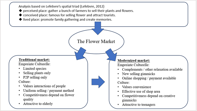
4. Conclusion
In
conclusion, this study employs a cultural geography perspective to reveal the
connections between Hong Kong's geographical context, Chinese floral culture,
and the transformation of Mong Kok Flower Market. The market's strategic
position, bridging mainland China and the global market, coupled with the rise
of consumerism, has driven its evolution from traditional wholesale operations
to modern diversified business models. The core logic of this phenomenon
emerges from the dynamic interplay between cultural imprints and spatial
production.
Lefebvre's spatial triad and cultural traces concepts were instrumental in interpreting this phenomenon, the former framing the market as perceived (wholesale bustle), conceived (touristic planning), and lived (emotional blessings), while the latter capturing the continuity and transformation of auspicious symbolism and modern experiential demands within floral culture, offering a critical framework for analyzing its geographical-cultural roots.
To balance traditional preservation with modernization, the study proposes a "Flower Market Cultural Conservation Initiative", subsidizing digital transformation for traditional flower shops to preserve their wholesale advantages and cultural identity, while establishing cultural exhibition zones to preserve symbolic meanings through festive markets and floral art workshops, ensuring the market's century-old cultural legacy thrives through innovation.
ReferencesCity Unseen. (2025, April 7). Origins to edges: How local farmers were pushed to the flower market’s margins. https://cityunseen.hk/flower-market-past-and-present/
Chen, Y., Jiang, E. J., & Mo, P. L. L. (2025). Does a founder’s cultural imprint affect corporate ESG performance?. Research in International Business and Finance, 76, 102800. https://doi.org/10.1016/j.ribaf.2025.102800
Lefebvre, H. (2012). From the production of space. In Theatre and performance design (pp. 81-84). Routledge. https://philpapers.org/archive/LEFTPO-4.pdf
Graph (2025). Made by our group.
Wu, Q. T., Chen, Z. K., & Chen, J. M. (2022). 根莖葉花—花墟的記憶與想像 [Roots, stems, leaves, flowers: Memories and imaginations of the flower market]. https://hkbookcentre.uk/building-cityscape/Memories-and-Imaginations-of-Flower-Market/
1. Introduction
The
presence of over 200,000 Filipino domestic helpers is a defining feature of
Hong Kong's social and urban landscape, a direct consequence of the city's
economic development and evolving family structures since the late 20th
century. While they live and work in the city, their experience is inherently
transnational, situated between the private, often isolating, sphere of their
employers' homes and their own familial roles in the Philippines. Their fixed
weekly rest days, primarily on Sundays, perform a dramatic weekly
transformation of public spaces across Hong Kong into vibrant, temporary
enclaves. While well-documented gatherings occur in Central's statuary squares
and under the overpasses of Mong Kok, our research focuses on a significant yet
less-studied congregation at Lik Sang Plaza in Tsuen Wan. Here, Filipino
domestic helpers do not merely socialize; they engage in a complex ecosystem of
economic and social activities, from sending meticulously packed balikbayan boxes
(literally, "repatriate boxes") to purchasing specific culinary
ingredients unavailable in mainstream markets. This paper investigates this
phenomenon through a cultural geography lens, exploring how the unique spatial
and economic layout of Lik Sang Plaza facilitates a crucial site for cultural
maintenance and how this gathering reflects an ongoing, nuanced "struggle
for place" within the host city.
Our
analysis is guided by a synthesis of theoretical concepts that illuminate the
production of social space. Michel Foucault’s heterotopia provides a powerful
starting point, describing "counter-sites" that exist within every
culture, but are "simultaneously represented, contested, and
inverted" (Foucault, 1967). These spaces are often linked to slices of
time, or "heterochronies." Lik Sang Plaza functions precisely as such
a heterotopia, particularly on Sundays. It becomes a space tied to the specific
temporal rhythm of migrant workers' rest days, where the dominant commercial
logic and social norms of Hong Kong are temporarily suspended and replaced by a
distinctly Filipino-centric economy and social order. It is a space of
illusion, exposing the reality of Hong Kong's reliance on migrant labor, and a
space of compensation, seeking to create a perfect, microcosmic version of a
Filipino community abroad.
This
transformation is further elucidated through Henri Lefebvre’s spatial triad,
which conceptualizes space as a social product composed of three elements
(Lefebvre, 1991). First, Spatial Practice (Perceived Space) refers
to the physical layout and daily use of Lik Sang Plaza—its corridors, shops,
and adjacent open areas. Second, Representations of Space (Conceived
Space) is the space as planned by architects, developers, and
authorities; a commercial plaza for retail and pedestrian flow. The Filipino
community's activities, however, generate the third element: Representational
Spaces (Lived Space). This is the space as directly lived through
its associated images and symbols, where users appropriate and redefine the
conceived environment. Through their spatial practices, the community resists
the plaza's intended use and re-inscribes it with their own cultural meanings,
creating a lived space of identity, memory, and community, thus completing a
dynamic process of spatial production.
Spatial Layout and Regional Environment: The Anatomy of a Hub
Tsuen
Wan’s urban fabric is fundamental to understanding the organic emergence of Lik
Sang Plaza as a community hub. Satellite imagery and field observation reveal a
high-density residential area characterized by a stark socio-economic diversity
of housing, from the gleaming, securitized towers of Vision City to the
weathered, densely populated tong lau (tenement buildings) in
districts like Yi Pei Square. These varied residential landscapes, whether
catering to affluent dual-income families requiring household management or
elderly and new immigrant families in need of childcare and eldercare, generate
a concentrated and sustained demand for live-in domestic help. This localized
demand is met by a visible clustering of Filipino domestic helper recruitment
agencies in the vicinity, establishing Tsuen Wan as a nodal point for the
community even before their day of rest.
Figure 2: The open space in the Yi Pei Square
(Source: taken by the authors on 20/11/2025)
Lik
Sang Plaza’s specific spatial and economic characteristics make it an ideal
ground for this weekly transformation. Its history is significant; previously
known as a hub for pirated CDs and alternative electronics, the plaza has long
been associated with informal and alternative economies. This legacy laid a
foundational tolerance for non-mainstream commercial activities and a clientele
comfortable with navigating cultural margins. Critically, its location is
strategically marginal. While easily accessible, it is positioned just outside
the prime commercial orbit of the Tsuen Wan MTR station. While large,
corporatized malls like OP Mall and Luk Yeung Galleria dominate the station's
immediate exits, Lik Sang Plaza offers significantly lower rents. This economic
viability is essential for small, community-focused businesses—grocery stores
selling Choc Nut and bagoong (fermented
shrimp paste), or a small café offering halo-halo—that could not
survive in the high-rent districts.
Furthermore, its position at the busy intersection of Tai Ho Road and Castle Peak Road provides excellent accessibility not just for people, but for logistics. This is a crucial enabler for the courier services that specialize in shipping balikbayan boxes, forming a tangible link between the helper in Hong Kong and her family in the Philippines. This powerful combination—a dense local resident-helper population, functional accessibility, and affordable commercial space—creates a self-reinforcing ecosystem that attracts and sustains the large-scale gathering at Lik Sang Plaza.
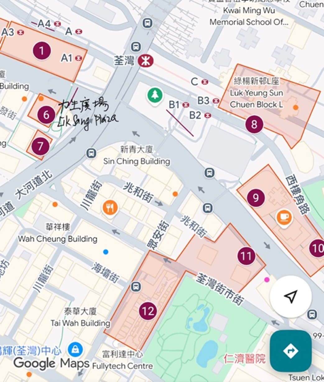
Figure 4: The distribution of Shopping Centers in Tsuen Wan MTR station
(Source: Google Map)
For
Filipino domestic helpers, Sundays at Lik Sang Plaza are more than leisure;
they are a vital act of cultural reaffirmation and psychological decompression.
After a week of work within the constrained and often regulated space of their
employers' homes, they actively reclaim public space to build community and
practice traditions. A key example of this cultural adaptation is the
reinvention of the Kamayan feast—a traditional Filipino
practice of communal eating with one's hands from a spread of food laid on
banana leaves. In the context of Hong Kong, where banana leaves and large-scale
feasting are impractical, the tradition is ingeniously transformed into
communal picnics on cardboard sheets or mats in the open spaces near the plaza.
Through sharing homemade adobo and pancit, taking
group photos and TikTok videos, and speaking in their native tongues, they
forge a powerful community bond. This creates a temporary ethnic enclave, a
"little Manila" that actively mitigates the isolation and alienation
of living abroad.
This
cultural maintenance is intrinsically tied to economic activity. Inside Lik
Sang Plaza, a parallel economy flourishes, catering almost exclusively to their
needs. Remittance centers like Cebuana Lhuillier and LBC are not just shops;
they are sites of ritual where hard-earned wages are transformed into familial
security, ensuring children's education and parents' medical care. Parcel
services are surrounded by helpers meticulously packing balikbayan boxes
filled with clothes, toys, and non-perishable food, a physical manifestation of
love and sacrifice. These activities are profound rituals of care that rebuild
and sustain familial ties across borders, making the plaza a crucial node in
their transnational lives and a space where their identity as breadwinners and
caregivers is honored and enacted.
However,
this vibrant creation of a temporary enclave is not without its tensions,
revealing a "struggle for place" that underscores the contested
nature of public space. The very act of spatial appropriation creates friction
with local residents who hold a different conception of the same space. On
weekdays, the area around Lik Sang Plaza functions as a commuter pathway, a
"representations of space" dominated by the swift, purposeful flow of
local pedestrians. On Sundays, this conceived order is disrupted. The same
space is occupied and transformed by large, static gatherings, leading to
tangible tensions over noise levels, physical congestion, and the perceived
right to use and control public space.
Local
residents often perceive this occupation as an infringement, a territorial
challenge that diminishes their power and comfort in their own neighborhood.
This perception fuels a cycle of contention: complaints are lodged with
district councils, and stories are pitched to local media, which often frame
the issue as a problem of obstruction and nuisance. This public discourse, in
turn, pressures authorities like the police and Food and Environmental Hygiene
Department to periodically "reassert control," perhaps by moving
people along or increasing signage. The plaza thus becomes a visible frontier
where the social contract between the transient migrant workforce and the
permanent host community is constantly being tested, negotiated, and redefined.
It is a silent dialogue of presence and resistance, where the act of claiming
space for cultural survival is met with efforts to maintain spatial order.
In
conclusion, Lik Sang Plaza in Tsuen Wan serves as a critical heterotopia for
Filipino domestic helpers—a site of cultural compensation, social reproduction,
and economic resilience within the hyper-capitalist and often impersonal
landscape of Hong Kong. Its specific spatial history, economic viability, and
strategic location enable a marginalized community to actively maintain its
transnational identity through a dynamic interplay of social gathering and
informal commerce. This spatial appropriation, powerfully analyzed through
Lefebvre’s triad, demonstrates how a "lived space" can be produced
from below, challenging the top-down "conceived space" of urban
planners.
Yet, this process inherently involves a continuous struggle for place with local residents, highlighting the complex and often contentious politics of public space in a dense, competitive urban environment. Despite these underlying tensions, a fragile, dynamic balance has emerged over time, reflecting a mutual, if often unspoken, accommodation driven by economic interdependency and the pragmatic realities of shared urban life. Looking forward, this space holds the potential for a more profound and genuine multiculturalism in Tsuen Wan. It is a potential future where Filipino domestic helpers can find a more secure and accepted sense of belonging, and where the local community can come to appreciate, rather than merely tolerate, the dynamic and essential cultural landscape that these migrant workers help create every Sunday.
References
Foucault, Michel. (1984). “Of Other
Spaces, Heterotopias.” Translated from Architecture, Mouvement,
Continuité no. 5: 46-49,
Lefebvre, H. (1991). The production of space. Oxford:
Blackwell.
Manalo, A. B. (2025). Kitchen Kapwa: How Filipino food
literature reveals decolonial Community-Building [MA thesis, University of
St. Thomas]. https://researchonline.stthomas.edu/esploro/outputs/graduate/Kitchen-Kapwa-How-Filipino-Food-Literature/991015325435703691
Nabil, S., & Lee, J. (2018). Filipino migrant workers in Singapore: a case study of Lucky Plaza. www.academia.edu. https://www.academia.edu/36535624/Filipino_Migrant_Workers_in_Singapore_A_Case_Study_of_Lucky_Plaza
1. Introduction
The climate and geographical traits vary greatly across different cities in China. With these characteristics influencing the cities’ culture, this project examines how the geographical factors of Zigong City have shaped its unique food and tourism culture. Salt pans, salt warehouses, and workers' settlements are traces behind the history and culture. They recorded how the local environment and salt economy shaped people’s daily life, spatial layout and even collective rituals. From the trace, we can tell the past modes of production, social hierarchy and communication identity through today's landscapes and practices.
The spatial location of the Zigong City is favourable for the production of salt, hence giving rise to the prosperous economy of ancient Zigong City and its special food culture. The project primarily draws upon Henri Lefebvre’s theory of the production of space, specifically the triad of spatial practice, representations of space and representational spaces. Also, Julian Steward’s cultural ecology is used to analyse, from a cultural geographical perspective, how Zigong’s unique geographical context and culture are interlinked and mutually produced.
2. Cultural Geographical Perspective in Use
A cultural geographical perspective focuses on how culture is constructed, practised and represented in space and place. It emphasises that landscapes are not simply natural or neutral backdrops, but are shaped by power relations, economic structures, social practices and cultural values. In this view, the built environment, everyday spaces, and even “ordinary” scenery all become cultural texts that can be read and interpreted, revealing how a society’s history, identities and power dynamics are embedded in the material landscape.
Our project seeks to link the cultural geography of Zigong City to the space production theory constructed by Henri Lefebvre. In space production theory, there are three main ideas. Representations of space are defined as the various ways humans conceptualize, visualize and describe space, ranging from concrete forms like maps and photographs to abstract forms like graphs, models and textual descriptions. The second idea, representational space is defined as the symbolic meaning a person or group gives to a physical environment through living experience, emotion and culture. The last one, spatial practice is defined as the way humans interact with, organize and give meaning to physical space through their daily activities, routines and social actions ( Schmid, C, 2022).
We will also use the theory of anthropology—cultural ecology, which was suggested by Julian Steward in the 1950s, headlining the significance of environmental factors in shaping cultural features. (Cultural Ecology | Research Starters | EBSCO Research, n.d.) Zigong has adapted to the natural environment, utilizing her special geography to become "Millennium Salt City". This further shaped her distinctive food culture and developed tourism.
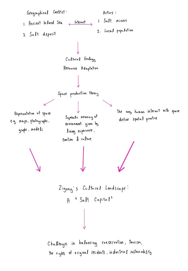
3. Empirical Analysis
Zigong City is located in the Southern part of Sichuan Province, China. Its name comes from two major salt-production sites in the city, Ziliujing and Gongjin, showing the importance of salt to the Zigong City. The Sichuan Basin was once an ancient inland sea; it held concentrated brine and saline rock deep beneath its surface, mining salts here for centuries (Cavish, 2025). Zigong City is also characterized by hills and low mountains that contain brine-rich aquifers fed by rock salt. It makes Zigong City an ideal location for sale extraction.
The influence of Zigong's salt heritage is prominent in the culinary landscape of the city, featuring salt in flavour of traditional Sichuan food. Since salt was easily available in the past, it influenced not only food flavourings, but also food preservation, which led to base flavour created in cooking methods that were bold or savoury. One notable example of a salt heritage dish is salted beef slices-thinly sliced beef coated in salt and soy sauce, dried and smoked at a low temperature. This example of cooking traditions originates from a preservation method stemming from Zigong's salt trade.
Besides, the salt sector is a substantial focus of cultural tourism. This is partly due to heritage sites, including the old salt wells and artifacts associated with traditional methods of drilling. They comprise visitors who are interested in history and industrial culture, which falls beneath cultural tourism, and with them comes an increase in visitors coming to heritage sites, along with all the meanings associated with culture. Festivals like the incredibly well-known Lantern Festival, which have origins in the salt worker's settlement communities, add to cultural tourism, drawing visitors for an immersive experience while celebrating land, culture, and the economy of salt. (陈密容, n.d.)
There are several actors that have played an important role in bridging the gap between the phenomenon and the geographical context through specific mechanisms. To begin with, the workers in the salt industry have perfected the salt-drilling techniques. For instance, the Shenhai well was drilled to extract salt from concentrated brine. This greatly encouraged the extraction of salt from the natural brine and saline rock and allowed locals to make good use of the resources in the environment to make profits. Besides, the local population has also been crucial in bringing the geographical context of Zigong city and the culture together. With the rich supply and thus easy accessibility of salt, they have been able to create unique usage of it. Apart from inventing the salted beef dish, which then evolved into an iconic local cuisine, locals also developed the usage of salt as a preservative. Though seemed as taken for granted in the local’s eyes, the ancient salt extraction method and homely food have become attractive tourists’ must-try. The tourism of Zigong city is thus boosted. From this, it can be seen that the salt farmers and the local population have forced interaction between the culture and the geographical context of Zigong city.
The cultural landscape of Gongshi as a “salt capital” reflects a series of emerging challenges and ongoing transformations. With industrialization and market liberalization, large-scale mechanized salt production and cheap imported salt have undercut the cost advantage of traditional sun-dried salt. Local salt making is no longer a routine economic activity but has gradually become a “past” industry (Chan, 2018). This decline itself is a cultural trace: we can see abandoned salt pans and repurposed salt warehouses in the landscape, marking the shift of salt from a productive resource to a historical memory.
In response to these structural changes, the government and business sector have repositioned “salt” as a cultural resource, using it for city branding and tourism promotion—for example, salt museums, salt spa experiences, and salt-themed souvenirs (Li, 2020). The identity of “salt capital” is repackaged to tell local stories and attract tourists and investment. This “heritage + branding” strategy on the one hand extends the symbolic meaning of salt, allowing the public to continue to know Gongshi through its landscape and cuisine; but on the other hand, it introduces commercial tensions.
Tourism development may drive up land prices and push original residents and salt-worker communities to relocate, excluding those who actually laboured in the salt industry from the new “salt capital” narrative (Smith, 2006). At the same time, many souvenirs marketed as “Gongshi salt” are in fact produced elsewhere, creating “fake locality” and weakening the authentic link with local production. Moreover, the harsh, time-consuming work of salt making is often repackaged into a brief recreational experience, aestheticizing historical labour as light entertainment. Visitors mainly engage with the surface landscape while overlooking the deeper social relations and class dimensions behind it. Thus, the cultural trace of Gongshi as a “salt capital” simultaneously records economic restructuring and exposes ethical and social justice issues arising from the commodification of culture and city branding. How to balance conservation, tourism, the rights of original residents, and industrial sustainability has become the central challenge revealed by this landscape.
4. Conclusion
The space production theory and the anthropology-cultural ecology closely relate to the salt industry of Zigong city. While the former describes the local’s adaptation to the environmental advantages of the city, the latter theory points out that the locals’ utilization of natural spaces have granted them unique values.
To combat gentrification and the displacement of the original saltworking community, the government could create a Resident Retention Fund which would allocate 20–30% of all tourism sales to subsidize housing and provide relocation compensation only in the historic salt districts to maintain these residents in-place. Also, tourism operators could be mandated to include mandatory guided modules addressing labor history and class relations, replacing optional “salts raking photo opportunities” with critical education to expose the actual social relations behind the landscape rather than superficial entertainment.
References
Chan, K. W. (2018). Globalization and the transformation of traditional salt-making industries in coastal China. Journal of Coastal Cultural Studies, 5(2), 45–62.
Cultural ecology | Research Starters | EBSCO Research. (n.d.). EBSCO. https://www.ebsco.com/research-starters/environmental-sciences/cultural-ecology
Li, Y. (2020). From production space to heritage space: Rebranding industrial landscapes in China’s small cities. Urban Cultural Geography, 12(1), 77–95.
陈密容. (n.d.). Traditional salt-making method reflects Sichuan artisans’ wisdom- CHINESE SOCIAL SCIENCES NET. http://english.cssn.cn/skw_culture/201706/t20170628_5653736.shtml
Schmid, C. (2022). Henri Lefebvre and the theory of the production of space (Z. Murphy King, Tran.). Verso.
Smith, L. (2006). Uses of heritage. Routledge.
St Cavish, C. (2025, April 8). How salt became the white gold of Sichuan’s Zigong city and helped shape a cuisine. South China Morning Post. https://www.scmp.com/postmag/culture/article/3305202/how-salt-became-white-gold-sichuans-zigong-city-and-helped-shape-cuisine?module=perpetual_scroll_0&pgtype=article
1. Introduction
This project examines the interaction between the theming of place in Dali Old Town and the ethnic identity of the Bai people. Through tourism-oriented renovations, its themed landscapes (such as restored Bai architecture, folk performances, and cultural products) are reshaping the local space and ethnic identity, leaving tangible cultural traces(the shift of traditional customs from ‘daily practice’ to ‘tourist spectacle’). These traces record both the long-standing integration of modern and Bai cultures and the contemporary negotiation between tourism capital and local traditions (1,2). This phenomenon warrants close attention, as it represents a powerful global process: local cultures are being repackaged into marketable landscapes, fundamentally reshaping ethnic identities. Geographically, Dali’s location as a pivot on the Sino-Tibetan route, its tourism-dependent economy, and Yunnan’s “14th Five-Year” cultural tourism policies drive this theming. The project draws on Urry’s “tourist gaze” and Relph’s “place identity” concept to analyze the interconnections between the phenomenon, geographical context, and culture.
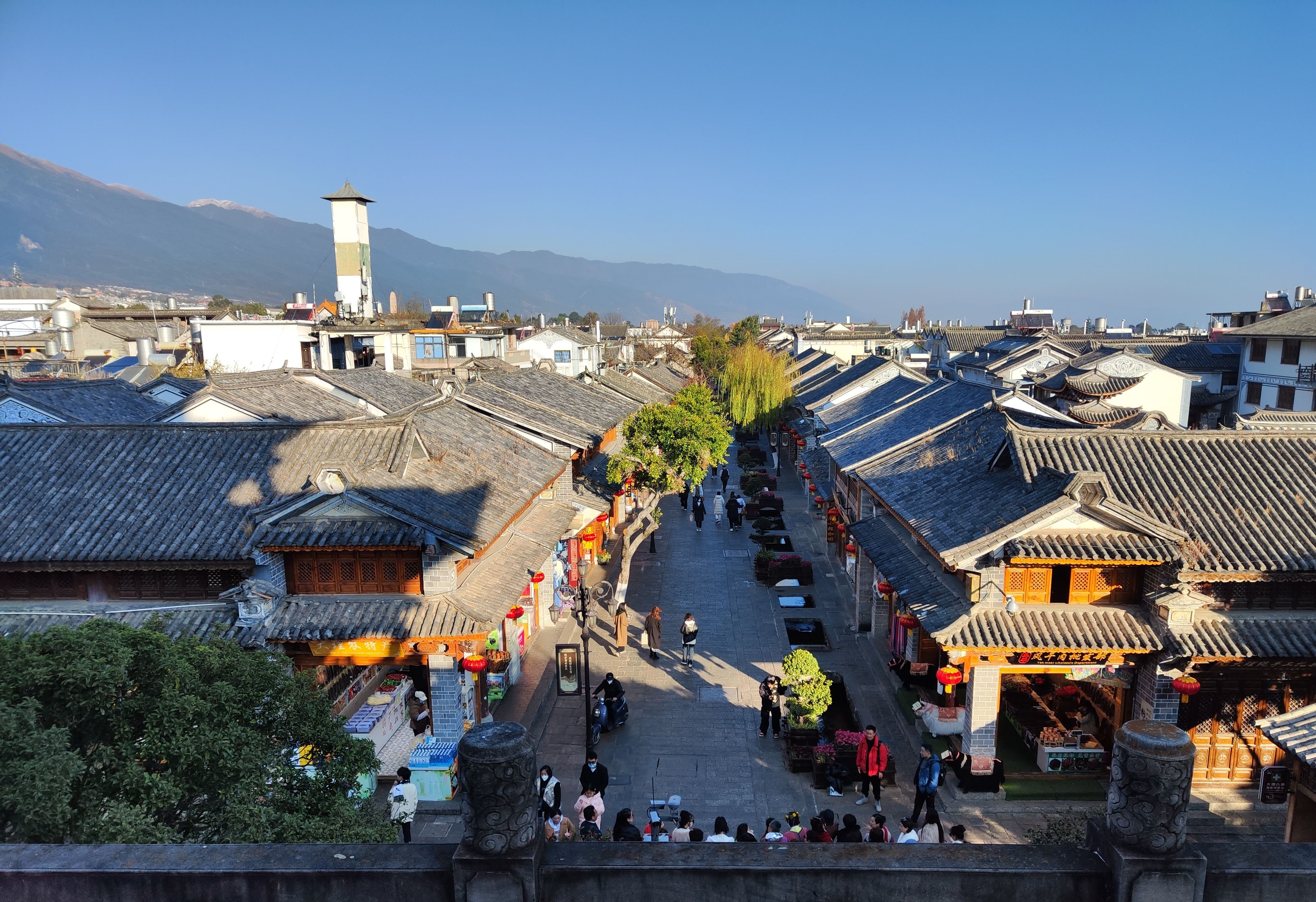
2. Cultural Geographical Perspective in Use
In this work, we adopt a cultural geographical approach to decipher the way theming of place in Dali Old Town changes the Bai ethnic identity with the help of tourism development. The cultural geography perspective emphasizes that landscapes are not only physical but are the results of meanings, performances, and power.. The perspective explains why the "Bai cultural landscape" of Dali is not just handed down but is also reconstructed.
The idea of place-making will be introduced, as the old town has been intentionally turned into a visible "Bai space" by the means of the restored architecture, the streets, and the staged cultural activities so that the image of Bai that is mostly given to the tourists is the one that has been actively produced but not preserved. This points to cultural commodification to which the traditional practices like tie-dyeing, Jiama painting, clay sculpture, and even wedding rituals are converted into commercial products. Bai cultural symbols are turning to be the major economic resources, thus causing the discord of authenticity and tourist expectations, as pointed out by Yang, Xue, and Song (2021). Urry’s concept of the tourist gaze clarifies these changes, tourists come with the preconceptions of what a minority culture is, and both the government and tourism businesses reshape the place to meet these expectations. This mechanism is the reason why customs are being simplified into short, visually appealing shows and traditional courtyard houses become boutique houses.
Moreover, Relph’s point of view about place identity being a factor in understanding the employment of Bai symbols in the public space, either in architecture or performances, constructing a collective feeling of “Bai-ness” that impacts not only the tourists but also the local residents who have to figure out their cultural belonging in a themed environment which reflects commercial logic more and more. A recent research conducted by Bai and Weng (2023) also reveals that tourism-driven commodification is not only reordering local cultural layers but also pushing the visually attractive elements to everyday practices, which is similar to what is happening in Dali. Those combined give an analytical framework where Dali Old Town is the result of the interaction of government policies, tourism capital, and preferences, turning the town into a cultural trace that indicates both the persistence of Bai identity and the pressures of commercialization, thus having a direct impact on the changes talked about in the empirical section.
3. Empirical Analysis
4. Conclusion
References
Bai, L., & Weng, S. (2023). New perspective of cultural sustainability:
Exploring tourism commodification and cultural layers. Sustainability,
15(13), 9880. https://doi.org/10.3390/su15139880
Chen, S. Y. (2017). A Summary of Japanese Scholars’ Research on Yunnan Minority Cultural Studies in the 21st Century. 现代人类学, 5(3): 33-39. https://doi.org/10.12677/ma.2017.53005
Yang, H., Xue, M., & Song, H. (2021). Between authenticity and commodification: Valorization of ethnic Bai language and culture in China. International Journal of English Linguistics, 12(5), 74–84. https://doi.org/10.5539/ijel.v12n5p74
Yunnan Provincial People's Government.(2025). 大理州接待游客逾521万人次. Retrieved November 19, 2025, from https://www.yn.gov.cn/ywdt/zsdt/202510/t20251010_318537.html
丁怡全, &严勇. (2024). 瞭望 | 大理:文旅产业圈圈突破. 新华网. http://www.xinhuanet.com/ci/20241112/e7894c6e37d54981aac971d8f919fc6d/c.html
大理日报新闻网. (2023). 国家历史文化名城—大理. https://www.dalidaily.com/content/2023-03/20/content_44948.html
1. Introduction
This project examines Temple Street, a historical and cultural landmark in Hong Kong, well known for its vibrant night market and rich traditions. Temple Street serves as a cultural landmark, reflecting Hong Kong’s transformation from a colonial trading hub to a modern metropolis while preserving elements of its local heritage. The street’s evolution — from a working-class marketplace to a tourist attraction — deserves its attention as it highlights the tensions between modernization and cultural preservation.
Situated in densely populated Kowloon, Temple Street’s strategic location and socioeconomic diversity have shaped its role as a public space. The street embodies Hong Kong’s hybrid cultural identity, blending traditional Chinese values with urban modernity. This project draws on concepts such as place-making and cultural trace theory to explore how Temple Street connects its geographical context with cultural practices through conducting interviews and observation in a site visit, offering insights into the interplay of heritage, space, and identity in a rapidly urbanizing city.
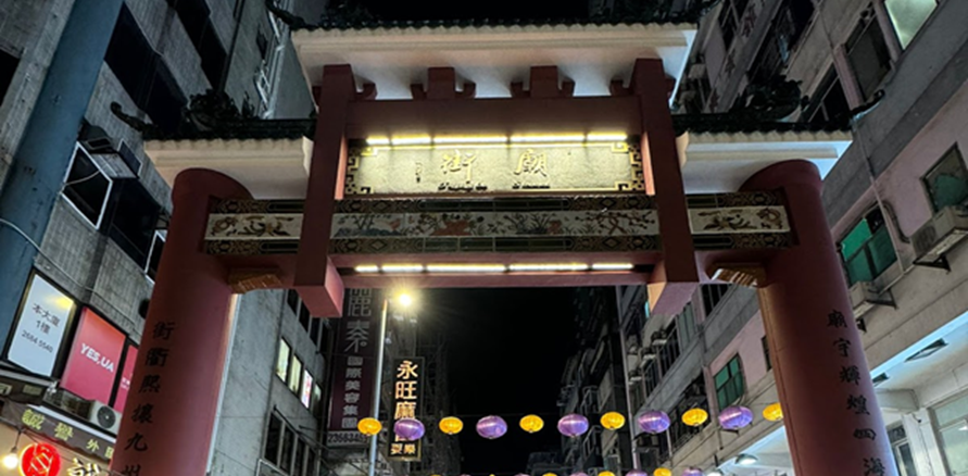
Figure 1. Temple Street Archway
2. Cultural Geographical Perspective in Use
From a cultural geography perspective, cultural traces in a place reflect the dominant cultural order, shaped by the interaction of socio-economic forces, power dynamics, and spatial transformations. These traces, whether preserved, modified, or erased, embody the evolving relationships between social groups and their environment (Anderson, 2021). As cultural orders shift over time, previously dominant practices may be marginalized, commodified, or replaced, creating a layered cultural landscape. In Temple Street, the forces of tourism and the transformation of entertainment culture have significantly altered its identity, displacing local practices while introducing new ones.

Figure 2. Illustration of the relationship between Culture and Place
Historically, Temple Street was a grassroots cultural hub for the working class, with Cantonese opera, mahjong, and street chess reflecting a communal entertainment culture. However, the push for urban modernization and global tourism has transformed it into a tourist-focused marketplace, erasing many traditional elements. Economic pressures have reshaped Temple Street, with local practices adapting to tourist demands. Informal street performances, once rooted in traditional storytelling, are now staged acts for visitors. Similarly, fortune-telling, once a meaningful spiritual service, has become a commodified, exoticized experience.
The entertainment culture of Temple Street has also evolved in response to these changes. Traditional practices such as mahjong and street chess, which fostered social bonds within the local community, have largely disappeared due to the loss of communal spaces. In their place, karaoke bars, VR arcades, and other forms of modern entertainment targeting younger audiences and tourists have emerged, reflecting the commercialization of leisure.
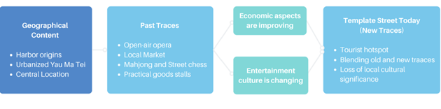
Figure 3. Project analytical framework
3. Empirical Analysis
The change in the way of leisure is an important factor that should not be overlooked in the transformation of the cultural landscape of Temple Street. At the beginning of the last century, Yung Shue Tau's harbor culture formed the initial trading of daily necessities by hawkers to the sea people. With the acceleration of urbanization in the mid-nineties (“香港記憶 | Hong Kong Memory”), inexpensive leisure and recreational facilities were needed and welcomed by the underprivileged. Some of the stalls selling daily necessities evolved into Temple Street Market, which was a popular entertainment place option for people at that time. People's interest in the marketplace also led to the emergence of a large number of businesses of various trades and industries in the Temple Street area. Popularity of traditional divination stemmed from Lingnan culture's emphasis on commercial transactions in expectation of favorable business development ahead. On the other hand, apart from Cantonese opera, drama, and storytelling, which were popular forms of entertainment nurtured by the Lingnan culture at that time, social connection was particularly prevalent. Families, friends and colleagues gather and chat as part of their nightlife, savouring local cuisine namely hotpot, seafood, dessert and other street food through the night at stalls in the middle of Temple Street. The successive emergence of these diverse cultural traces and their steady development over a long period of time were products of the interactions between the Hong Kong harbor region and its local cultures. Not only did they provide people at that time with a myriad of choices of entertainment and life experiences, but also formed a rich material and folk culture, as well as a technical arts industry in Temple Street.
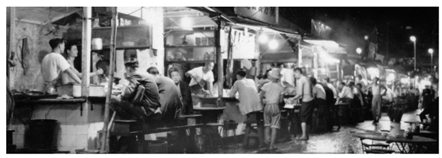
Figure 4. Food stalls in the 1960s
In contrast, today's leisure options are even more abundant and diverse (“香港記憶 | 街坊集體記憶”). The electronic entertainment that young people enjoy without stepping out of their doors has replaced the habit of gathering at the open space at Yung Shue Tau to listen to performances. The government has offered more space, for instance, Yau Ma Tei Community Centre Rest Garden outside Tin Hau Temple, for residents to rest, socialize, and relax in the city centre. Nonetheless, it trivialized the space for entertainment in the original Temple Street. Nowadays, the emergence of contemporary cultures have led to the competition between traditional Cantonese opera and new popular music (劉, 何, 2005); the competition between convenient e-commerce and bazaar shopping; and the competition between new shopping malls and entertainment venues of old stores. Together with the issue of aging and loss of population in Temple Street (劉, 何, 2005), the change of Temple Street's traces have been escalated. For instance, the addition of up-to-date products and merchandise including IT gadgets, incorporation of Western fortune telling means namely tarot cards, are spotted during the site visit. The combination of old and new marks has transformed Temple Street into a place that now serves the tourism industry.
Figure 5. Integration of foreign fortune telling (Taken during site visit)
The second reason we believe Temple Street has undergone significant changes is the economic aspect. Shopkeepers have experienced lower incomes. Referring to a documentary on Temple Street in 2005, sellers of glasses and watches share a similar point of view.
Before 2000, there were cinemas and piers, so people used to gather there. However, after 2000, there were no cinemas or piers anymore, and the competition between shops intensified with the creation of large shopping malls (劉, 何, 2005) .
According to the 2000 Hong Kong yearbook, following a moderate recovery since 1999, local consumer spending saw more significant improvements in 2000. The rise in employment numbers, real growth in labor income, and the price discounts offered by retail stores all contributed to rekindling consumer interest. Private consumer spending showed a steady real growth of 5.4% in 2000, compared to a mere 0.7% increase in 1999 (Information Services Department, 2000).
Figure 6. Chart about the relationship between GDP and CPI from 1995 to 2005
Moreover, from 1998 to 2004, Hong Kong experienced deflation (Hong Kong Inflation Rate, n.d.), leading to generally lower prices. Consequently, people began choosing nearby shopping malls and a new street called the “Ladies' Market” over Temple Street, which was often referred to as the “Poor Man's Night Club.” This shift resulted in decreased foot traffic in the area. Additionally, as the mainland market opened up to Hong Kong, Lai, a glasses shop owner, mentioned that he could only sell 2-3 glasses in an hour or sometimes none at all, compared to selling 10 previously (劉, 何, 2005).
We can see that the culture, the economy of the street, and even that of Hong Kong have changed, affecting people’s shopping modes, behaviors, and thoughts. These changes are reflected in the income of shops and foot traffic. In order to address these challenges, new traces have emerged.
Due to unsatisfactory economic conditions, the chairperson of the Yau Ma Tei Temple Street Association successfully applied for shops to open in the afternoon, not just at night, to attract more people. Temple Street has also diversified its products, ranging from selling fruits and “doggie's noodles” to electronic watches and unique handicrafts to attract tourists and locals alike. It has even transformed into a part-time pedestrian area to limit vehicular traffic (劉, 何, 2005). The composition of these new traces has, in a way, created a new Temple Street and imbued it with a fresh significance. It is no longer just a local destination but has also become a renowned spot for tourists.
Table 1. Summary table of cultural changes through observation & interview
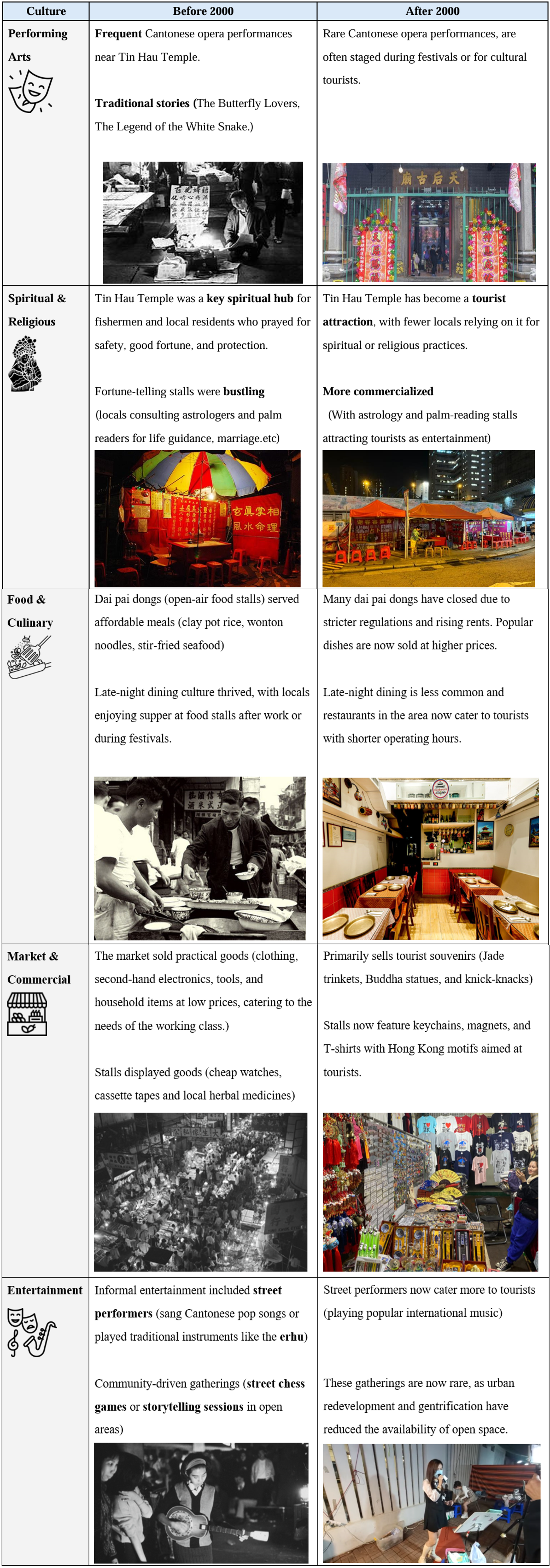
4. Conclusion
Overall, this project reveals the transformation of Temple Street through interplay between geographical location, cultural heritage and socio-economic forces. The comparison between past and current traces entails modernization and economic prosperity, which have considerably altered the traces in Temple Street, converting its identity from a local landmark with rich cultures into a tourist destination. In light of this, part of conventional practices disappear under the impact of tourism and commercial activities. Notwithstanding the significance of rapid tourism development, it is suggested that policy planning and interventions should cater to a balance of cultural preservation. For example, as reflected by the interviewee, initiate and promote authentic cultural practices without entirely adapting to the current trend of commodification. Consequently, the drawbacks brought by the aforementioned factors can be mitigated while retaining Temple Street as a representative of Hong Kong cultural hub.
Hong Kong Inflation Rate. (n.d.) Trading Economics. https://tradingeconomics.com/hong-kong/inflation-cpi (23 Nov 2024)
Information Services Department. (2000) Hong Kong Yearbook 2000: Economic-The Economy in 2000. Hong Kong Special Administrative Region Government. https://www.yearbook.gov.hk/2000/b5/04/c04-02.html (20 Nov 2024)
Hong Kong Memory. (2012). 香港記憶 | Hong Kong Memory. https://www.hkmemory.hk/MHK/collections/MemoriesWeShare/about/index_cht.html (23 Nov 2024)
Hong Kong Memory. (2014). 香港記憶 | 街坊集體記憶-活動-娛樂消遣-看電影是流行的平民娛樂. http://www.hkmemory.org/ymt/text/index.php?p=home&catId=503&photoNo=0 (23 Nov 2024)
Information Services Department. (2000). Hong Kong yearbook 2000: Economic – The economy in 2000. Hong Kong Special Administrative Region Government. Retrieved November 20, 2024, from https://www.yearbook.gov.hk/2000/b5/04/c04-02.htm
Yau, F., & 王冠豪 (編輯). (2021). 油尖旺本土文化風物誌 (第一版). 間築社有限公司.
劉瀾昌., 何錦燦., Asia Television Limited, & Asia Television Limited. (2005). 廟街榕影.
梁濤, 香港. 市政局., & 香港. 市政局. (1993). 九龍街道命名考源 = Origins of Kowloon street names .市政局.
蕭國健. (2006). 油尖旺區風物志 (第4版.). 油尖旺區議會.
李子建, 蒲葦, 鄭保瑛, 拾慧, 梁操雅, 許景輝, & 區婉儀. (2022). 我們的油尖旺故事 (初版.). 中華書局.
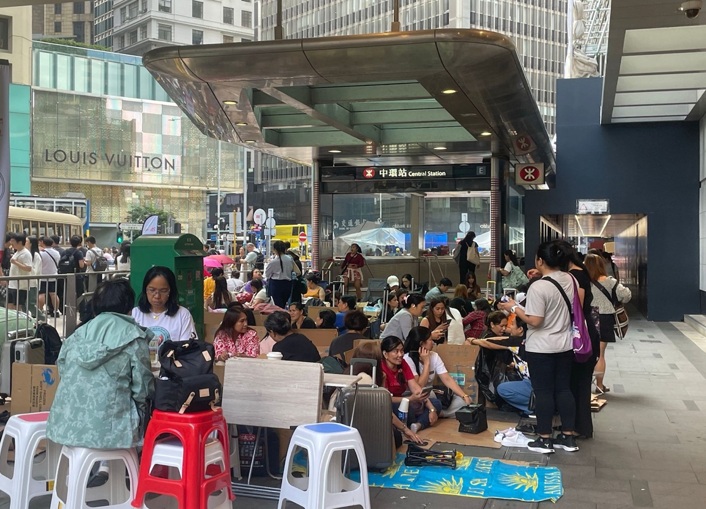
1. Introduction
From the standpoint of cultural geography, space is a
place with social customs and cultural significance in addition to being a
physical location. This interaction is demonstrated by the monthly meetings of
Filipino domestic workers in Hong Kong's Central District, whose cultural
requirements turn public places into multipurpose hubs for connection and
community. These events draw attention to a cultural tension: although Central
represents the quick-paced, effective image of a major international financial
central, its public areas also serve as essential gathering places for Filipino
domestic workers to maintain their cultural identity and strengthen social
ties. The ensuing conflicts and their consequences for managing urban space are
examined in this essay.
2. Cultural Geographical Perspective in Use
Cultural geographical perspective is finding the local
culture by learning the specific traces of geographical context in a particular
place. The local culture involves the local resident’s or nation’s religion,
holidays and conventions. It demonstrates their sense of value and worldview.
And one place may consist of various cultures but the space of a place is
limited. Thus, some conflict between different cultures will be produced
because of the occupation of the place. Our project focuses on the conflict
between the Philippine and local workers and residents about the usage of
Central place. In cultural geography, “place” emphasizes the uniqueness and
significance of specific locations. It is not just a geographical space but
also carries cultural meanings and identities, influencing people's lifestyles
and social interactions. According to Agnew and Duncan(1989), “place” has three
parts: location, locale and sense of place. Central, usually regarded as the
CBD of Hong Kong, has row upon row of skyscrapers and excellent modern
infrastructure. It is a symbol of finance, modernization and prosperity.
Generally, we think the sense of Central should be clean, tidy and modern.
However, every Sunday hundreds of Filipinos come here and set numerous
footholds occupying many public places in Central. It not only influences the
traffic but also is contrary to the Central’s sense of place.
Relationship
Cultural Influences
Growing up in a collectivist society, Filipinos always prioritize family over themselves. In fact, the culture and characteristics, family-oriented and strong sense of belonging (AFS-USA, 2023), of Filipinos align with the result of our interview. A Filipino domestic helper working in Kai Tak mentioned, “I usually buy Philippines goods like snacks in Central. I also send necessities and part of my income to my family once a month. But without an HKID, I can only use my passport to do so, and Central banks are the most convenient places for us.” Another Filipino domestic helper who works in Hung Hom reveals her reason for staying at Central, “ All of my friends are gathering in Central and I really see them as my family. Being together helps us feel less alone in a foreign place.”
Responses to our interview matched with and emphasized
the culture and characteristics of Filipinos while addressing four main
considerations of Filipino domestic helpers when choosing gathering spots on
holidays, being the availability to buy products from their hometown, send
necessities and money to their family, and meet their friends respectively.
There are a lot of Filipino-oriented stores run by Filipinos located in Central. For instance, the stores on the first three floors of the World Wide House offer a wide range of products, including traditional Filipino food, clothes, and household items. There is a postal services shipping spot underneath the footbridge of that building. Moreover, as the central business district (CBD) in Hong Kong, most banks and financial institutions are located there. Its location also allows people to access easily from every place in Hong Kong.
Besides, the urban infrastructure of these public
spaces is designed to facilitate social interaction. For example, Chater Road
(between Pedder Street and Jackson Road) is regulated as a part-time pedestrian
street from 7 a.m. to 12 midnight on general holidays (Transport Department
- Central, 2024). It creates a safe and welcoming environment for
gatherings. Also, open areas and shaded spots in Central are sufficient to
provide a comfortable gathering environment as well. Therefore, public
spaces such as Victoria Park, Charter Garden, and the areas around the Central
MTR station turn into important spots for socializing and connecting.
Traces of the interaction of the geographical context and culture
The interaction of geographical context and cultural
influences shows how Filipino domestic helpers utilize Central as a
multifunctional space for social, economic, and cultural activities. Their
choice to gather in this area is practical and deeply rooted in their cultural
need for community and connection. Filipino-oriented stores(i.e. World Wide
House) and financial institutions(i.e. multiple banks in Central), alongside
the open spaces and public areas(i.e. Chater Road) there completely comply with
the four main considerations and needs of Filipino domestic helpers. Given such
a satisfactory location, Filipino domestic helpers will doubtlessly consider
and choose Central as their gathering spot on holidays. Moreover, Central
perfectly combines the cultural practices of domestic helpers with a vibrant
urban environment that supports community interaction. Despite the challenges
of living and working in a foreign city, Central shapes their day-to-day
experiences and highlights the resilience of their cultural identity within the
urban landscape in Hong Kong.
Conflict
Being a hustling and bustling commercial district, Central houses lots of skyscrapers and luxury boutiques. Most of the professionals in Hong Kong work in Central, where the pace of life is fast and aims for high efficiency. The public areas are primarily designed to enhance productivity and represent Hong Kong’s identity as an international financial center. These areas are mainly filled by office workers and tourists in Central. This evidence showcases the importance of this dynamic urban environment to its users.
In contrast to this image, every Sunday, the public areas in Central turn into gathering places for Filipino domestic helpers to socialize and connect with their communities. These gatherings often spill into streets and sidewalks, which creates a congested atmosphere that disrupts the usual flow of pedestrian traffic and road users. Furthermore, Filipino domestic helpers usually have various kinds of entertainment activities such as eating and singing karaoke during their gatherings which causes nuisance, be it noise or hygiene annoyance, to pedestrians in and the environment of Central. A street cleaner we interviewed in Central noted the impact of these gatherings on her work, claiming “After the domestic helpers leave, I often find hair, food containers, and cardboard left on the streets, which increases my workload and causes hygiene problems.” Similarly, a tourist visiting Central for the first time expressed her frustration as well, saying “I expected a vibrant, organized space, but the crowd made me feel insecure and overwhelmed sometimes.”
In summary, by gathering every Sunday, Filipino domestic workers have transformed public spaces into gathering spots. Even though this kind of Sunday congregation encourages social interaction among the helpers, it also leads to issues like noise, littering, and crowding, which may also puts tourists' safety at danger. Consequently, Central loses some of its reputation as a busy but well-organized business hub. This necessitates balancing the preservation of the district's reputation with the management of urban space.
4. Conclusion
Central's commercial and landmark characteristics require efficiency, a fast production pace and cleanliness. The gathering of Filipino domestic helpers on Sundays affects these characteristics and creates a cultural clash. Filipino domestic workers bring their own culture to Central, including religion, festivals and customs. This affects the old values in Central. Agnew and Duncan say that 'place' has three parts: location, locale and sense of place. Tens of thousands of Filipinos live in Central. They use public spaces in Central, which creates a policing burden and damages the commercial image. But the urban design of these spaces allows for integration of these two values. It also allows for cultural meanings and identities to be expressed, influencing the lifestyles and social interactions of workers, tourists, residents and Filipinos in Central.
In conclusion, the interaction between cultural
practices and urban space in Hong Kong's Central District has turned out to be
complex. While Central is an epitome of a busy financial hub-isolated under the
banners of efficiency and modernity is also utilized as a very important
meeting point for the Filipino domestic workers who seek community and cultural
contact. Their weekly congregations turn public areas into multifunctional
spaces, which foster social cohesion but simultaneously create tensions over
noise, litter, and pedestrian congestion. This is a cultural conflict that has
brought up demands for management in urban space inclusive of varied community
needs while preserving the image of the district as a prime business center.
Balancing these competing interests is key to maintaining the identity and
functionality of Central and ensuring a vibrant space for all its users.
Agnew, J.
A., & Duncan, J. S. (1989). The Power of place : bringing together geographical and
sociological imaginations. Unwin Hyman.
AFS-USA. (2023). The Philippines. AFS-USA. https://www.afsusa.org/countries/philippines/
Transport Department - Central. (2024, May 27). https://www.td.gov.hk/en/transport_in_hong_kong/pedestrians/pedestrianisation/central_/index.html
1. Introduction
Hong Kong, a place often described as a "Cultural Desert," has led the Hong Kong government to implement several cultural policies to boost the artistic atmosphere in the city. The West Kowloon Cultural District (WKCD) is one of the biggest policy-generated places recently. Ideally, the government aims to create a world-class culture space, promoting contemporary and performing arts, and provide entertainment spaces for citizens through WKCD (Culture, Sports and Tourism Bureau, 2022). Being at the center of Hong Kong, near the high-speed station and Western Harbour Crossing, WKCD is expected to be very vibrant. Unfortunately, the effectiveness is certainly not as high as expected due to over-commercialization and capitalization. There is also news stating that the WKCD Council is running out of money, leading to the sale of land to maintain financial stability. As a result, the value of culture in WKCD decreased. In the following essay, the relationship between WKCD and capitalism will be analyzed based on geographical location, usage, and effectiveness.
2. Cultural Geographical Perspective in Use
From a cultural geography perspective, places are shaped by cultural traces, which emerge through the actions of governing authorities and the interactions of people within these areas. How a place is shaped can influence people’s perception towards this place and one’s connection to it. David Harvey (1989) proposed that cities have adopted an entrepreneurial approach to address economic challenges, with their primary aim being to attract talent and capital to stimulate economic growth. One common strategy is the development of cultural facilities that aestheticize cities and foster a culture-based economy. This would lead to the commodification of art which culture is not an end but a tool for economy.
In the colonial period, Hong Kong’s government had considered culture facilities as a welfare provision (Yiu, 2022). Since the handover of sovereignty to China, Hong Kong has embraced an entrepreneurial approach in the development of its infrastructure and cultural facilities. The West Kowloon Cultural District (WKCD) is one of the largest cultural projects in Hong Kong. Its purpose remains in attracting tourists and capital.(Zheng & Cartier, 2024). From its planning and construction to its architecture, WKCD reflects the Hong Kong government's business-minded approach and its intent to assert authority. Various traces of WKCD, such as Lau Bak Livehouse, M+ Museum and Freespace, embody these values. Hence, the West Kowloon Cultural District remains a culture business, instead of a center for nurturing artists and aesthetic education.
In this analysis, secondary data and academic articles would be used to investigate the cultural and economic implications of WKCD.
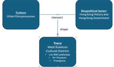
Figure 1 The conceptual framework of our study suggested by Anderson (2010)
3. Empirical Analysis
Trace 1: Lau Bak Livehouse
Live house, similar to places like a club or a bar, is a place for music performances. Its significance lies in its role as a platform for less renowned musicians and bands to deliver lives. As a crucial part of arts and music culture, live house has been included in WKCD, operating by Lau Bak Livehouse (留白 Livehouse) currently.
Lau Bak Livehouse serves customers music shows every Friday and Saturday night and gastronomic offerings as another highlight other than performance during business hours. Such business mode manifested a contrast to the conventional live house culture, where the concentration should be on music alone, with other services like delicacies, alcohol, and seats are to be subordinates, even absent sometimes. Leasing the location to profit from dining and leisure purposes apart from music means government’s further commercialization of the live house beyond its primary staging function for artists in the first place.
Lau Bak Livehouse in WKCD can hardly be differentiated from a bar out of live show period, with meal sets, light snacks, and drinks available. When it comes to showtime, things like illuminations and settings are adjusted to create a space favorable to performance and creation of vibe. Under the stage are diners and visitors - the former take seats and enjoy both dinner and music, whereas the latter stand behind and enjoy live shows without ordering food. The switch between the two modes of operation and the divergence from typical live house during performance time presented Lau Bak Livehouse as a trace embodied both artistic culture of live house and ideology of capitalism when they encounter and merge with each other. That is, while the emphasis remains on music, a higher degree of commercialization in the provision of catering service is found to be a new attraction to make income, in addition to live shows supposedly.
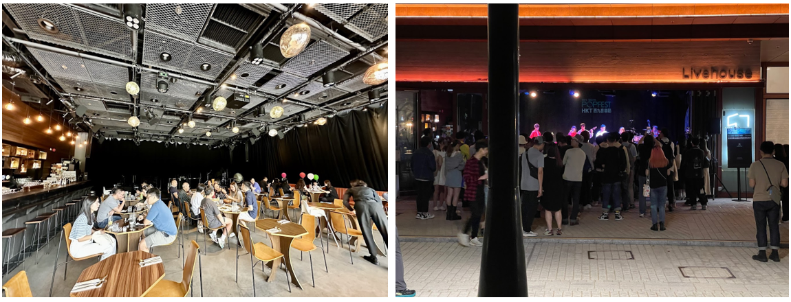
Figure 2 Lau Bak Livehouse at different time with diverse usage of the place (Source: Google Map)
Trace 2: M+ Museum
The M+ Museum, located in WKCD, presents itself as a breakthrough in the preservation of the contemporary visual culture of Hong Kong and the international stage. The exhibitions include visual art, design, and architecture, and persist to inspire the audience with the help of a collaborative business model with entrepreneurs. Immense investment in the design and construction of the M+ Museum indicates the ambition for a peak in the fusion of cultural sustainability and commercialization.
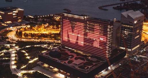
Figure 3 M+ Museum (Source: Ming Pao)
The M+ Museum commits to accessibility and connection to the public. Partial workshops and programs are free of charge due to sponsorship as well as exhibitions. One of the remarkable exhibitions was ‘Hong Kong: Here and Beyond’, in which artists interpret the features of historic stages of Hong Kong in the form of visual art. In addition, the entry was handled free of charge as sponsored by Bloomberg Philanthropies and Chartwell Capital. The museum succeeding in multiplicity in passionate art expression is ascribed to the stable financial foundation provided to the artists and venue without the scenario of operating on strictly controlled budget from the government that disturbs the fluidity of art expression. Therefore, the primary distinctive feature of the collaborative business model is the financial stability provided for cultural sustainability.
On the other hand, the course of art expressions may be redirected due to profit maximization by the partnered entrepreneurs. The business model welcomes partnerships with custom schemes offering commercial benefits to each partner, including promotion through souvenirs, digital marketing events and sociality through exclusive events. Although accountability exists in M+ Ltd, influences are often indirect and subtle to originality. Therefore, while finances guard cultural sustainability, commercialization of the institution may restrict the maximization of freedom of art expression due to the intervention of entrepreneurs.
Figure 4 HSBC becoming the leading sponsorship partner of M+ Museum (Source: HSBC)
Trace 3: Freespace
Freespace in WKCD is designed for contemporary performing arts in Hong Kong. The area offers a platform for different kinds of programs and activities like art exhibitions, community activities, modern dance, music festivals, and theatrical experiences. Committed to presenting performances and promoting innovative artistic experiences as well as corporations, Freespace allows people of different ages and backgrounds to enjoy arts and communicate.
In Freespace, the relationship between commercialization and cultural sustainability through its diverse programming and community engagement is shown. For example, events like concerts or art exhibitions were hosted to attract large audiences. Also, it can generate revenue while promoting accessibility. However, the larger focus on popular and commercial events may overshadow niche artistic self-expressions. Some public-private partnerships with corporate sponsors providing fundings could influence the topic or form of pieces directly. It manifested the challenge of balancing the economic interests under capitalism and commercialization and implicit voices or purpose of the exhibited works.
Furthermore, Freespace is attractive because of insufficient open spaces in Hong Kong. It supports the development of creative industries by providing affordable rental space for artists. This lowers the entry barrier and allows talents to show their work and develop sustainable business models. Art and businessman’s vision are interdependent, and this most accurately describes the capitalistic approach, whereby branches to which cultural organizations belong learn how to bring value to the audience while preserving creators’ vision. It is a win-win scenario if a young artist can offer an attractive place where space is provided at moderate prices. It enables all to evolve by creating cultural initiatives that seek efficiency even in a capitalistic model which demonstrates that cultural activities can indeed be sustained by developments in the business realm rather than the opposite occurring.
Figure 5 Freespace (Source: West Kowloon District Authority, taken by Winnie Yeung)
4. Conclusion
To conclude, capitalism leads to the emergence of the WKCD and the architectural structures mentioned earlier. Examples such as the Live House, M+ Museum, and Freespace clearly illustrate the concept of cultural geographical use, where places are molded by cultural imprints arising from the actions of governing authorities and interactions among people within these areas. This demonstrates the common practice in Hong Kong of utilizing this approach to shape spaces. However, questions arise regarding the original intent behind the creation of the WKCD. Under capitalism, how can cultural development be sustained? It poses a challenging situation, yet there are some brief policy recommendations. For instance, leasing out spaces to individual artists and organizations to enhance vibrancy, with the rental income aiding sustainability. The aim is to establish a cultural hub that fosters interaction among diverse cultural practitioners, rather than solely operating as a business, as typically seen in Central or Wan Chai. Let’s look forward to how WKCD will be better in the future.
References
Harvey, D. (1989). From Managerialism to Entrepreneurialism: The Transformation in Urban Governance in Late Capitalism. Geografiska Annaler: Series B, Human Geography, 71(1), 3–17. https://doi.org/10.1080/04353684.1989.11879583
West Kowloon Cultural District. Culture, Sports and Tourism Bureau. (2022, July 22). https://www.cstb.gov.hk/en/policies/culture/west-kowloon-cultural-district.html
Yiu, M. H. L. (2022). Cultural Centers in Hong Kong: Welfare Provision or Economic Instrument?. Architecture and Culture, 10(1), 58-75. https://doi.org/10.1080/20507828.2021.2020040
Zheng, J., & Cartier, C. (2024). Territorializing the Pearl River Delta:“state entrepreneurialism” in the cultural facility boom. Urban Geography, 1-27. https://doi.org/10.1080/02723638.2024.2387994
1. Introduction
This project focuses on
the revitalization of historical buildings in Hong Kong's Central District. It
will analyze the reasons for their preservation and continued use in the face
of modernization. The revitalization of these buildings illustrates not only
the evolution of the city at the crossroads of globalization and local
character but also how this city has preserved its traditional culture while
pursuing cost-effectiveness and efficiency. Applying the humanistic analysis
methodology of New Cultural Geography, our project will take the Big House and the
Central Market as examples. By analyzing how these buildings maintain their
unique value within Hong Kong's geographical and cultural context, we can gain
a brief insight into how the revitalization has been accomplished in Hong Kong
and promote this approach to other regions.
According to the humanistic analysis method of New Cultural Geography, the study of cultural landscapes in the form of dwellings should not only focus on the changes in their formal functions but also on the cultural significance of the landscape to the observers and their changes over time. Due to the differences in people's aesthetic sensibilities, social relations, and other aspects, there are many different forms of dwellings even within the same natural environment, which shows that the humanistic factor is the main factor in the formation of such cultural landscapes, and the dominant factor in the changes in forms and functions of such cultural landscapes. Considering humans' essential role in these cultural landscapes, more attention must be paid to their cultural significance from an anthropocentric perspective in our analysis. (Cosgrove etc., 2005)
Cultural landscapes, as
traces resulting from the interaction between geographical context and
cultures, carry the prevailing ideologies and values of society. The changes in
their forms and functions can reflect the changes in the mainstream thoughts of
society over time. Adopting the humanistic analysis method, our study will
analyze the transformation and revitalization of the historic buildings in
Central Hong Kong from the perspective of their cultural significance and
changes to Hong Kong people, as well as the collision, contradiction, and
co-existence with Hong Kong culture, particularly in the context of the city’s
rapid development and emphasis on efficiency. By evaluating the revitalization
of the historic buildings in Central Hong Kong, we can gain a deeper
understanding of protecting historic cultural landscapes under the rapid
development of modern society.
3. Empirical Analysis
Central Market
Central Market, whose history can be traced back to 1842, is one of the oldest markets in Hong Kong. The 1st generation Central Market was built under the governance of Britain after the occupation of Hong Kong Island in 1841. In the past, the Central Market was just a marketplace that used Functionalism as its main building style without many complex designs. This shows the emphasis on efficiency in Hong Kong culture since British Hong Kong. (Chinachem Group,2024). The Central Market is a cultural landscape, and its values and appearance vary with the change in value judgment and culture of society. Using the humanistic analysis method, we can contrast the past and modern Central Market.
As time passed, the latest generation Central Market has immersed elements of arts while keeping some functions of a market. In 2009-2011, different stakeholders had shown their opinions and expectations to the revitalization of the Central Market. Most of the citizens expected that the Central Market would be revitalized into a space for leisure and affordable eateries with local cuisines. Since Hong Kong was ruled by Britain for almost a century, the building designs and the culture were blended with the foreign culture. We can see the function and meanings toward Hong Kong citizens varies over time, which changed from a market purpose to a place for recreation. (Chinachem Group,2024).
Over the centuries, Hong
Kong citizens have continued to emphasize efficiency in every aspect, including
the design of buildings.
Compared to revitalizing a building, it is more efficient and cost-effective to
demolish and build another infrastructure in the same place. However, the
Central Market has not been demolished into another skyscraper. This is because
the culture in this place has brought a sense of belonging to the citizens
nowadays. The sense of belonging and collective memory has saved the Central
Market from being demolished. The mainstream thoughts of efficiency have not
changed over time, but cultural development has also become one of the
mainstream thoughts nowadays.
In modern times,
efficiency and cultural development are equally important. Hence, the
revitalization of the Central Market will be an example of how to preserve
tradition while pursuing benefits. Different topics of art exhibitions or
events about local or international cultures would be held in the Central
Market every month. As time passed, the Central market has not only been
preserved as an ordinary market but also a place to gather citizens, promoting
art and culture in Hong Kong. This shows the usage of the Central Market has
changed as citizens tend to pursue art and cultural development in Hong Kong.
With this trend, the Central Market is currently challenged by the problem of
balancing commercialization and culture preservation. (Chau,2021)
Big House, which was the
Former Central Police Station compound in the past, was built in 1864 in Hong
Kong Central. At that time, Central was the concentration of colonialism, and Big
House was the symbol of the law and authority of the colonial government. As
one of the key facilities, it assumed the functions of a police station, court,
and prison. It has deep imprints of colonial culture. Its architectural style
fully shows design features in the colonial period, such as symmetrical
architecture, red brick facades, and arched windows. These elements showed the
high emphasis placed on functions and orders during the British colonial
period.
As the most prosperous
commercial and cultural center in Hong Kong, Central combines traditional and
international features. The location of Big House is not only close to the
financial center but also to the traditional streets. This geographical context
provides more complexity and possibilities for the revitalization of Big House.
There are more requirements to maintain the historical trace and encounter
modern society's needs for various functions. The revitalization of Big House
is not only the protection of historical memories but also the mixing of
cultures. By mixing traditional and modern, local and international elements,
Big House successfully became a vital platform for showing the diversity of
Hong Kong culture.
The revitalization of Big House cannot be realized without the joint effort of government, community, and market. First, the Hong Kong government provides policy support and financial security for the revitalization of Big House. Besides, by planning activities that combine traditional and modern culture, the culture institutes and community help Big House transform into a public space for citizens. The power of the market also cannot be ignored. The commercial value of Central attracts the participation of creative industries. By introducing artists, cultural and creative shops, and characteristic restaurants, Big House has not only achieved a diversity of functions but also enhanced its economic sustainability. This cooperation of government, community, and market makes Big House keep its historical value and get involved in modern city life.
Big House has even more functions and symbolism than in the colonial period after revitalization. Through the introduction of Hong Kong's traditional and local cultural elements, Big House gets an extensive form of culture. It holds cultural lectures and exhibitions with different themes frequently, including modern art and Hong Kong's traditional art. These activities not only enrich the cultural content of Big House but also highlight the diversity and inclusiveness of Hong Kong's culture.
In the process of the
revitalization of Big House, there have been many challenges, like the
over-commerce problem and the cultural identity conflicts in the colonial
background of Big House. To meet these challenges, Big House enhances the
participation and sense of belonging of the public by holding various
multicultural events. For example, by organizing events that combine
traditional festivals with modern art, Big House becomes a cultural sharing
space. It not only resolves cultural conflicts but also allows Big House to
find a balance between cultural heritage and modern functions.
4. Conclusion
In conclusion, this study
focuses on the revitalization of historic buildings in Central Hong Kong and
analyzes the socio-ideological shifts reflected behind each morphological
transformation of locations, such as Big House and Central Market. The
evolution of these places is more than just a practical adjustment. It is also
a reflection of cultural identity and memory, where traditional and modern
aspects coexist. Through the study, we propose that the revitalization effort
in Central shows the possibility of mutual reinforcement between tradition
preservation and the pursuit of benefits, emphasizing the importance of keeping
historical authenticity while meeting modern needs. We also conclude that Hong
Kong's building regeneration work is worth repeating globally: encouraging
multi-stakeholder participation, such as using cultural activities to enhance
the public's sense of belonging and cultural identity and encouraging social
and commercial organizations to undertake revitalization work.
Berg, L. D. (2005).
Cosgrove, D. 1985: Social formation and symbolic landscape. Totawa, NJ: Barnes
and Noble. Progress in Human Geography, 29(4), 475–477. https://doi.org/10.1191/0309132505ph565xx
Central Market 中環街市. (n.d.-a). Retrieved November 16th, 2024 from https://www.centralmarket.hk/en/history-timeline
Central Market 中環街市. (n.d.-b). Retrieved November 16th, 2024 from https://www.centralmarket.hk/en/revitalization
Chau, C. (2021b, August
26). Hong Kong’s Central Market comes back to life but conservationist takes
issue with “gentrification.” Retrieved from Hong Kong Free Press HKFP website: https://hongkongfp.com/2021/08/26/hong-kongs-central-market-comes-back-to-life-but-conservationist-takes-issue-with-gentrification/
Historical Timeline | Tai
Kwun. (n.d.). Retrieved November 16th, 2024 from https://www.taikwun.hk/en/taikwun/heritage_conservation/historical_timeline
Projects | J. Roger Preston Limited - Heritage - Tai Kwun (Former Central Police Station Compound). (n.d.). Retrieved November 16th, 2024 from https://www.jrp-group.com/en/projects/detail/4/
1. Introduction
In accordance with the theory of oceanic settlement(Zhang, 2023), this project proposes the concept of oceanic city. Taking Quanzhou during the Song and Yuan dynasties as the object of study. We tried to analyze, through several cases, in what geographic factors the oceanic character of Quanzhou was formed. And how it moderated the complex and pluralistic religions of Quanzhou.
Oceanicity implies both dependence on and belief in the ocean and passive acceptance of whatever the ocean brings. The instability makes it possible to solve problems only in a flexible way rather than in a violent way. Quanzhou is a standard oceanic city. Economically, Quanzhou's unique location made it one of the largest commercial port cities of his time. Thus, it also culturally brought with it a large number of foreign religions in addition to beliefs of indigenous maritime origin. Today we can see a large number of religious relics of different religious gathered in Quanzhou in the small city (Wang, 2017), so how did foreign religions and the local culture of Quanzhou resolve the contradictions brought about by the differences in the principles of faith in such a complex situation of beliefs in the Song and Yuan dynasties? What kind of cultural connotations do they represent?
Islam (伊斯蘭教)
Qingjing Temple
is a Islam temple, located on Tumen Street features 99 pointed arches on its
door frame, symbolizing Allah's 99 beautiful names (Baidubaike, n.d.). It operates to worship
Allah and perform worship, with Quranic verses carved on the south wall windows
and interior niches, reflecting believers' devotion. The first mosque is
located in Mai, since they have to worship facing Mecca (south side) , they erected
a row of date palm trunks on the south side to let followers pray under shadows
(Cai, Y. L., 2017). They keep it as a tradition and a feature of Qingjing
Temple which emphasizes Islam disciplinary, unity and attention to detail.
Buddhism and Induism(佛教与印度教)
There are many Buddhist temples in Quanzhou, the most famous of which is Kaiyuan Temple. The most representative buildings in Kaiyuan Temple are the two pagodas and Hindu stone pillars. The Zhenguo Pagoda is 48.27 meters high. From bottom to top, it gradually represents the five realms of Buddhist practice, including gods, generals, arhats, eminent monks, Bodhisattvas, and Buddhas. There are 40 carvings on the girdle of Xumi Zuo, 37 of which are pictures of Buddhist sutra stories. Buddhist sutra stories are a way used by monks to promote Buddhist ideas. The Renshou Pagoda is 45 meters high, and the carvings on it express the equality of all living beings. It is conceivable that Buddhism could organize a large social organization and have sufficient economic level in Quanzhou at that time. Both pagodas convey the characteristics of Mahayana Buddhism. There is also a corridor of special stone pillars in Kaiyuan Temple, which are Hindu stone pillars. It shows stories from Hinduism, mainly showing the power and magic of Hindu gods.
In 1941, A Nestorian ChristianityTombstone written by Uyghur was founded in Quanzhou (Niu Ruji, 2003). It is inferred that the Nestorians in Quanzhou mainly come from the Uyghur people in the north. The "History of Yuan" indicates that many Uyghur people were re-employed by the Yuan government, with a significant number serving as officials in the southern regions. Which is believed in Nestorian Christianity. Nestorian Christianity won the emperor's favor in the early Tang Dynasty. Then Nestorian teachings transformed into Buddhism, which greatly pleased Empress Wu and allowed it to continue to develop.
During the Huichang period, Emperor Wuzong of the Tang Dynasty exterminated Buddhism. The Church of the East in China and Manichaeism was affected. Master Hulu of Manichaeism therefore fled to Fujian and preached in Quanzhou via Fuqing and Fuzhou.
Emperor Taizu of the Ming Dynasty banned Manichaeism, known as Mingjiao, because he believed the name of the country was too exalted for a religious having similar name. After That, The religious activities gradually became Buddhist, and the Mani Buddha statue in the Cao'an, considered by later worshipers to be a Buddhist temple, was once worshiped as a statue of Sakyamuni Buddha.
Folk Culture and Religion In Quanzhou
The local
culture of Quanzhou comes from two sources, one is derived from marine culture
and the other is traditional culture. The most representative are the Tianhou
Palace and Tonghuai Guanyue Temple (通淮关岳庙).
Tianhou Palace was built in 1196 near Deji Gate, the southern gate of
Quanzhou's ancient city. The main deity is Mazu, who mainly protects the safety
of people in the inner harbor and at sea. Tonghuai Guanyue Temple is next to
Qingjing Temple. The main deities enshrined therein are Guan Yu and Yue Fei,
both of which primarily represent justice and loyalty. Both are the most
significant deities in traditional society, and also these two natures play an
important role in commercial cities.
Confucian Characteristics
The Confucian buildings in Quanzhou were mainly constructed during the Song Dynasty, and the most representative one in Quanzhou is the Quanzhou Prefectural Temple of Literature. It was rebuilt during the Southern Song Dynasty in the pattern seen today, with large palace-like corridors and a main hall in which Confucius and his disciples were enshrined. This was due to the rise of Song and Ming ethics during the Southern Song Dynasty, coupled with the prevalence of the Song literati ethos. It made it a kind of cultural force of the Song officialdom.
Taoist (道教)
Yuanmiao Temple, established in the 3rd century, is the first Taoist temple built after the introduction of Taoism to Quanzhou. Throughout various dynasties, it has undergone numerous reconstructions and remains the most significant Taoist temple in the city. Taoism thrives in Quanzhou, highlighted by a mountain stone-carved statue of Laozi on Qingyuan Mountain (清源山石造像), which is the largest Taoist statue in China. According to legend, Laozi journeyed here to achieve sainthood, attracting global reverence. The continuous incense offerings have made Qingyuan Mountain a renowned destination for Taoist sightseeing , pilgrimage, and enlightenment (Ding, Y. L, 2019).
2. Conflict and Integration between religions
In Quanzhou's religious beliefs, the contradiction between religious beliefs and culture mainly exists between local and foreign cultures as well as between the original foreign culture and the backward foreign culture. In short, local culture is the cultural background of Quanzhou formed before the Tang Dynasty. After the Tang Dynasty, Buddhism, Hinduism, and Taoism took root in Quanzhou and formed its mainstream religion. After commerce became sufficiently developed from the end of the Tang to the Song Dynasty, Islam, Nestorianism, Manichaeism, and other foreign religions emerged once again when they entered with merchants, and traditional Confucianism, which had become Song and Ming ethics, took hold. The two examples discussed in this project are derived from historical records and can be reflected in actual cultural imprints. The first example is about indigenous culture and Buddhism. The second example is about the conflict and integration of Islam and Confucianism.
In the first example, at the end of the Northern Song Dynasty and the beginning of the Southern Song Dynasty, King Tong Yuan was the most popular local belief in Quanzhou, who was able to regulate the wind and rain and blessed those who sailed the sea. As a local belief, the “Tong Yuan Wang Ancestral Hall” often held festivals at the Yan Fu Temple, and it was popular to slaughter animals to sacrifice to the gods. In the first year of Shaoxing (1131), the abbot of Yan Fu Temple,Hui Sui Chan Shi, reformed the secularized Taoist rituals with Buddhist precepts. And constructed an additional suilu-an to reform the Tongyuanwang Shrine. As a result, a temple for the worship of local gods was opened in Yan Fu Temple, which had already been established in the Jin Dynasty. This is due to the fact that the indigenous religions of Quanzhou, which originated from the sea, were very complex and often consisted of only basic deity worship without specific religious ordinances. This phenomenon can be reflected in their misplaced functions and hierarchies of the various deities. (Gu, 1927) Thus it is possible to tolerate all kinds of religions and accept their transformation. Another point is the ideology of equality of all living beings and the strict Buddhist precepts represented by the Buddhists, and Buddhism at this time had the corresponding social power to interfere with the ritual behavior of other cultures. At the same time, such phenomena also happen in the relationship between the dominant religious power and the fine-stream religious power. This can be seen in the cultural imprints of the Hindu stone pillars in the Kaiyuan Temple and the Manichaean straw nunneries that changed the images of the gods into a combination of Buddhist and Taoist images.
The second example is during the Southern Song Dynasty, when Wang Dayou governed Quanzhou. A group of Arabs wanted to build a mosque in the city, but the building was so close to the nearby Confucian school that it would affect the Confucian students. Wang Dayu strictly forbade it and made it clear that no residence should be allowed to enter the urban area(Tuo, 1343) . In the Song Dynasty, a neighborhood of outsiders was formed outside the city, called “Fan Fang”(蕃坊). In reality, however, the mixing of outsiders with local residents may have been a reality(Li, 2007). This shows that the government of Quanzhou in the Song and Yuan dynasties, while respecting religion, also had specific regulations and guidance for religious groups in terms of taxation and public order. This can also be seen in cultural imprints such as the inscriptions of Song dynasty Quanzhou government officials who assisted in the construction of a pagoda at the Buddhist Kaiyuan Temple, and the Yuan dynasty inscriptions that enthroned administrators of Islamic and Nestorian religions (Wang, 2019).
Quanzhou Historic Sites Geographic Information Map (Source: https://www.google.com/maps/d/edit?mid=1UWabahDFDiKGov6PeoyI5zB2XcFv6Xo&usp=sharing)
3. Conclusion
After the above analysis, we can see that there are certain differences and contradictions between different religions in Quanzhou. In the specific process of getting along together, the local culture as the belief of oceanic origin gradually becomes the carrier of Quanzhou culture, and becomes the base color and bonding vessel of any religion. Various religions were transforming the native culture while influencing each other. At the same time, the political forces in Quanzhou are not to be ignored. In the mutual influence of various forces, we can see that Quanzhou during the Song and Yuan dynasties embodied the inclusiveness of an oceanic city, which enabled all kinds of religions of the world to merge and develop together in Quanzhou.
References
Niu, R.J. (2003). The origin of Nestorianism in Quanzhou and Yangzhou from the unearthed inscriptions. Research on World Religions. https://www.cultus.hk/Quanzhou/LoPC/QZNestTablet.Pdf
Ou Shimei. (n.d.). Islam in Quanzhou. Hong Kong Tertiary Student Social Service Team. http://hkcssst.net/web_1210/religion_tomb/religion_tomb.html
Cai, Y. L. (2017, January).Global collection: Islamic architectural art under the sky of Allah. Classic magazine. https://rhythmsmonthly.com/?p=31596
Baidubaike. (n.d.). Qingjingji Temple. https://baike.baidu.com/item/清净寺/222178
Zhang, M. (2023).Concepts related to maritime archaeology.Marine Settlement and Coastal Defense Remains: A Survey Study of Marine Cultural Remains in Nan'ao.Shanghai: Shanghaiguji Publish.
Wang, S. J.. (2017). “Song-Yuan Quanzhou and Religious Symbiosis in the Perspective of the Maritime Silk Road”. Ningxia Social Science (06), 170-178. doi:CNKI:SUN:LXSK.0.2017-06-029.
Wang, S. J. . (2019). Indirect Governance Progressions in Religious Governance in Yuan Dynasty--Taking Religious Symbiotic Space in Quanzhou in Yuan Dynasty as an Entry Point. Journal of Northwest University for Nationalities (Philosophy and Social Science Edition) (01), 24-32. doi:10.14084/j.cnki.cn62-1185/c.2019.01.004.
Li, J. Q.. (2007). Ethnic Interaction and Cultural Change (Master's thesis, Fujian Normal University). https://kns.cnki.net/KCMS/detail/detail.aspx?dbname=CMFD2008&filename=2007186285.nh
Tuo, T..(1343) Song History. Beijing: Zhonghua Book Company.
Gu, J. G.. (1927) The Land God of Quanzhou. Weekly magazine of the Institute of Chinese Studies, Xiamen University.
Ding, Y. L. (2019, August). Foreign religions in Quanzhou. Academy of Chinese Studies. https://chiculture.org.hk/tc/china-five-thousand-years/1875
1. Introduction
This
project explores Hong Kong’s vibrant neon signboards, which once defined its
iconic skyline and symbolised the city’s bustling urban life. Yet such
signature brightness has dimmed as a result of tug-of-war between powers, especially through governmental legislation and
intervention in the past decades, which has been brought to our attention. As
traces could be durable in both a material and non-material sense, the
disappearing signboards now remain as an intangible cultural trace,
particularly a collective memory in many residents’ hearts (Anderson, 2015).
Hence, this project investigates how the concept of power and hegemony applies
in the decline of neon signboards, and how major stakeholders including the
Hong Kong government and conservation groups have circulated around the trend.
2. Cultural Geographical Perspective in Use
Power is ubiquitous and present in various aspects of life including the field of cultural geography (Sharma, 2018). Instead of being static, power is dynamic since it will move multi-directionally and circulate while people will experience both exercising the power and being subjected to the power (Lucknow University, n.d.; Sharma, 2018).
The above brief introduction reveals that there is a shifting and changing exercise of power among stakeholders regarding neon signboards. Thus, we would like to employ one of the cultural geographical perspectives which is power dynamics to analyze how stakeholders such as the government and the conservation groups exercise their powers and interact with one another and how these contribute to the transformation of neon signboards in Hong Kong. For instance, the government exercise its power through the modality of legislation that results in a dramatic decline in the number of neon signboards in Hong Kong as well as the dominance effect. Nevertheless, power can be productive in terms of engendering the appearance of new behaviours and resistance, which is a built-in attribute of power, comes along with the exercise of power (Balan, 2010; Lucknow University, n.d.). Different measures such as establishing exhibitions for demolished neon signboards have been adopted by the conservation groups to not only preserve neon signboards and those embedded collective memories and values but also resist or challenge the dominating power of the government. These measures employed by the conservation groups have also transformed neon signboards in Hong Kong such as converting the value of these signboards from a commercial one to an artistic one. The above is a succinct account of how the exercise of the powers of different stakeholders and their interactions impacts neon signboards. The following analysis will provide a more comprehensive and in-depth explanation.
3. Empirical Analysis
Dominating power and hegemony
The Hong Kong government has implemented its powers over neon signboards with various legislative measures and regulatory frameworks, leading to neon signboards' decline nowadays. Dominating power is established with regulations that curb new building works, reduce existing building works and attain cultural change through education of neon signboards. It provides the government with ways of regulating operations and offering monitoring. Legal authority impacts the commercial and cultural value of neon signboards in Hong Kong.
The regulation of neon signboards in Hong Kong has been comprehensive through various legislation, greatly reducing their prevalence. The population of these signboards has decreased from an estimated 120,000 in 2011 to fewer than 500 by 2023 (Leung, 2023). Within five years, the government has issued almost 5,000 removal orders about 16,711 signboards (Hu, 2023). This change indicates that the government emphasizes urban aesthetics and public safety over cultural preservation.
Hegemony is the dominance of one cultural group others, obtained through
various ways such as coercion, regulation and the willing acquiescence of
citizens. The regulatory mechanism has spread the message to the public that
neon signboards are outdated. Many people view neon signboards as unpopular or
even illegal, which affects the perception of the public and reduces resistance
to their eradication. Here, the government has abused its power to suppress the
idea of neon preservation, thus demonstrating the existence of hegemonic
practices.
The Hong Kong government implemented stricter neon signboard installation and maintenance restrictions. Under the Building Ordinance, signboards must be approved by the Buildings Department before building, and smaller, lower-risk ones must deliver completed photos within 14 days. Some projects are excluded from permission or professional services. Signboards not set up using the aforesaid processes are illegal (法律101, 2023). The Buildings Department can order the removal of an unauthorized signboard under Section 24(2)(c) of the Buildings Ordinance. Many signs have been removed for safety and building compliance reasons (Building Department, 2018).
Neon signboards are regulated by the government since improper installation and maintenance could put public safety in jeopardy. Most neon signs are very old, and the government needs to make sure they do not fall from ageing and destruction and attack pedestrians and cars (胡恩威, 2022). Besides safety concerns, light pollution is one reason the government needs to act upon it. It affects residents' quality of life as urbanization develops. Therefore, the government controls the neon signboards to protect the citizens' environments (香港01, 2018).
Neon signboards play an important role in commercial activities and attract customers' attention. As part of its regulation, the government will exempt small signboards that meet safety criteria to boost the local economy. The government has introduced a voluntary "Validation Scheme" for smaller signboards with reduced risks built before September 2013. Keeping signboards after examination and approval by Safety inspectors, consolidators, and certifiers who are appointed by the owner. After 5 years, signboard owners must examine or remove them (法律101, 2023).
The
"Validation Scheme" allows some signboard owners to maintain them if
they fulfil safety regulations. Signboard owners face constant difficulties
with five-year re-inspections. Under the inspection method, just a few signs
can last for five years before their legality is challenged. Since the signs
were illegal, their long-term viability is uncertain. Companies have switched
to digital displays or compliance signage.
Table 1: Signboards eligible for validation (Sources: Buildings Department. (n.d.))
|
Signboards eligible for validation |
||
|
Type of signboard |
Clearance from
|
Projection from |
|
Projecting signboard
|
Pavement:Min. 3.5m Carriageway: Min. 5.8 m Tramway:Min. 7m |
Kerb: Min. 1m External wall: Max. 4.2 m Signboard on the opposite side of the street: Min. 3m Centerline of the street: 1.5m
|
|
Wall signboard |
Footpath: Min. 2.5m |
Wall: Max. 600mm |
|
Signboard on roof |
|
Inside face of the roof parapet or curb: Min. 1.5m |
Resistance of the conservation groups
Resistance power arises accompanying dominant power. Conservation groups adopt various strategies to express their strong demands for cultural heritage protection and dissatisfaction with government policy in response to the power dynamic.
Conservation groups believe that neon signboards reflect Hong Kong's social and economic evolution, as they represent previous prosperity. These groups perceive neon signboards as essential to Hong Kong's culture, rather than only a commercial instrument. Their absence will reduce Hong Kong's uniqueness in its urban landscape and culture. This change impacts the identity of the local population and complicates the ability of international tourists to appreciate the unique attractions of Hong Kong (豆子, 2020).
Some conservation groups founded "Neon Intersection" in Hong Kong to focus on neon signboard conservation. They work with commercial entities like Tsui Wah Group to conserve neon signs. It held monthly displays of restored neon signs to educate the public about their history. To raise awareness of neon lights and their cultural significance (ELLEMEN HONG KONG, n.d.). Conservation groups use such methods to raise awareness of neon signboard conservation. To combat government-promoted principles, neon signboards are no longer popular and can be dangerous.
More people are paying attention to the
conservation of neon signboards. Some young people are studying the trade to
preserve this traditional expertise (香港文匯網, 2023). This movement supports existing
signboards and allows for future creations. For instance, some shops and restaurants have moved neon
signboards indoors to continue their role. It helped turn neon lights into
aesthetics from their commercial value (香港旅遊發展局, n.d.).
Exhibition View at Vita Sign Laundry Step (Source: Tai Kwun)
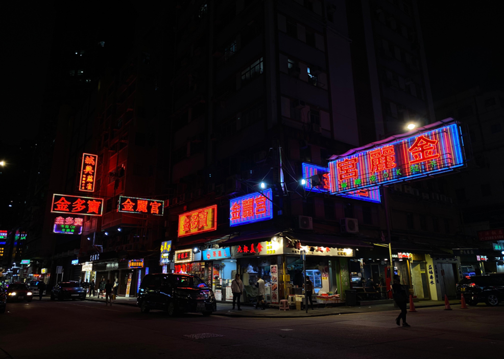
Existing neon signboards in Mong Kok (Source: Self-taken Photo)
4. Conclusion
To
sum up, this project laid emphasis on analysing how power dynamics are shown
from neon lights. The two major stakeholders comprising the power dynamics are
the government and the conservation groups. The government implemented
legislative measures and frameworks to regulate signboards. Height and size of
signboards are legislated for the sake of ensuring public safety and
alleviating light pollution, while retaining the value of signboards on
commercial activities. On the other side, the conservation groups endeavour to
promote this unique culture representing Hong Kong by raising public awareness
while conforming to the government’s safety regulations. Through analysing neon
lights’ impact with the use of power dynamics, effort on preserving this precious
trace from various stakeholders are apparent.
References
Anderson, J. (2015). Understanding cultural geography : places and traces (2nd ed.). Routledge. https://doi.org/10.4324/9781315819945
Balan, S. (2010). M. Foucault’s view on power relations. Cogito. Multidisciplinary Research Journal, II, 55-61.
Building Department. (2018). Signboard Control System. https://www.bd.gov.hk/tc/building-works/signboards/signboard-control-system/index.html
Buildings Department. (n.d.). Signboards eligible for validation. https://www.bd.gov.hk/en/building-works/signboards/signboards-eligible-for-validation/index.html
ELLEMEN HONGKONG. (n.d.). 霓虹保育|碩果僅存的巨型霓虹招牌被移除. https://www.ellemen.com.hk/daily-glow/neonsign2020/
Exhibition view at Vita Sign Laundry Step. (2023). Tai Kwun. https://www.taikwun.hk/en/programme/detail/vital-signs/1222
Hu, O. (2023, December 15). Bid to keep neon glowing in HK. chinadailyhk. https://www.chinadailyhk.com/hk/article/366790
Leung, H. (2023, April 16). ‘It’s disappearing very fast’: Hong Kong’s fading neon heritage shines a spotlight on the craft. Hong Kong Free Press HKFP. https://hongkongfp.com/2023/04/16/its-disappearing-very-fast-hong-kongs-fading-neon-heritage-shines-a-spotlight-on-the-craft/
Lucknow University. (n.d.). Chapter 1 The Foucauldean Concept of Power. https://www.lkouniv.ac.in/site/writereaddata/siteContent/202004021930365629saroj_dhal_socio_FOUCOULT.pdf
Sharma, S. K. (2018). Michel Foucault's concept of power/knowledge discourse: A critical analysis. International Journal of Multidisciplinary Research, 4(1). https://www.epitomejournals.com/VolumeArticles/FullTextPDF/317_Research_Paper.pdf
法律101. (2023, February 11). 特色招牌變僭建物?談談《建築物條例》. 《法庭線 The Witness》. https://thewitnesshk.com/法律101-特色招牌變僭建物-談談建築物條例/
胡恩威. (2022, April 11). 【恩威並施】為什麼要消滅香港霓紅招牌?. 香港01. https://www.hk01.com/深度報道/757561/恩威並施-為什麼要消滅香港霓紅招牌
豆子. (2020, November 11). 消失中的香港文化——霓虹燈招牌. 當代中國. https://www.ourchinastory.com/zh/98/消失中的香港文化——霓虹燈招牌
香港01. (2018, August 6). 【光污染】《戶外燈光約章》濫竽充數? 立法規管阻力何在?. https://www.hk01.com/01觀點/219431/光污染-戶外燈光約章-濫竽充數-立法規管阻力何在#google_vignette
香港文匯網. (2023, April 21). 招牌保育義工陳倩文助香港霓虹綻放新生. https://www.wenweipo.com/a/202304/21/AP6441a274e4b08b8491466414.html
香港旅遊發展局. (n.d.). 香港標誌霓虹燈如何步入藝術殿堂?. https://www.discoverhongkong.com/tc/explore/culture/hong-kong-iconic-neon-signs.html
1. Introduction
Miao
witchcraft, which has been a form of myth and religion, was stereotypically
defined by Han as a method of harming other individuals (Pan, 2005, pp. 1-2).
Han had developed this stereotype on behalf of the society in order to promote
social exclusion and solve the conflicts of interest between Han and Miao, thus
creating misunderstandings and extreme imagination (Pan, 2005, pp. 1-2). During
the 16th-19th century, in Western Hunan, Han's ruler wanted to create
Mechanisms of spatial management and cultural control, in order to fulfill this
purpose, Han constructed stigmatisation on Miao's witchcraft. Miao's witchcraft
has shown the power struggle between Han and Miao, Han utilised witchcraft as a
method to suppress Miao's status, raising the tension between their power
relations (Pan, 2005, pp. 3). The following paragraphs describes how the
Han-Miao power struggles shaped witchcraft's concept and applications, and how
these power relations manifested in accusations and social control.
2. Cultural Geographical Perspective in Use
To begin with, cultural geography has been
the study of life's varied richness and how people use and understand the
environment, space, and locations to maintain their culture (Crang, 1998).
Marks, vestiges, or leftovers left behind by
cultural life have been referred to as traces. Both tangible and intangible
traces, visible and unseen, permanent and transitory, might be present
(Anderson, 2015). Even if the original context has been lost or distorted,
these remnants have provided proof of the existence and significance of a past
moment. Trace-chains have revealed hidden histories and patterns by connecting
locations into networks of similarities and contrasts (Anderson, 2015). It
revealed how Han people's stereotypes of the Miao people were preserved and
transmitted through both tangible and intangible forms.
Moreover, transgression has involved
deliberately crossing or violating established boundaries, whether legal,
moral, or normative (Anderson, 2015). Transgressors have willfully disregarded
the boundaries established by those in positions of power, refusing to be bound
by norms or regulations. By doing this, they have provided new opportunities
for identity development, self-expression, and social change. The Miao people
were viewed as disruptors of Han cultural norms. The Han people interpreted the
Miao's lifestyle, religious beliefs, and social organizational methods as
violations of mainstream cultural order.
Lastly, resistance power has referred to the
deliberate act of opposing, challenging, and resisting authority, and
attempting to change the memory and culture of the ruling power structure,
abolishing the orthodox culture (Anderson, 2015). From minor acts of
disobedience to huge societal movements, this resistance has taken many
different forms. The goal of resistors has been to sabotage the efficient
functioning of power by highlighting its prejudices and constraints and
creating new avenues for opportunity. Revealed how the Miao people demonstrated
their subjectivity within this special politics.
3. Han Chinese Historical Perceptions of Witchcraft and Social Control of the Miao People
From a cultural geography perspective, the geographic environment played a crucial role in shaping the Han people's perspective about the Miao people's poison sorcery, demonstrating a transformation process from natural space to sociocultural space (Wu, 1942).
During the Ming and Qing dynasties, the migration of Han people into the southwestern regions led to spatial anxiety when confronting drastically different geographical environments (Wu, 1942). This manifested primarily through disease: unfamiliar climatic conditions, dietary habits, and biological environments caused Han people to contract many unknown diseases. The Han blamed these naturally occurring diseases on Miao’s "poison sorcery," such as snake, lizard, and centipede-based poisons (Pan, 2005, pp. 26-28). They attributed the dangers encountered during migration to the southwest to ethnic minorities. This process of stigmatization reflected how rulers utilized environmental differences to construct cultural hegemony.
Furthermore,
Han people leveraged the southwestern region's geographical characteristics to
categorize the Miao into "civilized Miao" and “unacculturated
Miao," distinguishing between controlled and uncontrolled Miao groups for
implementing differential governance (Zhang, 2020, pp. 6-7). This relegated the Miao people to a
marginalized geographical position and established spatial segregation. This
process manifested not only in policies but also in folk literature, such as
government bans on Miao writing, fantastical folk novels written in Chinese,
storytellers' fabricated tales, and the gradual formation of public fear and
stereotypes about Miao shamanic practices (Pan, 2005). It was also reflected in
cultural expressions like clothing patterns. For instance, the horizontal lines
representing rivers and square patterns representing farmland on Miao women's
clothing recorded their migration trajectory of being driven from the Central
Plains to the borderlands by the Han (Zhang, 2020, pp. 5-6). The patterns are not only the
representation of forced domination but also interpreted to preserve cultural
memory and hidden resistance. Through these means, geographical differences
were transformed into cultural hierarchy narratives, becoming significant
guidelines for Han people to established and maintained their cultural
hegemony.
4. The Stigmatization of Miao Women in Han Culture
In addition, the Han people's
perceptions of the Miao people's shamanism and witchcraft particularly revolved
around women (Wu, 2006). The first reason was that, within the discourse system
of the patriarchal society of the Han people, Miao women exhibited characteristics
of transgression. For example, the Han society upheld concepts such as
"three obediences and four virtues" and the belief in male
superiority over females (Pan, 2005, pp. 33). However, in Miao society, women
enjoyed a higher status and autonomy, not limited to the fixed roles of
"men farming and women weaving". They could move freely, possessed the
freedom to choose their partners, inherit property, and held specialized
knowledge in fields such as healthcare and religion (Pan, 2005, pp. 7-34).
These behaviors transgressed the established gender order in Han culture,
provoking anxiety among the ruling class (Pan, 2005, pp. 33-34). Therefore, Han
society demonized and stigmatized Miao women by associating these activities
with witchcraft, aiming to uphold the dominant culture.
The second reason was that Miao women, as cultural others, inherently embodied a form of resistance. Consequently, Han society responded to this resistance by constructing a stigma associated with "witchcraft." First, Han society demonized the outward physical characteristics of Miao women by emphasizing traits such as red eyes from cooking, excessive body hair, and shiny foreheads. This malicious portrayal transformed ordinary Miao women into witch-like figures in order to establish boundaries. (Pan, 2005, pp. 29-32). Secondly, Han society linked the cooking practices of Miao women with witchcraft and poison-making, thereby establishing a stereotype that portrayed Miao women as dangerous (Pan, 2005, pp. 47). Finally, Han society connected Miao women with ancient shamanic and witchcraft cultures, defining their practices as evil and assigning them immoral labels to rationalize discrimination (Pan, 2005, pp. 7). The accumulation of these three layers of stigma has created a complete chain of stigma, deepening from physiological characteristics to behaviors and then to morality, firmly imprinted in the minds of everyone. It has been evident that this was not merely a matter of cultural prejudice; rather, it represented a process of constructing the cultural other within the discourse of power.
5. The negative effects to Miao society by the stigmatization of witchcraft
In ancient times, Miao people believed
all objects, places and creatures possessed divine essence, and those spirits
controlled all natural phenomena (Wu, 2014). To avoid natural disasters, the
ancestors of the Miao people had created rituals such as offerings and
sacrifices to please the spirits (Wu, 2014). Agriculture later became a major
part of the economic systems of ancient Miao people, and it had contributed to
Miao people's needs for excellent natural resources and climate, hence the
elementary rituals they constructed were passed on and became Miao's witchcraft
(Wu, 2014).
Despite having strong cultural roots,
the Miao witchcraft tradition has been gradually fading as young Miao people do
not take it seriously due to cultural invasion (Wu, 2014). The origin of the
Chinese word for witchcraft could been found in Shuowen Jiezi (Wu, 2006).
Originally referring to insects that were formed from decaying materials, such
crops, the word has since evolved to signify something deadly and enigmatic. In
the beginning of the Liberation of China, many Miao people still had strong
belief in their witchcraft, and it caused Han people to panic or despise them
(Pan, 2005). After the government's attempt to educate the public about
superstitious and stop false accusation on witchcraft in 1950s, the number of
witchcraft charges against Miao people decreased. However, the aggression
towards them had become more subtle (Pan, 2005). Younger Miao people who
experienced Han style education became estranged from traditions (Wu, 2014).
Many of them simply viewed witchcraft as superstition, nothing more than an
artistic expression and entertainment (Luo, 1993).
Moreover, the stigmatization of
witchcraft by Han people has led to sexism and repulsion towards their
traditions (Wu, 2006). With the Chinese proverb, "illness enters the body
through the mouth", Han made Miao
witchcraft was frequently associated with women as they oversaw cooking
typically. Gave rise to numerous allegations accusing Miao women of witchcraft
(Pan, 2005). This has led to hatred and loathed against Miao women and unequal
treatments towards them such as refuse to wed Miao women as men feared to be
"cursed" if they marry a Miao woman with witchcraft (Pan, 2005).
6. Conclusion
In conclusion, Miao witchcraft
represented the tribes' belief in supernatural beings and their use of
witchcraft as a method to combat illness and disease (Pan, 2005). It also has
served as a trace and marker of the Miao people's geographical and cultural
aspects, revealing the power struggle between the Miao and the Han. Despite
being a part of Miao culture, the Han have stigmatized it, resulting in
internal discrimination (Pan, 2005). It ultimately stemmed from the ancient Han
rulers' desire to dominate and control the Miao people, as they constituted the
majority (Wu,1942). The Han then used witchcraft as a "tool" to
subjugate the minority. We believe the government could foster an open society
where individuals of all ethnic backgrounds could appreciate one another's
cultures, even though we might not trust the rumors in the modern world.
Anderson, J. (2015). Understanding Cultural Geography: Places and Traces. Ch.1-3
Crang, M. (1998). Cultural Geography (1st ed.). Routledge. pp.3-12
Luo, Y., Perspectives of magic of Miao people in China, 1993, pp. 11-12
罗义群.(1993) 中国苗族巫术透视, 頁11-12.
Wu Bei, An Analysis of Information Dissemination Regarding Miao Witchcraft Beliefs, Journal of Chinese Ethnic and Folk Medicine, 2006, pp. 67-69.
吳蓓,<苗族巫蠱信仰現象的信息傳播分析>,<中國民族民間醫藥雜誌:2006年>,頁67-69
Wu Minglin, Research on the Witchcraft Culture of Miao Nationality, A Thesis Submitted to Chongqing University in Partial Fulfillment of the Requirement for the Master‟s Degree of Literature, 2014, pp. 12-16
吴明林. (2014). 苗族巫文化研究 (Master's thesis, 重庆大学),頁12-16
Pan Wenxuan, Miao People and Witchcraft: Imaginations and Accusations of the Other, Master's Thesis, Central University for Nationalities, 2005, pp. 1-55.
潘文獻 ,<苗人、巫蠱:對於他者的想像和指控>,<碩士論文,中央民族大學 ,2005年>,頁1-55
Wu Zelin, Chen Guojun, Research on the Miao and Yi Societies of Guizhou. Jiāotōn Shūjú, 1942.
呉沢霖, & 陳國鈞. (1942). 贵州苗夷社会研究. 交通书局
Zhang Zhaohe,Between Evasion and Clinging: The Identity of the Miao People in Southwest China and the Politics of the Other, 2020, pp. 5-7.
張兆和.(2020). 在逃遁与攀附之间:中国西南苗族身份认同与他者政治 , 頁5–7
1. Introduction
The Tao Fong Shan Christian Centre in Hong Kong was
built in 1930 as a Christian church to propagate the Christian faith to the
Buddhist and Taoist communities in Hong Kong. The site was privately owned by
missionary Karl Ludvig Reichelt, whose unique religious understanding led the
complex to emulate ancient Chinese architectural styles, boldly integrating
Chinese dojos, schools, gardens, with the symbolic Christian cross. This
project aims to explore the role and influence of the site's religious and cultural
elements on the integration and development of Christianity in the Hong Kong
community. This project analysis draws on the theory of cultural diffusion and
glocalization to examine the diffusion dynamics through cultural
differentiation and the formation of these cultural landscapes.
2. Cultural Geographical Perspective in Use
Cultural geography perspective looks into the communication between different cultures and the traces it left for a place that may form its own sense of place and cultural expression. From cultural geography, cultural diffusion theory explains how cultural elements, such as ideas, practices, and technologies, spread through interactions among cultures, often moving from developed to developing nations (Coşkun, 2021). It distinguishes between hierarchical diffusion, where influential individuals disseminate ideas, and contagious diffusion, which spreads more broadly (Coşkun, 2021). Local cultures respond to these influences in various ways, shaped by their unique historical and social contexts (Coşkun, 2021). Outcomes of these encounters can be enriching—introducing beneficial innovations; or detrimental, potentially eroding traditional customs (Coşkun, 2021). Additionally, blending cultural elements can create hybrid identities (Coşkun, 2021). In the context of globalization, the theoretical term glocalization merges “global” and “local” to capture the interaction between global and local forces, showing how local contexts are influenced by global trends while reshaping those trends through local practices (Roudometof & Carpentier, 2020).
This project explores the tension in Tao Fong Shan’s cultural landscape, where global Christian influences intersect with local architectural and religious traditions. Established by missionary Karl Ludvig Reichelt, the center embeds Christianity within the diverse religious milieu of Hong Kong and broader China. As a pivotal site for cross-cultural dialogue, Tao Fong Shan exemplifies cultural diffusion by adapting Christian ideas to engage with local Buddhist and Taoist traditions, which demonstrates the processes of adaptation and hybridization that shape Hong Kong’s spiritual landscape.
3. Empirical Analysis
Tao Feng Shan was located north of
today’s Shatin station. It’s only a 25 minutes walk from today’s MTR station.
The nearby village Pai Tau Tsuen appears to have strong Buddhist cultural
traces , with temples like Po Ming Yuen and Ten Thousand Buddhas Monastery.
Here we clearly see the co-existence of Christianity and more local religions
like Buddhism. Rather than creating an East-and-West contrast , the Norwegian
missionary used a Buddhist-influenced mix of Chinese architecture style to
attract local people.
Figure 1. The road signs along the way up to Pai Tau Tsuen. (source: Authors)
In the bigger context of Hong Kong, this Chinese-style Christ Church reveals a unique blend of cultures, a phenomenon that bears traces of profound mutual influences and interactions.
Whether it is the history of British
colonization or the broad tolerance of immigrants and newcomers in modern
times, Hong Kong, as a city blending Eastern and Western cultures, carries a
rich history and cultural heritage, especially in terms of acceptance of
religious beliefs. It is in such a culturally diverse and friendly environment
that the Chinese elements incorporated in this Christ Church were nurtured, and
this phenomenon of cultural exchange is reflected in the architectural style of
the Christ Church. The Norwegian missionary, Karl Ludvig Reichelt, had
established the Jingfeng Mountain and Tianfeng Mountain Christian centers in
Nanjing and Hangzhou in the 1920s to 30s to entertain Buddhist and Taoist
apprentices. At that time, classical Chinese architecture was in vogue in
mainland China, and there was a tendency for Catholic and Christian churches to
abandon the classical Western style and build churches with Chinese elements to
bring them closer to the Chinese people. Reichelt moved his work to Hong Kong
in 1929 due to the war, and invited the Danish architect Johannes Prip-Moller
to co-design the Chinese style building complex. Reichelt's personal experience
and his dedication to bringing Eastern and Western religions into close
dialogue and exchange eventually gave birth to the Tao Fong Shan Christian
Centre.
Figure 2. Huizhou-style architecture Ma Tou Wall. (Sources: Authors)
Tao Fong Shan Christian Center can be summed up as a ‘Western vision of Chinese architecture’. From the characteristic Ma Tou (horse-head) walls and white walls and gray tiles of Huizhou-style architecture (Figure 2), to the cave doors and inscriptions of Soochow-style garden, as well as the classic features of traditional Chinese architecture, such as the dragon and auspicious cloud motifs, and the pavilion structure linking up the building complex.
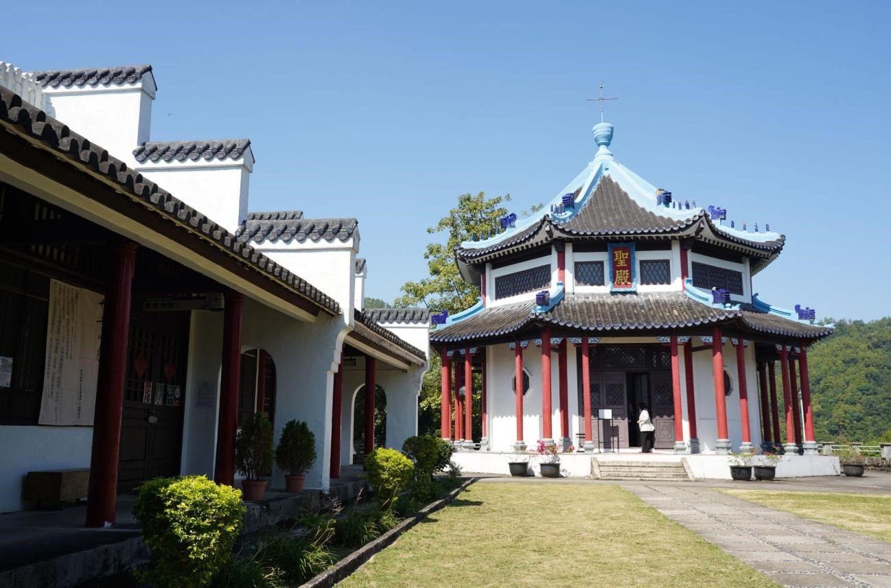
Figure 3: Courtyard and Temple (圣殿). (Source: Authors)
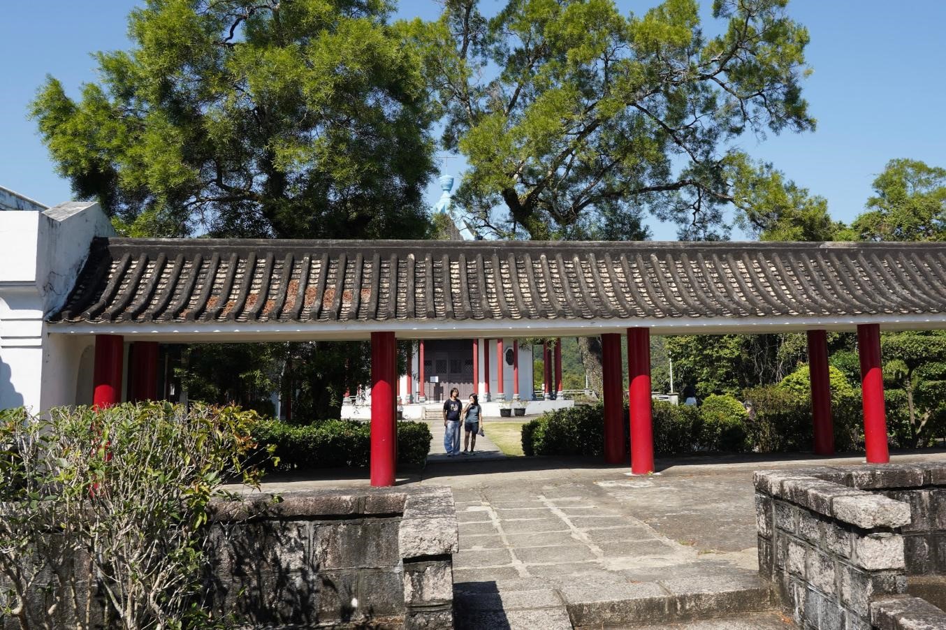
Figure 4: Chinese-style corridors connecting yards. (Source: Authors)
As a whole, the mixing of different architectural styles in this complex is not harmonious, but is more like an accumulation of elements. Besides, in the traditional Chinese architectural layout, the complex is composed of a number of buildings and courtyards in a harmonious way, while most of the Western buildings are independent, highlighting the shape and beauty of the individual. It is clear that the builders did not consider the overall harmony of the Chinese style, but rather used Western architectural aesthetics and ways of thinking for the layout and design.
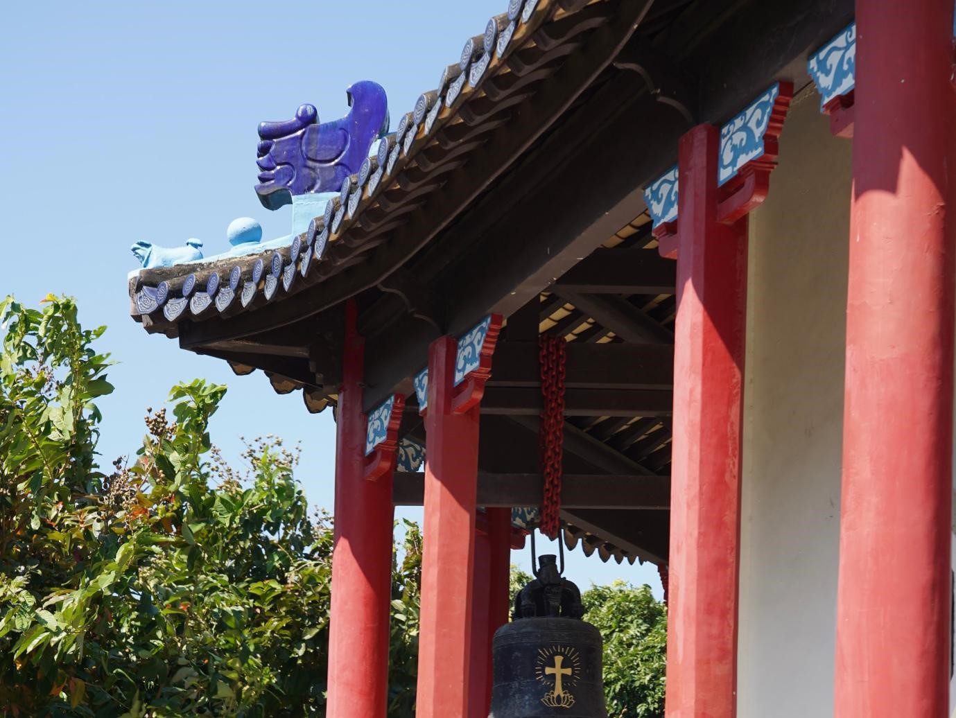
Figure 5: Eaves and ridge beasts. (Source: Authors)
From the details, it is obvious that these buildings show that the builders and designers only wanted to use the Chinese architectural style as a framework to build an innovative, East-meets-West architectural complex. For example, in Jiangnan, the eaves formed by the stacking of tiles are a special feature due to the region's constant rainfall. However, in the Sheng Dian temple at Tao Fong Shan, we can see that the stacked tiles on the eaves are only similar in shape to the impression of Chinese tile eaves, but not the actual use of the correct technique. Such problems can be seen in the beams and columns of the building (Figure 5) as well as in the construction of the flying eaves (飞檐), where the designers did not think about using actual Chinese architectural techniques, but rather imitated its features with western, modern architectural stylistic technologies.
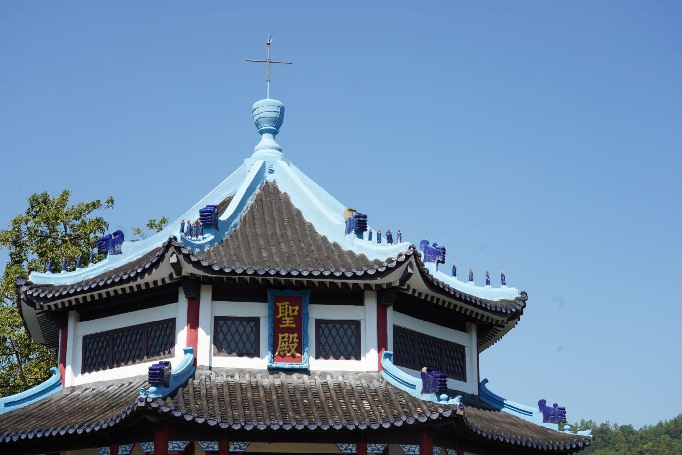
Figure 6: Chinese-style roof and cross of the temple (圣殿). (Source: Authors)
Whether it is Chinese style or Western perspective, the geographical environment not only shapes the architectural style of this Christian church, but is also influenced by the phenomenon itself, reflecting Hong Kong's identity as a place of cultural integration. Hong Kong embraces and carries a wide variety of religions brought by foreign nationalities and populations, and harmoniously localizes these religions from all over the world, showing the local cultural imprint and the huge energy created in the process of globalization, and creating new power and space while integrating and shaping. Reichelt visualized the connection points between religions through innovative architectural forms. Perhaps influenced by the trend of localization of foreign religions in the mainland in the early 20th century, he chose to use the architectural perspective of Christianity and the West to express the concept of architecture as an external structure in this complex. The architectural style of the Tao Fong Shan Christian Center in Hong Kong is eclectic, integrating Buddhism, Taoism, Christianity and court styles, reflecting its important role in the integration and dissemination of religious theology and local culture.
Similar to the buildings in the Tao Fong Shan Christian Center which clearly resembles a “buddhist Christian” style (Wang & Liu, 2024), where the negotiation of local and foreign power is clearly visible, the Tao Fong Shan Christian Cemetery was also built as a hybrid of the East and West. The gate of the cemetery is very representative in this respect. It had the traditional Chinese style of gate: one set of horizontally inscribed words up above (匾额), and then a couplet of words vertically inscribed onto the stones(对联). Like the main buildings, the architect take a chinese form, but aim to express christian meanings, because the couplet reads: Those who believe in me will never die, rebirth and life are both on me (信我的人永远不死,复活在我生命也在我). While general visitors were not allowed to go into the cemetery, a peek at what’s inside shows this is clearly a christian cemetery, where Cross is visible, although not present in every grave. While globalization through means of colonialism took place in Hong Kong, it led to cultural diffusion that’s indeed uni-directional as what Coşkun argued (Coşkun, 2021). The delicate strategy Christian culture spread was through making itself appear alike to local culture, or “taking up a local corporeal but having a western soul”.
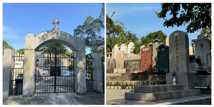
Figure 7&8. The Gate and the graves of the Tao Fong Shan Christian Cemetery.(Source: Authors)
While all of our analysis tends to indicate that there’s this “western” power trying to disseminate christianity through assimilating into local, especially buddhist architectural forms and culture, we’ve noticed something reversal in terms of power relationship. Inside the Christian buildings there is this hand drawn map about Tao Fong Shan in tiles. It is particularly interesting because some tiles of the current painting had fallen off at the left corner and it shows the interior of that painting, which tells us that the current tile painting was painted on an old map of Tao Fong Shan. While the current map resembles a Chinese style painting and the words written in Chinese, the old map has its words written in English. On the current painting it reads: painted in 1963. In 1963 the Norwegian missionary had already died, which may mean the western colonial control in Tao Fong Shan had already weakened and the place was becoming increasingly Chinese. This act can be viewed as a response and even resistance to the colonial power and its cultural diffusion. Theories of glocalizations argue that when global forces meet local context, local culture will not only be influenced by the outside, but also have the power to resist and reshape the global cultural norms. In this case the resistance is not towards spreading Christianity through a Buddhist way, but rather the language “English”, which is also a culture that represents colonial power.
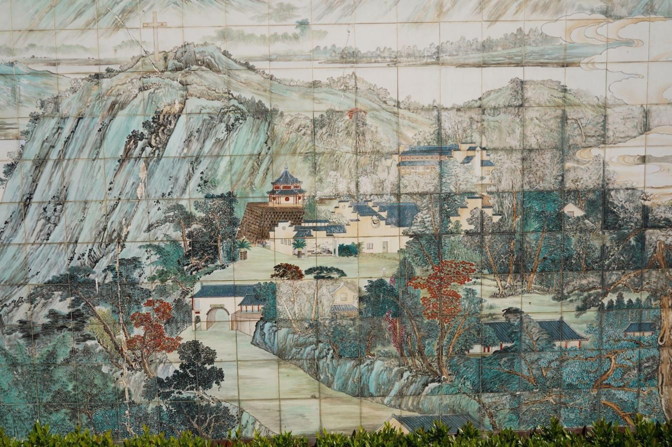
Figure 9. Map of Tao Fong Shan. (Source: Authors)
4. Conclusion
This paper analyzes in detail the cultural dynamics of the Tao Fung Shan Christian Center in Hong Kong under the interaction of global Christian influence and local religious practice through the theory of cultural diffusion and glocalization. This geographical landscape integrates Christianity with the multi-religious landscape of Hong Kong and China Mainland, reflecting the inevitability of the emergence of new cultural landscapes under the collision of different values, as well as the localization process of foreign cultures from a religious perspective. Although our group thinks the Chinese elements used in its architecture are lacking in balance and technical aspects. It is undeniable that the architectural style of the fusion of Chinese and Western still reflects the cultural tolerance and uniqueness of Hong Kong as a global city, reflecting the profound mutual influence and interaction with the geographical background, and the identity of Hong Kong's cultural diversity.
References
Coşkun, G. (2021). Cultural diffusion theory and tourism implications. International Journal of Geography and Geography Education, 43, 358-364.
Chen, Weitong. (2016, January). 香港沙田道風山建筑群. 汉语基督教文化研究所. https://www.iscs.org.hk/Common/Reader/News/ShowNews.jsp?Nid=1541&Pid=3&Version=0&Cid=334&Charset=big5_hkscs
Roudometof, V., & Carpentier, N. (2020). Translocality and glocalization: A conceptual exploration. In Handbook of culture and glocalization (pp. 324-329). Edward Elgar Publishing. https://doi.org/10.4337/9781839109010.00029
Wang, W., & Liu, Y. (2024). “Buddhist-christian style”: The collaboration of PRIP-Møller and Reichelt—from Longchang Si to Tao Fong Shan christian centre. Religions, 15(7), 801. https://doi.org/10.3390/rel15070801
道風山基督教叢林. https://www.tfscc.org/
1. Introduction
Globalization, as a complex process characterized by cross-border exchanges, involves not only the flow of goods and services, but also the spread of ideas, values and lifestyles. The trend of globalization has had a huge impact on traditional culture. In order to further demonstrate how globalization has changed the material culture and spiritual products of traditional villages, this project analyzes the profound impact of globalization on Hong Kong's walled villages and examines this phenomenon from the perspective of cultural geography. The cross-cultural interaction of globalization has had a profound impact on the local culture and identity of the walled villages. From a geographical perspective, urban development and Hong Kong's socio-economic changes have exacerbated the tension between modernization and cultural protection. Therefore, the study uses cultural geography theory to explain the transformation process in the study and uses the concepts of cultural landscape and locality to explain the complex interaction between globalization, local cultural practices and the evolution of the identity of walled village residents. The project then delves into how globalization reshapes local culture and social structure, illustrating the shifts in local values and community connections under its influence.
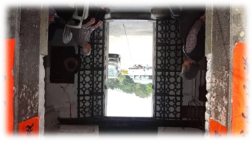
2. Cultural Geographical Perspective in Use
To find out the impacts on the Walled Villages, we will focus on the cultural geography perspective of globalization and investigate how the value of people and the traditional culture changed through globalization.
Globalization, which results from tones of cross-border exchanges, is a process of the movement of substance and spirit products without boundaries and affects every corner of the world.
From the cultural geography angles, geographical context and culture interacted with each other and produced traces. At the same time, the values of the residents and the geographical space interact to form cultural landscapes. When the context and the culture fluctuate, traces are constantly being produced. Thus, places are given new meaning in the production, conflict and fusion of traces.
Applying it to our project topic, globalization brings new sources to the Walled Villages, affects the production of traces by changing local people’s values and behaviours, as well as the traditional culture. New traces including material traces like electronic lantern with LED light and non-material traces like young people converted to Western religions and stopped attending traditional services are formed. Walled Villages, the place, are formed by a branch of new traces and the original meaning of it varies (Figure 1)
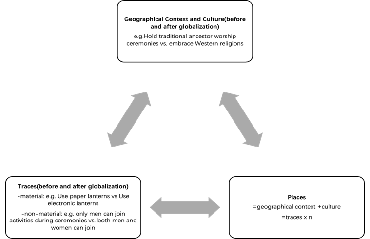
Figure 1.(Source: by the author)
3. Empirical Analysis
3a. Impact of modernization
1) Urban development --- Studied village:Nga Tsin Wai Tsuen
Nga Tsin Wai Village is the only aboriginal walled village that existed in urban Hong Kong after the 20th century. In its heyday, it was connected with six nearby walled villages, collectively known as the "Seven Neighborhoods of Ng Tsin Wai". However, with the development of the city, all six villages were converted into residential high-rise buildings or other comprehensive development facilities, leaving only Nga Tsin Wai Village. In urban areas full of high-rise buildings, there are still small and dense surrounding villages, forming urban villages.
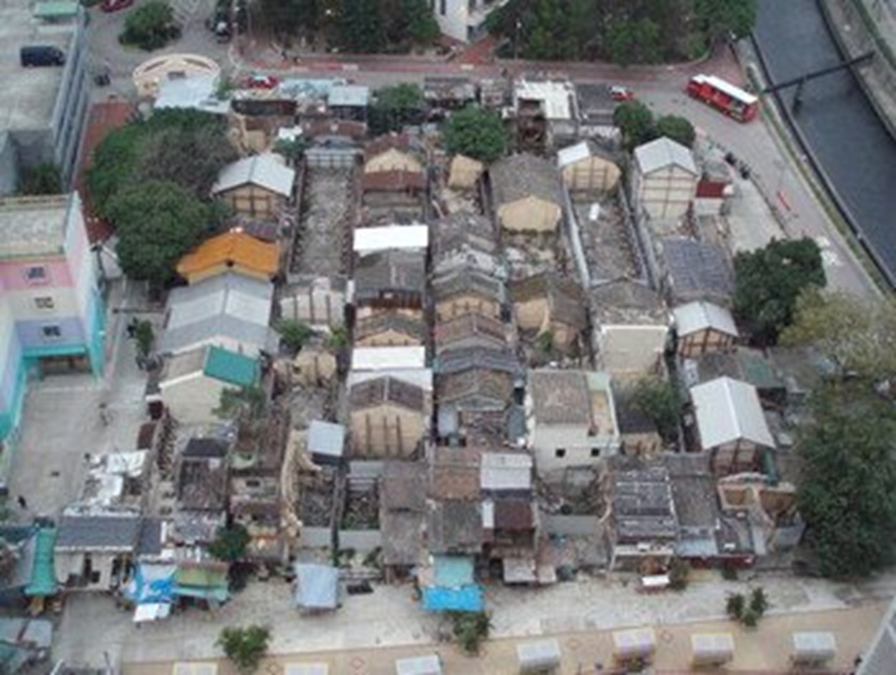
Figure2: The scene of Nga Tsin Wai Village before demolition--- urban villages
(Source: https://www.ura.org.hk/tc/project/redevelopment/nga-tsin-wai-village-project)
Due to the backward facilities of the original village houses, it has been suggested by outsiders that they should be renovated to improve the quality of life. However, due to opposition from residents, no measures were implemented. Later, the walled village was gradually acquired by real estate developers and included in the government's reconstruction project to develop new towns. Even if it encountered strong opposition from residents, this centuries-old village could not escape the fate of reconstruction.
Nga Tsin Wai Village is the only walled village in the urban area with a history of more than 600 years. However, under the premise of urban development, cultural relics conservation is often ignored. The Antiquities Advisory Committee believes that the walled village has no heritage value, which is disappointing. Under the policy of blending the old and the new, only three cultural relics remain in the walled village, which did not consider the cultural value carried by this land.
2)Weak collective consciousness--- Studied village:The Tang Clan of Yuen Long's Walled Village
The village is surrounded by narrow streets and narrow alleys, and the distance between houses is close. The villagers help each other, so their relationship is harmonious, and they have a strong collective consciousness. During festivals, villagers gather to participate in regularly organized celebrations such as the Tin Hau Festival, they also making and sharing delicacies such as Poon Choi Aka Pen Ca.
However, with the development of urbanization, Hong Kong's population continues to increase. As old residents move out and residents move in, the originally close community relations become increasingly alienated. The young people of Deng family did not want to live with their parents and left the walled villages. The concept of big family in the walled villages in the past became a small family. Moreover, people with foreign surnames believe in Western religions and do not participate in traditional festivals. Although the old festival customs are continuing, the number of participants has gradually decreased, and the traditional sense of identity and participation has gradually weakened.
3)Invasion of foreign languages
Waitou dialect and Hakka dialect are the dialects of the original residents of Wai Village. Hakka was once the second most spoken language in Hong Kong, after Cantonese. However, with the popularity of Cantonese and the use of English and Mandarin in education. Also, speaking dialects can lead to discrimination. Young people in the surrounding villages are unwilling to learn and speak the dialect to integrate into society, leading to its gradual decline. Today, these two dialects are almost lost.
3b. Culture (Traditional Customs)
Apart from the values of people, the traditional culture in Walled Villages has also changed significant from past to now, due to different reasons. Some of the traditional customs are “Lantern Lighting Ritual”, “Distributing Simmer Pork” and “Spring and Autumn Ancestral Worship of Lineage”.
“Lantern Lighting Ritual” is one of the traditional customs that have been changed. From paper lantern with candle to electronic lantern with LED light because of decreasing in the production of traditional paper lantern and the globalization of the technology. From celebrating the newborn boys by lighting up the same number of small oil lamp with the number of newborn baby boys, to just lighting up a big revolving lantern. The place of holding the ceremony is moving from ancestral hall to the temple, the people who hold the ceremony is also changing from a male master to a nun as no one are willing to take over the ancestral hall. The declining number of people who producing traditional artwork, globalization of technological discovery and taking over ancestral hall are the main reasons leading to the change in “Lantern Lighting Ritual”.
Another traditional custom that has changed from time to time is the “Distributing Simmer Pork”. In the past, people in Walled Villages will distribute simmer pork in different festival, as simmer pork is traditional Hakka food. However, this ceremony in distributing simmer pork in festival are nearly missing in the recent years. The reason is that making simmer pork is very difficult and troublesome which people in Walled Villages are not willing to make this traditional Hakka food, and the ceremony of distributing simmer pork become distributing money. This led to a decline of traditional customs in Walled Villages.
Moreover, “Spring and Autumn Ancestral Worship of Lineage” is a festival that must celebrate in Walled Villages. All the resident in Walled Village will go up the hills to visit their ancestors. And in this festival, all the males will make poon choi and eat together at the bottom of the hill meaning “食山頭 eating on the hillsides”. However, females are not able to join these activities in the past, they are not allowed to eat poon choi with the males. But this have been changed in recent years, due to arising awareness on gender equality. As a result, the traditional of all males making and eating poon choi at the hillsides has been changed after the new values pop out.
4. Conclusion
In an
in-depth study of Hong Kong walled villages, we found that globalization, as a
complex process of cross-border communication, has had a profound impact on the
material culture and spiritual products of these traditional villages. Our
study reveals how globalization has reshaped the cultural landscape and social
structure of walled villages through the perspective of cultural geography.
Walled villages, once a strong fortress against foreign enemies, are now facing
the dual challenges of modernization and globalization. Urban development and
socioeconomic changes have not only changed the traditional customs and
community structure of walled villages but also led to the decline of community
connections and cultural practices. The impact of globalization is
multidimensional, which not only brings the risk of cultural homogenization,
but also provides opportunities for cultural innovation and
adaptation. Therefore, we suggest that the protection of cultural heritage
and the promotion of community participation should be strengthened in urban
planning and development strategies. Policymakers and urban planners must
recognize the value of cultural diversity in the context of globalization and
take positive measures to integrate cultural protection with contemporary
development strategies.
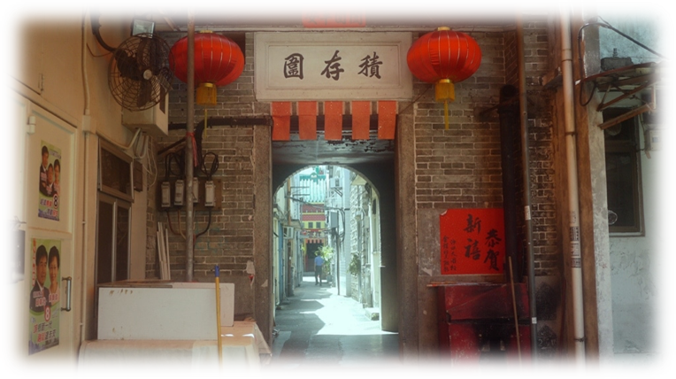
References
1. Introduction
The project aims to examine the influence of Xi’an history on its urban planning.Xi’an embodies rich and vibrant historical remains , such as the terracotta army, Da Yan Ta and ancient city walls, etc. The preservation of these historical remains influence its current layout.Through the concept of environmental determinism,the project will explore how Xi'an's urban planning reflects an adaptation to the natural environment, on how traditional planning concepts rooted in environmental determinism are evident in Xi'an's layout, where factors like topography, climate, and water sources are carefully considered. This approach results in a spatial arrangement where the ancient city serves as the focal point(Wang & Gu, 2022), surrounded by residential areas and farmland harmoniously integrated into the city's fabric. This project also seeks to analyze the links between Xi'an's historical tales, its geographical context, and cultural values, thus on how it contributes to the current urban planning of the city.
2. Cultural Geographical Perspective in Use
In light of Xi'an's modern urban planning, the project applies a cultural geographical perspective to understand the phenomenon, particularly using the environmental determinism concept which was proposed by the renowned historian Fernand Braudel (1902-1985), plays a significant role in shaping Xi'an's urban landscape. Environmental determinism asserts that human growth, development, and actions are dictated by the physical environment (Lethwaite, 1966). Environmental determinism posits that the Xi’an environment, particularly its physical attributes including climate, shapes human cultural patterns and societal progress.Thus to examine how culture and geography intersect to shape human experiences, behaviors, and landscapes. It is emphasized of the dynamic relationship between space, place, and cultural practices within a specific geographical context.Thus the project seek to evaluate three of the following:
1. Place: Xi'an's cultural characteristics and the meanings associated with specific locations play a crucial role in shaping the city's identity and urban development.
2. Cultural Identity: The link between cultural identity in Xi'an and individuals' connections to their rich cultural heritage influences spatial practices and urban design.
3.Spatial:Spatial practices within Xi'an reflect how cultural behaviors are enacted in physical spaces, influencing urban design and social interactions.
3. Empirical Analysis
Due to the influence of climate, traditional living patterns (such as courtyard houses) are designed with the needs of ventilation and heat preservation in mind. These architectural forms are widespread in urban structures and promote interconnectedness within communities.Also, due to the dry climate, local residents invent a half cover house. The house not only can reduce a large amount of wood and production cost, but also provide warmth and higher breathability than a common house, further exemplifying how environmental determinism shapes housing solutions.Therefore, these houses appear everywhere in Xi'an's rural area.
As noted, Xi'an has a temperate continental climate, which affects the selection and design of building materials. For example, many modern buildings use materials with good thermal insulation properties such as timber or masonry infill walls to cope with the cold winters and hot summers in Xi’an. In addition, the building layout takes into account ventilation and natural lighting with the sim of coping with residents’ living comfort. On the other hand, due to population growth, limited rainfall, and excessive surface water consumption, Xi'an faces a scarcity of local water resources. In response, Xi'an, under the auspices of the International Water Association, is striving to establish a water resource security framework characterized by spatial equilibrium and judicious distribution. This initiative,according to "Xi'an City's 14th Five-Year Plan for Water Resources Development" (《西安市“十四五”水务发展规划》) involves bolstering strategic water reserves, managing between urban and rural water supplies tailored to local needs, and enhancing water supply infrastructures to optimize the allocation of water resources effectively for the city and its residents.when taking into account of Xi'an's climate characteristics, it is observed that a complete drainage system and flood control facilities have been added to the urban planning to deal with potential risks caused by rainfall, which shows how environmental determinism influence its planning in its spatial realm.
Xi'an, formerly known as Chang'an, was a prominent ancient city with numerous important cultural heritage such as the ancient city wall, Da Yan Ta and the Terracotta army(Zhu, 2017), which not only attract a large number of tourists, but also influence a reference framework for its urban planning in order to preserve the unique heritage characteristics it embodies. Since the 1950s, Xi'an has undergone significant phases of urban regeneration driven by diverse economic factors. Initially, the urban development focus in the first master plan (1953–1972) prioritized industrialization, particularly in textile and machinery manufacturing sectors, within a centrally planned economy. However, the subsequent 1980–2000 master plan marked a shift towards a more balanced approach, integrating advanced science, culture, education, and tourism into the city's development agenda. This shift acknowledged Xi'an's rich cultural heritage resources, notably exemplified by the iconic Terracotta Army(Bonaduce et al., 2008), a UNESCO World Heritage Site featuring over 8000 terracotta statues within Qin Shihuang's mausoleum complex.(Yeji Zhu,184)When planning new areas, it is prioritized on how to coexist harmoniously with these historical sites and avoid damaging their landscape and cultural significance. Its urban design echoes its historical roots, characterized by a grid layout centered on the iconic Bell Tower and enclosed by preserved Ming dynasty walls. The city seamlessly blends modern structures with its ancient heritage, where ancient and new coexist in the city itself, exemplified by the harmonious coexistence of well-maintained historic walls alongside contemporary buildings.As worded by Zhu, there is a “museumification” in the urban planning,with the collaborative efforts of the Department of Urban Planning and the Provincial Bureau of Cultural Heritage, Xi'an proposed an urban planning to transform Xi’an, where public spaces and structures are repurposed into heritage objects, reminiscent to the Tang dynasty for public display and consumption (Yeji Zhu,184).
For instance Xi'an's renowned Bell Tower stands prominently at the central crossroads of the walled city, where North Street, South Street, West Street, and East Street intersect, forming a bustling hub of activity and historical significance A short distance away on West Street lies the Drum Tower..It can be seen as the duality of both ancient and modern buildings that coexist in its urban planning.
Smith, J. (2023). Terracotta Warriors in Xi'an [Photograph figure 16]. Newgeography. https://newgeography.com/files/xian-evolving_16.jpg
Furthermore,Xi'an is located on the edge of the Loess Plateau, with the Qinling Mountains and Weihe River surrounding Xi'an forming a natural barrier (The Editors of Encyclopaedia Britannica, 2024), which limits the direction of the city's expansion. Historically, these natural boundaries have enabled the defensive development of cities and, as a natural protection, yet this continues to influence the layout of infrastructure in modern planning. For example, major traffic arteries and public transportation systems are designed to avoid direct conflict with mountains to ensure transportation convenience and safety, as well as urban planning being mostly concentrated in flat areas, which showcases how environmental determinism influences urban spatial organization,as the natural geographical environment directly influences its current construction.
4. Conclusion
In conclusion, Xi'an stands as a prominent proof of cultural heritage, geographical determinants, and how its vibrant historical background influences its modern urban planning practices, which the city has successfully navigated the complexities of preserving its rich cultural legacy while using contemporary development initiatives, balancing and coexisting of past and present. Xi'an's harmonious coexistence of ancient landmarks and modern infrastructure not only cherishes its rich cultural and historical heritage but also showcases how, without changing its natural landscape, urban planning can still be carried out, which acts as a model of harmonious coexistence between nature and human activities.
References
Bonaduce, I., Blaensdorf, C., Dietemann, P., & Colombini, M. P. (2008). The binding media of the polychromy of Qin Shihuang’s Terracotta Army. Journal of Cultural Heritage, 9(1), 103–108. https://doi.org/10.1016/j.culher.2007.08.002
Cox, W. (2020, December 31). Xi'an: Ancient and Modern: The Evolving Urban Form. Newgeography.https://www.newgeography.com/content/006896-xian-ancient-and-modern-the-evolving-urban-form
LEWTHWAITE, G.R. (1966), ENVIRONMENTALISM AND DETERMINISM: A SEARCH FOR CLARIFICATION. Annals of the Association of American Geographers, 56: 1-23. https://doi.org/10.1111/j.1467-8306.1966.tb00540.x
The Editors of Encyclopaedia Britannica. (2024, November 6). Xi’an | China, Map, History, & Attractions. Encyclopedia Britannica. https://www.britannica.com/place/Xian-China
Wang, F., & Gu, N. (2022). Exploring the spatio-temporal characteristics and driving factors of urban expansion in Xi’an during 1930–2014. International Journal of Urban Sciences, 27(1), 39–64. https://doi.org/10.1080/12265934.2022.2085152
Zhu, Y. (2017). Uses of the past: negotiating heritage in Xi’an. International Journal of Heritage Studies, 24(2), 181–192. https://doi.org/10.1080/13527258.2017.1347886
1. Introduction
In this
consumerism and metropolitan city, Kwai Chung Plaza stands out among other shopping
malls, with its simple and irreplaceable
aesthetics. This
30-year-old shopping mall attracts numerous teenagers every weekend with its
“young and trendy” vibe and shops. The traces left by the people along the years have shaped the place beyond a mere
mall, it has become an iconic symbol of the
district for community gathering,
leisure and dining.
In this
project, we are going to investigate why Kwai Chung Plaza had become a place for people who embrace old-fashionedness, and the
traces that
have been left by the related stakeholders
to the mall.
Using Henri Lefebvre’s theory of spatial triad, we can better understand the social space and its cultural meaning to the people of Kwai Chung Plaza.
2. Cultural Geographical Perspective in Use
By definition, Cultural Geography studies the relationship between culture and space and how cultural activities manifest in different forms in specific contexts (Crang, 2013), such as cultural value, practice, how people make sense of places and build an understanding of places (Human Geography, 2024). Also, the relationship between culture, space and place is important in cultural geography whether space is abstract, homogeneous, and timeless, but the place is opposite with it. To transform space into place, culture acts as a medium by giving people a concrete understanding of abstract space.
Lefrebvre’s (1991) theory of “Production of Space” contends that space is a product and means of production consisting of perceived space, conceived space and lived space (Lefrebvre, 1991). Perceived space somewhere containing social production and reproduction of cities and daily lives (Lefrebvre, 1991), such as history and human population activities of a specific place. While conceived place is conceptualized spaces governed by the knowledge and ideologies of scientists, planners, social engineers and related professionals (Lefrebvre, 1991), such as different governmental blueprints and reconstruction plans. Lastly, the lived space is the living space for residents and users, which is the combination of prior two spaces, collateral with strong emotional representation. Hence, social space is produced by the intersection of three spaces (Lefrebvre, 1991). Therefore, we adopt this theory, which is consistent with the cultural geography perspective we aim to draw upon, as an analytical framework to illustrate how the above concepts illuminate our empirical analysis.
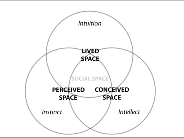
Figure 1. Henri Lefebvre's triad of space production. (Source: Wiedmann & Salama, 2012)
3. Empirical Analysis
The Perceived Space
Kwai Chung Plaza, inaugurated in 1990, had more than 600 shops inside the building. However, due to high rent, there were not many stores and customer traffic. Over the next few years, some owners divided their stores into multiple stores to gain access to higher rental opportunities. Until now, there are more than 1000 small shops inside Kwai Chung Plaza (Chen, 2016). Inside Kwai Chung Plaza, at first glance, the decoration is stale compared to nearby shopping malls: the floor tiles are black and white, and the headroom of each floor is low.
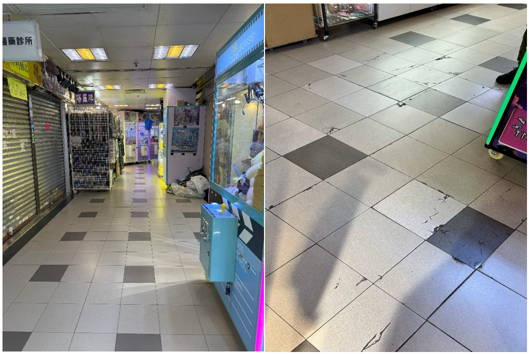
Figure 2a and 2b. the interior of Kwai Chung Plaza
As figure shows, some stores decorate with nylon lights. There are multiple types of stores inside Kwai Chung Plaza, such as food, books, clothes, and even jade shops, it provides most of the basic needs for the community. Because of the comprehensive nature of Kwai Chung Plaza, it has become the core of the community and provided a platform for people to communicate and interact. For example, some couples come to Kwai Chung Plaza for dates, and some families come for parent-children’s activities.
Wandering in Kwai Chung Plaza, visitors can feel the vibrant and bustling environment, where bargaining voices perfuse the environment. The aisle is very crowded because every shop is packed tightly, and some shops put their goods on the aisle exceeding the yellow line boundary encircling their shop.
To sum up, the interior atmosphere of Kwai Chung Plaza is enhanced by a diverse array of shops, food stalls, odour of many cuisines, and sounds of conversation; the mix of those elements evokes the feeling of a street-like ambiance.
Figure 3. The yellow line of the shop
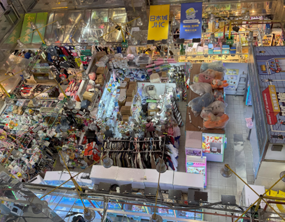
Figure 4. The ground floor of Kwai Chung Plaza
The Conceived Space
Kwai Chung Plaza was the first mall in the district of Kwai Chung, one of Hong Kong’s traditional industrial hubs where busy container terminals, factory buildings, and large-scale public housing complexes encompass the mall.
Unlike most malls in Hong Kong, Kwai Chung Plaza was not developed by large scale property developers, such as Sun Hung Kai or New World Development. Kwai Chung Plaza’s management system differs a lot. Unlike most real estate developers, who only withhold the “rent and do not sell” policy, its developer Nan Fung Group sold all the shops to the public when the mall was built in 1990. As Kwai Chung Plaza’s ownership was then fragmented into several hundred pieces, representatives from both residential and retail mall owners currently oversee the plaza on behalf of the store owners. When leasing out property, as long as individual property owners receive rents, they generally don’t consider tenant’s brand and type nor will they communicate with other owners about it, leading to the extreme disorganization of store arrangement, forming one of the plaza’s unique sceneries.
In most higher-end malls, the central management team generally sets decorations specifications for tenants to ensure they align with the mall’s luxurious style and they are required to update their decorations collaterally with the mall. Nevertheless, the fragmentation of ownership in Kwai Chung Plaza has made coordinated renovation and modification impossible, meanwhile most older malls have already been refurbished by today’s standards, Kwai Chung Plaza still retained its primitive appearance in the 1990s.
To locals, visiting the plaza is like travelling back in time for the old memories. Thanks to its unique ownership history, the uniqueness in store arrangement and decoration, Kwai Chung Plaza will always remain a great icon of the district.
Lived space
Overall, the features in Kwai Chung Plaza are multifarious and display a fine blend of old and new in perceived space. The reason behind this can be traced to the negotiations between different stakeholders: customers, retailers, and the management.
As mentioned in conceived space, the policy from developer and strata title ownership has created a unique commercial environment inside the plaza. Tenants received fewer restrictions on their business. These factors encourage the multifunctional mall to fulfill the desires of customers of all ages in the Kwai Chung Plaza, fostering long-lasting relationships between tenants and customers. These experiences contribute to collective memories to the perception of customers which attract them to patronize the time-honored brand within the lived space.
Meanwhile, young inexperienced entrepreneurs are attracted to start their businesses within the plaza. The large customers flow from the plaza facilitates them to startup their business. Indeed, young entrepreneurs are rejected by the high threshold of capital in modern shopping malls. The old plaza acts as the stepping stone for them to chase their dreams.
For them, Kwai Chung Plaza is a place for trial-and-error. Newer forms of businesses slip into the mall easily bringing in many up-to-date merchandise and services to the mall. People from different cultural backgrounds inadvertently leave cultural marks, promote the values embedded in their businesses to wider audiences outside of their local context. Different powers, new and old, transgressed, resisted and incorporated against each other, ever-changing the cultural landscape that are left behind.
The young entrepreneurs generate new traces with passion and vigour, which fuse with the old traces to form a new, unprecedented culture. The process of integration may create conflicts due to discrepancies of values. Over time, these two cultures inevitably amalgamate and merge with one another.
4. Conclusion
In conclusion, using the theory of spatial triad, we can understand the cultural characteristics inside Kwai Chung Plaza. The dynamics of traces shape the uniqueness of shopping culture in district Kwai Chung. The old traces bring collective memories, and the influx of new traces brings energy to the district. The utilization of both traces creates a landmark, showing the diversity of culture.
It is difficult for the young to fully integrate into this society due to various constraints like limited cultural endorsement from society. Nevertheless, Kwai Chung Plaza provides opportunities, allowing them to exhibit their personal values and cultures. The fusion of traces in this plaza is an example of showcasing the cultural diversity of Hong Kong.
References
Chen, Q. E. (2016). zai
lian suo fu zhi de shang chang zhong hai you yi zuo cheng zai zhe「xiang gang ben tu」 [In chain-copied shopping
malls, There is also a building that carries "Hong Kong Mainland"]. Initium
Media
Crang, M. (2013). Cultural geography. Routledge.
Human Geography (2024). Dartmouth Libraries. https://researchguides.dartmouth.edu/human_geography/main
Lefebvre, H. (2012). From the production of space. In Theatre
and performance design (pp. 81-84). Routledge.
Wiedmann, F., & Salama, A. M. (2012, December). The role
of architecture in producing urban qualities for sustainability: Implications
for the future of architectural education. In Malaysian Architectural
Education Conference (MAEC 2012) (pp. 20-26).
在連鎖複製的商場中,還有一座承載着「香港本土」 | 端傳媒
Initium Media.
1. Introduction
The following project takes the case of Kowloon Walled City as a
cultural and geographical truce. The Kowloon Walled City, herein referred to
KWC or Walled City, was a Hong Kong based city described as one of “history’s
great anomalies” (Fraser, 2017). The 6.4-hectare enclave was known for its
unique architecture and its densely packed, largely unregulated urban
settlement that existed until its demolition in 1993 (Benoit, 2023). Initially,
it was a Chinese military outpost but later evolved into a sanctuary for
squatters, illicit businesses and marginalized communities during the British
rule in 19th century (Crawfold,, 2023). An estimated 30000 people
lived in the Walled City during 1950s and 1960s (Benoit, 2023). Located near
Kowloon City District, KWC developed into an area for illegalities due to low
government oversight. This analysis draws upon concepts of urban cultural
geography to explain how geographical and cultural perspectives resulted to the
Walled City.
Drawing from Taylor (2014), the term ‘cultural geographical perspective’ is a study on the relationship between culture and geography by investigating the linkage between society, cultural values, practices, material expression and artefacts of people as well as the cultural diversity and plurality of society, taking note of how cultures are distributed overs space and how people make sense of these places. All these helps to explain the existence of social significance in those meaningful places. It also consists of concepts, for example, place, landscape, and social practice, parsing how cultural meanings and power dynamics guide communities and their interactions, correlations with their surroundings, hence influencing urban phenomena such as Kowloon Walled City. More specifically, this project seeks to draw upon the central concepts of place, landscape and social practices for its empirical analysis.
The concept of place, which Stedman (2016) terms as ‘Sense of Place’ (SOP) is a good approach when seeking to understand people-place relationships grounded in geographical location. In this project, I adopt the definition by Gottwald et al (2022) who describe SOP as the meanings and emotional connections that people develop towards a place. According to this project, landscape describes the densely built structures representing the social neglect by British and Chinese authorities while social practice concept encompasses the informal economies, cultural interactions and survival strategies that thrived through the Kowloon Walled City unregulated space (Gong, et al., 2022).
This research references the structuration theory suggested by Anthony Gidden, a British social theorist. Mentioned in the structuration theory, Gidden states that human actions are either enabled or constrained by structural contexts, for instance, political neglect. (Gidden, 1991). In regards to this research, the theory helps to explain the phenomenon of residents living in the Walled City navigating and adapting to its nature full of chaos and its surroundings and environment.
3. Empirical Analysis
The Kowloon Walled City’s unique style of development is deeply related to its geography and culture. The Kowloon Walled City is geographically located in Kowloon City District, and is adjacent to Kai Tak Airport. Originally built as a Qing dynasty military garrison, it became an administrative area during British colonial rule. While Hong Kong was ceded to Britain in 1842, the Walled City remained nominally under Chinese jurisdiction, creating a political vacuum. Neither the British nor the Chinese governments governed the area, resulting in its eventual transformation into an unregulated area. The British government only needed Hong Kong to serve as an entrepot, without intention for them to compete with the Chinese government for the jurisdiction of Kowloon Walled City.
Following the Japanese occupation in World War II, the Walled City saw massive influx of employee fleeing from conflicts on the mainland China. The Walled City experienced raised population density to a new level. By 1950s, KWC was home to 30,000–50,000 people on only 6.4 hectares of land. Owing to the high population on a small place and lack of legal oversight facilitated the proliferation of illegal activities such as gambling, prostitution, and quack doctor services and hence the Walled City became a hot bed of crime.
Culturally, the Walled City was a blend of various cultures. The refugees who fled to Hong Kong from the mainland China brought in their cultural practices while the British colonial rule brought in new culture of Western values. Thus, cultural mixture of these cultures along with the spatial limitations of the enclave led to a chaotic social environment. Due to the small and closed geographical environment of the Kowloon Walled City, it was not politically supervised by either Chinese, British, or British Hong Kong governments. It was also not affected by urban planning. Residents adapted by constructing tall high-rise structures that maximized as much vertical area as possible and thus the city became a chaotic network of closely interconnected buildings without any formal architectural design or planning. According to Crawfold, (2023),there were about 350 buildings with heights of 10-14 stories, occupied by 10700 households. With this status, the city continued to accept refugees hence it became more and more densely populated.
The Walled City also lacked a mainstream value in culture and had no leading power to impose moral constraints. As a result, the walled city fell into the power struggle of the underworld. The chaotic state of the Kowloon Walled city made the government less able and less willing to regulate it, eventually leading to anarchy. Thus, the unregulated nature resulted to social stigma with KWC being portrayed as a hub of crime and squalor overshadowing the community’s resilience and ingenuity. However, plans to demolish it emerged in the late 1980s and residents were relocated in 1993 to pave way for its renovation and redevelopment.
The existence of the Walled City is a cultural memory of colonial Hong Kong and is an example of how socio-political abandonment and survival of the people intertwine. It makes Hong Kong people in the post-colonial era to reflect on the past history. Its chaotic landscape symbolized the failures of colonial governance but also the ingenuity of its inhabitants in creating a functioning society within an unregulated environment. This duality offers a view of how minorities survive inequality and abandonment, pointing to issues of urban design and equity in postcolonial cities. As a slum, the various phenomena that occur inside the Kowloon Walled city, such as rampant crime and dense population, reflect that Hong Kong, where the gap between rich and poor is still very wide today, may face similar problems in the future.
The Kowloon Walled City is a good example of how geographical conditions and cultural factors interact to produce an urban phenomenon that is a result of socio-political abandonment and human determination. To summarize, this research adopted the cultural geographical perspective, and has demonstrated how lack of governance and jurisdictional certainty during British colonialism led to the emergence of the Walled City as a highly populated and juridical location. This study used concepts of place, landscape, and social practice concepts to analyze the case of KWC as territory of lawlessness and people’s adjustment.
Giddens theory of Structuration theory, helped to build on arguments and provided an understanding of how people and communities navigated around structural factors like legal ambiguity and and resource scarcity (land) to shape their living environment. This framework pointed to the subjugation of the Walled City’s inhabitants and their innovative ways of coping with the lack of governance, informal social structures and the use of the vertical space in their buildings.
Therefore, the Walled City shows that only proper urban management and
appropriate policies can counter socio-economic injustice. The example
expresses the fact that modern cities can deal with informal settlements and
build resilience in vulnerable populations. In conclusion, the study links past
evidence to current issues situated in urban settings, thereby making a
significant input into the understanding of how cultural and geographical
factors deeply could influence the lives of people in cities nowadays.
Furthermore, his essay has demonstrated that physical environments, structures
and governance can play both as a role of constraint or an enabler. Thus,
future urban planning policies should be taken into account for learning from
such examples, addressing socio-economic inequalities and ensuring that
marginalized populations are not left into unregulated spaces.
Benoit, M. (2023). The lasting legacy of Hong Kong Kowloon Walled City. Retrieved from https://www.discovermagazine.com/the-sciences/the-lasting-legacy-of-hong-kongs-kowloon-walled-city (Accessed on November 22, 2024)
Crawfold, J. (2023). The strange saga of Kowloon Walled City. Anarchic, organic, surreal, this enclave was once among the most densely populated places on Earth. Retrieved from https://www.atlasobscura.com/articles/kowloon-walled-city (Accessed November 19, 2024)
Fraser, A., & Li, E. C. Y. (2017). The second life of Kowloon Walled City: Crime, media and cultural memory. Crime, Media, Culture, 13(2), 217-234. http://dx.doi.org/10.1177/1741659017703681
Giddens, A. “Living in the World: dilemmas of the self,” from Anthony Giddens. Modernity and Self-Identity: Self and Society in the Late Modern Age, Stanford, Stanford University Press, pp. 187-201. Available at https://uregina.ca/~gingrich/319m606.htm
Gong, Z., Zhang, Z., Zhou, J., Zhou, J., & Wang, W. (2022). The evolutionary process and mechanism of cultural landscapes: an integrated perspective of landscape ecology and evolutionary economic geography. Land, 11(11), 2062.
Gottwald, S., Albert, C., & Fagerholm, N. (2022). Combining sense of place theory with the ecosystem services concept: empirical insights and reflections from a participatory mapping study. Landscape Ecology, 1-23. https://link.springer.com/article/10.1007/s10980-021-01362-z
Taylor, P. J. (2014). The value of a geographical perspective. In The Future of Geography (RLE Social & Cultural Geography) 1st ed, pp. 92-110. London: Routledge.
Wikipedia contributors. (2024, November 17). Kowloon Walled City. In Wikipedia, The Free Encyclopedia. Retrieved from https://en.wikipedia.org/w/index.php?title=Kowloon_Walled_City&oldid=1258029621 (Accessed November 19, 2024)
1. Introduction
Sheung Wan, a business district where skyscrapers, dried seafoods and Chinese medicine meet.
Keyword: Residential area、Hong Kong-Macau Pier、Trams、Temples
Geographical context:
The cultural policy of the Hong Kong government includes the following four key elements: respect for creative and expressive freedom; providing opportunities for greater public participation; encouraging diverse and balanced development; and offering a favorable environment and conditions (venues, funding, education, and administration).
Culture:
Hong Kong culture: freedom, democracy, human rights, and the rule of law.
Cultural Geographical Perspective:
Geographical Context+ Culture= Cultural Trace
Place=N *Cultural Trace
2. Cultural Geographical Perspective in Use
Cultural Geographical Perspective:
What is a method or field of study to understand why the surrounding world is the way it is today? What role do we play in its formation? How can we maintain or change it?
Geographical Context:
Countries or political regions, physical landscapes, and specific environments (such as language, laws, customs, etc.) are omnipresent in the geographical context.
Culture:
Thoughts and values, as well as various aspects of society, politics, and economics, come in different types: mainstream, non-mainstream, and counter-mainstream.
Cultural Geographical Perspective:
Propose and study the interaction between geographical context and culture that produces "traces."
Material Traces:
Architecture, sculpture, graffiti, dance.....
Non-material traces:
Behavior, rituals, performances, emotions, memories...
3. Empirical Analysis
Phenomenon 1: Western Market
A shopping mall built in the British Edwardian architectural style,
constructed of red brick with a granite foundation, featuring a large arch at
the main entrance.
Geographical Context: Victoria City is a commercial
center that attracts merchants from around the world for trade. At that time,
the primary mode of transportation was by sea. To manage maritime affairs, the
British colonial government constructed the Marine Department Headquarters
building in 1906, which became the predecessor of West City.
Culture: Following the relocation of the Marine Department, the building transformed into a market and later became the current shopping mall. The entire structure continues to thrive with the support of Hong Kong citizens, highlighting the spirit of heritage conservation among the people of Hong Kong.
Phenomenon 2: Hong Kong Tram
Geographical Context: The northern part of Hong Kong Island developed rapidly. By 1881, the population of Hong Kong had grown to 160,400, but at that time, there were only rudimentary modes of transportation such as horse-drawn carriages, rickshaws, and sedan chairs, which could not meet the demand. There was an urgent need to introduce a collective transportation system. In June of that year, members of the Legislative Council of Hong Kong proposed the establishment of a tram system for the island, which was approved. Due to funding constraints, the Hong Kong Tramways Company began laying track in sections in May 1903. The initial routes completed were from Happy Valley and east of Causeway Bay to Shau Kei Wan, followed by the section from the western part of Wanchai's Arsenal Street to Kennedy Town, which was completed from July to August 1904. On August 13, 1904, the entire line from Kennedy Town to Shau Kei Wan was opened for service.
Culture: The Hong Kong tram system allows passengers to board at the rear and disembark at the front while making payments, increasing the efficiency of getting on and off. This design reflects Hong Kong's emphasis on efficiency as a cultural value.
Phenomenon 3: Proliferation of Dried Seafood and Chinese Medicine Shops
Geographical Context: In the mid-19th century, the Taiping Rebellion occurred in China, causing a large number of refugees to flee to Hong Kong. Among these refugees were many merchants who established numerous shops along Bonham West Street, near the triangular pier by the sea, focusing on trade between the north and south. Dried seafood and Chinese medicinal herbs became popular goods in this trade.
Culture: Hong Kong people place great emphasis on health, drinking herbal tea in spring and summer, and nourishing tonics in autumn and winter. In their daily lives, they select various nourishing dried seafood and medicinal ingredients according to the seasons, using them as ingredients in dishes or soups to promote well-being.
Phenomenon 4: Kwong Fuk Yik Temple and Man Mo Temple
Geographical Context: The temples were built between the 1840s and 1860s, during the early days of the port's opening when laborers from Guangdong settled in Sheung Wan in search of job opportunities. To ensure their work went smoothly, they constructed Kwong Fuk Yik Temple and Man Mo Temple in Sheung Wan to worship Taoist deities for safety and success in their endeavors. At that time, some laborers who died in accidents and could not be returned to their hometowns for burial would have their spirit tablets placed in Kwong Fuk Yik Temple, expressing gratitude for their contributions to Hong Kong's development. As a result, the temple was also referred to as the "Common People's Temple." Today, it is dedicated to the worship of Che Kung and Ksitigarbha Bodhisattva.
Culture: To this day, Man Mo Temple remains one of the most popular Taoist temples in Hong Kong. Because Hong Kong people place great importance on academic performance and career prospects, they visit Man Mo Temple to offer prayers to the literary and martial deities, hoping to gain favorable opportunities in their careers.
Phenomenon 5: Tai Dap Tei (or "Big Market")
Geographical Context: During British rule in Hong Kong, after the British army landed in Sheung Wan, a military camp was established on Water Street. Later, when the military camp moved away, the vacant land became a gathering place for local residents, featuring various stalls, street performances, hawkers, and "dai pai dong" (open-air food stalls). This space provided entertainment and relaxation for the citizens of that time, as well as a livelihood for the hawkers. However, in 1992, the British colonial government reclaimed all the land in Sheung Wan designated for Tai Dap Tei under the pretext of developing Hong Kong.
Culture: Although Tai Dap Tei has been reclaimed, many stall-style eateries and shops can still be found in the Sheung Wan area today. Many tourists specifically visit the dai pai dongs or tea stalls in Sheung Wan to savor the authentic flavors of old Hong Kong. For example, "Bing Kee Tea Stall," a favorite of singer Eason Chan, has attracted many visitors in recent years.
In Sheung Wan, we observe many unique phenomena, such as buildings in the English architectural style, the distinctive trams of northern Hong Kong Island, numerous dried seafood and Chinese medicine shops, and traditional temples that showcase unique architecture. Sheung Wan is a community rich in both Chinese and Western cultures, encompassing continental-style buildings, traditional Chinese architecture, and the older structures of Hong Kong. We are eager to explore the reasons behind the formation of these phenomena, so we plan to analyze the geographical context of Sheung Wan from a cultural geography perspective, combining the thoughts and values of Hong Kong citizens to see how the interaction of these elements shapes these phenomena.
References
這些香港地道文化,你體驗過沒有? | 香港旅遊發展局. (n.d.). Dhk-Local-Market. https://www.discoverhongkong.com/hk-tc/explore/culture/experience-hong-kong-s-traditional-rituals-and-ceremonies-like-a-true-local.html
穿越古蹟一日遊 | 香港旅遊發展局. (2024). Discover Hong Kong. https://www.discoverhongkong.com/tc/explore/culture/experience-hong-kong-s-east-meets-west-heritage-in-one-day.html
香港電車 - 電車史話. (n.d.). Www.hktramways.com. https://www.hktramways.com/tc/our-story
1. Introduction
Hong Kong is one of the most populated cities in Hong Kong, with a population density of 6,740 people per square kilometre in 2022 (CSD, 2023). With its high flexibility and mobility, itinerant hawkers have played a crucial role in the local economy for patrons to buy necessaries. They are usually found on the streets with high pedestrian flow, such as urban areas and new towns in New Territories. However, during the 1970s, Itinerant Hawker Licences were issued, when the succession and transfer of licences were banned. The number of hawker licences has dropped drastically from 1,147 in 2000 to 295 in March 2023 (FEHD, 2023). Under this observation, the project aims to investigate the conflict of space between hawkers and different stakeholders, under the cultural geographical perspective of power relations.
2. Cultural Geographical Perspective in Use
With the possible conflict between different cultural groups mentioned above, we would like to introduce one of the cultural geography perspectives – power relations, to show how the power relations shape the conflict of public spaces between hawkers and the government. According to the analysis of power relations mentioned by Foucault, “when there is power, there is resistance” (Mathias, 2014). Power is not solely held by a particular group or institutions but dispersed throughout the society. Resistance is not a single act, but a continuous process emerges from power structures. The power-resistance theory allows the forced group to resist and challenge oppressive power authority.
Applying this study, the hawkers have created their spaces in public areas, to meet the commercial needs of the citizens and maximise their profits. The mobility of the hawkers allows them to extend their power to other public spaces. On the other hand, the government has imposed strict restrictions on the hawkers, such as the issuing system and overwhelming law enforcement, which limits the locations and period for hawkers to reach potential customers. Moreover, the nearby shops and residents may not allow hawking activities near the buildings, as they conflict with the current usage of the buildings. How do these stakeholders define the usage of public space? As the space is very limited in Hong Kong, especially in densely populated areas, how does the power relations between different stakeholders form the conflict of space between them, and shape the space of hawkers? This will be our focus of the analysis.
3. Empirical Analysis
Dominating power and hegemony
In hawker culture, power relationships are complex and encompass various factors, including the government's legal authority, social norms, and social recognition. Legal authority plays a significant role as dominating power in this context as it establishes rules and regulations governing the behaviour and operations of hawkers while providing the government with tools for management and oversight. The influence of legal authority extends to aspects such as the range of hawker activities, the allocation of stall locations, and the granting of operating permits.
Over the years, the authorities have implemented policies aimed at effectively regulating licensed hawker activities and taking law enforcement actions against unauthorised vending. (2023, September 14) We can see the following from the website of the Food and Environmental Hygiene Department of Hong Kong. Starting from the early 1970s, the issuance of new hawker licences has largely ceased. However, following a review of hawker licensing policies in 2009, the Director of Food and Environmental Hygiene authorised the issuance of 61 new licences for mobile (frozen dessert) hawkers and 218 new licences for fixed stalls (other categories) between July 2009 and April 2012. Under the current hawker policy, licences for fixed stalls can only be "inherited" or "transferred," and there are no plans to issue new licences for mobile hawkers (FHED, 2022). Consequently, the number of hawkers is expected to continue declining.
Cultural hegemony refers to the dominance of one cultural group over others through coercion, regulation, or the tacit acceptance of society. In managing and regulating hawkers, the government employs legal frameworks and institutional mechanisms. However, there are instances where the government excessively emphasises its authority and control while overlooking the rights and participation of hawkers. In some cases, there may even be instances of the government abusing its power to suppress hawkers, indicative of the presence of hegemonic practices.
Government’s actions towards itinerant hawkers
Comprehensive measures were adopted to crack down on the space of the itinerant hawkers. Besides hard measures including law enforcement and banned licence issuance, soft measures are used to incentivize surrendering their licences. The government is targeting to integrate itinerant hawkers into the city’s formal economy, incenting them to become hawkers in a fixed pitch like operating in a stall in the government’s wet markets and a stall with a fixed location on the street (HK01, 2023). However, the action in disguise is forcing the itinerary hawkers to pay unaffordable rent and run the business as normal merchants, altering the original traces and business practices.
Since the end of the COVID-19 pandemic, the Hong Kong government has been seeking to stimulate the economy and boost consumer spending. On September 14, 2023, they launched "Hong Kong Night Delights," a research initiative aimed at promoting the nighttime economy through night markets. However, the government has yet to introduce a new plan for issuing licences to itinerant hawkers, and the number of compliant vendors has been dwindling due to their ageing population. While the government's initiative is commendable in theory, it has failed to truly address the concerns that would benefit the itinerant hawkers, making it difficult to satisfy the needs of different cultural groups.
Resistance of the itinerary hawkers
Power is not unidimensional, and the government will meet resistance and challenge when it is exercising executive and legal power. In the case of itinerary hawkers, they have no access to the dominant power, and they adopt different measures to navigate the power dynamics.
“Dawn Markets” in Sham Shui Po (Source: HK01)
For example, they may grasp the patterns of inspection carried out by the officers from the Food and Environment Hygiene Department. Hawkers will take advantage of the dawn when the officers have not begun their patrols. They set up the famous “dawn markets”, which normally operate from 5-8 am to evade the officers. These markets are very prevalent in poorer districts around Hong Kong, as grassroots bought daily necessities with a cheap price before going to work. Meanwhile, they have established some sort of unspoken rules with the officers, who will not enforce the law on special occasions such as public holidays (Initium Media, 2016).
Meanwhile, hawkers endeavour for their legal status. Despite having little access to political power, they can leverage their economic and cultural power to navigate and challenge the dominant power held by the government.
Economically, hawkers provide affordable options for the grassroots to buy their daily goods. Many grassroots and retirees also rely on hawking for extra income. Hong Kongers viewed street vendors as a cultural emblem of the city, which adds diversity to the otherwise monotonous and unitary communities. Their economic significance and cultural value surges, as the government wishes to revitalise the night economy, and to emphasise on the cultural uniqueness of the city to attract tourists (HK01, 2023).
Their efforts have made progress in some sense, as local newspapers and lawmakers begin to advocate for reissuing licences for street vendors (HK01, 2023).
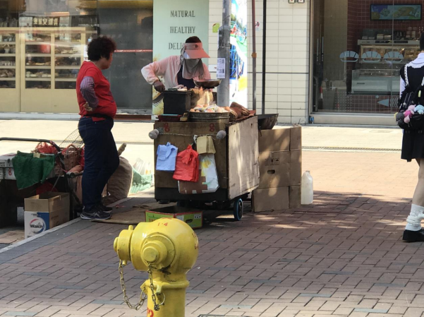
Legal Itinerary hawkers outside Shek Mun MTR Station (Source: Self-taken Photo)
4. Conclusion
To strive under the dominating power of government’s legal authority, the itinerant hawkers employ various strategies to navigate power dynamics. The resistance from the vendors demonstrates their resilience and unrelenting spirit to fight for their spaces despite facing harsh measures and regulations. As its economic and cultural values, hawkers are one of the unique cultural symbols in Hong Kong. As the new initiative to promote and restore the city’s economy in the post-COVID era, in the near future, we may see the hawker’s legal status, being forced and vulnerable in a few decades, may start to change at the same time.
References
Census and Statistics Department (CSD) (2023). Hong Kong in Figures, 2023 Edition.
FHED (2022). Hawker Control. Food and Environmental Hygiene Department. https://www.fehd.gov.hk/english/pleasant_environment/hawker/overview.html
HK01 (2023, June 19). 小販之苦·下|從公共空間到城市想像 香港連小販都容不 下嗎? 香港01 。 https://www.hk01.com/article/904686?utm_source=01articlecopy&utm_medium=referral
HK01 (2023, August 28). 香港仔天光墟商戶收告票停業 業界:象徵漁港文化吸引遊客應保留。香港01。 https://www.hk01.com/article/932281?utm_source=01articlecopy&utm_medium=referral
HK01 (2023, May 17). 來稿|打造小販經濟提升治理溫度 還給香港多些煙火氣。 香港01。 https://www.hk01.com/article/898882?utm_source=01articlecopy&utm_medium=referral
HK01 (2023, September 14). 固定小販攤檔20年減逾2千檔,呢區剩最多,有類攤販 只剩5檔恐絕跡。 香港01。 https://www.hk01.com/article/938565?utm_source=01articlecopy&utm_medium=referral
Hong Kong Special Administrative Region, Press Release. (2023). LCQ18: Preservation of the characteristics of the hawking culture. https://www.info.gov.hk/gia/general/202304/26/P2023042600216p.htm#:~:text=1%20 %281%29%20As%20at%20March%2031%2C%202023%2C%20the
Initium Media (2021, January 5). 旺角騷亂後,30年小販黃老太述說她與 香港的魚蛋夢。端傳媒 Initium Media. https://theinitium.com/article/20160220- hongkong-hkvendors
Mathias K. S. (2014). Foucault on Power Relations, Irénées. https://www.irenees.net/bdf_fiche-notions-242_en.html
An Unusual Existence in the City
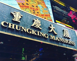
1. Introduction
The project explores one of Hong Kong’s best recognised cultural landmarks, Chungking Mansions, in the highly accessible central business district of Tsim Sha Tsui (Figure 1). Surrounded by many luxurious hotels and high-end shops, Chungking Mansions stands out as a vertical cluster of small businesses and guesthouses, where ethnic minorities ranging across traders, workers, tourists and asylum seekers converge. This earns Chungking Mansions the name “Ghetto at the Center of the World”, after the title of Gordon Mathews’s (2011) seminal anthropological account of the building.
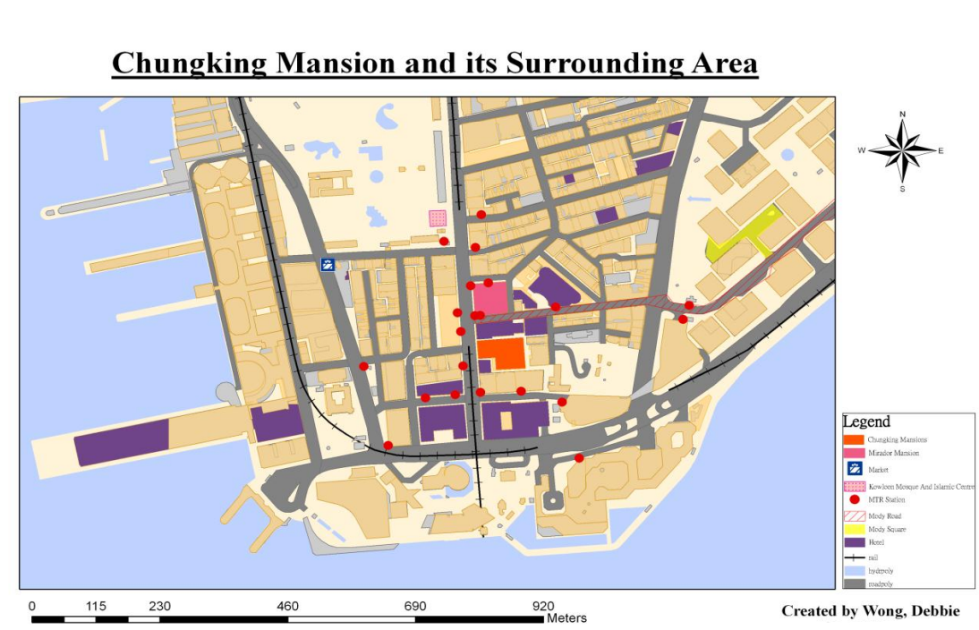
Chungking Mansions and its Surrounding Area
Why can we find Chungking Mansions as a “ghetto” in Tsim Sha Tsui, where land rent is sky high? How is the cultural – particularly ethnic – complexity inside the building embedded within Hong Kong’s geographical context? These are the questions this project attempts to address from a cultural geographical approach, with the aid of Henri Lefebvre’s theory of spatial triad.
Theoretical Approach: Lefebvre’s Spatial Triad
A cultural geographical approach analyses the diversity of symbolic and material practices of human communities as cultural traces – outcomes of interaction between culture and the geographical context in which these traces are found. Accordingly, this project takes Chungking Mansions as a cultural trace produced through the interactions between its many stakeholders (e.g., property owners, vendors, visitors, etc.) from diverse cultural backgrounds on one hand, and the socio-spatial context of Hong Kong evolving over time.
Proposed by French sociologist Henri Lefebvre, the theory of spatial triad offers a framework to systematically analyse how cultural traces are produced through: (i) interactions between actors with different social status over space, and (ii) interactions between these actors and the space for which they compete. As its name suggests, the theory draws attention to three analytical dimensions, “representations of space”, “representational space”, and “spatial practice”. The following table explains their meanings and their application in the subsequent analysis of Chungking Mansions.
Analysing Chungking Mansions through Lefebvre’s Spatial Triad (Source: Compiled based on McCann, 1999)
|
Dimension |
Definition |
Example |
Analytical focus in Chungking Mansions
|
|
Representations of space |
Spatial imaginations of those in power, regulating how space should be ordered and used |
Official zoning plan for a city |
Government policies and property owners’ decisions which shape the physical layout, functions, and ethnic composition of the building (Section 3.1)
|
|
Representational space |
Symbols imbued in space by people living in it, often for challenging existing representations of space
|
Artistic representation (e.g., movie) of a city |
Attitudes of different people towards the building (Section 3.3) |
|
Spatial practice |
Physical space and the everyday routines and experience of people living in it
|
Actual spatial activities in a city |
Physical features, everyday activities, and social relations in the building (Section 3.2) |
Chungking Mansions as a Complex Cultural Trace
Why has Chungking Mansions developed into an ethnic enclave?
For many outsiders of Chungking Mansions, the most observable phenomenon in the building is the gathering of people from diverse ethnic backgrounds, mostly South Asians and Africans. This is made possible by three ways Hong Kong was, or is, politically and institutionally positioned in the world (Mathews, 2011).
First, the significant presence of ethnic South Asians can be traced back to the early history of Hong Kong as a British colony, which began in 1841. Back then, the Indian Subcontinent was also under British rule. Some South Asians came to Hong Kong as recruits of the British Army and the city’s colonial government, while others as traders and labourers.
Second, people from various parts of the world are drawn to Hong Kong as an international commercial centre. Located midway between the Chinese mainland and Southeast Asia, Hong Kong has developed as a gateway for traders to multiple rapidly emerging economies. Notably, more African entrepreneurs can recently be seen in Hong Kong as they visit the city to buy Chinese products for resale in their home countries.
Third, consolidating its geographical advantage in trade development, Hong Kong champions free trade and adopts visa-free policies for many nationals to facilitate flows of goods and people. These moves attract for Hong Kong not only traders and tourists from many countries, but also attract asylum seekers and foreign illegal workers.
With these factors in mind, a more specific question comes: Why do all these people from diverse backgrounds specifically cluster in Chungking Mansions? For South Asians, this might be a matter of following the choice of their early settlers in Hong Kong, many of whom concentrated in Tsim Sha Tsui. However, more generally, this has to do with the building’s availability of affordable spaces for business and accommodation.
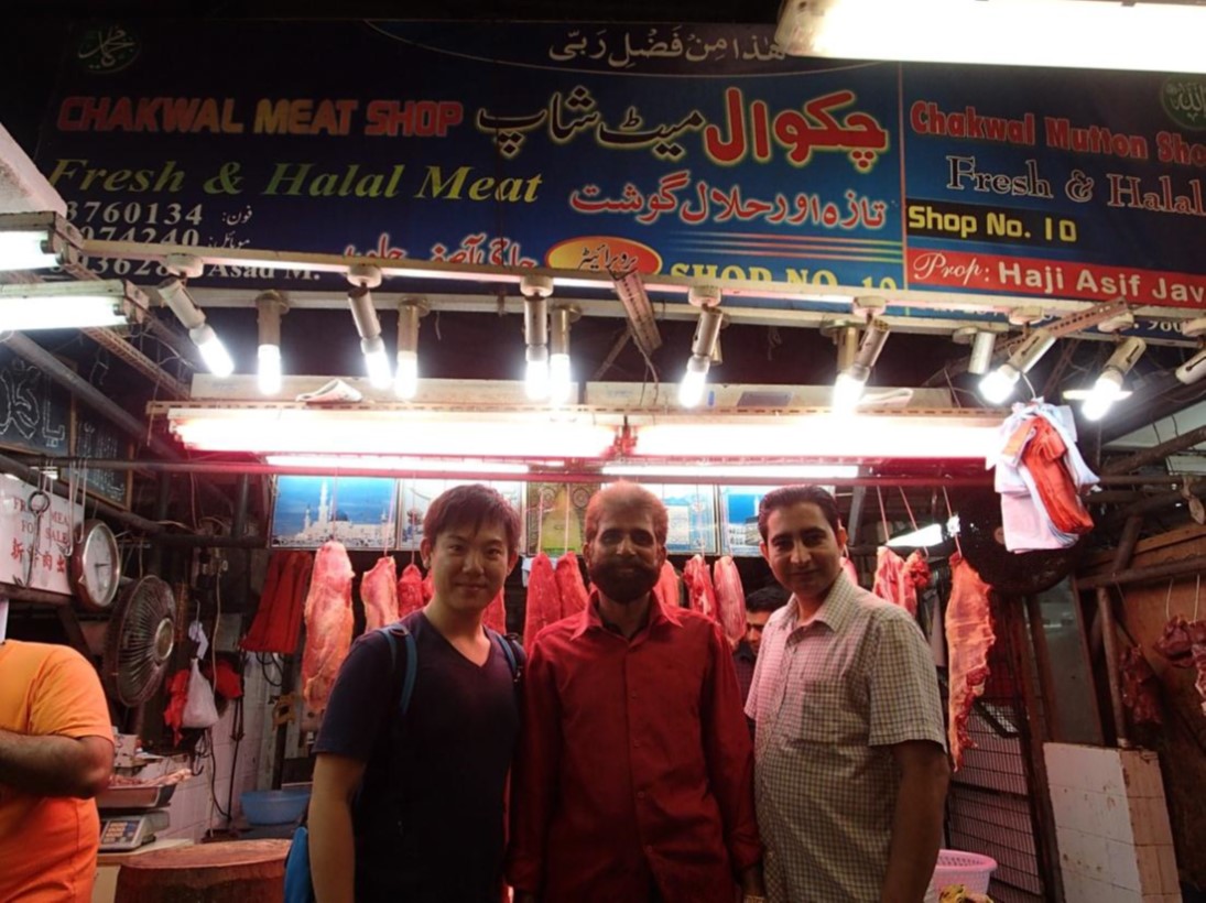
Trace of South Asian community in Tsim Sha Tsui: Halal meat store
Built in 1961, Chungking Mansions boasts a total of 920 co-owners (Mathews, 2011, p. 38), as it is partitioned into multiple units conveyed to different parties. Given the building’s extremely fragmented ownership, it has been difficult for individual co-owners to pool together enough ownership shares to sell the building for redevelopment. As the building deteriorates, co-owners can only lease their units a low rent. In a visit to the building in 2017, we learnt that the monthly rent of a shop selling phones and accessories is only about HKD 17,000. Such low-cost space is ideal for ethnic minority migrants, who come to Hong Kong with financial difficulties, to make a living with a small business.
How do people make a living in Chungking Mansions?
Chungking Mansions is divided into three distinct clusters of different functions. For the stores mentioned above, they are found in the building’s first two floors, each as a separate cluster. The first floor is home to stores selling SIM cards, food, clothes and other daily necessities, and several money exchange stores, while the second floor is dominated by stores selling electronic gadgets. Meanwhile, the third floor and above is the territory of guesthouses and restaurants.
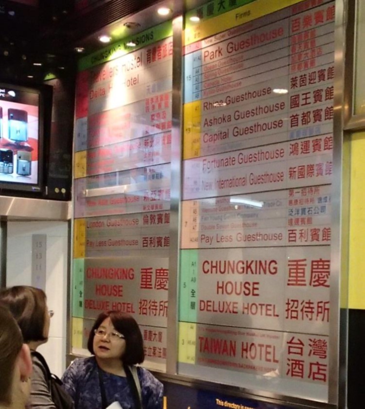
Chungking Mansions as a cluster of guesthouses
Guesthouses in Chungking Mansions have been known for their affordability. They first came to significant attention in the 1970s, after being featured in the famous travelling guidebook “Lonely Planet” for accommodating backpackers at very low prices (Mathews, 2011). Since the 1980s, they have blossomed within Chungking Mansions through partitioning of apartments, meeting demand from tourists with a tight budget and traders from developing economies for low cost accommodation. This contributes further to the large number of ethnic minorities in the building.
The significance presence of ethnic minorities, however, has not resulted in elaborative display of ethnic or religious features in Chungking Mansions. This is because of two reasons. Firstly, limited floor space makes it impractical to do so. Secondly, some owners are concerned that religious items may not be welcomed by everyone and thus not beneficial to their businesses.
Indeed, the economic imperative can push even the most fundamental religious principles out of consideration. According to the Quran, alcohol is prohibited for Muslims. Surprisingly, one of the Muslim restaurants we came across was selling beer to customers. “Since we just have to make a living, Allah will understand,” the boss of the restaurant shared.
What does Chungking Mansions mean to its outsiders and insiders?
To many local Chinese, Chungking Mansions is unwelcoming and dangerous. This impression stems not only from the building’s sizeable ethnic minority population which they are unfamiliar with, but also a 1994 Hong Kong movie entitled “Chungking Express”. Directed by the renowned filmmaker Wong Kar-wai, the movie depicted Chungking Mansions as a place where only people with complicated backgrounds or gangsters would go. It has had a huge impact on the public in terms of engendering and spreading the impression of the building as a “prohibited land”.
However, to the many ethnic minorities residing or working in it, Chungking Mansions is rather their ‘beacon of hope’ (Mathews, 2011, p. 16). Popularly associated with a sense of insecurity, Chungking Mansions has faced downward pressure for the rental level of its retail units. While this is hardly pleasing to the buildings’ many co-owners, it is good news to migrants and traders from the developing world, who are finding a gap in a global capitalist system working against the interest of their countries and them. To them, given the relatively low cost of finding refuge and doing business in it, Chungking Mansions stands as the best place for them to climb up the social hierarchy through their hard work, eventually overcoming the poverty and discrimination they currently suffer.
Conclusion
This project has attempted to deploy Henri Lefebvre’s theory of spatial triad to unpack how Chungking Mansions represents a cultural trace produced through three aspects of interaction between it as a multi-storey architectural space and various actors. First, territory-wide policies and rental decisions of property co-owners promote the concentration of ethnic minorities with developing world origins in Chungking Mansions. Second, some ethnic minorities are becoming less unusual as they prioritise economic pragmatism over their religious traditions. Third, despite the previous point, personal perception among some local Chinese and cinematic representation continue to obscure Chungking Mansions’ value to support the struggle of ethnic minority individuals to achieve prosperity, thereby keeping the building behind a sense of unusualness.
References
Mathews, G. (2011). Ghetto at the centre of the world, Chungking Mansions, Hong Kong. Hong Kong, China: Hong Kong University Press.
McCann, E. J. (1999) Race, Protest, and public space: contextualizing Lefebvre in the U.S. city. Antipode, 31(2):2, p.163–163-184.
This page is developed based on a project undertaken by students ... in 2018-19.
1. Introduction
Strolling on the streets in Keelung, one would be amazed by the cultural diversity which shapes the city’s distinctive local landscape. Located at Taiwan’s northern tip, Keelung has been one of the important gateways to Taiwan.
This research departs from the cultural geography perspective that a place is formed by cultural traces left by a series of conflicts and integration of cultures. In the case of Keelung, its cultural landscape is formed through the interplay of different prevailing socio-political forces during the reign of three governments:
- the Qing Court (1683–1895), under whose reign people from southern Fujian, also known as Minnan (閩南), migrated to Keelung;
- the Japanese colonial government (1895–1945), which took over Taiwan after Qing’s loss in the First Sino-Japanese War (1894–1895), and
- the Republic of China (ROC) government (since 1945), which acquired Taiwan’s sovereignty after Japan’s defeat in World War II.

Location of Keelung in Taiwan (Map by Luuva / CC BY-SA 3.0)
2. Cultural Geography Perspective in Use
From a cultural geography perspective, a place is formed by various cultural traces which reflect and reinforce a particular cultural order. Every place has its own cultural order, which is defined by the social groups possessing dominating power. The presence of cultural order means that some groups are accepted in a place, while others are marginalised, if not completely crowded out. Cultural traces in a place captures the outcome of the interaction between social groups, and their relative position in the cultural order. As such orders evolve over time, older cultural traces may be erased by, overlaid upon, or integrated with newer traces, creating a complex cultural landscape.
Keelung is a sum of Minnan, Japanese, and ROC culture, with the assimilation managed by the government and the acculturation promoted by citizens through conflicts and compromises. Governmental assimilations added new traces to erase the legacy of the last era and to propagate the dominant culture. In spite of the governmental unyielding changes, the public also encounter conflicts between different cultural beliefs when new culture entered Keelung. The clashes may result in a mixture of distinct beliefs after a period of time. Although new cultures were not accepted when they first entered Keelung, as time passes, people gradually integrate foreign cultures with their own culture, and that forms the modern Keelung.
Socio-political conflicts as well as traces of cultural integration can be observed throughout Keelung’s development since the 19th century. The following discussion will evaluate how a combination of Minnan, Japanese and ROC influences have given rise to three distinguishing features of Keelung: the city’s Ghost Festival, the spatial complex of Dianji Temple (奠濟宮) and Miaokou Night Market (廟口夜市), and the city centre’s road system.
3. Traces of Cultural Integration and Transformation
3.1 Keelung Ghost Festival
Keelung Ghost Festival is an intangible cultural trace of the armed conflicts between migrants from different parts of Minnan, a region separated from Taiwan by the Taiwan Strait. During the Qing Dynasty, many Minnan people migrated to Taiwan in seek of a better life, with Keelung being one of their popular destinations. These people came mainly from two parts of Minnan, Zhangzhou (漳州) and Quanzhou (泉州). Due to their different origins, religions and cultural practices, these new settlers ran into a series of deadly confrontations during the 1850s, now collectively known as Zhang-Quan Conflicts (漳泉械鬥) (Wei, 2011). The Zhangzhou people won and took over the land near Keelung Harbour (基隆港), while the Quanzhou people were forced to move inland to Nuannuan District (暖暖區).
District map of Keelung City, Taiwan (Adapted from: https://upload.wikimedia.org/wikipedia/commons/b/b1/Keelung_districts_map.svg)
To avoid further bloodsheds, leaders of the Zhangzhou and Quanzhou migrants eventually reconciled in an interesting manner. Instead of physical confrontations, they agreed that their communities would compete in hosting rituals during the Chinese Ghost Festival, which falls on the 15th day of the seventh month of the Chinese calendar, to appease and sate the deceased (Wu, 2009). The competition, represented at first by 11 and later 15 clans, continues to date in two parts. First, the clans compete across years as they take turn to decorate the main alter (主普壇) of the year as elaborately as possible. Second, the clans also compete head to head in the same year in organising the most eye-catching street parade. Given its colourfulness, Keelung’s Ghost Festival attracts a lot of local visitors and foreign tourists, and earns the name of one of Taiwan’s top twelve festivals identified by the Taiwan Tourism Bureau.
The three-storey main altar of Keelung Ghost Festival, currently used as the Keelung Mid-summer Ghost Festival Museum
(Photo by Eugene Yeh / Photo courtesy Taiwan Tourism Bureau)
3.2 Dianji Temple and Miaokou Night Market
The history of Minnan migrants also leaves a tangible trace in Keelung – Dianji Temple, whose siting reflects the legacy of Zhang-Quan conflicts. Established in 1875, Dianji Temple was built by the Zhangzhou community to worship the Sage King Kaizhang (開漳聖王), a Minnan folklore hero, for his loyalty and effort in developing the Fujian province (Keelung Municipal Government, 2018). At the back of Dianji Temple lies Qingning Temple (清甯宮), built by the Quanzhou community to worship the Gods of the Water (水仙尊王). Since Quanzhou people lost in the conflicts with Zhangzhou people, they were only qualified to build their temple as a smaller building behind Dianji Temple.
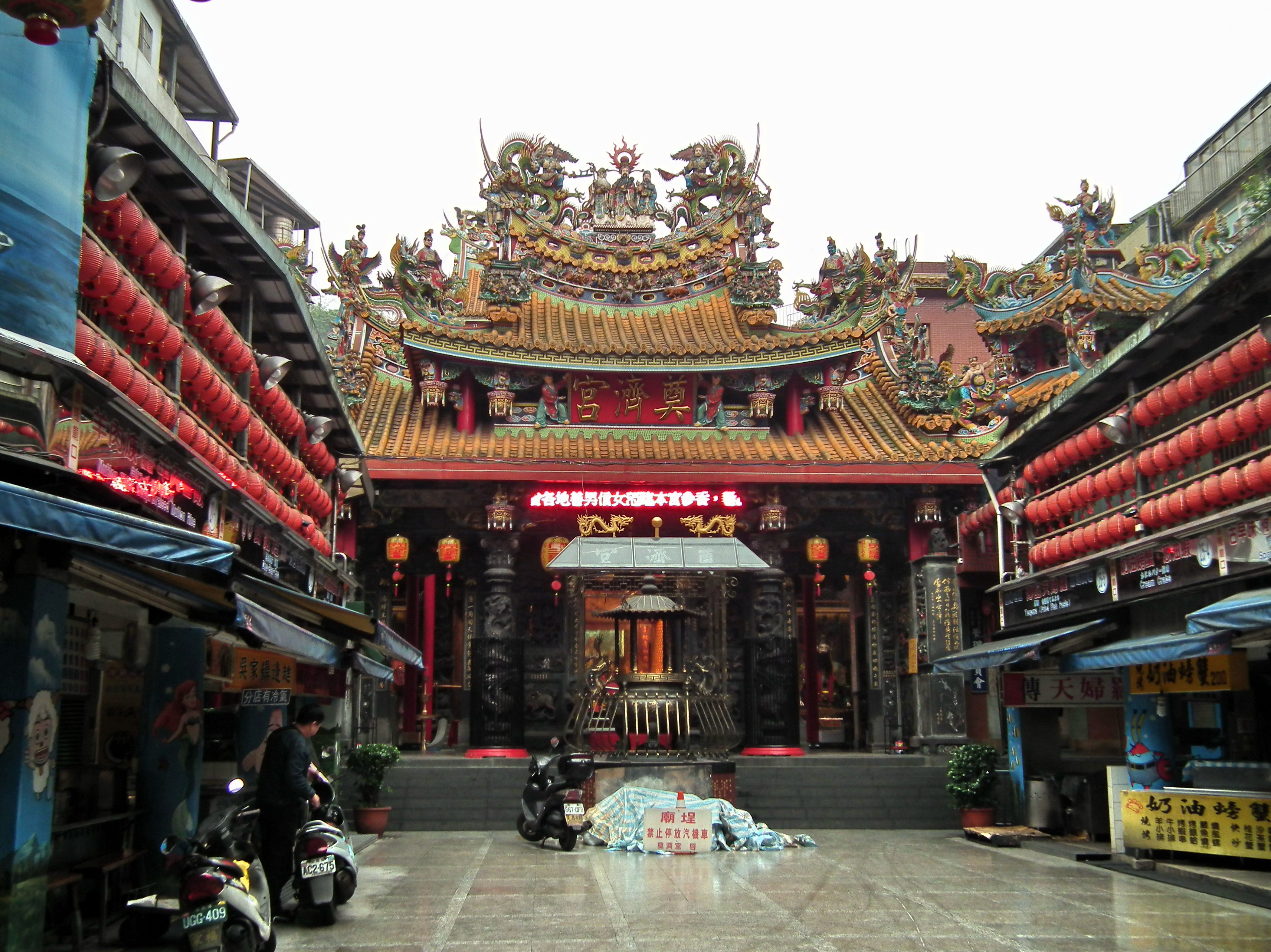
Keelung Dianji Temple (Photo by lienyuan lee / CC BY 3.0)
In addition, Dianji Temple showcases the compromise and coexistence of Japanese and Chinese cultures. The temple’s main hall stands two pairs of pillars decorated with different motifs. Erected by the Japanese colonial government, the older pair is decorated with patterns of flowers and birds, as they are symbols of good fortunes and a free spirit in Japanese culture (Chen, 2005). On the contrary, added by the ROC government, the younger pair is decorated with patterns of a Chinese dragon, reinforcing traditional Chinese culture in the temple.
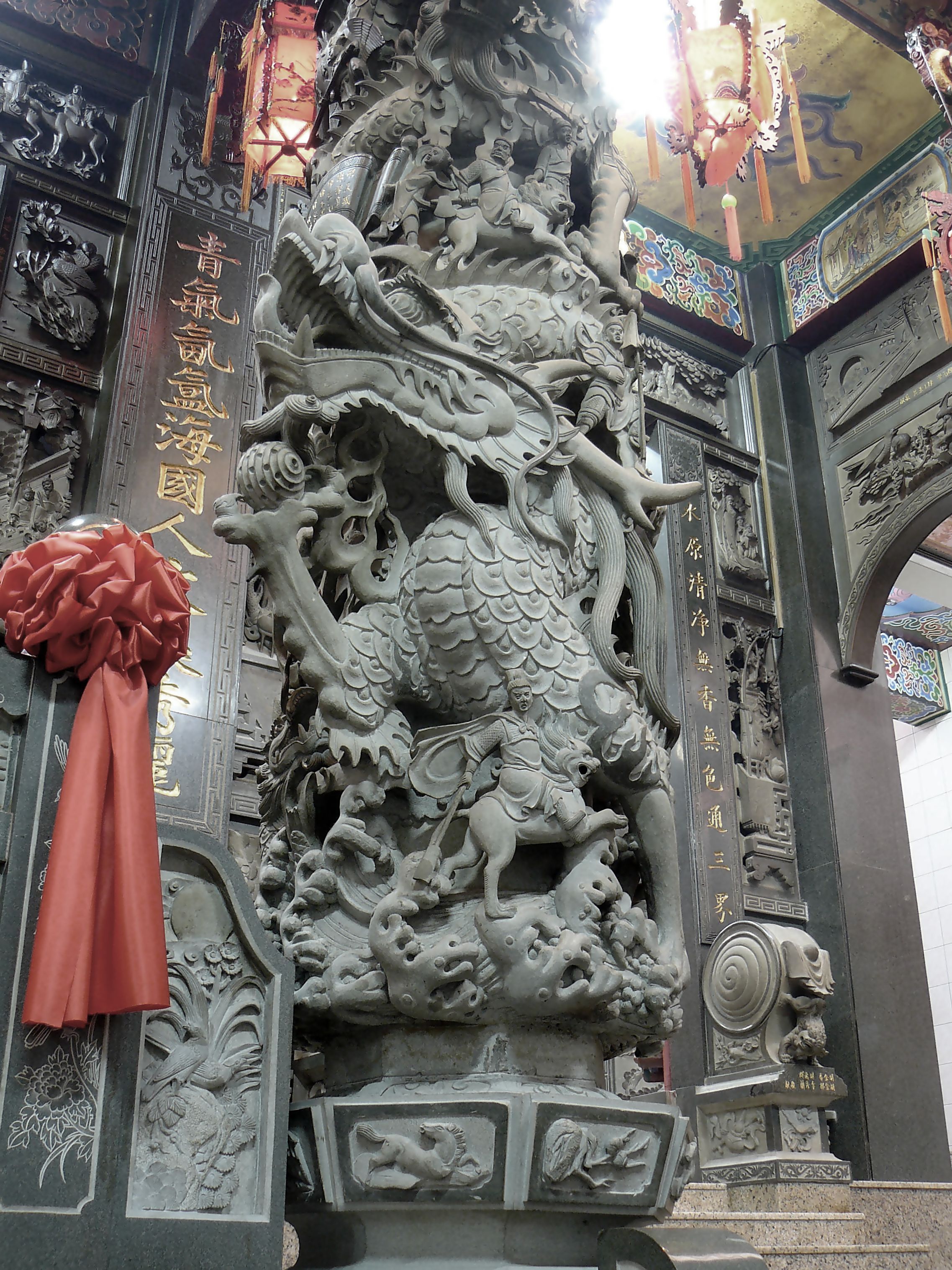
Pillar with pattern of a dragon in Dianji Temple. (Photo by yeowatzup / CC BY-2.0)
The significance of Dianji Temple has evolved over time with the development of Miaokou Night Market around it. In the past, countless people visited Dianji Temple for worships. This attracted many vendors to operate around the temple. The night market so formed is named ‘Miaokou’, which literally means the entrance to a temple. However, in modern days, people are less superstitious and visit Dianji Temple as tourists instead of disciples. Therefore, the temple’s social significance as a worship venue is gradually decreasing, while people pay more attention to the night market, particularly the wide range of food it offers, including those of Japanese, Minnan, Zhejiang, and Taiwanese origins. Miaokou Night Market has taken over the status of Dianji Temple as the most important spatial feature of the local area at which they are located.
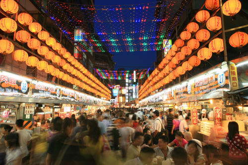
Miaokou night market (Photo by Wu-Chih Hsueh / Photo courtesy Taiwan Tourism Bureau)
3.3 Keelung’s Road System
The road system of Keelung is a typical example of spatial transformation for economic and political goals. The system first took shape during the Japanese colonial era, when the colonial government considered Keelung a place with great development potential but physically in disorder. To develop Keelung into a modern port city, the colonial government formulated the Keelung Municipal Improvement Plan in 1905. The plan introduced a grid of modern roads and sewers to facilitate modern transport and reduce flooding risk (Ho, 2018).
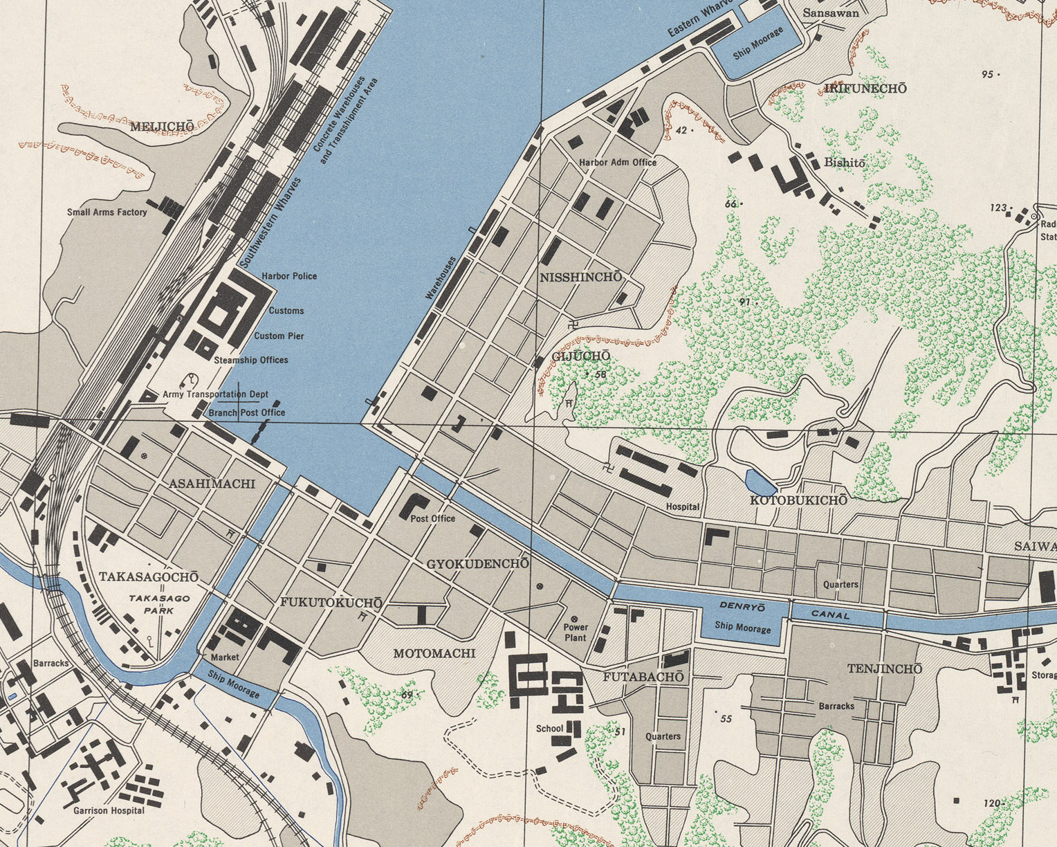
Keelung’s grid road plan, 1945 (Map by U.S. Army Map Service / Courtesy University of Texas Libraries)
After World War II, the ROC government was eager to erase Japan’s colonial influence and assert its authority on the island. In Keelung, the ROC government preserved the grid of roads, but renamed them according to the ‘eight virtues’ generalised by Sun Yat-sen, the founder of ROC, from traditional Chinese values (Lee, 2016). They include dedication (忠, zhong), filial piety (孝, xiao), benevolence (仁, ren), love (愛, ai), trustworthiness (信, xin), justice (義, yi), peace (和, he) and equality (平, ping).
Keelung’s roads named after eight virtues: Ai 3rd Road (left) and Xin 2nd Road (right)
(Left and right photos by Solomon203 / CC BY-SA-4.0)
4. Concluding Thoughts
Owing to conflicts and compromises among the Minnan migrants and the ruling powers in the past hundred years, Keelung, a small city at the top of Taiwan’s map, bolsters a range of material and non-material traces which embody the cultural influences from the Minnan communities, the Japanese colonisers, and the officials of the ROC government. From these mesmerizing and intriguing traces, we can retrace and study how dominating powers and transgression of different parties shape the cultural diversity and distinctive cultural landscape of the city over time.
Roses always come with thorns. Foreign cultures, while giving birth to Keelung’s cultural diversity in the past, may dampen its cultural diversity nowadays. Under the influence of globalization, local cultures are at risk of being banished. In recent decades, the local government developed the cruise economy in Keelung port, driving up land rent in Keelung. Some local vendors cannot afford the rising cost and have been displaced by stores of multinational corporations with stronger financial strength. Without concerted effort to conserve the local ways of living, Keelung’s cultural diversity and continuity may cease to exist. Whether Keelung can preserve its uniqueness in cultural terms is a question that deserves our further attention.
References
Keelung City Government. (2018). Keelung Travel - Dianji
Temple. Retrieved from https://tour.klcg.gov.tw/en/attractions/temples/奠濟宮/
Wei, L. (2011). Chinese festivals. Cambridge:
Cambridge University Press.
Wu, H. (2009). Kinship Resolution to Replace Regional Conflicts?
The Ghost Festival in Keelung and the Surname Rotation System. The
Journal of History, NCCU, (31), 51-95.
何昱泓(2018年09月21日)。〈鍵盤基隆小旅行:從築港工程到地下旭川,百年來港都大改造的歷史軌跡〉。取自https://gushi.tw/old-times-keelung/
李筱峰(2016年03月08日)。〈基隆地名的故事〉。取自http://www.peoplenews.tw/news/878a496e-49b2-4456-b38a-0ac52e66d532
陳凱雯(2005)。〈帝國玄關─日治時期基隆的都市化與地方社會〉(碩士論文)。取自http://ir.lib.ncu.edu.tw:88/thesis/view_etd.asp?URN=91125015
A Study of Mong Kok’s evolving spaces through Lefebvre’s spatial triad
Foreword
The research project pays homage to the street culture of Mong Kok pedestrian zone, which has been permanently closed down on 31 August 2018 due to overwhelming noise pollution. This research project was conducted from September to December 2017, shortly before its closure. It is believed that the project could show the glimpse of Mong Kok pedestrian street culture before it faded with the de-pedestrianization policy. This zone has been a significant landmark to both locals and tourists – not only does it provide the seedbed for local culture, it also reflects the development, changes and stories of Hong Kong.
Figure 1. A night view of Fa Yuen Street (花園街 ), Mong Kok (Photo by Chi Lok TSANG/ CC BY 3.0)
1. Introduction
Located at the centre of Kowloon Peninsula, Mong Kok has long been a place with seemingly conflicting traces. First, it has been a crux of local culture – gathering local shops (hawkers, street food, niche stores for youngsters), local people and tourists in seek of the authentic side of Hong Kong. It is visited in the highest frequency by tourists and locals as a cultural and leisure centre respectively. It is known for its chaotic, bottom-up spirit. Second, and a phenomenon that gains momentum later, Mong Kok lies at the centre of the MTR network and serves as the transfer station for two major metro lines. It represents a homogenizing force, with its orderliness and its role as a driver of large-scale urban development. This project examines the juxtaposition of these two forces in general, and in particular whether the MTR’s dominating influence has affected local culture and whether there is any conflict between these contrasting traces.
2. A Cultural Geographical Perspective on Mong Kok
Our investigation is structured around the following question: Will the MTR, as one of Hong Kong’s key drivers of urbanization, eradicate the local culture embedded in Mong Kok?
To reveal the relationship between daily commute and spatial arrangements of Mong Kok, Lefebvre’s spatial triad is used as a theoretical perspective to analyze how the space in Mong Kok interact with the culture there, and contribute, if any, to the existing culture.
Lefebvre’s spatial triad consists of three elements:
- Representation of space is the conceived space by the ones in power in influencing the city plans and urban planning, e.g. scientists and planners;
- Representational space is the consumption of space by daily users, e.g. using the space according to personal feelings, intuition, and habits.
- Spatial practice is the daily usage of space on which we implement our knowledge
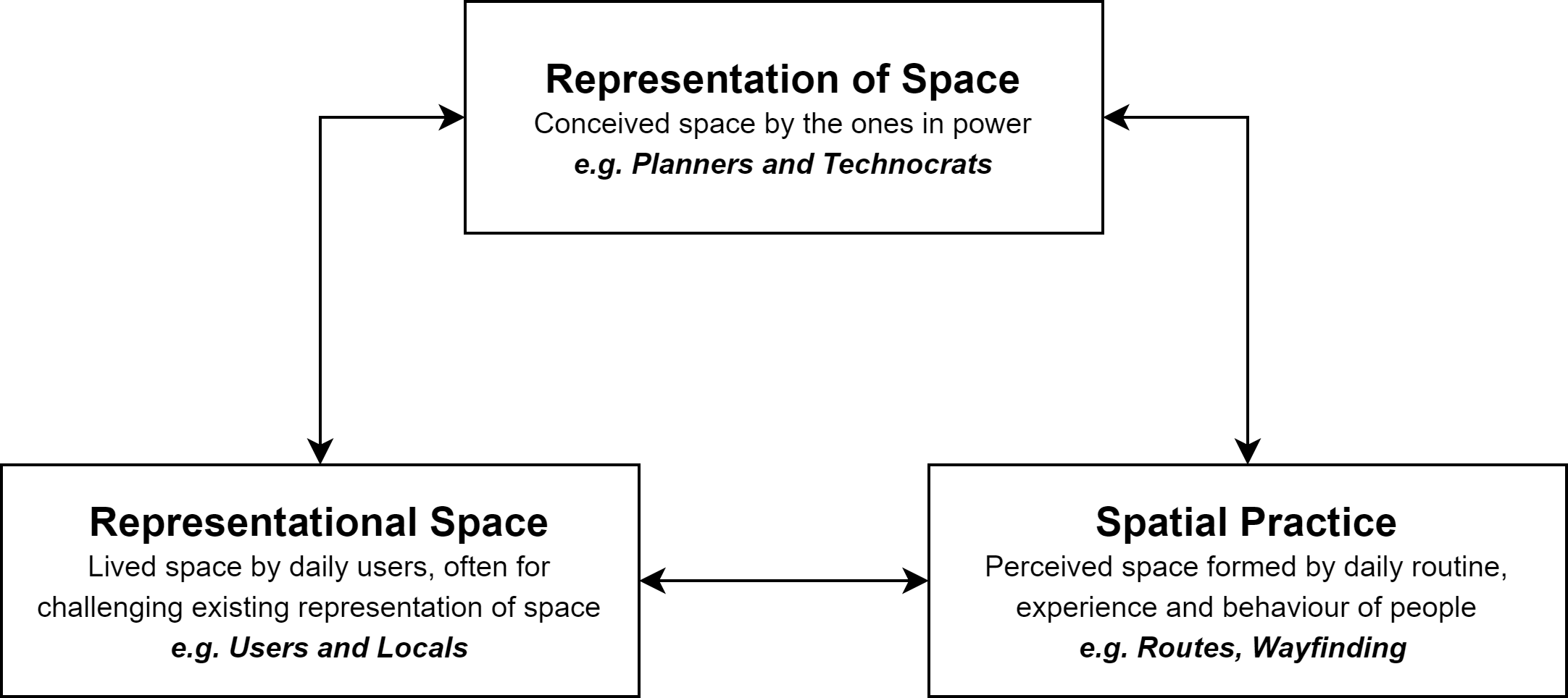
Figure 2. An illustration of Lefebvre’s spatial triad (Source: Lefebvre, 1991)
The spatial triad provides a way to analyze how space is both a tool and a result of the power struggle between social groups with different levels of power. It draws attention to (A) how users of stronger or weaker power conceive the places based on their daily routines and habits, and (B) how the conception of spaces by daily users reshape the conception of space by urban planners. Specifically, we argue that the complicated, fast-paced urban spatial arrangement in Mong Kok – i.e. the representation of space developed by the MTR – has limited the growth of the local culture.
3. Empirical Analysis
Representational space and representation of space in Mong Kok: Impacts of the MTR
Once a farming village, Mong Kok began to flourish at the beginning of the 20th century as a commercial area. It has since evolved into a melting pot of ‘street culture’, a set of ‘practices, styles, symbols, and values associated with, adopted by, and engaged in by individuals and organizations that spend a disproportionate amount of time on the streets of large urban centres’ (Ross, 2018, p. 8). It is known for its open-air markets, where locals and tourists alike visit the hawkers for knockoffs and street food. It is also known for its appeal to teenagers, who patronize the area for its concentration of entertainment venues, electronics stores and vendors of trendy products. It is furthermore known for its pedestrian zone, whose success in attracting a large number of street performers provoked local residents’ opposition that led to its abolition.
The chaos and crowdedness bolstered by these diverse traces of culture stand in sharp contrast to the orderliness brought by the MTR. As Hong Kong’s railway monopoly, the MTR structured the culture of Mong Kok and other parts of the city through its extensive railway network. With the power to enforce a set of by-laws on any railway premises, the MTR has transformed wherever its railway reaches into spaces with ordered cultures. As a notable example, the MTR stations are full of instructions – from exits, directories, the flow of people, where to stop and where not to etc., from eye level, above and below, with none that was left with no regulatory guide. These signs were accompanied by non-stop announcements, from reminders of last trains and safe use of elevators, to appeals for passengers to squeeze into the carriages to make room for others.
Owing to the dominance of cultural values embedded by the MTR development, these geographical borders further extended beyond the metro stations and infiltrated various streets and landmarks. Signs and guides for metro stations and exits are ubiquitous in the public spaces including various pedestrian walkways, flyovers and shopping centres.
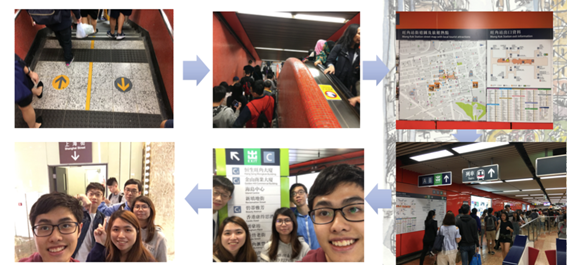
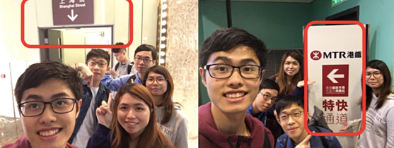
Figure 3. The MTR stations in Mong Kong are highly regulated spaces.
Evidence of transformation: Spatial practice in wayfinding and navigation
An emerging trace in unveiling the impact of metro developments on spatial practices is the pedestrians’ changing sense of direction and wayfinding behaviours. Before the construction of the MTR station, most residents relied on landmarks and streets for navigation which represents the chaotic and yet disordered traces. The Mong Kok streetscape has undergone significant transformation and socialization. Since the 1970s, commercial activities have burgeoned and grown around nodes of the MTR stations given their high accessibility. Old buildings such as tonglau (唐樓) are hence gradually overhauled by office complexes and malls such as Langham Place, which become the new exits of the metro stations. The transformation of space has then marked the transition of value from disordered yet continuous space into socialized space advocating formality, orderliness and regularity.
These transformations in cultural traces are evidenced by the results of our street survey. The MTR exits have become the dominant trace which people depend upon for navigation. During our field study, 60.9% of our respondents use metro signs and exits to find their ways and destinations in Mong Kok. Some would identify the location of a place by its closest MTR exits. Some even deliberately move from one location of Mong Kok to another through the MTR station in order to orient themselves with the aid of the station map. At the same time, 84.5% of the respondents indicated that they were unable to identify the streets of Mong Kok without the aid of an MTR map. These findings suggest that most of the places in Mong Kok have been socialized by the values of orderliness and regularity introduced by the dominating power of metro stations. These transformations have, thereby, significantly reshaped the pedestrians’ conception of space and directions, as well as their behaviour in their navigation of Mong Kok.
These spatial practices are in contradistinction to those of the local inhabitants and daily users. Long-term residents inhabited for many years tend to rely more heavily on the street names than their non-residential counterpart, who can barely identify other parts of Mong Kok besides the town centre due to the crowdedness and disorganized culture of the streetscape. While youngsters tend to rely on metro signs and iconic, middle-aged and senior citizens roam around based on their knowledge and impressions on the streetscape. Owing to more established and complete memory of the urban areas, many residents can visualize Mong Kok by street names and even demolished buildings when compared to their younger counterparts. However, as the dominating metro culture continues to develop, it is expected that fewer and fewer pedestrians may perceive the space by buildings and streets, and hence vanish of the disorderliness of street cultures.
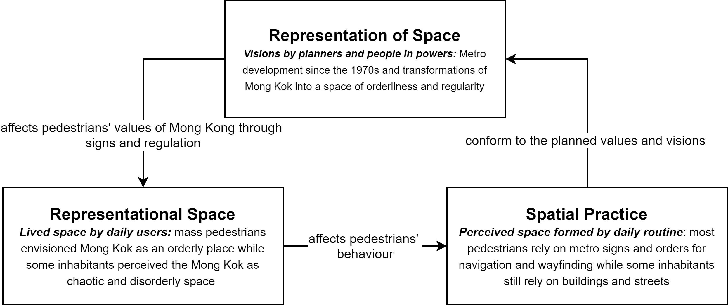
Figure 4. An illustration of Lefebvre’s spatial triad and the conflicts between street and metro culture in Mong Kok
This finding suggests that the formation of new and organized cultural traces as facilitated by the MTR development has significantly altered people’s conception and knowledge of a space and how they navigate. These metro culture has been acting as a dominant force that reshaped and socialized the streetscape in Mong Kok. These findings generally correlate with Lefebvre’s idea of the spatial triad. While people in power may structure their representation of space through imagining Mong Kok into an organized city with full metro coverage and signs in various public spaces, other users may have their own values assigned to the landscape through representational space. Both of these traces are merged into the spatial practice through everyday routine and experience of wayfinding and navigation in Mong Kok.
4. Conclusion
This study
attempts to integrate Lefebvre’s spatial triad into the examination of how
railway developments significantly reshaped the distinct cultural practices in
Mong Kok. While the spatial arrangements in Mong Kok
are heavily regulated by organized yet dominant metro culture, pedestrians
spatial practice and daily routine of navigations and wayfinding have also been
socialized by the metro’s value of formality and regulation. However, the
government and the MTR have not been all-powerful. The subcultural groups could
respond with tactics through spatial reimagination and practices to counter the
representation of space and values by the powers. For instance, re-imagining
our own short-cuts and alternatives to the directions of the metro signs on
skywalks may allow us to explore and experience Mong Kok in unconventional
ways, thereby defying conventions embedded by metro cultures.
Reference
Lefebvre, H. (1991). The production of space. Oxford: Blackwell.
Ross, J. I. (2018). Reframing urban street culture: Towards a dynamic and heuristic process model. City, Culture and Society, 15, 7-13. doi:10.1016/j.ccs.2018.05.003
The Cultural Geography of Public Housing in Hong Kong
1. Introduction
As a home for 3.3 million people and almost half the population of Hong Kong, public housing complexes have remained pivotal to the construction of local identity and Hong Kong culture (Vetter, 2019). Despite drastic changes in their appearance over decades, many of the public rental estates have established themselves as one of the most renowned cultural and historical relics of local culture (Hui, 2018). This project aims to investigate how the architectural designs of public housing estates, the histories of socio-economic development and their rich cultural values have co-evolved over time.
Figure 1. Choi Hung Estate – A Slab Public Housing Estate in Kowloon (Photo by Kara M/ CC BY 3.0)
The project adopts a cultural geographical perspective and attempts to understand how the geography of a "space" interacts with social development, thus creating a "place". By utilizing the concept of cultural traces, we aim to examine how their designs coincide with the course of Hong Kong's development, including impacts of rapid economic advancement, changes in social values and traditional Chinese culture on the design of public housing estates.
2. Cultural Geography Perspectives in Use
Anderson (2015) articulated that a "place" is formed by the interactions and co-existence of different cultural traces which reflect the local cultural order. While the cultural order is continuously constructed and deconstructed, these cultural traces may capture how various social values and ideologies have changed over time. Inspired by these theories, this report adopts four major perspectives - structural, spatial, auspicial and commercial - to analyze how the cultural traces of public housing complexes have evolved and transformed since the 1950s. Table 1 summarizes these perspectives and analytical focus.
Table 1. A summary of the four major perspective and analytical focus.
|
Perspective |
Definition |
Analytical focus |
|
Structural |
The way in which parts of a system or object are arranged. |
The layout and design of individual flats of public housing estates. |
|
Spatial |
The position, area and size of things. |
The master layout of public housing estates, the positions of buildings and facilities. |
|
Auspicial |
Good omen and the indication of future success. |
The naming methodology of public housing estates, the analyzation of public housing block designs using Feng Shui. |
|
Commercial |
Buying and selling things. |
The shopping malls of public housing estates and the variety of shops. |
3. Traces of Cultural Transformation and Integration
The history of public housing traces back to the 1950s. On Christmas day, 1953, a severe fire broke out in the squatter area in Shek Kip Mei, and more than 50000 people lost their homes overnight. In response to this crisis, the government built several blocks of resettlement housing in the next year - presently known as Shek Kip Mei Estate - marking the beginning of public housing in Hong Kong (Hui, 2018).
Structural design: from a livable space to a living space
The living conditions of public housing have greatly improved since the 1950s. The earliest public housing blocks constructed in the 1950s provided poor living conditions for its residents. The Mark 1 Resettlement Blocks, for example, are only equipped with shared toilets and shower rooms, and a 24 sq. ft. per-capita living area as opposed to the legal requirement of 35 sq. ft (香港房屋的變遷", n.d.). A kitchen is non-existent.
Owing to the revitalized economy in the 1970s and improved social welfare systems, the desire for better living conditions flourished and has greatly influenced the designs of public housing estates since then. Individual toilets and kitchens were introduced to each flat in the new designs of Slab (Figure 2) and Twin Tower blocks. Residents no longer needed to cook and shower on the balcony. The living conditions were further improved in the 1980s with respect to improvements in the local economy. The introduction of Trident Block (Figure 3) design has marked the first type of block whose flats are designed to enable subdividing of bedrooms. Flats of the Harmony blocks were highly standardized due to the use of modular and prefabricated components. While emphasizing on a comfortable living environment and space in the modern era, the latest designs of Concord (I) and New Cruciform (Figure 4) in the 1990s till 2000s bears striking resemblances to private housing blocks, with a smaller (8-10) number of flats on each storey, larger areas for each flat, and pre-set bedroom layouts (香港房屋的變遷", n.d.).
Figure 2. The layout of Standard Block Slab (Link 1 = 180o), a prominent design for public housing estates in the 1970s (Reprinted from "Standard Block Typical Floor Plans", The Housing Authority. 2016, Sept. 5.)
Figure 3. The layout of Standard Block Trident, a prominent design for public housing estates in the 1980-90s (Reprinted from "Standard Block Typical Floor Plans", The Housing Authority. 2016, Sept. 5.)
Figure 4. The layout of Standard Block Concord 1 (Option 1), a prominent design for public housing estates in the 1970s (Reprinted from "Standard Block Typical Floor Plans", The Housing Authority. 2016, Sept. 5.)
The privacy of public housing flats has also been enhanced to transform the “livable space” into “living space” in public housing estates. While flats of earlier designs such as the Mark 1 blocks only provide one corridor-facing window, which wraps around the building for the residents, newer designs in the 1970s, like the Twin Tower or Linear Blocks, presented the residents with more windows facing the corridor. Nevertheless, issues of privacy still remained unsolved since it allowed outsiders were able to peek into the flats. Such problems have not been alleviated until 1984 with the construction of Trident blocks in May Shing Court (美城苑) and Mei Lam Estate (美林邨) (Lau, 2016; "香港房屋的變遷", n.d.).
The structures of public housing have been improved over the years, with more basic facilities within the flat and a larger per-capita area. This process coincides with the period when Hong Kong experiences an economic boom (From 70s to 80s, the first Twin Tower block was finished in 1970) (Lau, 2016; "香港房屋的變遷", n.d.). It can easily be inferred that as the economy boomed and the society generally became more affluent, more comfortable housing became a consensus across various stakeholders including the government, especially for those who grew up in the Resettlement Areas, which were notorious for their poor condition. This reflects a paradigm shift in the social ideology for residential space from "quantity" to "quality" and from a "livable space" to "living space".
Spatial Design
In some sense, the spatial designs of public housing estates also follow similar trends. The early resettlement areas contain very little public and leisure facilities, aimed only at cramming as many blocks as they can. An example is Tsz Wan Shan Estate, with 66 resettlement blocks, and only one playground at the middle of the estate.
For these early estates, public spaces are mainly located within the building itself, like corridors, shared bathrooms and lift lobbies. These common areas are being relocated to outside the building now, and there is usually more than one playground or one park in the same estate. Newer estates also contain more public facilities such as schools, shopping malls and public transport interchange. The layout of buildings also becomes important. Architects, under community planning, take minor details such as microclimate, aesthetic details and accessibility of premises into consideration ("Upper Ngau Tau Kok Estate", n.d.). Greenery is also common within estates.
While the spatial designs generally have become more pleasing, the close relationship between tenants of the estate, as reflected in the increased amount of public facilities in estates remained unchanged. While socializing in corridors in the past, they are now carried out in parks and public areas. The increased public and recreational facilities help residents create a close relationship and a pleasing living environment, in line with the emphasis on quality housing.
Auspicial Perspective: Wishing for Prosperity and Good Luck
Chinese traditions and culture are deeply embedded in the design and naming of the public housing complexes. While most of public housing estates are built in a specific pattern, the culture for naming these multi-storey complexes with word patterns that symbolizes luck and blessings to its residents has remained unchanged since the 1950s. One example would be the naming patterns in Lek Yuen Estate (瀝源邨) and Fung Wo Estate (豐和邨) in Shatin. Despite the fact that the two estates were built in the 1970s and 2010s respectively, the strong emphasis on rituals and blessings in the naming process stayed crucial. The first Chinese character of the seven buildings in Lek Yuen Estate can form a phrase that means prosperity, luck and longevity (榮、華、富、貴、福、祿、壽). A similar pattern can also be found in the naming of the three building blocks of Fung Wo Estate indicating peace, safety and happiness (順, 安, 悅).
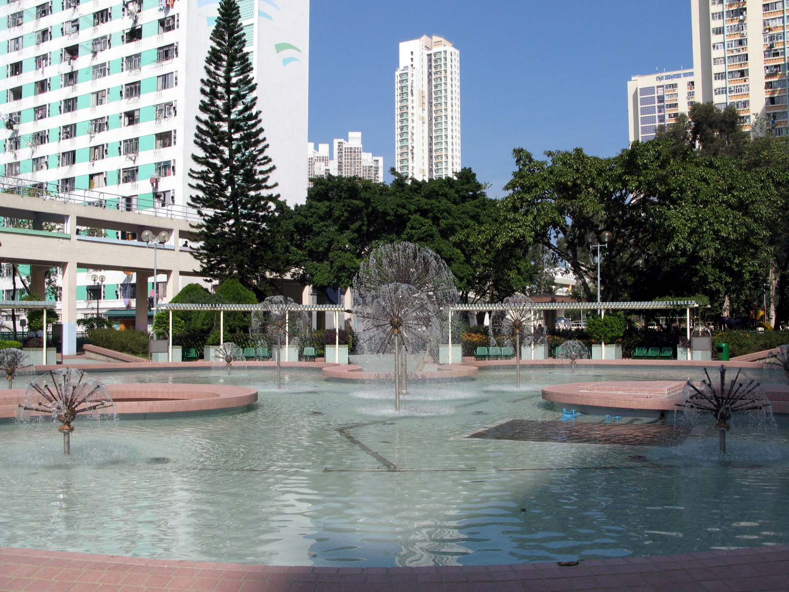
Figure 5. A Water Fountain at Lek Yuen Estate - The only water fountain found in any public housing estate in Hong Kong (Photo by WiNG/ CC BY 3.0)
Feng Shui (風水) is also accentuated in architectural designs of the public housing estates. These housing complexes can be categorized with respect to their shapes, such as cruciform, H-shaped, Twin Towers and Trident. While different architectural styles may epitomize different values and beliefs, their designs, in general, reflect the residents' expectations and wishes for prosperity and respect, as well as avoidance from sickness and death. For instance, the H-shaped public housing estates, such as Sha Kok Estate (沙角邨) and Sun Chui Estate (新翠邨), are constructed in the shape of an “H” or the Chinese character of jobs (工) (Koo, n.d.).
Commercial perspective: Changing traces of localness and wholesale development
Public housing estates also provide intriguing examples to the study how the emergence of new ideologies of globalization and wholesale development reconstruct these cultural traces. In the past, local shopping malls were mainly composed of small-scale local businesses like stationery shops, local bakeries, Cha Chaan Teng (茶餐廳) and Dai Pai Dong (大排檔). These shops emphasize on their locality and sense of place and community, which were much preferred by the older generations.
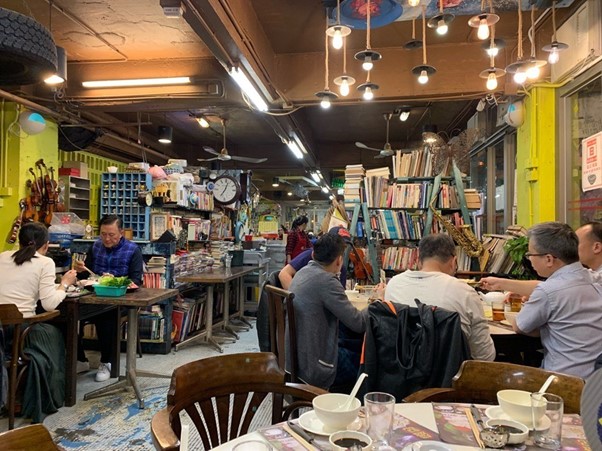
Figure 6. Shing Kee Restaurant – a 50-year-old Dai Pai Dong located in Lek Yuen Estate, Shatin (Photo by nevertoosweet/ CC BY 3.0)
Under globalization and waves of enclosure development, these shops, however, have slowly been outcompeted and replaced by international brands and local chain stores, which own plentiful resources of plenty to afford higher rents. These chain stores are generally more popular among the younger generation, who dines in chain stores for a classier and high-end dining experience rather than in an old-fashioned Cha Chaan Teng. At the same time, these shopping malls underwent drastic renovations, such as installing air-conditioning, changing the lighting system, exchanging floor tiles for marble-Esque floors, to fit their prestigious brandings. The old traces filled with localness, compassion and warmth, were wiped out and transformed into a modern, commercialized, international, and yet aloof environment. The commercial traces of public housing have been transformed under the influences of enclosure development.
Public housing is a unique cultural landmark in the modernization of Hong Kong. Representing the shift of socio-economic conditions, living standards, and social values since the 50s, it reflects relationships and beliefs of its residents, and marks the traces of globalization. We argued that the development of public housing is inalienable from the socio-economic development of Hong Kong, which is reflected in the livelihood and beliefs of Hong Kong people of different generations. These traces will continue to be constructed and deconstructed, reflecting an influx and development of new ideologies in the future.
References
Anderson, J. (2015). Understanding
cultural geography: places and traces. Routledge.
Hui,
M. (2018, August 09). Public Housing for Some, Instagram Selfie Backdrop for
Others. Retrieved September 21, 2020, from
https://www.nytimes.com/2018/08/09/world/asia/hong-kong-instagram-photography.html
Lau,
C. P. (2016, January 16). 從房屋看香港歷史. Retrieved from https://commons.ln.edu.hk/cgi/viewcontent.cgi?referer=https://www.google.com/&httpsredir=1&article=1001&context=jchkhlp_talks
Standard Block Typical Floor Plans. (2016,
September 05). Housing Authority. Retrieved from https://www.housingauthority.gov.hk/en/global-elements/estate-locator/standard-block-typical-floor-plans/index.html.
Upper
Ngau Tau Kok Estate. (n.d.). Retrieved September 21, 2020, from
https://zh.wikipedia.org/wiki/%E7%89%9B%E9%A0%AD%E8%A7%92%E4%B8%8A%E9%82%A8
Vetter,
D. (2019, January 19). Why public housing shortfall will remain a thorn in Hong
Kong's side. Retrieved September 21, 2020, from https://www.scmp.com/news/hong-kong/society/article/2182106/why-public-housing-shortfall-will-remain-thorn-hong-kongs
香港房屋的變遷. (n.d.). Retrieved from https://www.fed.cuhk.edu.hk/history/history2005/teach_s3_03.pdf
The Transition from Old to New in Kwun Tong Industrial Area
1. Introduction
Kwun
Tong factory district is a unique zone with diversified land-use which
significantly differ from that in the past. These include a mixture of old
industrial buildings, new commercial offices, art and recreational sites and
restaurants. Through examining the phenomenon of old and new alternation in
Kwun Tong industrial area, this project aims to argue that these cultural
traces are strongly shaped and regulated by the changes in socio-economic
developments and community in Hong Kong. This project draws upon Lefrebvre’s
(1991) theory of “Production of Space” to deduce and analyze how these culture
traces illustrate the socio-economic transformations in Kwun Tong.
2. Cultural Geographical Perspective in Use
Cultural
geography integrates the notion of space and place into the
investigation in how cultures work in a specified location in practical
(Anderson, 2015). In other words, cultural geography explores the intersections
of culture and context and seeks out why cultural activities take place in a
specific way in a specific context (Crang, 2013).
Key
concepts included in the theory mentioned above will be defined as follows.
First, culture is comprised of a mixture of human activities, that consist of
social norms, behavioural practices and emotional reaction we take part in
obeying, resist or ignore (Crang, 2013). Therefore, it embodies a broad span of
human life and can never be seen separately from the economy, society or
politics. Second, geographical context; often related to physical landscapes,
locations and nationalities; refers to the material and non-material “things”
like historical events and values that influence what humans do (Crang, 2013).
Third, traces can be considered as tangible “objects”, like statues and
buildings, and non-tangible “things”, such as values (Crang, 2013).
Lefebvre (1991) proposed the theory of “Production of Space”, which conceptualized space, consisting perceived space, conceived space and lived space, as a social product (see Fig. 1) (Lefebvre, 1991; Wang, 2009). Perceived space is somewhere containing spatial practice involving usual activities and values that pre-exist in the space, while a conceived space consists of conceptualized rules and regulations that control the discipline of space (Lefebvre, 1991; Wang, 2009). Last, the lived space is a representation of space that appears after the prior two spaces merged. Social space is hence produced by the intersection of the three spaces (Lefebvre, 1991; Wang, 2009). Therefore, we had used this theory, which resonates with the cultural geographical perspective we seek to draw upon, as an analytical framework to explain how the concepts identified above explicate our empirical observations.
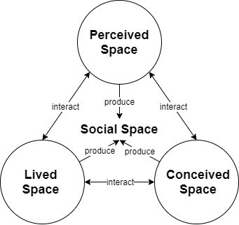
Figure 1. An illustration of the relationship among the three spaces in the "Production of Space" . (Source: Lefebvre, 1991).
3. Empirical Analysis
‘Production
of Space’ involving the intersection between culture and geographical context,
is mainly guided by human beings. There are three primary
stakeholders: government, factory buildings’ owners and users, who are
with different level of power in influencing the old and new alternation in
Kwun Tong. The corresponding three spaces and the interaction between
stakeholders will be demonstrated below.
The Perceived Space
The old Kwun Tong industrial area was produced based on historical events and human’s value. Kwun Tong, which has witnessed Hong Kong becomes a superior industrialized city in South-east Asia, is the earliest developed district in the urban area. In the early 1940s, refugees moved from mainland China to Hong Kong to seek asylum due to civil war, bringing a lot of capitals and cheap labour force to the city (Hong Kong Tourism Board [HKTB], n.d.; Kwun Tong District Council [KTDC], n.d.). Later, the embargo imposed by the United Nations in the 1950s triggered Hong Kong’s economic reform to start light industry (HKTB, n.d.; KTDC, n.d.). Numerous industries then appeared in a sudden, creating a massive demand for industrial areas. The industrial development of Kwun Tong reached golden times from 1965 to 1985 (Energizing Kowloon East Office [EKEO], 2014). Moreover, its products accounted for 18% of the total productivity of Hong Kong in the 1980s, reflecting its importance in the city’s economy (EKEO, 2014). At that time, the textile industry was the dominant business in Kwun Tong.
Besides, during that period, most people lived in Kwun Tong were refugee, immigrates and workers, who were mainly grassroots. They usually lived in low-cost houses, where they needed to share facilities such as kitchen and washroom with their neighbours. Despite the poor living conditions, they were still industrious to work, which revealed Hong Kong people’s emphasis on the economy and the Lion Rock spirit. Nevertheless, Kwun Tong industry started to decline in the 2000s after a wave of the relocation of many entrepreneurs’ production lines to Mainland China, where provided cheaper labour and production costs, due to her ‘reform and opening-up’ later (EKEO, 2014; HKTB, n.d.; KTDC, n.d.).
The Conceived Space
The government, possessed the dominate transformative
capacity, had proposed the “Energizing Kowloon East” (EKE) as the blueprint for
the redevelopment and revitalization of Kwun Tong industrial area. It aimed at
reconstructing Kwun Tong into a second Central Business District
(CBD) of Hong Kong, which was influenced by the transformation of the
economy (EKEO, n.d.). In the Conceptual Master Plan 2.0 under EKE, goals had
been set to improve the surrounding environment in the industrial area, which
illustrated the additional emphasis toward human’s standard of living (EKEO,
2014).
To
implement these, she changed the land use of regarding zone from industrial to
commercial in 2001, amended several regulations in 2010 and established
Energizing Kowloon East Office in 2012 to support the project (EKEO
n.d.) . First, in terms of Cap. 545 Land (Compulsory Sale for
Redevelopment) Ordinance, the amended ordinance lowered the application
threshold for compulsory sale orders of industrial buildings inside
non-industrial zones from 90% to 80% of ownership (GovHK,
2017; GovHK, 2019; Department of Justice [DJ], n.d.). This addressed the
problem of fragmented ownership in flatted Kwun Tong industrial
buildings. Second, the wholesale conversion of industrial buildings in
“Industrial”, “Other Specified Uses” annotated “Business”, and “Industrial” zones
is liberalized (GovHK, 2017; GovHK, 2019; DJ, n.d.). The
original waiver fees incurred to the owners in the course of the application of
usage conversion of industrial buildings are exempted. Third,
the government relaxed the waiver application policy of individual units in
existing industrial buildings to encourage the arts and cultural sectors and
creative industries to operate. Owners are no longer required to make separate
waiver applications and pay waiver fees, so long as the altered uses of industrial
units are permitted under the planning regime (GovHK, 2017; GovHK,
2019; DJ, n.d.).
The Lived Space
The transformed land use and activities nowadays, which was
found out in our field trip, are developed under the convergence of the two
above spaces. Firstly, it was found that there is a diminishment of tradition
factory belt and enlargement of the commercial zone, which consists of newly
emerged hotels, office buildings, places of entertainment and restaurants.
Secondly,
it was discovered that cultural and creative industries, including music
performance site and the art museum, has been introduced into those unused
factories’ units.
Figure 2. An Art Museum in Kwun Tong. (Source: Authors).
Thirdly, it was also
realized that several recreational facilities have constructed in the Kwun Tong
Promenade located near the sea (See Fig. 9-12). All these present as new traces
as the result of the execution of conceptual space.

Figure 3. Recreational facilities in Kwun Tong Promenade. (Source: Authors).
The interaction between
stakeholders will be further demonstrated as follows. As mentioned previously,
in conceived space, the government proposes plans and
implements policies, while the other
two stakeholders interact with each other in perceived space and
lived space and either adapt or contend against the redevelopment
plan. The three stakeholders influence and counterbalance with one another,
resulting in a representation space (lived
space).
On the one hand,
regarding the industrial land use of factory buildings. First, the factory
buildings’ owners were allowed to rent their units legally without paying
any additional fee to non-industrial land users. Some merchants operate
the business with potentially higher market value and can afford a higher rent,
due to the change of governmental policies. Therefore, the factory owners can
no longer enjoy cheap rent as before and have to either pay high rent
or to find another place to operate. Otherwise, their factories had to close
down.
On the other hand,
concerning the non-industrial land use of factory buildings, as mentioned
previously, factory buildings’ owners no longer need to reject or paid an
additional fee for tenants with other land-lease purposes. Instead, they can
rent out their units as, for example, studio, design and media production,
printing and publishing units legally. Consequently,
the non-industrial users do not need to hide
their reason for renting units from industrial buildings and
operate publicly, which facilitates promotion and flourish
of their unique culture.
4. Conclusion
In conclusion, the
phenomenon of transformation in Kwun Tong industrial area’s cityscape can be
explained by the theory of “Production of space”. The corresponding zone had
been reconstructed gradually from a manufacturing quarter or “perceived space”
to a place accommodating various land use for business, trading and
recreational purposes, also known as “lived space” containing changed traces.
The progression was made possible with “conceived space”, which is the urban
development plan and complementary building codes, under the interactions of
multiple stakeholders including the government, users and the land developers
and their altered values. Even though multiple theories can as well be used to
justify the old and new alternation in Kwun Tong factory belt, cultural
geography concludes the result of intertwining of social aspects, making the
research context more comprehensive.
Reference
Anderson, J. (2015). Understanding
cultural geography: places and traces. Routledge.
Crang, M. (2013). Cultural geography.
Routledge.
Energizing Kowloon East Office. (2014). 九龍東工業傳統及公共藝術/城市設 計潛力研究. Retrieved Nov 5 ,2019, from
https://www.ekeo.gov.hk/filemanager/ content/whatsnew/IHS_executive_summary_chi.pdf
Energizing Kowloon East Office. (n.d.).
Retrieved Nov 7, 2019, from https:// www.
ekeo.gov.hk/tc/vision /index.html.
Hong Kong Government. (2017, June 21). Press
Releases–Legislative Council: Using
Industrial Building Units for Cultural, Arts
and Sports Purposes. Retrieved Nov 9, 2019, from,
https://www.info.gov.hk/gia/general/201706/21/P201 7062100474.htm
Hong Kong Government. (2019, Feb 1). Press
Releases– Relaxation of Waiver
Application for Existing Industrial Buildings. Retrieved Nov 9, 2019, from https://www.info.gov.hk/gia/general/201902/01/P2019020100743.htm?
Hong Kong Tourism Board. (n.d.). Kwun
Tong. Retrieved Nov 5, 2019, from
http://www.discover hongkong
.com/tc/see-do/neighbourhoods/kwun-tong.jsp
Kwun Tong District Council. (n.d.). Kwun
Tong History. Retrieved Nov 5, 2019, from https://www.kwuntong.org.hk
/tc/history.html
Laws Compilation and Publication Unit. (n.d.).
E-legislation. Retrieved Nov 9, 2019, from https://www.elegislation.gov.hk/
Lefebvre, H. (1991). The Production of
Space (Vol.142). Blackwell: Oxford.
Wang Zhi-hong. (2009). 多重的辯證列斐伏爾空間生產概念三元組演繹與引申. 地理學報, (55), 1-24.
**Noted that all photos were taken by group members in Kwun Tong Industrial Zone on 9th November in 2019.**
The Struggle between Commercialization and Preservation of Heritage and Art
1. Introduction
Tai Kwun is a renowned cultural heritage located in the center of Hong Kong. Redeveloped from the former Central Police Station compound, Tai Kwun has remained as the epitome of British colonial architecture since the mid-19th century. Owing to its immense historical value in Hong Kong, its constituent compounds, which include three major establishments: a police station, a magistracy and a prison, were declared as historical monuments. Its revitalization project is led by ‘The Jockey Club CPS Limited’, a not-for-profit company set up by The Hong Kong Jockey Club Charities Trust to operate the Centre for Heritage and Art at the revitalized compound (The Hong Kong Jockey Club, 2015).
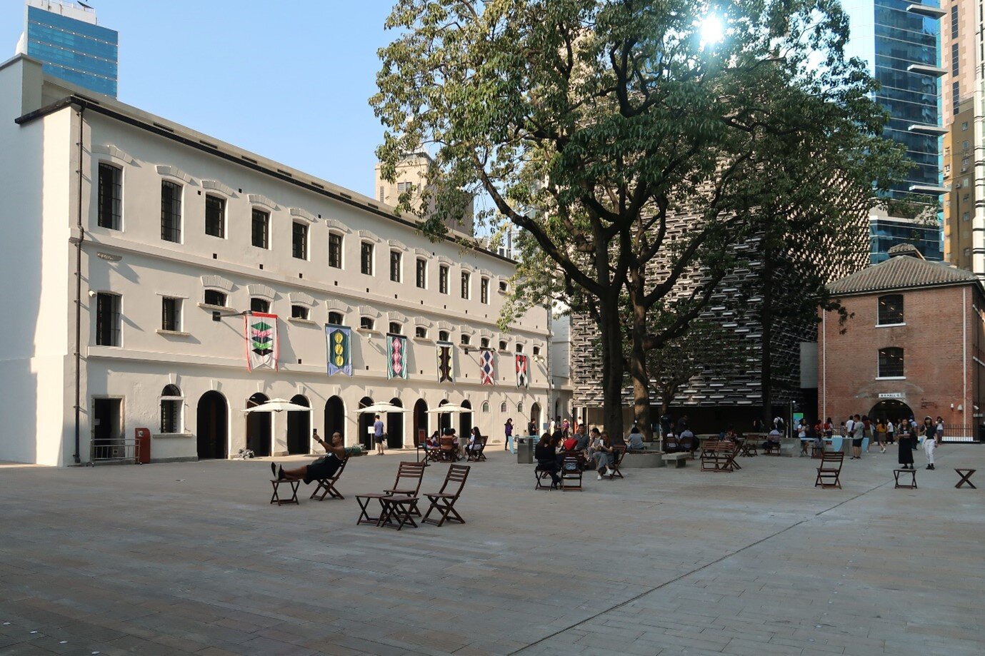
Figure 1. The Prison Yard in Tai Kwun. (Photo by Wpcpey/ CC BY 3.0)
However, criticism and doubts on the heritage’s
role in promoting art and heritage conservation arose because of its financial dependency
on rent received from tenants of shops and restaurants (The Jockey Club CPS
Limited, 2018). While various evidences suggested that the emphasis has been
placed on commercial elements that underlie the financial sustainability
instead of the preservation of the historical heritage, this research aims to
analyze the relationship between commercialization and heritage conservation in
Tai Kwun through a cultural geographical perspective with respect to Anderson’s
notion of dominating power (2009).
2. Cultural Geographical Perspective in Use
One of the key aims of Cultural Geography is to examine the intersection of geographical context and culture in how, where and who produces various cultural traces. While these traces may exist in material, non-material or a combination of both forms, they are essential in understanding the values and beliefs that constitute a place. Therefore, the interaction between various cultural ideologies and geographical context may create a varying and yet unique cultural landscape that represent the unique stories that are exclusive to different cultures and locals.
Cultural geographical approach, as highlighted by Anderson (2009), also argues that while multiple cultural traces may co-exist in the same context, these traces are always conformed to the ideologies of the dominating power and cultural hegemony (Anderson, 2009). Stakeholders and ideologies with greater influence may presents their ideology or their beliefs to other people as ‘common sense’. The dominating groups will then instill their own cultural values on the traces in different ways to maximize their benefits. They may then try to persuade the public that these values are the “gospel truth”. Cultural hegemony will be achieved if the dominating power successfully convinces the mass that their cultural values are ‘natural’. Therefore, when a society allow a particular cultural group to dominate over the others, this hegemonic group has successfully transformed their own beliefs and values into the ideological order of their culture.
Therefore, this project aims to examine how the cultural traces in Tai Kwun are reshaped by the dominating group through commercialization. Entrusted by the Hong Kong government through a partnership, the Hong Kong Jockey Club is currently operating Tai Kwun. As an initiator of the development plan, the organization generally represents the dominating power in the development of Tai Kwun. The concept of dominating power and cultural hegemony raised by Anderson (2009) will be illustrated through the following empirical analysis.
3. Empirical Analysis
Trace 1: Layout Planning
One of the essential traces in reflecting the values of a dominating power exerted to a place is Tai Kwun’s layout planning. Through studying the allocation of prime areas and non-prime areas of Tai Kwun, we can analyze how the dominating power – The Jockey Club CPS Limited – presents Tai Kwun to the public. Although heritage preservation and art promotion were repeatedly claimed to be the significant motives of Tai Kwun, a stronger emphasis on commercial elements was observed, as the prime locations were all rented out to restaurants, bars, and shops.
Figure 2. A Map of Tai Kwun. (Reprinted from Map & Directory, Tai Kwun. Copyright by The Jockey Club CPS Limited. Retrieved from https://www.taikwun.hk/en/visit/map_directory)
During our visit to Tai Kwun, it is observed and noticed that the Storytelling Spaces are particularly small and located in non-prime areas. For instance, the room for “The Story of Central Police Station” is on underground level two. The obscurity of the location reduces the interests of visitors to explore. On the contrary, the prime areas, such as ground floor and upper floors with terraces, are rented out to shops and bars. As a case in point, the Parade Ground, located closest to the entrance, is surrounded by restaurants and shops including famous brands such as Vivienne Tam. These dispositions have done the purpose of heritage preservation and promotion of art a disservice. Another prominent example is the JC Contemporary, originally designed to promote contemporary art, sits at the furthest corner of the structure, requiring visitors to go through the Parade Ground and the relatively long Tai Kwun Lane before reaching the museum. Since the easily accessible areas have been designed for commercial instead of serving historical and artistic preservation purposes, it is hence deduced that the Jockey Club CPS Limited is placing such a stronger emphasis on commercial gains to the point where they overshadowed the “main motives”.
Trace 2: Localization and Language
The second trace is the signs of localization. Localization refers to the process of adapting a product or content to a specific locale or market in order to boost its development (Globalisation & Localisation Association, n.d.). After visiting various restaurants in Tai Kwun, a few interesting names for dishes and beverages were discovered, including ‘Maximum Sentence’, ‘1997 Punch’, ‘Vet Antidote’ and ‘D Hell Curry Chicken’. It is hence deduced that the history of Tai Kwun influenced the naming process, integrating commercial elements with revitalization. Those “localized” names are inspired by the original functions and the history of Tai Kwun. However, without adequate information, visitors will find difficulty in understanding the hidden meanings and stories. The attempts of location serve the sole purpose of commercialization. In an 8-page menu at one of the bars, only three localized drinks are provided, while the others are box-standard drinks that can be found anywhere. Visitors may hence find it difficult to discern the preservation of cultural and historical value of Tai Kwun by this mean. Besides, only a few bars or restaurants, such as Hidden Bars, have adopted the theme of prison cells to match with the original function of Tai Kwun. Though the localization of catering in Tai Kwun helps to promote the historical value of Tai Kwun, there is indubitably more emphasis on the commercial and business aspect.
Figure 3. "Localized” names for drinks in the Dispensary, a bar at Tai Kwun.
Trace 3: Commercialized nature of Tai Kwun
The third trace is the overriding value of profit maximization over cultural conservation. Owing to Hong Kong’s long tradition of economic development, integration of business elements into heritage conservation is genuinely accepted as a normality for locals and visitors. The dominating group, Hong Kong Jockey Club, advocates the ‘Value of Central District’ - a pursuit of economic wealth, efficiency, development and globalization. These elements served as the index for social progress and further developed into the core value of Hong Kong. The economic benefit, therefore, became a critical consideration in developments of every aspect. One of the interviewees mentioned that allocating public funds to financially support heritage conservation is not sustainable in the long run. This is due to the operation model of heritage revitalization is being heavily influenced by the ideology of the Hong Kong Jockey Club: minimizing the loss and increasing the profits by adding business elements in operation of the heritage. This allow the project to achieve self-sufficiency and sustainability in management, rather than solely relying on insufficient government funds, which would have never broken even, not to mention made a profit. Therefore, business elements have to be added into Tai Kwun revitalization project in order to follow the cost-effectiveness principle. As suggested by the interview, under the influence of the dominating ideology of the dominating power, Tai Kwun revitalization tends to focus on cost-effectiveness.
Figure 4. The Jockey Club Contemporary, an art gallery displaying various contemporary arts in Tai Kwun. (Photo by Chengting Xie/ CC BY 3.0)
Besides, it will be a huge generalization to declare the idea that heritage conservation merely requires preserving the original hardware of the building and brief introduction of history. Interviewees acknowledged the alteration of space utilization in Tai Kwun, as long as the architectural style of the building is intact with the location’s history in mind. They also found development acceptable as long as it the space is used to its full potential. Extra commercial elements also enhanced the attractiveness of the site. Therefore, it is concluded that under the influence of cultural hegemony - ‘value of central district’, the inheritance and importance of history and culture of colonial Hong Kong have been gradually minimized. Instead, the financial gains brought by the commercial elements are far more paramount. Moreover, only 2 out of 6 halls of Victoria Prison in Tai Kwun are kept in their original design and are used for history introduction. The remaining halls, however, were redesigned into restaurants or abolished. The evidence reveals that the most fundamental element of revitalization, the original function of the building, has already been abandoned. Unable to retain its function of illustrating colonial history, Tai Kwun seems to have lost its core purpose. The significance of historical heritage conservation is not fully shown in this preservation project.
4. Conclusion
Through studying the three aforementioned traces, the Hong Kong Jockey Club, as the dominating power, enforces the ideology that commercial elements are indispensable in Tai Kwun revitalization. They justified their actions taken to achieve financial sustainability of heritage revitalization. Initial evidence reveals the financial sustainability is of greater emphasis than the preservation of history and art. However, further investigation is required for a comprehensive assessment of the effects of commercial elements in the Tai Kwun revitalization project. Tai Kwun is not only a tangible cultural heritage illustrating the colonial history of Hong Kong, but also a community landmark for our contemporary society. Therefore, we should rethink whether commercial gains or cultural preservation should be prioritized when revitalizing historical establishments.
5. References
Anderson, J. (2009). Understanding cultural geography: places and traces. Routledge.
Globalization and Localization Association. (2017, September 15). What is Localization? Retrieved December 1, 2018, from https://www.galaglobal.org/industry/intro-language-industry/what-localization
The Hong Kong Jockey Club. (2015, November 6). Open call for an art exhibition and request for retail proposals at revitalized heritage site - The Jockey Club CPS Limited will operate as Tai Kwun Centre for Heritage and Art. Retrieved December 1, 2018, from https://www.hkjc.com/english/corporate/racing_news_item.asp?in_file=/english/news/2015-11/news_2015110601410.html
The Jockey Club CPS Limited. (2018). Revitalization Timeline. Retrieved December 1, 2018, from https://www.taikwun.hk/en/taikwun/conservation/restoration_story
1. Introduction
In China, there is a long history of the circulation and transformation of money. Shell coins, which are derived from the barter trade method, are the most primitive coins that appeared in the Shang and Zhou dynasties. Since then, money has been changing over time and even evolved to different new currencies such as Qin Banliang, a coin which has a round edge and square hole, in Qin Dynasty. For all currencies, its core value as a medium of exchange is eternal, but its ancillary values like text, shape, weight, and pattern were varied. From our observation regarding the aforementioned ancient coins, the ancillary values' transformation was mainly caused by insufficient knowledge, ancient beliefs, the convenience of the transactions, anti-counterfeiting, internal affairs, and the purpose of strengthening the centralization.
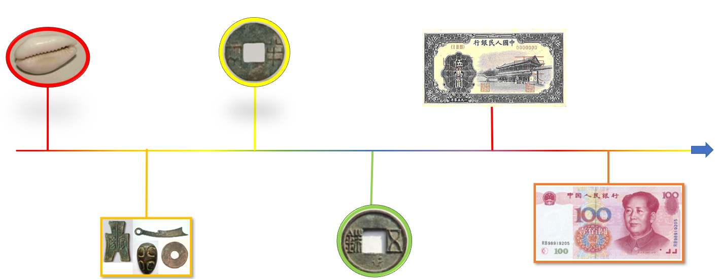
Figure 1. Evolution of currency in China
Now, the era of the circular coin with a four-sided hole is over, Renminbi has been the Chinese official currency for more than 70 years. Yet the ever-changing nature of the currency's ancillary values remains constant. We use money daily, and we are also aware of the change in the appearance of banknotes over the years, but seldom do we contemplate the reasons behind such transformations. It is time for us to learn about the less obvious but in-depth messages carried by these small pieces of paper. Therefore, this research aims to investigate the change in the ancillary value of currencies in China through a cultural geographical perspective.
2. A Cultural Geographical Perspective on Currency
From a cultural geography perspective, culture refers to people’s beliefs and values. With experiences and influence from other parts of the world, culture changes from time to time. For example, under globalization, many Chinese would value individualization rather than collectivism. Meanwhile, both the history and the present factors forming context help shape society, thus explain the particular existence of phenomena and lead to some changes. Some of the contexts would be law, environment, climate, etc. Consequently, from a cultural geography perspective, the culture and context are tentative to change, together they form a “place” and traces have arisen from culture. Under constant development, culture, thus people’s behavior and traces do not stay the same but alter bit by bit.
In our project, we are focusing on the evolution of currency in China over the years. The truth is that currency is a "place” in cultural geography that combines many different traces. Not only is currency affected by the economy and business when tracing back to the years, factors like the Chinese people's education level also resulted in the currency used in the past. We aim to find out reasons of the changes in the currency as a place.
The following study will evaluate how the political and social status was back in the days in China led to the changes in Chinese currency. We try to find some common trend to the alterations in order to indicate their ancillary values. On the other hand, by comparing the currencies, including coins and cash, we also discover how Chinese people wanted to use currency this trace to preserve their culture and boost the country’s development too.
Figure 2. Cultural geography concept
3. Empirical analysis
Our research covers both ancient and modern Chinese currency. Since the Renminbi (RMB) brings us a greater insight into how the currency will evolve in our future, the cultural geography of the first and fifth series (latest series) of the Renminbi will be highlighted in this section. And we focus on two aspects reflected by the traces on Renminbi's pattern-- target reader and convenience.
First Series of Renminbi
To understand the traces on the first series of Renminbi, one must appreciate its production history. In brief, this currency was published amid the civil war between the Communist Party of China (CPC) and the Kuomintang Chinese Nationalist Party. The CPC won and governed the mainland. It is conceivable that the resident’s faith in the new government dropped. From the CPC’s point of view, gaining citizens’ trust is of utmost importance. Therefore, it published a down-to-earth design for the first series. The banknote pictures reflect the agricultural and industrial production at that time, such as workers and farmers, and factories. As such, the worker class would consider the CPC government as a considerable political power and resulted in crowd support directly. By addressing the internal target, the goal of maintaining political stability was achieved.
Figure 3. A version of first series Renminbi that shows workers and farmers
(Source: The People’s Bank of China, 2011)
Figure 4. A version of first series Renminbi that shows factories
(Source: The People’s Bank of China, 2011)
A trace of the first series Renminbi---having huge denomination --- appeared after the following event. In 1950, citizens began to spend the Renminbi extensively due to the fear that it would devalue. As such, the velocity of the money skyrocketed. The inflation pressure became high; As a result, the denomination of the first series of Renminbi was raised, even up to RMB 50,000 (Cheung, 2009). You may ask why the People’s Bank of China would issue a version with a new and larger denomination? If we observe China’s geographical context---price levels in 1950, (Table 1), we will understand the value of convenience was influential. As money's core function is facilitating exchange, it is senseless to keep using banknotes with a low denomination. To sum up, inflation coupled with the emphasis on convenience, promoted the appearance of the huge denomination in the first series Renminbi.
Table 1. Price levels in 1950
(Cheung, 2009)
|
Item |
Amount |
|
Price of rice in Tianjin |
RMB 2150 per jin |
|
Daily income of tricycle driver |
RMB 7000-8000 |
Figure 5. The front appearance of first series Renminbi for RMB 50,000
(Source: The People’s Bank of China, 2011)
Fifth Series of Renminbi
The extrinsic values of Renminbi have changed dramatically from unifying currencies into spreading Chinese personality traits, strengthening ethnic fusion, as well as boosting the tourism industry in China, which shows a transition in China’s future development plan, from focusing on the own country to the world, in which China aims to become the world’s foremost economy to avoid suppression of other nations.
In the fifth series of RMB, several characteristics, such as using different languages, images of most appreciated flowers, and renowned tourist scenic spots, are added. In addition to Pinyin, four other ethnic minority languages are printed to demonstrate China’s goal in promoting ethnic unity. The flowers in the center, such as plum blossom, indicate China's significant spirits and Chinese personality. These alterations in banknotes are expected to influence youngsters to understand Chinese culture for educational purposes. Moreover, a significant trace in revealing the impact of adopting photos of China's cultural landscape on RMB banknotes is the increasing attention of both Chinese and foreigners to these tourist attractions. As a tourist, you will be aware of the money. Having the hottest checked-in attractions, such as the Guilin landscape on the notes are notable soft power promotion and align with China’s development plan to foster economic growth remarkably.
Also, the obverse of the fifth series of banknotes includes a portrait of Mao Zedong in remembrance of his thoughts. Mao Zedong, a communist leader, gained support and trust in his times. The change in cultural traces of RMB is due to the aim to positively inspire numberless people in modern days, as well as anticipating adolescents to “Serve the People”.
Since the reform and opening up of China in 1978, China’s economy has bloomed and has now become the world's largest economy (on a purchasing power parity basis), manufacturer, merchandise, exporter and importer, and holder of foreign exchange reserves. (Falianty, 2019) Chinese are getting more and more wealthy, thus, processing increasing purchasing power, the use of Renminbi is expected to become more and more universal. There is a need to autonomize the transaction of banknotes to sustain the economic growth and maintain the efficiency. Thus, the fifth series of Renminbi has included over twenty security measures. Shops and banks can use currency detectors to verify the genuineness of notes and coins. The quality and reliability of the fifth series of Renminbi has vastly improved, especially focusing on the technological input. For instance, the portrait of Mao Zedong as relief, microprinting and optical variable ink. These features prevent the counterfeit of Renminbi, also promoting the implementation of modernized autonomic transactions.
Figure 6. The security measures of fifth series Renminbi for RMB 50
(Source: The People’s Bank of China, 2019)
Other than improving its security measures, Renminbi has also included braille on the front of banknotes since the fourth series of Renminbi. There were almost 18 million people with visual impairment in China in 2018 and they accounted for around 20% of China’s total disabled population. (China Association of the Blind, 2018) With such a large community who live in constant darkness, it is very important to make them feel included in society and help them in their everyday lives. With braille on the banknotes, blind people can tell the domination of the currency easily. This has greatly improved the convenience of using Renminbi for them, not only promoting the rights of people in need, but also encouraging the unity of people to embrace people with different needs. This measure has made Renminbi more convenient and a symbol of social harmony.
From the above analysis, we can conclude that the target reader was shifted from internal (mainland Chinese) to global and the convenience of Renminbi was kept.
4. Conclusion
From the cultural geography perspective, through the appearance of ancient coins and modern Chinese currency both reveal the culture at that period. Those currency show what values are essential: region, internal affairs, convenience, and diversity. It indicates people’s beliefs and values are keeping on changing over the years.
Until now, there are more methods to make payment eg digital Renminbi. Although the convenience of Renminbi was kept, it also loses other values. The value of the currency is narrowing. Nowadays, users care about the effectiveness and convenience more than others value of the currency. Together with China’s stronger participation in globalization, in the future, e-payment of Renminbi without geographical constraint will be more popular.
References
Cheung, L. (2009). 新中國第一次通貨膨脹與第一套人民幣面額結構的形成 [New China’s first inflation and the formation of the first series of RMB denomination structure]. Hebei Finance, 6(3).
China Association of the Blind. (2018). NGO Alternative Report on the Implementation of Convention of the Rights of the Child. Retrieved from China Association of the Blind - Ohchrwww2.ohchr.org › english › bodies › crc › docs › ngos
COVID-19 to drive digital payments take-up in Hong Kong. (n.d.). Retrieved October 18, 2020, from https://hongkongbusiness.hk/financial-services/news/covid-19-drive-digital-payments-take-in-hong-kong
Falianty, T. (2019). Renminbi in ASEAN Economy: How ASEAN responds to Renminbi Internationalization. Journal of Economic Cooperation & Development, 40(3), 1– 24. Retrieved from http://easyaccess.lib.cuhk.edu.hk.easyaccess2.lib.cuhk.edu.hk/login? url=https://www-proquest-com.easyaccess2.lib.cuhk.edu.hk/docview/2337330422? accountid=10371
The People’s Bank of China. (2011, March 26). The First Series of RMB. Web.Archive.Org. https://web.archive.org/web/20110326050342 http://www.pbc.gov.c/n/publish/huobijinyinju/664/index.html
The People’s Bank of China. (2019). Banknote of the Fifth Series of RMB. Retrieved from http://www.pbc.gov.cn/rmyh/2019rmb/index.html
1. Introduction
Kowloon Walled City was a Chinese military fort in Hong Kong, which turned into an enclave after the New Territories were leased to Britain in 1898. During the Japanese occupation, the Walled City was zoned as the Kowloon City Development Zone of British Hong Kong and was narrowed to 2.6 hectares. It used to be the most crowded area containing more than 50,000 residents. It was also an ungoverned settlement controlled by local triads, having a high rate of prostitution, gambling and drug abuse.
In the 1980s, the colonial government decided to demolish the Walled City and it was eventually demolished in 1994. Nowadays, the Kowloon Walled City has become a legendary place in the history of Hong Kong.
In this project, we will study the mysterious despairing Kowloon Walled City from its production of space with the Spatial Triad by Henri Lefebvre.
2. Cultural Geographical Perspective in Use
From the perspectives of cultural geography, a place is formed by interactions between geographical context and cultures, which hence create various traces, both tangible and intangible.
![]()
The composition of Kowloon Walled City can be analyzed as:
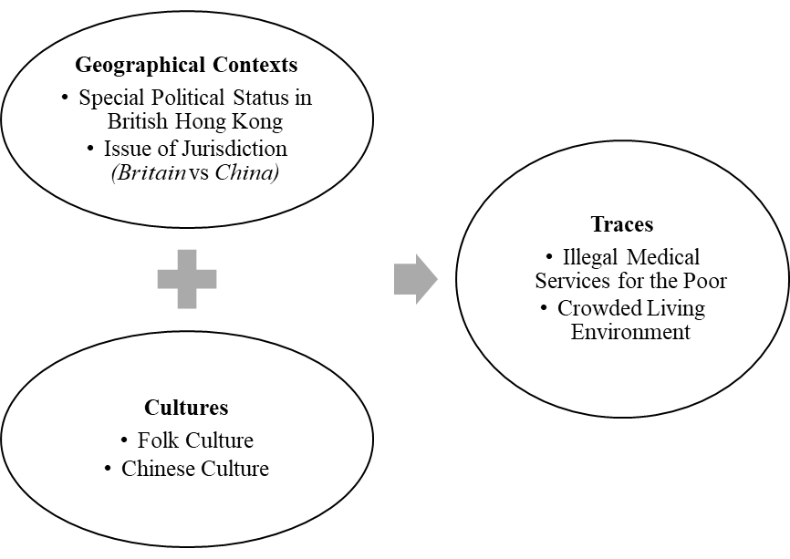
Figure 1: Kowloon Walled City from Cultural Geographical Perspectives
Noticeably, with the demolition of Kowloon Walled City in 1994, the importance of Geographical Context and Cultures has faded out as most traces, results of the interactions between the two, have disappeared. Its representations have hence become the major traces of Kowloon Walled City nowadays.
These kinds of memory, in terms of the Spatial Triad by Henri Lefebvre, are Representational Space. The theory states that a space comprises Representations of Space, Spatial Practice and Representational Space which are later defined by Steward (1995) shown in the Figure 2, together with its application to the case of Kowloon Walled City:
![]()
![]()
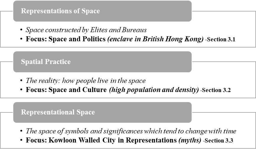
Figure 2: Kowloon Walled City in Production of Space
The three constituents, later elaborated by Wang (2009), are dependent on each other and cannot live alone. Thus, even after demolition of the City, it can only be concluded that Representational Space has become dominant in its creation nowadays. Later parts of this study will then focus on the Representational Space of Kowloon Walled City, investigating the influences from Representations of Space and Spatial Practice on it, as well as its internal changes with time.
3. Empirical Analysis
3.1 Space and Politics (from representations of space to representational space)
Dirty, poor and ungoverned become the first impression when the Kowloon Walled City is mentioned. The Kowloon Walled City began in the center of Hong Kong where it served as garrison of Chinese government. (Fulton, 2016) It became a place where the Chinese government was reluctant to give up to the Britain and insisted strongly to maintain its jurisdiction after the Convention of Peking. (Sinn,1987)
「所有現在九龍城駐紮之中國官員仍可在城內各司其事」
Figure 3: Convention of the Extension of Hong Kong Territory
(Academy of Chinese Studies, n.d.)
Later Britain took actions to retain its jurisdiction of Kowloon Walled City and claimed it would be administered the same way as other parts of the Colony. However, the fact was both Chinese and British governments declared their jurisdictions of the City, but none put in effort to administrate the city.
Figure 4: Reasons for the Ungoverned State of Kowloon Walled City
As a result, the place gradually became ungoverned and a deficiency of authority, creating the mysterious image of the City, as the saying goes:
「香港政府不敢管,英國政府不想管,中國政府不能管」 (Lu, 2002)
The failure at ruling the City, coupled with its mainly low-class composition, had led to the rise of gangs. This ruling power had continued expanding so greatly that an avalanche of crimes such as drug abuse and fighting were reported. (Kowloon City District Council, 2005) This further undermined the jurisdiction of China and Britain, as well as worsened the image of the City.
Noticeably, under the control of gangs, Kowloon Walled City did not have any development plans. Given that Hong Kong had been continuing its role as an entrepot and even developing manufacturing industries, the physical landscape and living standard of people in Hong Kong had been increasing. However, the ungoverned Kowloon Walled City had most constructions remained how they used to look like, as an old Chinese town with plaques, historical buildings, cannons et cetera. This strong difference had further developed the mysterious, poor dirty image of Kowloon Walled City.
“Chinese Town” was used to represent Kowloon City
Figure 5: Map of Hong Kong and Kowloon in 1915
(An Official Guide, 1915)
3.2 Space and Culture (from spatial practice to representational space)
When we look back at the Kowloon Walled City, it reminds us of dark alleys and a dense population. At the same time, the 25,900 square meters of concrete jungle is what 50,000 people called home. (Routley, 2019) Inside this community is where drug addicts and children walk the same halls, and prostitutes and priests live side-by-side. Despite the different walks of life, inside this vertical village, close bonds were formed between neighbors as the community coordinates to conserve electricity, repair shared infrastructure and organize garbage disposal.
The existence of the Kowloon Walled City caused planes to turn 45 degrees before landing at the Kai Tak airport and the buildings were no more than 14 floors high to avoid collisions with aircrafts. (Routley, 2019) In the dense Walled City, staircases and alleys were interconnected creating a labyrinth where you could walk from north to south without touching solid ground. (Girard & Lambot, 1999) Additionally, because buildings were built side-by-side, many rooms have no windows or natural lighting which makes the City's rooftops an important place to gather, relax and children to play or do homework after school. (“Devil's Paradise”: 1900-1992, n.d.) Hence, the Kowloon Walled City demonstrates communal living where much of the perceived space acts as shared space for the vertical village. Additionally, without the help of architects and engineers, the Walled City demonstrates people can get along just fine without regulations guiding every aspect of life.
Indeed, the Walled City is notorious for a high crime rate. However, contrary to popular beliefs, only a small number of people in the City engage in criminal activities and most are just elderlies living out their retirement. (“Devil's Paradise”: 1900-1992, n.d.) In 1983, the Walled City’s crime rate was declared under control, however, the city was still known for unlicensed doctors and dentists who continued to operate without prosecution. In a sense the Walled City created a shadow economy for Hong Kong as it contained hundreds of unregulated workshops and factories that provided outsiders with lower priced goods and services.
3.3 Kowloon Walled City in Representations (changes in representational space)
After the demolition of the Kowloon Walled City and the handover of Hong Kong, the local imagination of the Walled City has been proactively shifting from a grim, lawless mess to a site of old colonial Hong Kong aesthetic and nostalgia under Hong Kong's social and historical context in recent decade. Back when the Kowloon Walled City was still barely standing in the Kowloon Peninsula as an overly dense slum (before 1993), the City was notorious for its safety and hygiene issues. From drug dealing, prostitution to the consumption of dog meat, these menacing practices scared away outsiders from entering this dark spot of the City and covered it with a veil of mystery. The 1984 Hong Kong film, Long Arm of the Law, managed to capture the overall imagination of lawlessness and hideousness towards the place. This infamous image of the Kowloon Walled City constituted by both facts and rumors had been clouding the locals until new meanings were installed onto the Walled City after the 1997 handover.
As the political ambiguity of the Kowloon Walled City was weaved upon the tension between the British colonial power and Qing/Chinese government, the political significance of the Walled City dissolved after the demolition and handover. Such politically sensitive traces of the site and the habitats were cleansed from the official historical discourse after the handover. (Guan, 2014) Yet, unlike its fading traces, the image of the Kowloon Walled City was widely adapted and discussed amongst many postcolonial media pieces. From book City of Darkness Revisited (2014), TV drama A Fist Within Four Walls (2016) to video game Paranormal HK (2020), the obsession towards the visual and image of the walled concrete conglomerate was obvious. Without the blood stink of slaughtered dogs and suffocating ventilation in the crowded apartment, the history of the Walled City was sanitized and extracted to constitute the well-decorated version of the Kowloon Walled City for nostalgia. This new interpretation of the Walled City would be a product of the postcolonial reflection of Hong Kong people and would play an important role in the constitution of local cultural identity.
4. Conclusion
Using Henri Lefebvre’s Spatial Triad, we were able to study Kowloon Walled City under three interconnected spatial thinking. From Representations of Space, owing to the changes in time and rulership, the conceived space of the Kowloon Walled City with high-rise buildings densely constructed side-by-side was created. This characterized feature has also shaped a unique Spatial Practice there, namely the close bonds between neighbors, the formation of a tight community within the dense area, as well as safety and hygiene issues. Additionally, because of its Spatial Practice, the Kowloon Walled City is shrouded with mysteries and has become a popular Representational Space for lawlessness and poverty. Although the political traces of Kowloon Walled City have slowly faded due to its political sensitivity, the geographical status of the Kowloon Walled City lives on in popular modern media and culture.
Reference
“Devil's Paradise”: 1900-1992. (n.d.). Retrieved from https://mediakron.bc.edu/edges/the-yamen-an-inquiry-into-identity-and-place-in-the-kowloon-walled-city/devils-paradise-1900-1992
Academy of Chinese Studies. (n.d.). Pictorial History: The New Territories were leased to Britain. Retrieved from https://chiculture.org.hk/en/node/1201
An Official Guide to Eastern Asia, Volume 4: China. (1915). Tokyo: The Imperial Japanese Government Railways.
Carney, J. (2013 Mar 16). Kowloon Walled City: Life in the City of Darkness. South China Morning Post: Old Hong Kong. Retrieved from https://www.scmp.com/news/hong-kong/article/1191748/kowloon-walled-city-life-city-darkness
Fulton, M. (2016). The History of Kowloon Walled City In 1 Minute. Retrieved from https://theculturetrip.com/asia/china/hong-kong/articles/history-of-kowloon-walled-city-in-1-minute/
Girard, G., & Lambot, I. (1999). City of Darkness Life in Kowloon Walled City. Surrey: Watermark.
Guan, H. Y. (2014). 從歷史裏走出來的九龍城寨 [Kowloon Walled City from History]. Cultural Studies @Lingnan, 43, Article 7. Retrieved from http://commons.ln.edu.hk/mcsln/vol43/iss1/7/
Jones, G. (2011). The Kowloon City District and the Clearance of the Kowloon Walled City: Personal Recollections. Journal of the Royal Asiatic Society Hong Kong Branch, 51, 257-278. Retrieved fromhttp://www.jstor.org/stable/23891943
Kowloon City District Council. (2005). 九龍城區風物志 [Story of Kowloon City District]. Hong Kong: Wan Li Book.
Lee, J.J. (2016). Kowloon Walled City Revisited: Photography and Post coloniality in the City of Darkness. Difficult Histories, 6:2. Retrieved from https://quod.lib.umich.edu/t/tap/7977573.0006.202/--kowloon-walled-city-revisited-photography?rgn=main;view=fulltext
Lu, J. (2002). 九龍城寨史話 [History of Kowloon Walled City]. Hong Kong: Joint Publishing.
Routley, N. (2019). This Fascinating City Within Hong Kong Was Lawless For Decades. Retrieved from https://www.visualcapitalist.com/kowloon-walled-city/
Sinn, E. (1987). Kowloon Walled City: Its Origin and Early History. Journal of the Hong Kong Branch of the Royal Asiatic Society, 27, 30-45. Retrieved from https://www.jstor.org/stable/23886841?seq=9#metadata_info_tab_contents
Steward, L. (1995). Bodies, Visions and Spatial Politics: a Review Essay on Henri Lefebvre’s The Production of Space. Environment and Planning D: Society and Space, 13, 609-618.
Wang, C. H. (2009). Dialectics in Multitude: Exploration into/beyond Henri Lefebvre’s Conceptual Triad of Production of Space. Journal of Geographical Science, 55, 1-24. https://doi.org/10.6161/jgs.2009.55.01
1. Introduction
In Hong Kong, distinctive signboards of pawn shops are omnipresent. While the pawnbroking industry may be regarded as a “sunset industry”, there are still approximately 200 pawn shops in Hong Kong, a city where cut-throat competition and sky-rocketing high rent are found (HKPA, 2020). As an industry that witnessed the city’s growth for nearly 200 years, the development of the pawnbroking industry in Hong Kong was greatly associated with the city’s socio-economic development (see Figure 1).
It is blatant that the socio-economic development of Hong Kong is greatly influenced by other countries. For instance, the pawnbroking industry experienced significant expansion in the late-19th century when the city reformed as a major regional entrepôt and was then halted during the Japanese occupation.
To unveil the mystery behind the prosperity of the pawnbroking industry, our project casts light on how globalization influenced and transformed some characteristics of pawn shops in Hong Kong consequently, resulting in Hong Kong's contemporary pawn shop culture, using the perspective of cultural geography.
Table 1. Developmental stages of Hong Kong’s pawnbroking industry and its associated socioeconomic backgrounds.
(Sources: Cheng & Ko, 2016; Chui, 2015; Sze et al., 2013)
|
Stage |
Before
1842 |
1842-1926
1st Vigorous Expansion |
1926-1941: 1st Challenge & Stable Dev’t afterwards |
1941-1945:
A Halt |
1945-1990: 2nd Vigorous Expansion |
1990-present: Stable Development |
|
No. of pawn shops |
16 |
1890s-40 ⇒
1920s-135 |
~ 90 in early-1930s ⇒ develop stably afterwards |
/ |
1980s-160 |
200 (present) |
|
Events |
/ |
1842-Colonial rule in HK
(Fish Village --> Entrepôt/ Trading Centre) |
1932-World Econ Crisis
1937-JP’s Invasion of China |
1941-JP’s invasion of HK |
1945-Liberation
1979-Reform and Opening-up
1982&1988- Stock Market Crashes |
1997-Handover
2003-CEPA |
|
Other factors |
/ |
Influx of Population (businessman and workers)
-Population Growth |
-Gov’t monitoring from 1926
-Great competition among pawn shops |
Great demand of clothes in China |
Supportive attitude from colonial gov’t
-Influx of Population
-Economic transformation |
-Economic dev’t
-Competition from the financial industry |
Figure 1. A typical pawn shop in Hong Kong
(source: the authors)
2. Cultural geographical perspective in use
Globalization is a process, referring to the substance and spirit of the movement of products to break through the shackles of national boundaries, affecting every corner of the planet’s life. Apart from products, culture and technology are also spread through globalization, influencing and changing those from other countries.
Cultural geography states that traces, which are affected by context and culture, constitutes places. To illustrate the impacts of globalization on pawn shops, we will discuss how context and culture changed as a result of globalization. This affects people's beliefs and behaviours, contributing to the formation and transformation of material traces (screen doors and counters) and non-material traces (business models and trading methods) of pawn shops. As a result, the location, locale and sense of place of pawn shops change, indicating a change in place.
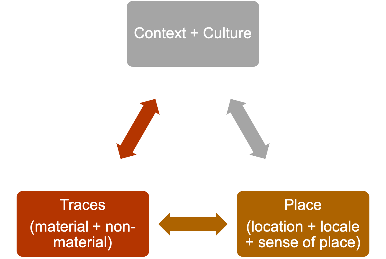
Figure 2. Cultural geographical perspective framework
(source: the authors)
3. Empirical analysis
3a. How globalization leads to changes in context and culture
The British colonization of Hong Kong had indeed marked the start of globalization and its impact on Hong Kong we see now. Due to globalisation, back in the 1950's, Hong Kong had had industrialization and financial market development (Schenk, Catherine, 2008). As a result, it improves the overall living standard of Chinese, which is shown in their increased expenditure on leisure and enjoyment. From then on, Chinese started to adopt the western, consumerist lifestyle in their daily lives, which allows ample of opportunities for the exchange and interaction of Chinese and western cultures in the future, which reforms the context and culture of pawn shops in Hong Kong.
3b. How material traces reflect changes due to globalization
Screen Doors
In the past, pawn shops had screen doors to block the view of passers-by and give customers more privacy to reduce their embarrassment (Mogul, 2020). With the blooming economy, prices skyrocketed and Hong Kong became more of a consumer society (Wang, 2015). The influx of western cultures through globalization also lowered the importance of the Chinese value to be self-sufficient (Terrill, 1977) so people became more willing to ask for help when needed. These decreased the shame and embarrassment of people having the need to borrow money (Chui, 2015), hence screen doors of pawn shops nowadays are just used as a decoration, indicating a change in material traces due to change in culture.
Counters
Back then, high counters were present in pawn shops, protected by bars for security. High counters were set to prevent people from seeing how pawnbrokers appraise the goods, which demonstrate the superior status of pawnbrokers over customers, aiming to lower customers’ bargaining power in order to increase monetary return (Annayiu, 2017) (Chui, 2020). However, the idea was then diminished due to globalization. In the early 1900s, the value of “The customer is always right” pioneered in Western societies (Blake, 2018). but the importance of customer services was first recognised in Hong Kong in 2002 (tc155, 2006). Therefore, it is strongly believed that the concept of equality or even prioritising customers affected pawn shops by then (Hunt, 2019). From then on, pawn shops have counters of regular height, where customers are able to communicate with pawnbrokers at eye level. Furthermore, the advancement and influx of foreign technology replaces the metal bars with modern security glass and CCTV for security (Chui, 2020).
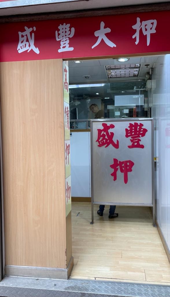
Figure 3. Screen door and counter in a pawn shop
(source: the authors)
3c. How non-material traces reflect changes due to globalization
Business Models
Under globalization, the pawnbroking industry developed a more comprehensive business model in response to the high demand in society. Pawn shops nowadays started to raise funds from the stock market and cooperate with partners in search for significant trades in property mortgages or valuable pawn goods. Take Oiwahpawn as an example, it has over ten branches evenly distributed in Hong Kong. Each of its branches is responsible for different businesses and services, for instance, Tak Wan Pawnshop provides pawn and redemption services to the customers, while Kei Wah pawnshop offers mortgage and property valuation services to customers. Therefore, we can see that Pawn shops nowadays adopt chain operation, rather than just a single party, which aims to reach distinctive targets through wholly owned subsidiaries’ merger and acquisition (pawnshop.com.hk/en/index, 2020, retrieved November 10,2020).
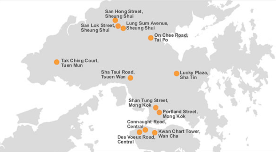
Figure 4. Oiwahpawn - Detailed Address and Map of the chain stores
(source:https://www.pawnshop.com.hk/en/map)
Trading Methods
Globalization also brought challenges to pawn shops in Hong Kong. With the advancement of intercommunication, people tend to use mobile applications to exchange their products for money, such as Carousell (Carousell.com, 2020, retrieved November 10,2020), one of the most popular applications for customer-to-customer transactions. A simple comparison with these mobile applications can easily reveal the inconvenience of pawn shops nowadays. Therefore, some pawn shops improved their online assets valuation system in response. Using Oiwah Pawn Group as an example, they developed an advanced online system to evaluate the price of assets, so customers can know the worth of their goods instantly, helping modern pawn shops to reposition themselves in the Hong Kong’s pawnbroking market.

Figure 5. OiWah Pawnshop - Online Mortgage Evaluation and Process
(source: https://www.pawnshop.com.hk/en/mortgage)
3d. How place (location, locale, sense of place) changes as a result
Place is a concrete concept that changes with time. In our case, the place is changing with foreign cultural shocks and technological evolutions over time. Place, such as location refers to a particular cultural landscape or object that symbolises the combined work of human and nature (Sigrist ,2011); locale refers to a geographic place at which there is or was human activity (USGS, retrieved November 10,2020); sense of space refers to the perspectives and feelings that individuals or groups hold towards the geographical areas (Hoste, 2012).
Location
Number of pawn shops have undergone dramatic changes due to social development in Hong Kong (see Table 1.). Currently, there are approximately 200 pawn shops in Hong Kong, populated in Yau TsimMong district (HKPA, 2020). With technological globalization, pawn shops have also undergone computerization and digitization, where customers can pawn goods simply through electronic devices (see Figure 5.).
Locale
There are 66 premises issued with mahjong/Tin Kau Licence currently in Hong Kong. Within Yau Tsim Mong district, there are already 10 mahjong schools in Mong Kok present (Licensing Offices, 2020). We can see that there is a close relationship between Pawn shops and mahjong schools, which is proved in our field study. This allows gamblers to pawn goods with them to earn extra money and continue with gambling conveniently (Michael, 2019).
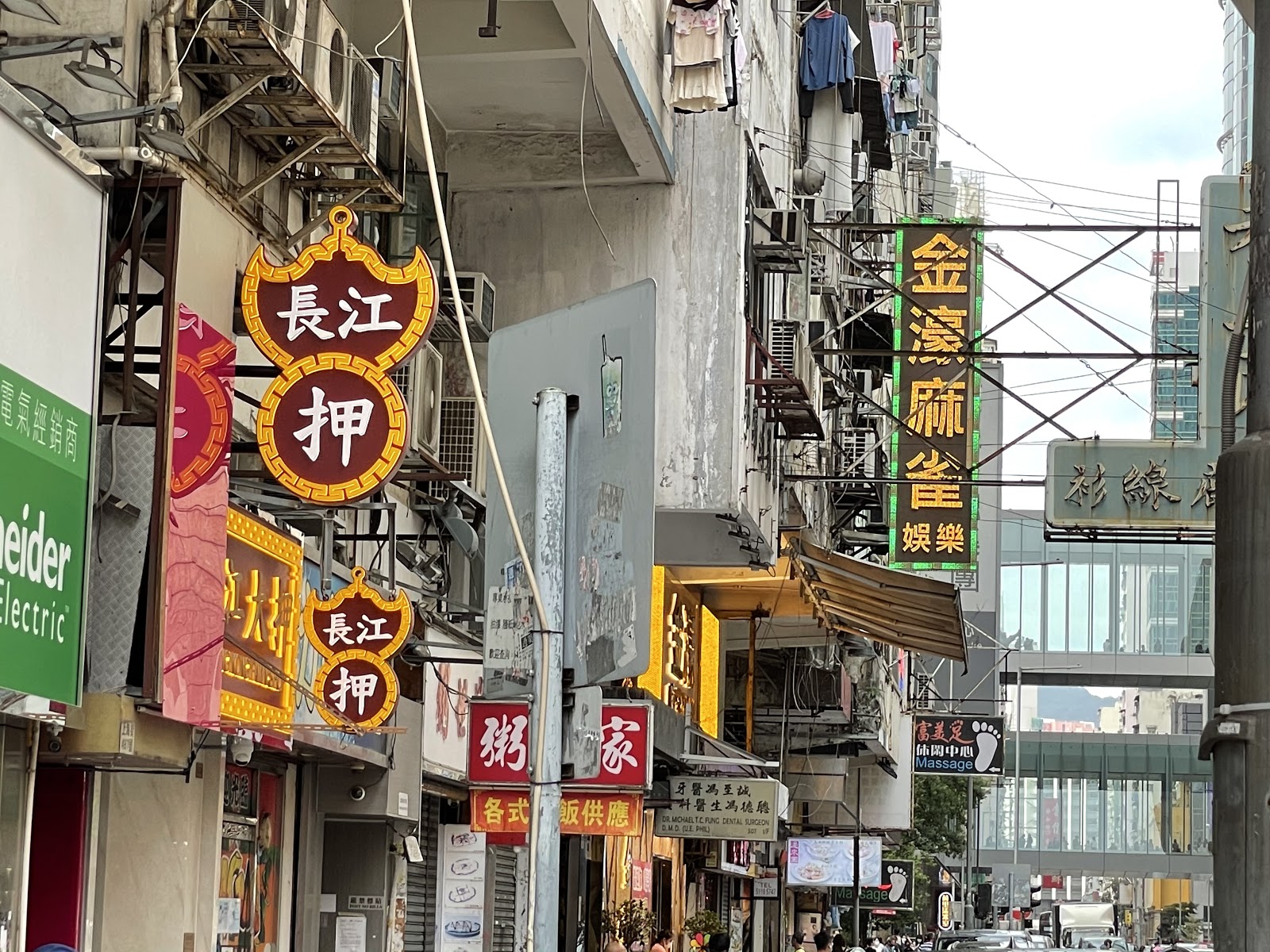
Figure 6. Close relationship between pawn shops and mahjong schools
(source: the authors)
Sense of place
Generally speaking, the older generations have a strong sense of belonging to pawn shops in Hong Kong, while the younger generations do not (Wong, M.H, 2019). Back in the Eastern Han Dynasty, the concept related to “pawning” was found in “ShuoWenJieZi” (zdic.net, retrieved November 10,2020), indicating that pawn shops play an important role in lending in the olden days. It was not until the 1950's that the lending system shifted from pawn shops to modern banks and financial institutions due to the globalisation of technology (SivaShankar, 2013). Being offered numerous choices of institutions for lending, most younger generations have less exposure to pawn shops, having less sense of belonging to pawn shops.
4. Conclusion
Growing with Hong Kong for nearly two centuries, the material and non-material traces of the local pawnbroking industry, including its architectural features, mode of business and operation, have greatly mirrored the city’s socio-economic development and the change of dominating ideologies over history as a result of globalization. Although the ever-changing status quo may pose challenges towards the development of pawn shops, the local pawnbroking industry has been resilient and flexible in responding to them accordingly. Hence, we strongly believe that the pawnbroking industry can stand firm in the future.
References
Annayiu. (2017)。<建築設計篇>。《當鋪-生存之秘》。取自https://passhonpropawnshop.wordpress.com/2017/05/01/%E5%BB%BA%E7%AF%89%E7%89%B9%E8%89%B2%E7%AF%87/
Blake, M. (2018). A Global View of “The Customer Is Always Right”. Retrieved from: https://www.forbes.com/sites/blakemorgan/2018/09/24/a-global-view-of-the-customer-is-always-right/?sh=13231d12236f
Cheng, W.T., & Ko, H. (2016) 。白手興家 : 香港家族與社會, 1841-1941 [Build a Home from Scratch: Family and Society of Hong Kong] 。香港: 中華書局(香港)有限公司。
Chui, C.P. (2015)。我哋當舖好有情 [ Our pawn shop good love ]。 香港: 突破出版社。
Chui, C.P.(2020)。〈當鋪設計- 從當鋪外觀到內部裝修〉[Design of Pawn Shops: From the exteriors to interior decoration]。《香港當舖遊蹤》[Tour of Pawn Shops in Hong Kong]。取自: https://www.jointpublishing.com/JointPublishing2013/media/Joint-Publishing/9789620446375-text-%E8%A9%A6%E8%AE%80%E9%A0%81.pdf?ext=.pdf
Costantini, I. (2019). Health, Education and Wellbeing in Hong Kong: British Legacy and Ne. Retrieved from: https://journals.openedition.org/interventionseconomiques/6472#tocto1n1
Figure 1. The Star Ferry
(RailTravel Station, 2019)
1. Introduction
Nowadays, capitalism rules the world in the sense of dominating economic and cultural systems. The globalization of capitalism further empowers capitalism to influence city governance practices and create traces over the world. To raise competitiveness, many cities begin to adopt marketing strategies to promote themselves. To attract capital, the city administration adopts marketing strategies to promote the city itself. In this process, the city started to conduct urban planning policies based on capitalist logic, which means that they began to use the entrepreneur's perception to manage the city. Capitalism, therefore, has deeply penetrated the city's urban planning. The Hong Kong government has also utilized image-building strategies to market the city. Since 2001, the government has launched the Brand Hong Kong program for promoting Hong Kong as a global city with security, good connectivity, and rich diversity. The city administration actively planned and implemented various development projects to establish a city image, just like the government. However, as these development projects may dismantle or reconstruct existing buildings, citizens may reject them and struggle for their place. Thus, this project would study how urban planning commercializes space and how citizens resist these capitalism-based policies for protecting their traces by analyzing the case of Central Reclamation Phase III and the Star Ferry Pier movement.
2. Capitalism, Globalization and City Marketing
From the cultural geography perspective, space is a social product that is formed by social and political factors. Lefebvre (1991) states that space is a product of capitalist society and a site of class struggle (as cited in Vilalta, 2008). To study why the urban space of Hong Kong becomes commercialized under the government's urban planning, it is vital to discuss how capitalism and globalization change government attitudes towards capital and city planning.
The globalization of capitalism has increased capital mobility, changed the rules of the game, and empowered corporations to influence government governance. To attract capital and compete with one another, cities began to adopt place marketing strategies to promote themselves. They started to use imagery to aestheticize places to increase their competitiveness (Hughes, 1999). For example, they may project themselves as an ideal business place, living place, and tourist destination to attract investment, talents, and tourism (Hughes, 1999). Cities then were aesthetically revamped to match with these invisible city image discourses (i.e. an ideal business place) and make the city image become visible in order to attract capital investors. One strategy is to build social and cultural infrastructures such as festival theatre and conference center (Hughes, 1999). These image-building activities show that governments have managed urban space based on capitalist principles like market values and profit-logic, and marketed cities as consumption sites to capital investors. They use culture to enhance the city's market value, which injects capitalist value into the culture and the city itself and leads to the commodification of culture and city. Thus, under image-building strategies, city, culture, and urban places have become a product of consumption.
However, these capitalism-based policies not only can attract capital but also can dislocate people from local cultures. To establish a city image, governments may dismantle local traces and replace them with homogenized traces, which may ultimately destroy the city's cultural diversity and make people feel ‘out of place’.
3. Empirical Analysis: Central Reclamation Phase III and the Central Star Ferry Pier
This section would discuss how Hong Kong government establishes city image and how citizens respond to these capitalism-based urban planning strategies by studying the case of Central Reclamation Phase III and the Star Ferry Pier movement.
From historical perspective, Central was a venue for Westerners and wealthy people in the 1890s. The ferry pier was used by the British government in 1898 and became Star Ferry Pier several years later (Cheng, 2010). Our study site, the Edinburgh Place Ferry which is the third generation of the pier, became a part of the public space planning project in the 1950s (Hong Kong Institute of Architects,2006).
The Central Reclamation has 3 phases in total. The purpose of phase III is to break new ground for building crucial transportation infrastructures. In order to reinforce the captivation of Victoria Harbour, phase III is also planned to construct a world-class waterfront promenade to provide extra land for greening and rest (Development Bureau, 2014). After the reclamation, there are such new famous landmarks as the Hong Kong Maritime Museum and the Hong Kong Observation Wheel. Through building these westernized traces, the government tries to enhance the city image as a top business and tourist destination. The dismantling of the Pier involved in the project was a controversial topic, as the pier has significant historical value and the traces involved are meaningful for local citizens.
Historically, the Pier marks the period when Hong Kong was under British colonial rule. It was built in 1957 by the colonial government. Its design is of British architecture style. The clock tower at the pier was designed by the same manufacturer as Big Ben in London (Auyeung, 2007). Many citizens consider it a representation of the colonial history of HK. Nevertheless, some argue that buildings with colonial style should not be preserved, since colonization history is not worth remembering. However, the value that the Pier possesses is not only the nostalgia for the colonial government but also the people’s lives and the social context during the colonial period (Cheung, 2016). It is a place where citizens root themselves and give themselves a definition. The affective and experiential traces have associated citizens with city, which then reinforced citizens' sense of belonging and sense of identity to local community.
Furthermore, numerous important large-scale social movements took place in the Pier from the 1950-70s. For instance, the 1966 riots and the Chinese movement in 1960-70s. The Pier served as a venue of protesting, showing that the Pier is not only a place of transportation but also a place for people to unify and fight for their rights. Although these movements have passed, the presence of the Pier can still recall the memories of people and remind people to bravely express their opinions to the government (Cheung, 2016). The Pier is of great significance to the community. Since it is public in nature, it can form any kind of relationship with anyone. It is a collective memory of citizens, constructing their sense of belonging to the city (Cheng, 2016).
Before the Star Ferry Pier Movement, Hong Kong citizens did not pay much attention to urban renewal development. It is the first social movement against the government's urban planning in recent years. In 2006, some citizens knew that the government plans to dismantle the Star Ferry Pier; thus, they tried to communicate with the government and asked for a better plan (Tsao, 2007). However, the government replied that the pier was not a cultural relic, and accused the public that there should be a more substantial reason for keeping a place since land resources are precious (Ho, 2006). It shows that they are in a dominating position in the urban planning process, and they can decide whether those historic buildings can be kept or not based on the definition of "cultural relics". In this case, the government denied the uniqueness and the cultural value of the pier, but only considered economic benefits.
In November 2006, Star Ferry pier ceased service, and the staff started the demolition work. Thus, people turned to participate in the demonstration in person; they went to the dockside and impeded staff from the construction. The incident aroused widespread concern later, but the minister who was in charge of the reclamation plan still refused to answer the phone called by the legislators (Sing Tao Daily, 2006). Concurrently, the government approved the demolition plan; the movement was deemed as a failure in the end (Tsao, 2007).
However, the movement is not a failure; people started to realize the capitalist ideology in urban planning. Unquestionably, they may not be able to resist the reclamation plan this time, but this movement is a milestone. It signifies that Hong-Kongers no longer focus on economic value only, but emphasize local culture and collective memory. Thus, while the government still plans our city by economic benefits only, residents begin to think about the relationship between space, history, architecture, and themselves, and eventually promoted the "Queen's Pier incident" and many other movements later.
4. Conclusion
Overall, this project points out that Hong Kong’s urban space has deteriorated in the cultural term as government policies are commercialized. The history of the Star Ferry Pier shows both advantages and disadvantages of the government’s urban planning. There is a proliferation of earnings under commercialization and globalization. However, gone are the days when Hong Kong has a notable cultural geographical symbol. All the events that happened in the landmark would disappear as time goes by. Undoubtedly, there is a dilemma in balancing historical value and economic value perfectly. Nevertheless, stakeholders need to review the effects of urban planning and think about how a city should be. The development of the city needs to be based on the thought of residents in the territory finally.
References
Auyeung, S. C. (2007). Reflection on the Development of Hong Kong's Heritage Conservation through the Star Ferry Pier Incident (Unpublished master's thesis). The Chinese University of Hong Kong, Hong Kong.
Cheng, P. H. (2010). 開埠至今之港島天星碼頭。街道倒後鏡。Retrieved from http://www.thevoice.org.hk/thevoiceOnline/article.asp?Position=7&ToPage=1&Class=11
Cheung, P. S. (2016). The Paradoxical Relationship among Hong Kong Local Discourse, Cultural Decolonization and Postcolonial Trauma: The Case of Queen's Pier Preservation Movement. A Journal of Cultural Studies, 23, 141-164.
Cheng, W. P. (2016). Spatial Politics of the Star Ferry Pier and Queen's Pier. Retrieved from https://angelland3.wordpress.com/2016/10/29/無法解殖的後殖民﹕天星及皇后碼頭運動的空間政治/
Development Bureau (2014). Fact Sheet: History of Central Reclamation Phase III. Retrieved from https://www.devb.gov.hk/reclamation/tc/basic/fact_sheet/fs1/index.html
Ho, P. (2006, July 27). Deconstruct "collective memories". Retrieved from https://www.hab.gov.hk/file_manager/tc/documents/whats_new/from_the_desk_of_secretary_for_home_affairs/shaarticles156_20060727_c.pdf
Hong Kong Institute of Architects (2006). 致立法會規劃地政及工程事務委員會──中環天星碼頭保育意見書。Retrieved from https://www.legco.gov.hk/yr05-06/chinese/panels/plw/papers/plw0920cb1-2236-4c.pdf
Hughes, G. (1999). Urban revitalization: The use of festive time strategies. Leisure studies, 18(2), 119-135.
RailTravel Station. (2019, November 20). Star Ferry (The Star Ferry Company): Central to Tsim Sha Tsui by Star Ferry Lower Deck. Retrieved November 10, 2020, from https://railtravelstation.com/star-ferry-the-star-ferry-company-central-to-tsim-sha-tsui-by-star-ferry-lower-deck/
Sing Tao Daily. (2006, December 13). Demonstrators block the clock tower and confront the police. Retrieved from https://web.archive.org/web/20070509113948/http://hk.news.yahoo.com/061212/60/1y4yg.html
Tsao, M. (2007). Recalling the demolition movement to defend the Star Ferry Terminal- a spontaneous movement. Cultural Studies@Lingnan, 4. doi: https://www.ln.edu.hk/mcsln/archive/4th_issue/criticism_04.html
Vilalta, C. J. (2008). Empirical Modeling in Urban Studies. Carlos J. Vilalta.
1. Introduction
Located in Wan Chai (Figure 1), Lee Tung Street (LTS) was once famed for its clustering of printing shops. Throughout the years, the street has undergone drastic alterations, from a printing street to a wedding card street, from a bypath to a side street. After the redevelopment, it has become a pedestrian zone filled with luxurious, high-end shops and has been donned a new name Lee Tung Avenue (LTA) (Ko, 2010).
Figure 1: Location of LTS
(Source: Google Map)
How do the interactions between different powers such as the government, property developers and and the residents have shaped Lee Tung Avenue and modified its cultural traces? What does it reflect about the relationship between cultural heritage and redevelopment? These are the questions this project aims to address from a cultural geographical approach, with the aid of Henri Lefebvre’s theory of Spatial Triad.
2. Cultural geographical perspective in use
Henri Lefebvre’s Spatial Triad includes three spatial dimensions (Table 1). Conceived space suggests the space that is planned, directed and organized by the power, for example, an urban planning map. Perceived space describes what people do in the space planned by those in power, such as selling wedding cards. Lived space indicates some symbols or values imbued by what people do, for instance, social ties. By using this framework (Figure 2), how different cultural traces of LTS have been produced through the interplay between the place, dominating power generated from conceived space, and resistance produced in perceived space and lived space will be analyzed in this summary
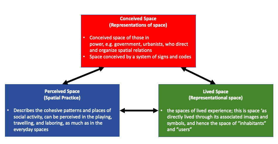
Figure 2. Henri Lefebvre’s Spatial Triad
(Source: Lefebvre, 1991)
Table 1. Framework of using Spatial Triad in LTS
(Source: Inspired by URA, 2003; Watkins, 2005; H.W. Wong & P. Wong, 2007; URA, 2007; Huang, 2009; Ko, 2010; Ng, et al., 2010; Gieseking, et al., 2014; Wong, 2016; Tsang & Zhang, 2019)
|
Dimensions |
Before redevelopment |
After redevelopment |
|
Perceived Space |
1. Sold traditional Chinese style products e.g. wedding cards, red packets
2. Low-income residents residing on the upper floors of tong lau
3. Residents helping and caring for one another. More interactions between neighbors |
1. Chain stores selling branded products like accessories, cosmetics etc.
2. High-income residents residing in The Avenue à gentrification
3. Original residents dispersed; the neighborhood disappeared
|
|
Lived Space |
1. Known as Wedding Card Street, having rich cultural values and uniqueness, as it was the only street in Hong Kong with the theme of wedding cards
2. Residents formed a close-knit community which is filled with warmth
|
1. Lost the meaning of Wedding Card Street. Turned to more high-end and commercial, loss of uniqueness
2. Loss of social ties, the history of the place and the residents’ connection to the place are lost |
|
Conceived Space |
1. During the 1950s, clusters of printing and wedding card making shops in LTS, and other retailers selling related items
2. Mandated by the government to supervise illegal publications easily |
1. In 2007, a redevelopment project launched on turning LTS into a “first-class shopping and leisure center”
2. “The wedding theme would be maintained”, said by the Hopewell Holdings Limited in 2013
3. Most of the printing shops having been replaced by luxury chain stores and high-quality boutiques, restaurants & hotels etc. |
3. Empirical analysis
A. Dominating power
In the case of LTS, the dominating power is represented by the Urban Renewal Authority (URA) and property developers, i.e. Sino Land Company Limited and Hopewell Holdings Limited. The URA is a statutory body in Hong Kong responsible for urban redevelopment projects. Though it is not a government department, the URA is granted much power and resources by the government and it works closely with the government. These stakeholders used various means to encourage a materialistic and capitalist culture.
First, the URA announced a development concept competition for LTS redevelopment project, in which entries were mainly encouraged to incorporate ideas of pedestrianizing, commercializing LTS and conserving pre-war historical buildings. From this, we can already see how the focus of the project was to make LTS into a center for economic and tourism activities, which is the new conceived space planned by the government.
Second, the URA chose property developers based on their experience and financial strength, showing how it pandered towards the financial interests of profit-oriented companies. Sino Land Company Limited and Hopewell Holdings Limited, which are key players in the real estate market, eventually won. The URA also stressed the importance of creating job opportunities for the construction sector and improving patronage flow. This further encourages the already capitalist mindset in Hong Kong and elevates the status of property developers through governmental recognition. The dominating powers further consolidate their transformative power.
Third, Lee Tung Avenue (the new conceived space), which is the result of the redevelopment project on the site of the original LTS, is a high-end shopping street that barely preserves any pre-existing cultural traces. URA promised to keep the wedding theme in Lee Tung Avenue after redevelopment, but the street is now dominated by international brand chain stores with only two wedding cards shops remained, showing that the dominating power had no genuine wish to preserve the traditional cultural values of LTS.
Overall, it can be seen that an overt focus on the economic benefits by the government and property developers drowns out any room for discourse from a cultural perspective.
B. Resisting power (strategies and concepts)
Being the resisting power, the residents, on an individual basis, does not have enough power to fight against the dominating powers. With the help from other parties, they can turn their incentives into actions, creating the ‘power of the powerless’ in the progress. The general strategies mobilized by resisting parties would be presented below (Figure. 3). And the whole protest movement can be divided into four stages (Fig. 4).
Figure 3. Strategies used by General Resisting Power Parties
(Source: McAdam, 1982)
*Cognitive liberation: gradual understanding of political and economic intentions of the powered
At stage 1, they had not yet fully understood the intentions of the powered. While the conceived reconstruction plan ruptured the original stable social network of LTS.
At stage 2, the residents achieved cognitive liberation. They found out the intentions and the inappropriate mobilization of power of the government. In the aspect of perceived space, the daily activities and the close social network had created a sense of belonging among the residents to LTS. They perceive LTS as their home, and it constitutes a large part of their identity. The unfairness fostered a sense of discontent among the LTS residents, turning objective fairness into subjective discontent. They started to make use of social resources and seek help from professionals to organize more resisting activities.
At stage 3, the altered reconstruction plan from the government was not accepted. The H15 Concern Group, formed by residents and shop owners affected by the redevelopment project, organized larger-scale activities, hoping the public would sympathize with their condition. Although the public became more aware of the situation in LTS, creating a force of public opinion that halts the redevelopment project, the LTS protest was not successful in the final stage.
There is an imbalance between the two power. The government could enforce laws that require the landlords to give up their property rights. At the same time, the reconstruction plan was supported by many big developers, who had strong financial base to oppose the resistance. Residents failed to bargain with the governments and developers despite obtaining the public’s support. In the end the resisting power had no actual power at all.
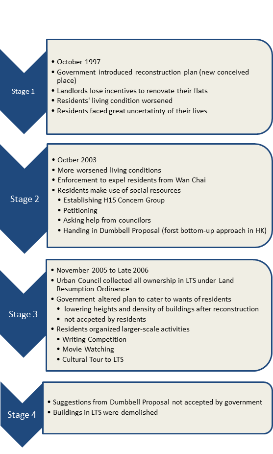
Figure 4. Four Stages of Conflicts between Dominating and Resisting Power
(Source: Xia, 2014)
C. Trends of development
From the case of LTS, the dominating powers enforced changes in the conceived space which provoked changes in the perceived space and lived space. It could be observed that during redevelopment, the old cultural traces of LTS were challenged and replaced by new merging cultures.
This introduces us to a new concept, placelessness. Since place are created when we embody “space” with cultural meanings. Placelessness refer to places that lack cultural diversity and do not reflect distinct local characteristics (Shim & Santos, 2011).
The creation of new cultural landscapes is usually profit-driven. The government may try to maximize the profit return in an urban renewal project. Commercial elements are preferred over cultural elements. The attractions in the city are targeted at the visitors instead of the locals. Which is perfectly reflected in the LTS project. Gentrification that results from redevelopment facilitates the creation of placelessness (Shim & Santos, 2011). Since the aggregation of higher-end shops will out-compete the local businesses which contribute to the unique local landscapes and identity.
Under this trend of urban development, the city’s landscape would appear to be “fabricated”, since the traces of a place would be modified directly by those in power instead of being generated from interactions within the residing community. The newly added elements in the redeveloped area are usually inspired by the characteristics of other places and are visitor-oriented (Shim & Santos, 2011). For instance, The Venetian Macao, a luxury resort located in Macao (Ip), resemblances Venice greatly and even has replicas of several Venetian landmarks. The “unique features” of a place becomes superficial and are not distinct anymore, deviating from their historical roots. For instance, Asian metropolis such as Hong Kong, Seoul and Tokyo may differ little from cities such as Las Vegas and New York. This results in the loss of social and cultural context of a place.
4. Conclusion
In this paper, we deploy Henri Lefebvre’s theory of spatial triad to analyze the changes of the cultural traces before and after the redevelopment of LTS, offering a systematic analysis of how exactly it was altered. Unevenly distributed transformative powers led to the emergence of resistance during the redevelopment period. Albeit adopting different strategies, the resisting powers posed no hindrance when faced with the dominating powers. The resisting power only contributed to the production of some short and temporary cultural traces from the conflicts between the dominating and resisting powers, for instance the banners and the signs being hung across LTS. While the dominating power re-constructed LTS based on their blueprint which focused on morphing LTS into a high-class shopping district, completely changing its cultural landscape.
Using the complete demolition of LTS as a case study, we tried to uncover the trend in redevelopment of decayed urban districts. Renovation of the decaying district is much needed, but it is observed redevelopment plans suggested commonly omit the importance of cultural preservation. Conceived space seems to play a more significant role than perceived space and lived space when drafting up a developmental plan. A balance between cultural heritage and redevelopment has yet to be found. But we believe communication bridges conflicting views. With more discussion, an intermediate solution that merges cultural preservation and economic development would be found.
Footnote
Source of the cover picture: photo by 捲捲和土豆拿鐵部落格, 2017.
References
Adrienne L.G., & Frederik P. (2016). State-led gentrification in Hong Kong. Urban Studies (Edinburgh, Scotland), 53(3), 506-523.
Gieseking J.J., Mangold W., Katz C., Low S., Saegert S. (2014). The Social Production of Space and Time. The People, Place, and Space Reade (pp. 285). New York: Routledge. Retrieved from https://books.google.com.hk/books?hl=zh-TW&lr=&id=b9WWAwAAQBAJ&oi=fnd&pg=PA289&dq=Henri+Lefebvre’s+Spatial+Triad+perceived+space&ots=KWWuyJiqw6&sig=hAoXAny8a79Rgg8frlp5cDfz5Js&redir_esc=y#v=snippet&q=spatial%20practice&f=false
Huang, S. (2009). A Sustainable City renewed by “People”-Centered Approach? Resistance and Identity in Lee Tung Street Renewal Project in Hong Kong. Retrieved from http://citeseerx.ist.psu.edu/viewdoc/download?doi=10.1.1.732.4972&rep=rep1&type=pdf
Ip, K. (n.d.). Asia's largest single-structure hotel building - modern engineering on a grand scale. Retrieved November 18, 2020, from https://www.arup.com/projects/venetian-macao
Ko, P. S. (2010). Intangible Heritage [Master’s thesis, University of Hong Kong]. The HKU Scholars Pub.
Lefebvre, H. (1991). The Production of Space. J.J. Gieseking, W. Mangold, C. Katz, S. Low, S. Saegert The People, Place, and Space Reade (pp. 285). New York: Routledge. Retrieved from https://books.google.com.hk/books?hl=zh-TW&lr=&id=b9WWAwAAQBAJ&oi=fnd&pg=PA289&dq=Lefebvre+production+of+spaces&ots=KWWvyHnnEa&sig=s0qcoAcoCgixF3nA2wGpFxuTFkQ&redir_esc=y#v=snippet&q=directly%20lived%20through%20its%20associated%20images%20and%20symbols&f=false
Ley, D, & Teo, S. Y. (2014). Gentrification in Hong Kong? Epistemology vs. Ontology. International Journal of Urban and Regional Research, 38(4), 1286-1303.
McAdam, D. (1982). Political Process, the Development of Black Insurgency, 1930-1970. Chicago: The University of Chicago Press
Ng, M.K., Tang, W. S., Lee, J., & Leung, D. (2010). Spatial practice, conceived space and lived space: Hong Kong’s ‘Piers saga’ through the Lefebvrian lens. Planning Perspectives, 25(4), 411-431.
Shim, C., & Santos, C. A. (2011). Urban Tourism: Placelessness and Placeness in Shopping ... Retrieved November 17, 2020, from https://scholarworks.umass.edu/cgi/viewcontent.cgi?article=1703&context=ttra
Snow David A., Jr E. Burke Rochford, Worden Worden, Benford Robert D. (1986). Frame Alignment Processes, Micromobilization, and Movement Participation. American Sociological Review, 51(4): 461-481.
Watkins, C. (2005). Representations of Space, Spatial Practices and Spaces of Representation: An Application of Lefebvre’s Spatial Triad. Culture and Organization, 11(3), 209-220.
Wong, H. (2016, February 1). Wedding Card St to be turned into ‘first class shopping’ district, developers accused of backtracking. Hong Kong Free Press. Retrieved from https://hongkongfp.com/2016/02/01/wedding-card-st-to-be-turned-into-first-class-shopping-district-developers-accused-of-backtracking/
Wong H.W., Wong P. (2007). 本土工程人 : 陳景輝專訪. Retrieved from https://commons.ln.edu.hk/cgi/viewcontent.cgi?referer=https://scholar.google.com/scholar?hl=zh-TW&as_sdt=0%2C5&q=利東街&btnG=&httpsredir=1&article=1056&context=mcsln
Urban Planning Renewal (URA). (2003, October 17). URA announced a 3.58-billion redevelopment project in Wan Chai [Press release]. Retrieved from https://www.ura.org.hk/tc/media/press-release/20031017
Urban Planning Renewal (URA). (2007, December 24). Wan Chai Lee Tung Street Redevelopment Project [Press release]. Retrieved from https://www.ura.org.hk/tc/media/press-release/20071224
Xu, J. (2020, September 15). Culture, space, place and power [Lecture notes].
李維怡(2007)。《黃幡翻飛處—看我們的利東街》。香港:影行者有限公司。
夏循祥(2017)。《權力的生成:香港市區重建的民族志》。北京:社會科學文獻出版社。
呂烈丹 (2007年2月7日)。〈不再在精英的口袋裡—利東街運動對文物保育概念的啟示〉。《明報》。
捲捲和土豆拿鐵部落格,痞客邦。(2017年7月11日)〈香港利東街 喜帖街。灣仔小歐洲步行購物街。香港最新景點〉。取自https://nigi33kimo.pixnet.net/blog/post/117461208
1. Introduction
Tai O is a village located at the south west of Lantau Island. It has been inhabited since the Han dynasty. The early settlers originated from the coastal area of Southeast China. Nowadays, it is a famous tourist spot which provides the view of a historical fishing village. In this project, the formation of different traces of Tanka culture in Tai O and the impact of modern values on the traces were studied. We will answer two research questions, i.e. “How were different traces formed by the intersection of the geographical context of Tai O and Tanka culture?” And “how do modern values impact the traditional traces? “
Table 1 Research questions and research objectives
|
Research questions |
Research objectives |
|
1. How were different traces formed by the intersection of the geographical context of Tai O and Tanka culture? |
To investigate the formation of different traces made by the interweaving of geographical context of Tai O and Tanka culture. |
|
2. How do modern values impact the traditional traces? |
To study the impact of modern values on traditional traces. |
According to Anderson, nothing would take place in a vacuum (2010). The geographical context is not only the political or national boundaries, but wherever there are human activities (Anderson, 2010). Culture is all things human beings do, including politics, economy, and different schools of thought and values, which influence the formation of places (Crang, 1998). Traces are residues, marks and remnants produced by the intersection of geographical context and culture (Anderson, 2010). In this project, stilt houses, temples and marriage customs were studied as traces. Tanka culture and modern values were studied as culture. The framework of this study is shown in Figure 1.
For methodology, secondary data, field study and in-depth interviews are utilized. A local Tanka resident and two temple assistants were interviewed during the field study on 8 Nov 2020.
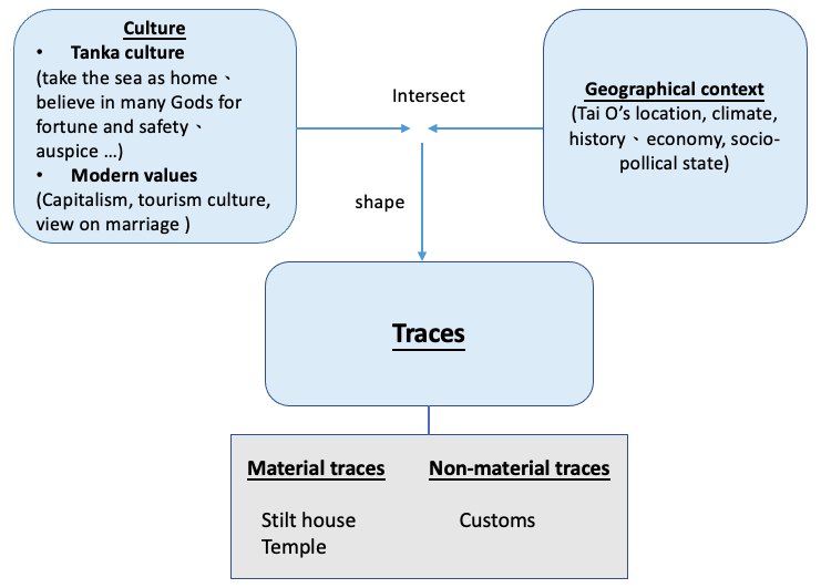
Figure 1 The conceptual framework of this study based on cultural geographical concepts
suggested by Anderson (2011)
3. Empirical Analysis:
3.1 The formation of traces of Tanka Culture in Tai O Fishing Village
Trace 1: Stilt house
Stilt houses are a unique scenery among Tanka residencies. The oldest stilt houses are built with simplistic and minimalistic materials, such as leaves of the Chinese fan palm and wooden boards. In the 1960s, Tankas started refurbishing these houses with more secure materials like metal sheets and concrete. This is because Tanka fishermen are originally categorized as a floating population instead of indigenous residents. They do not have the rights to abode, and the stilt houses are built illegally. They may not treat Tai O as a permanent place to reside and the belongingness is low. The change subsequently is due to the British Government bestowed favour on Tanka residents, making stilt houses legal. They have more belonging and confidence to reside in Tai O so they used more secure materials to consolidate the structure.
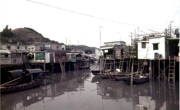
Figure 2. Stilt houses in Tai O are built with simplistic materials
(Source: Hong Kong Memory)
Moreover, until now, the interior and exterior of stilt houses don’t look posh as Tanka residents are typically frugal and would rather spend money to refurbish their boats.
Figure 3. The interior of a traditional Tai O stilt house with minimal interior
(Source: Field trip)
Another characteristic of stilt houses is their proximity, which originated from the proximity of boat squatters. This characteristic develops from Tankas’ nature of jobs, which are fishermen. Their job nature requires them to closely communicate for example, the location of catch and assist each other in times of natural disasters. The doors of stilt houses are always open so that neighbours can easily communicate.
Figure 4. Doors of a stilt house being widely opened
(Source: Field trip)
Trace 2: Temple
Temples are significant traces in Tai O which can be separated into two types according to their appearance and size. Two Hoi Sang Temples located in Tai O and Yi O are built individually. They are relatively crude and small. Those well-structured and frequently renovated temples, which are usually related to the benefits of the whole village, are under the regulation of the Government or Village Temple Committee. We focus on discussing the geographic location of these large-scale temple traces with the cultural perspective behind it. For instance, since the prosperity of the tracing business and the safety of navigation are particularly important for the fishing village, Kwan Tai Temple and Tin Hau Temple are located near the main entrance of the village.
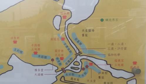
Figure 5 Map indicating each Temples in Tai O
(Source: Field trip)
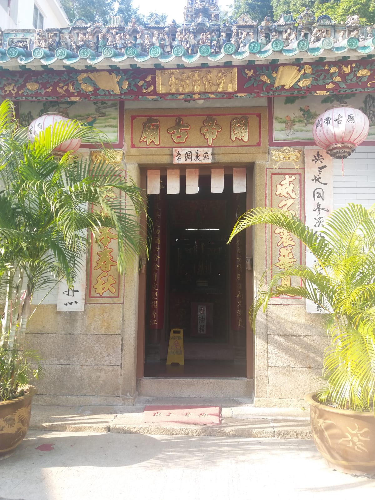
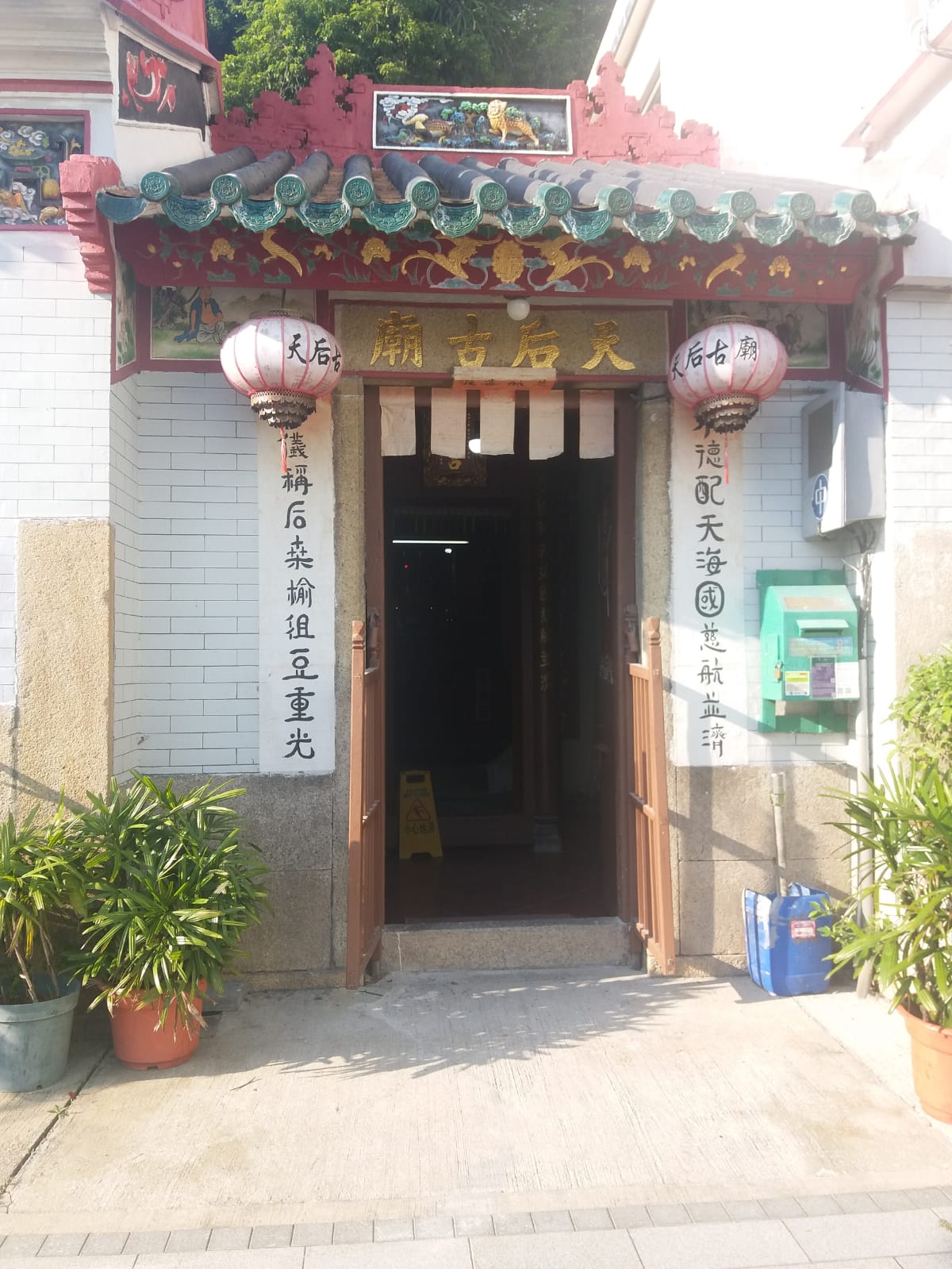
Figure 6. Kwan Tai Temple (left) and Tin Hau Temple (right) in Tai O
(Source: Field trip)
Also, before 2004, when Tai O Public Primary School was converted into Hong Kong Shaolin Wushu Cultural Centre, Hung Shing Temple was already located beside the school to bless students on gaining enthusiasm and achievement in the field of geography and meteorology like what Hung Shing did.
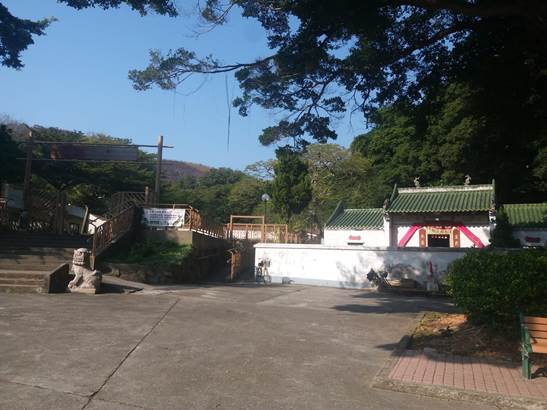
Figure 7 Hung Shing Temple with HK Shaolin Wushu Cultural Centre beside.
(Source: Field trip)
Trace 3: Customs of marriage
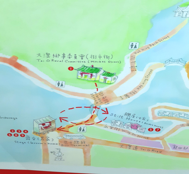
Figure 8 A graphical illustration on the route of the wedding and venue of various events on the wedding day.
(Source: Field trip)
Weddings are important celebrations for Tanka people. Being a traditional race, Tanka females have faced severe sexual inequality, which can be seen from weddings. The bridegroom was assigned a name to signify his maturity on the wedding day, while not for the bride. Moreover, if we take an overview from the whole wedding day, most events are held on boats from the bridegroom’s side. It implies that men have a greater power.
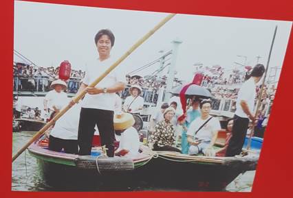
Figure 9. A man on the boat was trying to sing on boat on the wedding day
(Source: field trip)
Singing is also an important element in Tanka culture. Before the wedding day, the bride will sing in hopes of expressing her thankfulness towards her parents and her siblings who have made her who she is. She would also praise a better future.
On the wedding day, both sides of relatives will sing to each other on their boats. The singing hopes to build up the atmosphere, and also make both sides know more about the thoughts of each other. We can see that tanka people are artistic in expressing their thoughts, they know how to improvise lyrics and make up a melody, they also have the skill to question and answer through singing.
3.2. Modern values impact traces of Tanka Culture
Capitalism
Capitalism is a business-driven ideology focusing on goods that bring huge profits. Lefebvre (1979) states that urban space has become merchandise and is altered by the capitalist as how they imagine a capitalist society. Due to the economic transformation of Hong Kong in the 1960s-70s, the demand for labour in the secondary and tertiary industry has increased, Tankas may be lured to work in urban areas with a better salary. The better wages and job nature becomes an enormous inducement for Tankas to blend into the mainstream culture rather than fisheries.
Tourism culture
Tanka people have many unique cultures like "crying sigh". However, only customs with commercial value are valued under capitalism. For instance, the Tai O Dragon Boat Festival, one of the traditional events of Tai O Tanka culture, was listed as a national intangible cultural heritage in 2011. Traditions that have no significant economic value like stilt houses and traditional Tanka marriage have diminished. The government tend to re-package Tai O as a travel site.
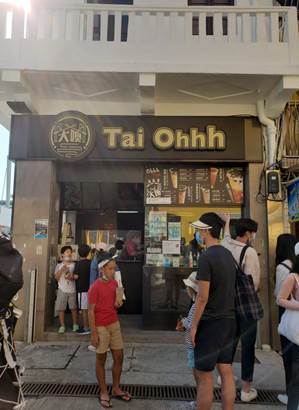
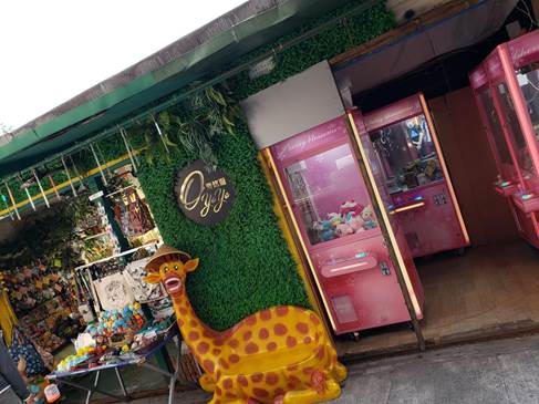
Figure 10. Beverage shop and clamping doll machine in Tai O
(Source: field trip)
According to Lee, a local Tanka resident in Tai O, the number of traditional shops like shops selling shrimp paste has dropped sharply from dozens to two (personal communication, November 7, 2020). But, in the wave of invasion of tourism culture, bubble tea, clamping doll machines have blended into Tai O to cater to the tourists’ needs.
Furthermore, the significant scenery of Tai O -- stilt houses have also been progressively commercialized. Some stilt houses have been renovated for business purposes such as selling salted fish, exquisite goods or transforming into coffee shops. One example is a café and boutique called “Solo” which opened in 2009. It has gained high popularity among visitors. It is undeniable that the renovation of stilt houses can stimulate the growth of tourism of Tai O, however, it is questionable whether the meaning and value of the Tanka culture can still be reflected by the renovated stilt houses.
Sustainability and environmental awareness
As mentioned, fishing and selling shrimp paste are the livelihoods of Tankas. However, according to Lee, in 2011, the government took back the fishermen's trawl license due to the environmental organizations' protest against trawling, which destroys the ecology of the sea. (personal communication, November 7, 2020) Due to the low socioeconomic status of Tanka people, the mainstream culture had often exercised dominant power over them since ancient China. And now, the traditional livelihoods of Tankas are diminishing.
Freedom and Sexual equality changing traditional marriage culture
After the reform and opening up, Tanka people have more freedom to choose their partners themselves. They are no longer stuck within their social circle but can engage with non-Tanka people. In the past, if Tankas wanted to get married, they had to seek help from a fortune teller. But nowadays, Tanka people have a greater decisive power to choose their partners.
Apart from freedom, sexual equality is another modern value which affects the Tanka culture. In the past, the bride had to live with her husband for four months without leaving. Nowadays, the bride is not restricted after three days after the marriage. Women gained more respect and rights from Tanka society.
5. Conclusion
All in all, the history, culture, geographic context and values of various traces of Tankas in Tai O are widely covered in this project. All the traces are valuable and unique. Cultural geographical perspective provides a comprehensive way in understanding the origin of heritage in Tai O. It also helps us to have further understanding on the interaction between traces and modern values. Hoping that all these heritages can be well-preserved in our commercialized society as a remark of history of Hong Kong.
Reference
Anderson, J.(2010). Understanding Cultural Geography. USA: Routledge
Crang, M. (1998). Cultural Geography. London: Routledge.
Lefebvre, Henri (1979) "Space: Social Product and Use Value", in Freiberg, J. W. (ed.), Critical Sociology: European Perspective (pp. 285-295). New York: Irvington.
Lee. (2020, November 7). Personal interview. [Personal interview]
Temple Street has perennially been known for its myriad of cultural traces, ranging from the plethora of ancient Chinese temples, to the night-time underworld crime during the colonial times – a theme which has been portrayed in many local dramas representing low to middle-class life stories back then. From our onsite investigation, we observed that time seems to play an important role in separating the functionality of the street, and how the reputation of the street is imbued with a socially undesirable/taboo element with the transformation from day to night. While daytime belongs to worship activities and represents the integration of multiple ethnicities seen through diverse food culture among restaurants, night-time witnesses a change in the street’s function into a bustling night market as well as a red-light district and hotbed of triad crimes. The diverse traces of religion, history, ethnicity, capitalism and food culture etc., encompassing both material and non-material, have invited us to question how all these traces contribute to the cultural place-making of Temple Street, as well as to investigate the role of time (separating day and night) in creating boundaries in terms of the functionality and cultural meaning of the place.
2. Cultural Geographical Perspective in Use
The three elements of place (Figure 1), as stated by political geographer John Agnew, includes “place as location, place as locale, and the sense of place.” (Lee et al., 2014) Location is defined as a position in the space, which can be described by longitude and latitude. Locale refers to the settings and environment of daily life actions, practices and social relations. It involves the concept where all cultural traces in the place came together as a whole. Sense of place is a subjective tie that links humans to a culture and environment. It gives humans identity while providing individual and collective meaning to a place. As place are saturated with cultural meanings, its traces are not fixed but dynamic entities as culture alters with social trend.
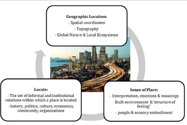
Figure 1: Three elements of place
(source: https://bit.ly/2Vstqu0)
Under the influx of foreign culture (Figure 2), transgression (breaching of a foreign culture into a certain region)may result when cultural orthodoxy is threatened. Notwithstanding, in inclusive regions such as Temple street, foreign cultures are acquiesced when local culture does not possess dominating power, thereby obviating cultural hegemony (domination of a specific culture in a culturally diverse society by ruling out other cultures with stronger economic or political power and influence). Given the robust foundation of local culture (Figure 3), foreign culture does not carry an eliminative potential, allowing an atmosphere of cultural inclusion to be achieved.
Figure 2: Nepal Restaurant
(Source: taken during Site Visit)
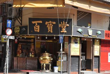
Figure 3: Herbal Tea Shop
(Source: taken during Site Visit)
3. Empirical Analysis
Figure 4: Guanyin Temple
(Source: taken during Site Visit)
In our project, we analysed Temple Street’s history when exploring how the street emerged as a place with such a special culture. In the 1870s, Temple Street got its name due to the recently built Tin Hau Temple (Figure 4) in the area. While Temple Street at that time merely served as a religious centre and was completely different from today’s Temple Street, it got its location at that time, which is the first fundamental aspect of place. Then, residents nearby started to use the space at Temple Street as a recreational area of play and rest during the 1920s. Businessmen utilized this opportunity to set up grocery stores in the street. These activities made up the locale of the street and became the prototype of today’s Temple Street. With the street becoming more famous and prosperous in the middle and late 20th century, residents became aware and proud of Temple Street’s culture. This gives the street’s sense of place and completes Temple Street’s three elements of place.
Day
The role of religion in Chinese culture is two-fold, namely the worshiping of ancestors and socialization (instructions on how to behave in the social setting). This is seen in how Tin Hau Temple shaped the habit of Yau Ma Tei (where Temple Street is located) fishermen who sought a sense of security through worshiping Tin Hau. With time, temples in Yau Ma Tei have transformed into tourist spots as they no longer reflect most residents’ lifestyles, thereby exhibiting a diminished cultural trace.
Figure 5: Mandala Arts Trading Company
(Source: taken during Site Visit)
Temple Street, as an inclusive space, carries traces from different Chinese provinces, demonstrating cultural hybridity. We observed a wide range of Chinese food culture on Temple Street, ranging from “daipaidongs” (street-side restaurants without air-conditioning) to Sichuan-Chongqing hotpots. In particular, this cross-culture hotpot is greatly valued in the Chinese society because it serves as the food choice for reunion. These traces from Chinese Provinces appear in Temple Street because their eating culture (such as Spicy Hot Pot) has become popular in Hong Kong, and are therefore with great demand. Glocalization (the practice of introducing foreign culture to a place while adjusting foreign cultural elements in order to adapt to local culture and beliefs) is also exhibited on Temple Street as shops which previously predominantly offered traditional Southeast Asian products started selling local snacks to lure local customers. It fully evinces the fusion of foreign culture with local culture, exhibiting culture hybridity on Temple Street. Under the envisaged globalization, the presence of non-materialistic traces like other religions such as Buddhism (Figure 5) and Hinduism have also rooted a sense of identity in both Chinese and Southeast Asians.
Night
After sunset, the functionality of Temple Street changes significantly. The street is most well-known for its flea market at night (Figure 6). Since the night market mainly provides products such as men’s clothing, electronic devices and second-hand antiques, which are predominantly for male customers, the street is also called “Men’s Street”. Moreover, as the stalls sell low-priced merchandise and allow consumers to bargain, the market is also hailed as the “Nightclub of Civilians” in Hong Kong. From the aforementioned, one can observe that nightlife on Temple Street tilts towards satisfying capitalistic and materialistic needs, where entertainment and economic benefits are put on a pedestal.
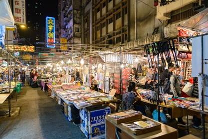
Figure 6: Temple street night market
(Source: https://bit.ly/2JkntwN)
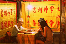
Figure 7: Fortune-Telling counter in temple street
(Source: https://bit.ly/3oksHXR)
Additionally, fortune-telling (Figure 7) and divinatory booths are also a significant component of Temple Street at night. In the early years, these booths were only set up by Fengshui and face-reading masters. Nowadays, we can discover a lot of western divinatory methods in the stalls, such as tarot, runes and astrology. Chinese and Western religions, when juxtaposed together, create a particularly mesmerizing scenery. This reflects the inclusiveness and openness in our society given the local residents’ acquiesce in foreign culture. As western culture blends into that of Chinese, the discrepancy between them are bridged, thereby inducing cultural fusion, which possess characteristics that lure both Chinese and Western people.
Moreover, food stalls, dubbed as daipaidongs (Figure 8), provide various local dishes that represent Hong Kong’s street food culture. The lyrics in the songs of buskers contain different characteristics of the street and some heartfelt wishes of locals, showing the close-knit bonding between the civilians and their neighbourhood, thus enhancing the sense of belonging for local residents.
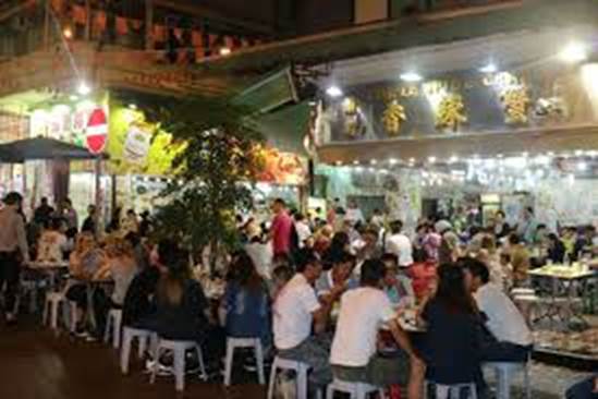
Figure 8: Daipaidong in Temple Street
(Source: https://bit.ly/2Vpiu07)
Ideological conflict in the function of Temple Street between day and night
According to Paul Carter, the author of The Road to Botany Bay: An Essay in Spatial History, place-naming is a powerful process in which “space is transformed symbolically into a place, a space with a history.” (Carter, 1998) The eponymous name “Temple Street” is derived from the plenitude of Chinese temples along the street, evoking an air of spiritual cleanliness and holiness, as well as the reverence from its historical weight. However, Temple Street is also known for its transformation into a red-light district at night, given the selling of adult sex toys (Figure 9) and loitering of prostitutes on the street (Figure 10). The irony lies in the fact these morally “impure” and socially undesirable activities simultaneously coexist on the same street which attracts worshippers to pay their respects to the gods (Figure 11).
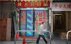
Figure 9: Shop selling sex toy
(Source: https://bit.ly/3qkortg)
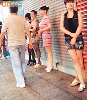
Figure 10: prostitutes loitering
(Source: https://bit.ly/2Jkq7CJ)
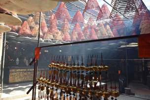
Figure 11: Temple with offerings to Gods
(Source: Taken during Site Visit)
Ideologically, there could not be a greater contradiction to Carter’s belief in the power of naming, as it seems that the process of place-naming has transformed a space into representing something symbolically opposite. It would be reasonable for one to think that at least some devout worshippers would be outraged at having these inappropriate and morally shameful activities taking place at such close proximity to a religious site. Yet, there seems to be a general lack of protest in reality.
One interpretation could be the inclusiveness in Temple Street owing to the general acquiesce in various cultural activities. Temple Street’s historical and religious background plays a cameo role in creating a sense of identity and emotional attachment in the street-users, instead most street users (businessmen, street singers, immigrants) treat it as a cultural hub. Another interpretation may be telling of Hong Kong people’s pragmatism, which prioritizes practicality over cultural significance regarding the use of space. Moreover, time itself seems to act as a boundary between these two antithetical cultural traces on Temple Street, with daytime belonging to a place of worship and normal functions of shopping and dining, and nighttime belonging to the underworld of street gangsters and prostitution.
Sense of Place – one of the elements of ‘place’
Overall, regarding the sense of place, Temple Street gives a strong sense of belonging to Chinese communities, especially of the lower- and middle-class. The numerous portrayals of the street in old local films may create evoke nostalgia in the older generations, as they reminisce life in the colonial era. It also has an increasingly multi-cultural and diverse spirit, allowing even Southeast Asian communities to call it “home” with its flourishing businesses. The rich religious history and beautiful ancient Chinese temples also instil in locals a sense of pride in their Chinese roots. This pride may also extend to Hong Kong’s international reputation with Temple Street’s increasing popularity among tourists. Lastly, the red-light district and shady activities at night may create a sense of fear among local women, as well as a sense of shame among men who are seen on the street at night.
4. Conclusion
Over the years, Temple Street has transformed from a merely local cultural space to an international tourist spot. Our topic compares the differences between the daytime and night-time function of this street. While some view Temple Street as a religious and holy space, stalls selling sex toys might may give the street a tarnished reputation. On the other hand, the street has become more culturally diverse from the influx of Southeast Asian immigrants who have established their businesses here. Though this gives the street a unique cultural identity, some Chinese culture traces might unavoidably be diluted and it was intriguing to explore the kinds of traditions that are fading in particular. Lastly, we sincerely hope that Temple Street’s rich historical, religious, and cultural traces, would be preserved by the government, so as to allow future generations to appreciate the physical manifestation of cultural diversity.
References
Withers, C. W. J. (2009). Place and the "spatial turn" in geography and in history. Journal of the History of Ideas, 70(4), 637-658. Retrieved from http://easyaccess.lib.cuhk.edu.hk.easyaccess2.lib.cuhk.edu.hk/login?url=https://www-proquest-com.easyaccess2.lib.cuhk.edu.hk/docview/1272094687?accountid=10371
Carter, P. (1988). The road to Botany Bay: An essay in spatial history. London: Faber and Faber.
Lee, R., Castree, N., Kitchin, R., Lawson, V., Paasi, A., Philo, C., ... & Withers, C. (Eds.). (2014). The SAGE Handbook of Human Geography, 2v. Sage.
Cover photo retrieved from: https://hk.trip.com/travel-guide/hong-kong/temple-street-10524210/ clave
1. Introduction
Our project aims to answer a focus question - “how the Lingnan cultural and geographical backgrounds help constitute the identity of Guangdong’s artists.” Guangdong artists had been creating many masterpieces which contribute as significant cultural traces. Yet, a lot of people have a limited understanding towards Lingnan and Guangdong’s artists. Hence, this project aims not only to learn about Lingnan, but also to promote Guangdong’s artists. Geographically, Lingnan is a highly vegetated coastal area that is far away from the central political centre. With such geographical features, these allow Lingnan to receive diversified culture besides from the central China, including Latin America, Southeast Asia, Europe etc. In this essay, it is eventually found out that interactions between these cultural and geographical backgrounds then have made up the unique identity of Guangdong’s artists.
2. Cultural Geographical Perspective in Use
In this essay, we adopted the methodology of new cultural geography. It is believed that mere cultural and geographical perspective alone is not enough to investigate the question, but social and historical context are needed as well to decode it. We theorized and analysed cultural artifacts and representations with high sensitivity to the workings of difference and power. In brief, our approach is to first identify the cultural and geographical information coupled with social and historical basis for each identity of Guangdong’s artists, then we use distinct cultural traces like drawings as reference and demonstration.
3. Empirical analysis:
Spiritual Factor
From Song Dynasty to Ming Dynasty, there were two significant ideologies that contribute to the value of the literati.
First, the Confucianism presented the idea of humanistic pragmatism. It was crucial for scholars to not only learn, but to act out their learnings and contribute to the society. Scholars should focus on the interest of the people rather than themselves. The Confucianism had demonstrated the benevolence of human with the influence of banished officials. Officials were often sent to Lingnan as political punishment. Yet, with their rich knowledge and opinion, their arrival had benefited the popular mass in Lingnan. As a less developed region, their knowledge and outlook had stimulated the growth in the area. As these officials passed on their knowledge in Lingnan, this could be seen as the start of Lingnan Literati.
Two noticeable literati were Su Shi and Han Yu. They both demonstrated an optimistic attitude in adverse circumstances and had actively helped the Lingnan society solving different crisis. Eventually, the two became the role models for Lingnan people. The public followed their attitudes and accepted their worldview. For instance, Su was banished from the imperial court due to internal conflicts. In Huizhou, he educated the society with his plantation knowledge and suggested the local authority to construct a bridge to connect the states and counties. Han Yu was banished as he indicated that Buddhism was unbeneficial to the nation. He was sent to Chaozhou where he carefully solved the flood and protected the people living by the river with crocodile worship.
Second, the Taoism presented a different philosophy around Mount LuoFu, a famous spot in Guangdong. According to the legends, Mount Luo and Fu collided to form Mount LuoFu; whereas the discovery made by geographers explain that it was caused by faulting of the crust - which squeeze the granite and causing this special geographical feature after million years of erosion. In the private viewing session, we were honoured to have a close look at a few pieces of Houlai Wang - a painter and poet who immersed himself into the nature and brought his observations in the nature into his paintings. In one of his work Luo Fu Sheng Jing, he painted Guanyuandong in Mount LuoFu. According to history, one of the Daoist masters visited Guanyuandong created the Lingbao School – a school that promote the idea of religious practices and rituals of Daoist. Ever since, Mount LuoFu became a scared place for Taoists and have attracted millions of believers traveling miles to worship the space.
Political factors: (Ming-Qing Transition)
In cultural geography study, any conflicts between dominant and emerging resistant power in a place could exert influence on the traces. During the Ming-Qing transition, the power switched from Ming to Qing authority provoked intense resisting force among Guangdong literati, altering the paintings (traces) in Guangdong.
In the late Ming dynasty, the country was facing severe socio-political instabilities owing to the eunuchs’ control of the royal court. Since 1627, rebellions led by peasants had erupted throughout the nation. In 1644, Beijing fell to the peasant rebels, marking the end of the Ming dynasty. At that time, many people fled to Guangdong to escape from battles in the Central Plain, including Ming loyalists and royals.(李權時,1993) Later on, Zhu Youlan, the Prince of Gui, was enthroned in Zhaoqing, and established his Yongli regime of Southern Ming dynasty in Guangdong. (袁鐘仁,1998) In 1650, Guangdong was under attack by Qing forces for almost one year, resulting in up to 700,000 death in Guangdong.(汪宗衍,1976)
The series of political events had aroused Guangdong people’s patriotic sentiment and revolutionary spirit, prompting them to engage in anti-Qing movements. Many Guangdong literati were also activists of anti-Qing movements and some had even sacrificed their lives for these movements. (李權時,1993) In addition, after the dynasty transition, many Guangdong literati were reluctant to serve the Qing government and chose to live in seclusion in remote mountains or even become a monk. (朱萬章,2010) This created a culture of retreating to the mountains among Guangdong literati.
The dynasty transition had led to changes in the theme, symbolism and style of Guangdong paintings.
First, many retreated Guangdong literati regarded landscape paintings as the best way to express their sentiment. Landscape paintings thus became the most prevalent art theme. (朱萬章,2010) For example, the famous artwork, Landscape, was drew by Cheng Jiu, one Guangdong literati who became a monk after the dynasty transition. (Figure 1)
Figure 1: Cheng Jiu, Landscape (釋成鷲《山水》)
Source: Art Museum, The Chinese University of Hong Kong, retrieved from Art Museum, The Chinese University of Hong Kong website
Second, symbolism was commonly used in Guangdong paintings. For example, Yang Changwen, a Guangdong literati, painted Orchid, Bamboo and Rock (Figure 2 and 3) to praise the uprightness of a friend who refused to work for the Qing government.(朱萬章,2010) Orchid is a symbol of ‘gentlemen’ (君子) in Chinese culture. This shows the nationalist fervour and revolutionary spirit of the painter.
Figure 2 and 3: Yang Changwen, Orchid, Bamboo and Rock (楊昌文《蘭竹石圖》)
Source: Guangdong Museum, retrieved from 朱萬章(2010)《明清廣東畫史研究》
Third, a scene of desolation was a common characteristic of the Guangdong paintings at that time. For instance, in Strolling in Autumn (Figure 4), Gao Yan, one of the Guangdong literati who lived in seclusion in mountains, depicted a bleak landscape in autumn, with a solitary scholar walking in the forest and a temple in the mountain, to convey his loneliness and suffering brought by the fall of his country (Figure 4) (香港藝術館,2020)
Figure 4: Gao Yan, Strolling in Autumn (高儼《秋原策杖圖》)
Source: Hong Kong Museum of Art, retrieved from Hong Kong Museum of Art website
Economic Factors: Booming Foreign Trades
Between the years 1757 and 1842, Guangzhou was the only official port that was opened to overseas exchange in China. The commercial culture in Lingnan created the Chinese export paintings (traces) in Guangdong.
In fact, Guangdong Province is one of the major ports for foreign trading since the Tang Dynasty. In the Reign of Qianlong (1757), the Qing government forbade all the marine trading activities in the coastal ports due to the administrative inconvenience, leaving the port in Guangzhou (Civil and Municipal Affairs Bureau of Macao S.A.R., n.d.). Therefore, until the Opium War, the transactions between China and the foreign countries concentrated in Guangdong, promoting the cultural exchange between oriental and occidental. In the cultural aspect, the traditional Chinese culture stresses agriculture and restrains commerce. However, Lingnan culture tells a different story. In this business community, the social structure was diversified and commercialized, and citizens advocated the pursuit of economic interests. Both the geographical and cultural backgrounds flourished under Lingnan's economic development, which created the Chinese export paintings (traces), a completely different style of painting from that created by the Guangdong literati.
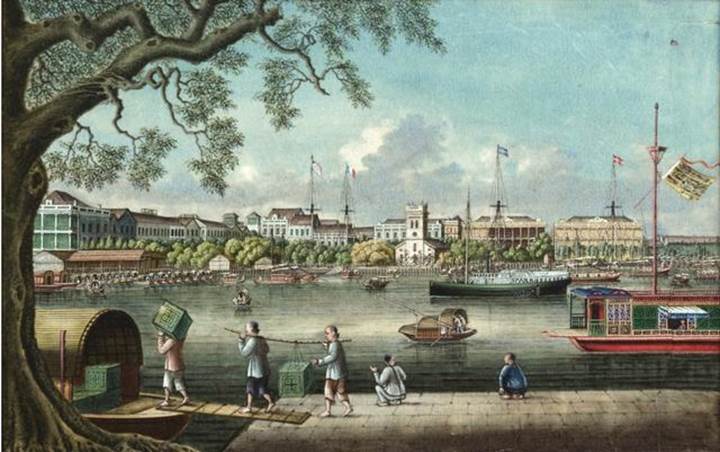
Figure 5: Tingqua, Studio of: View on the Canton Waterfront, Gouache on Pith Paper,《從廣州河南遠眺十三行商館區及明輪蒸汽船「Spark」號》
Source: Hong Kong Maritime Museum, Retrieved from https://artsandculture.google.com/asset/view-of-the-waterfront-at-canton-with-the-paddle-steamer-spark-tingqua-studio-guan-lianchang-fl-1840-1870/UgF3qiu4cTz3XA?hl=zh-tw
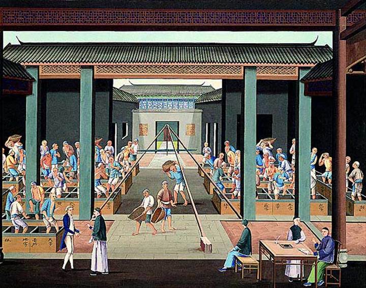
Figure 6. Anonymous, Production of tea: Packing tea for export, 《茶葉生產:茶葉裝箱外銷》
Source: Hong Kong Museum of Art, retrieved from https://hk.art.museum/en_US/web/ma/collections/china-trade-art.html
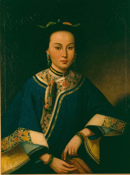
Figure 7: Anonymous, A Chinese lady, 《貴婦像》
Source: Hong Kong Museum of Art, retrieved from https://hk.art.museum/en_US/web/ma/collections/china-trade-art.html
Chinese export paintings were mainly oil paintings, watercolors on pith, or gouaches on paper, board, and glass. They used Western painting techniques to epitomize contents full of chinoiserie. Those paintings depicted contemporary life in China, illustrating the sceneries, occupations, plants and insects, as well as costumes (Liang, Burigio, Bailey & Cheung, 2020). Since transportation and technology development was not as advanced, China as a mystic oriental civilization had aroused the curiosity of foreigners. As it was hard to travel to China, the export paintings served as souvenirs to satisfy their fascination and thus was spread. Export paintings are realistic and exquisite. The difference between the export and traditional paintings verified one of the three main characteristics of Lingnan scholars, which is to be flexible and emphasizes mercantilism.
4. Conclusion
In summary, our project examined how the sense of identity of Lingnan scholars towards Lingnan are cultivated in the perspective of cultural geography. We separated it into culture and geography which contain three factors respectively. By linking its location in the southern part of China with Taoism and Confucianism ideologies, they explained the common ideal of Lingnan scholars shown in paintings and how it heightened their attachment to Lingnan. Besides, combining the political background of resisting Qing Emperor, its distant location from the north and abundant fields in Lingnan accounts for their openness and anti-traditional character which strengthened their affinity towards the place. Finally, the fusion of business culture and Lingnan’s coastal geographical context contribute to traits of flexibility and emphasis on mercantilism. This reinforced their bonds to Lingnan. Last but not least, studies on characters extension from Lingnan scholars to artists are expected to conduct in the future.
Reference
Liang, H., Burgio, L., Bailey, C. F., & Cheung, C.S. (2020). Culture and Trade through the Prism of Technical Art History – a study of Chinese export paintings. Retrieved from https://gtr.ukri.org/projects?ref=AH%2FK006339%2F1#/tabOverview
Civil and Municipal Affairs Bureau of Macao S.A.R. (n.d.). Export Paintings. Retrieved from http://www.mam.gov.mo/oldmam/photolist2.asp?prg_id=2004010101&lc=3&grp=2&name=Export%20Paintings
William, I. (2014). Created in Canton: Chinese export watercolours on pith. 广州制作 : 欧美藏十九世纪中国蓪纸画 (第1版 ed.). 广州市: 岭南美术出版社.
Hong Kong Museum of Art. (n.d.). Production of tea: Packing tea for export. Retrieved from https://hk.art.museum/en_US/web/ma/collections/china-trade-art.html
Hong Kong Museum of Art. (n.d.). A Chinese lady. Retrieved from https://hk.art.museum/en_US/web/ma/collections/china-trade-art.html
Hong Kong Maritime Museum. (n.d.). 從廣州河南遠眺十三行商館區及明輪蒸汽船「Spark」號. Retrieved from https://artsandculture.google.com/asset/view-of-the-waterfront-at-canton-with-the-paddle-steamer-spark-tingqua-studio-guan-lianchang-fl-1840-1870/UgF3qiu4cTz3XA?hl=zh-tw
李權時(1993)。《嶺南文化》。廣州 : 廣東人民出版社。
袁鐘仁(1998)。《嶺南文化》。瀋陽 : 遼寧敎育出版社 。
朱萬章(2010)。《明清廣東畫史研究》。廣州市 : 嶺南美術出版社。
汪宗衍(1976年12月)。〈明清之際廣東書畫家 為何氏至樂樓藏品展覽作〉,《中國文化研究所學報》第8卷第2期。取自
1. Introduction
Queen’s Pier, built in 1925, was named after Queen Victoria. It served as a public pier, a recreation space, and acted as a major ceremonial arrival and departure point (Pang, 2020). The collective memories evolved from the Pier has shaped Hong Kong citizens’ collective identity. Unfortunately, Queen’s Pier was demolished for the sake of Central and Wan Chai Reclamation (“History of Central Reclamation”, n.d.). The demolition has provoked an unprecedented level of debate between the Hong Kong government and various parties (Chai, 2009). The values behind them would be illustrated.
Figure 1. Queen’s Pier was a significant part of Hong Kong’s history, providing a main arrival and departure point for many ceremonial occasions
(Photo by Time Out)
2. Cultural Geographical theory
2.0 Introduction
As the clash of values between different stakeholders regarding the Queen's Pier is going to be discussed, cultural geographical concepts related to the formation of certain values as well as the conflict between different parties should be introduced in order to explain the issue in-depth.
2.1 Locale (場所)
Locale refers to the environment of the place and the composite of all the traces that come together. It refers to daily lives settings and social interactions. Located at Victoria Harbour, Queen’s Pier witnessed the colonial period during the 20th century. During that period, different governors took the Lady Maurine, the government’s official yacht which took them across Victoria Harbour and then disembarked at Queen’s Pier (“Governor MacLehose takes office”, n.d.). Besides, several members of the British Royal Family arrived in Hong Kong at Queen’s Pier. Furthermore, the government organized celebrations at Queen’s Pier such as the military parade which celebrates the birthday of King George V (“中環皇后碼頭歷史”, n.d.). The colonial period has left many memorable traces at Queen’s Pier.
2.2 Sense of place (場所感)
Sense of place is the feeling towards a place. A place is not a place if it doesn’t stimulate senses to people who are present there. Sense of place is the bridge that connects people, culture and the location all together. Queen’s Pier gives the colonial sense to Hong Kong people, with its Western architectural style etc. It is a significant place of Western culture, which is deeply rooted in Hong Kong until now. Queen's Pier has given Hong Kong people a sense of belonging to colonial rule. And the presence of Queen’s Pier also reminds Hong Kong people of their diversed identity.
2.3 Resisting force and dominant power (抵抗力與主導權力)
The dominant power has the power to regulate what others do, somtimes by threatening them. The dominant power has the authority, be it lawfully, militarily and most importantly, culturally. To resist the authority, resisting force has arisen to challenge it. In the case of Queen’s Pier, the dominant power is the government while the resisting force is the general public, cultural and environmental conservationists. The resisting force adopts measures, such as publicity, rallies, hunger strike to resist the government’s demolition decision.
2.4 Cultural traces (文化印記)
A place is composed of various cultural traces and they reflect specific cultural orders, which is defined by the dominant power. The entire Queen’s Pier is composed of various cultural traces, such as the “Queen’s Pier” horizontal plaque, the banners and posters made by the resisting forces, the performances at the Queen’s Pier, etc. Cultural traces can be distinguished into lasting or transient, material or non-material. The plaque is material and lasting; the banners are material but transient; the performances are non-materialistic and transient. Nonetheless, trace together form a place.
2.5 Clash of cultures (碰撞)
After clashes of different cultures, these ever-changing traces allow the development of new places. The current building blocks of Queen’s Pier are located at the government explosive depots in Kau Shat Wan. While the old Queen’s Pier and Star Ferry Pier formed the current Central Pier No.9. Besides, the land obtained by reclamation as well as the Queen’s Pier are now developed into the AIA carnival.
2.6 Relationship between space and place (空間與地方的關係)
Professor Linda Hershkovitz pointed out that the tension between the hegemonic dominance of public space and the temporary appropriation as a mass stage is part of the social process. This tension may continue to produce and change the social space. When the time passes, the older cultural traces may be erased or merged with new traces, thus forming a complex cultural landscape (Hershkovitz, 1993).
3. Empirical analysis
3.1 Dominant power – Government
Figure 2. Queen’s pier
(Photo by SCMP pictures)
In the early 2000s, the Government decided to carry out Central Reclamation Phase III. One of the major infrastructures is the Central-Wanchai Bypass. To build the bypass, Queen’s Pier must be demolished so that reclamation can be done. Besides, the Secretary for Home Affairs Mr. Ho Chi-ping has stated that the historical, archaeological and palaeontological values of Queen’s Pier are not sufficient to be a declared monument. Although the Antiquities Advisory Board has ranked the Pier as a Grade 1 Historical Building, the government chose to neglect the Board’s opinions.
The Secretary for Development, Carrie Lam, claimed that Hong Kong has a high population density. Hence, city planning is very important. It was urgent to start the Central Reclamation Phase III to alleviate transportation needs. This shows that the government prioritizes economic development over heritage protection.
From the cultural geographic aspect, the government establishes cultural order through traces to control one place. Even though these wishes or thoughts are not necessarily fair, the government may impose them on citizens through punishments. In fact, when citizens went to Queen’s Pier to participate in protests, like hunger strike, Queen’s Pier was temporarily used as a stage for the masses. The police then banished the protesters by force to redefine and control the place.
3.2 Resisting Power
3.2.1 Citizens
Three values are reflected from citizens, namely sense of belonging, increased awareness on cultural conservation and political awakening.
For sense of belonging, Queen's Pier signifies the identity of Hong Kong citizens as the citizens of British colony. (鄭, 2016) This can be explained by the locale of Queen's Pier as mentioned above. An increased awareness on cultural conservation is also shown. In the past, economic gain outweighed cultural heritage and many historical buildings were demolished. Later, citizens started to place more emphasis on the non-material quality of life, hence resulted in the increased awareness on cultural conservation, exhibited by other preservations like Blue House and Tai Kwun.
As citizens started to focus on non-material quality of life, they wanted to exercise their political rights and participate in decision-making(Ewing, 2020).. Therefore, they began to participate in protests to express their demands.
Figure 3. People are holding banners with the words “Preserve Queen’s pier” on July 30
(Photo by Samantha Sin/AFP)
3.2.2 Cultural Conservationist
There are three values reflected by the cultural conservationist, which are heritage completeness, location of heritage and the democracy of city planning respectively.
For heritage completeness, the government once proposed a plan to conserve only specific parts of Queen’s Pier, making symbolic cultural heritage incomplete, the cultural conservationists strongly oppose the suggestion, meaning that they value the completeness of Queen’s Pier to a large extent for arousing collective memory.
For the location of heritage, the government believes that there is a need to demolish the whole pier due to construction work. However, cultural conservation group The Conservancy Association proposed that the government can temporarily move the pier away and assemble them at the original location after the construction. This proposal is rejected by the government due to the high cost involved, but it can show that cultural conservationists think that the location of the heritage is directly associated with its culture and history.
Lastly, the cultural conservationists believe that they do not have the freedom to take part in the process of city planning. They believe that the “Antiquities and Monuments Ordinance” is outdated and the statements inside are ambiguous, causing the government to have sole control towards city planning. Moreover, the cultural conservationist stated that the Antiquities Advisory Board and the Antiquities and Monuments Office exist but without a concrete use. Therefore, they fail to take part in their valued city planning.
3.2.3 Environmentalists
There are two values reflected from environmental conservation groups, which are conservation of the environment and protection of marine life.
For the conservation of the environment, Action Group on Protection of the Harbour organised a Blue Ribbon Movement on 22nd December in 2016. Members from the environmental group as well as citizens tied blue ribbons on the fences along the Victoria Harbour. This showed their strong will in protecting the Queen’s Pier such that the whole Victoria Harbour scenery can be conserved. On the same day as the Blue Ribbon movement, members from the legislative council and district councils as well as citizens go on board. This boarding action was to show their opposition towards the reclamation of the Victoria Harbour as it will pollute the sea water, thus affecting marine life. Therefore, they value the protection of marine life.
4. Conclusion
Looking at the demolition of the Queen’s Pier through a geographical perspective, we have gained deeper insight on the issue. The cultural landscape of Queen’s Pier region that we see today are formed by constant clash of culture between different cultural groups, and the appearance of the landscape is a fusion of values from different stakeholders. It is recommended that for future city development plans of the government, understanding values of different cultural groups is crucial and as policy makers, the government truly has the duty to respect and integrate all the values.
References
Chai, K. (2009, January 01). Central Star ferry pier: Policy, politics and protest in the making of heritage in Hong Kong. Retrieved December 05, 2020, from http://hub.hku.hk/handle/10722/152558
Emmerton, R. (2016). Put Queen’s Pier close to its original location on Hong Kong Island. South https://www.scmp.com/comment/letters/article/1951659/put-queens-pier-close-its-original-location-hong-kong-island
Hershkovitz, L. (1993). Tiananmen Square and the politics of the place. Political Geography, 12(5), 395-420. https://doi.org/10.1016/0962-6298(93)90010-5
Pang, J. (2017). In Pictures: Demonstrations and demolition-10 years since the Queen’s Pier was pulled down. Hong Kong Free Press. https://hongkongfp.com/2017/08/06/pictures-demonstrations-demolition-10-years-since-queens-pier-pulled/
Time Out Hong Kong. (2020). Hong Kong’s Lost Buildings. Time Out. https://www.timeout.com/hong-kong/attractions/hong-kongs-lost-buildings
香港記憶: Hong Kong Memory. (n.d.). Retrieved December 07, 2020, from https://www.hkmemory.hk/MHK/collections/MemoriesWeShare/live_broadcasts/governor_macLehose_takes_office/index.html
中環皇后碼頭歷史和建築賞析. (n.d.). Retrieved December 05, 2020, from https://www.aab.gov.hk/form/AAB_Paper129_queen_annexb_c.pdf
香港皇后碼頭清場完畢 三人被捕 (2007, August 2) .). Retrieved December 25, 2020, from http://news.bbc.co.uk/chinese/trad/hi/newsid_6920000/newsid_6927100/6927167.stm
鄭, 威鵬. (2016, October 30). 無法解殖的後殖民﹕天星及皇后碼頭運動的空間政治 (討論提綱). Retrieved December 23, 2020, from https://angelland3.wordpress.com/2016/10/29/
Ewing, K. (2020, March 31). Out with the old: The political awakening of a new generation of Hongkongers. Retrieved December 23, 2020, from https://hongkongfp.com/2016/03/27/out-with-the-old-the-political-awakening-of-a-new-generation-of-hongkongers/
Figure 1: Mei Ho House (Source: Chiu, 2021)
1. Introduction
Mei Ho House (Figure 1) marked the commencement of Hong Kong’s public housing programme. The building witnessed the development of Hong Kong’s public housing and the evolution of the residents’ living environments since 1954. By investigating the revitalization project of Mei Ho House and drawing upon Lefrebvre (1991)'s "space production" theory (Figure 2), discussing the relationship between place and space, and exploring whether the revitalization project can successfully inherit the collective memories of the past.
Figure 2: Lefrebvre (1991)'s "space production" theory
Analysing Mei Ho House through Lefebvre’s Spatial Triad (Lefrebvre (1991)'s "space production" theory
Dimension
Definition
Analytical focus in Mei Ho House
Spatial practice
It embodies the close connection between daily reality (daily affairs) and urban reality (paths and networks that connect places reserved for work, private life, and leisure) in a perceived (perceived) space.
History, architectural characteristics and human’s life of Mei Ho House.
Representations of space
A conceptualized space, a space for scientists, planners, urban planners, technocrats, and social engineers. They are certain types of artists with scientific inclinations-they are all identified by conceived, lived and perceived.
New value and changes that were given by the revitalization plan of Mei Ho House.
Representational space
A space that is directly lived through related images and symbols. Therefore, it is a space for "residents" and "users", as well as a space for artists and those few writers and philosophers who only want to engage in description. The representation space can be said to be biased towards a more or less coherent system of nonverbal symbols and signs.
Old and the new traces left by aborigines. Conduct exhibitions and various cultural activities to continue the collective memory.
2. Cultural Geographical Perspective in Use / Empirical Analysis
2.1. Spatial Practice
There are three components that will be mainly covered: history, architectural characteristics, human’s life.
The origin of Mei Ho House began with the end of World War II, people returned to Hong Kong and the Mainland immigrants escaped to Hong Kong. Resulting in the Hong Kong population reached a peak at that time. However, the short supply of land and housing in Hong Kong caused them to build squatters by using corrugated iron and wood waste on the mountainside (Figure 3). On 1953 Christmas Day, around 6 million people’s homes were destroyed by a catastrophic fire (Figure 4) (Hong Kong Housing Authority, 2009). The Government decided to construct resettlement blocks for placing victims and Mei Ho House is one of the resettlement blocks. Therefore, Mei Ho House is the traces of the birthplace of Hong Kong's public housing policy. The ‘H’ shape of architectural characteristics combined by two rectangular prisms is the only one left from Hong Kong (Figure 5). There are 6 floors of Mei Ho House and only provide the basic living elements for the victims (Hong Kong Hostels Association, n.d.; Revitalizing Historic Building Through Partnership Scheme, n.d.).
People living in Mai Ho House only enjoy the minimum quality of living, sharing common areas such as toilets, cooking in the corridors, and the water supply (Figure 6 & 7). However, in this place develop their unique culture as well as living style and because of this sharing environment increases the interaction between the neighbourhoods (HC, 2013; HK Housing Authority, 2010).
Figure 3: Squatter on the mountainside (Source: Government Records Service, n.d.)
Figure 4: Shek Kip Mei Fire in 1953 (Source: Government Records Service, n.d.)
Figure 5: Mai Ho House (Source: Government Records Service, n.d.)
Figure 6: Cooking in the corridors (Source: Government Records Service, n.d.)
Figure 7: Public water supply (Source: Government Records Service, n.d.)
2.2. Representation of space - Conceptualized space
The new value and the changes that were given by the revitalization plan.
After the Non-profit-making organisations providing proposals about preservation of the historic building, financial viability and community benefit, the government will select and provide financial support for renovation.
According to the revitalization of Historic Buildings Partnership Project: Mei Ho House Information Booklet, the main purpose of revitalization is keeping main features while meeting all legal requirements. The detailed clause mainly mentions the external structure of the building. For example, the H-shaped building and the wall colour. But less specific activation requirements for the internal like room structure, corridor, fence. Also, the guidelines were likely guaranteed from an operational perspective, fewer guidelines from a historical perspective. For example, fire escape, floor load, sewage and waste management, etc were mentioned. In the preservation aspect, the government suggested having a public housing museum in Mei Ho House to reflect historical value and significance. Also, the government advised that Mei Ho House can be revitalized as an art centre or youth hostel.
Hong Kong Youth Hostels Association (HKYHA) was selected to revitalize Mei Ho House Hostel. According to the government document, those were the Mei Ho House architectural changes by HKYHA. The corridor floor was rebuilt because the load weight did not comply with the building regulation. The concrete fence in the corridor changed to glass one. Also, some changes were made to fit hostel needs. Each room area has been increased. The central part of the original building like shared toilets and kitchens were changed to lifts and fire-fighting systems.
The entire revitalization plan presents the space conceived by power. It projects that the feasibility of commercial operation is more important than preserving the residents' traces of life.
2.3. Representational Space - Living area for users (HK citizens)
2.3.1. Traces left by aborigines
The cultural groups, who are aborigines in Shek Kip Mei resettlement estate left some tangible and intangible traces. The tangible traces are equipment that appeared in the past estate, such as canvas beds (Figure 8), five-barrel cabinets that are present in a new space like showing an exhibition nowadays. And the intangible traces are old style residences and living experience owned by citizens, using some display boards to show the heritage currently.
Figure 8: Tangible traces: Canvas beds (Source: Chiu, 2021)
2.3.2. Various use of Mei Ho House nowadays
Present the historical appearance of the resettlement estate
Regarding the architecture and historical significance, it can be seen that it has inherited the past characteristics of “H-shaped” residential buildings (Figure 9). There are 1200 pieces of equipment provided by the aborigines built in new space and presented to the public.
Figure 9: “H-shaped” residential buildings nowadays (Source: Chiu, 2021)
Drive the regional economic growth
In terms of the economic significance, YHA Mei Ho House Youth Hostel and some restaurants take significant roles in boosting the regional economic development. Different kinds of employment opportunities have been created for the working population. The increase in the number and flow of citizens stimulates the consumption of shops and hostels in the new spaces.
Preserve residents' collective memories
Focus on the social and cultural significance, it can be seen that Mei Ho House Alumni Network holds different activities to let former indigenous residents remember their past living time and consolidate neighbourhood relations in the activated space. Take the Lee’s family in Shek Kip Mei estate as an example, they pointed out that Aleurites Moluccana has been preserved and became the symbol of Mei Ho House, integrating into the life of old residents to preserve the collective memories of the past.
Conflicts between power and space of the Heritage of Mei Ho House
The public can only visit the Heritage of Mei Ho House (Figure 10) with no use for commercial shooting unless applying in advance (HKYHA, 2021). Visiting rules must be followed in the Heritage and we regard it as power. But citizens as a space user, try to use imagination to occupy the dominated space. Like local filmmakers making YouTube videos and we students to complete academic investigations, it is expected to be used for commercial purposes and meet personal needs, competing with power to avoid obeying the rules. We, however, live in this restricted space and can only live at the bottom of urban space because we aren’t allowed to take massive photos and videos for our record in the exhibition hall or we will receive warnings from the security and staff there.
Figure 10: the Heritage of Mei Ho House (Source: HKYHA, 2021)
3. Stakeholders' analysis and conflicts analysis
Our analysis objects include the government, old residents of Mei Ho House, neighbourhoods and non-locals (i.e., people who are not born and raised in Hong Kong).
We conducted a survey targeting our analysis objects, it shows that the biggest conflict between stakeholders occurs between the government and the old residents.
Firstly, the government is the major supporter of the revitalization scheme. The Antiquities Advisory Board of the government (n.d.) believes Mei Ho House is a historic building, which reflects the importance in the development history of public housing in Hong Kong. Therefore, the government thinks that there's a necessity to preserve it. Secondly, the Hong Kong Housing Authority (2009) believes that the public’s demand for their standard of living has begun to increase and their awareness of conservation work has begun to increase. Therefore, in order to make Shek Kip Mei a better community, the government thinks that it is necessary to carry out the revitalization scheme.
However, the old residents of Mei Ho House are the biggest naysayers against the revitalization scheme. They think that the Heritage of Mei Ho House is only a kind of specimen production. They don’t have any sense of substitution with the exhibits that can only be contacted from a long distance. It feels like they can’t take part in the exhibition from beginning to end. Moreover, they use nostalgia as a gimmick to add them to modern facilities to make money, but the consumption is quite high and is not borne by the grassroots. Last but not least, in terms of quality of life, the revitalization scheme brings varieties of negative impact to them. The most serious negative impact is that it destroyed the neighbourhood, which is a component of nostalgia, as well as something the Heritage of Mei Ho House is trying to recall. According to an article written by the government (2013), Ms. Man, an old resident of Mei Ho Building, said, "Back in the old days during the festival, neighbours would party together and barbecue on the ground floor of the building. Everyone is very happy. Neighbours came to give away red packets during the Lunar New Year. Every year, people look forward to the radish cake sent by the neighbours”. Neighbourhood is something you can feel only if you were there. It’s a feeling, a relationship, an irreplaceable memory. That’s why the old residents disagree with launching the revitalization scheme.
4. Conclusion
To conclude, the Mei Ho House revitalization project preserves the old traces, original uses and architectural features of the Mei Ho House in the spatial practice. It shows the daily reality (showing Hong Kong's community development and public housing environment since the 1950s) and urban reality (changings of citizens' living habits) of the Mei Ho House in the perceived space.
Through rules, the provisions of the government revitalization programme and the management of HKYHA, a representation of space is formed. It is a conceptualized space. The early public housing estates are preserved by rehabilitation projects. The characteristics inherit the historical, cultural and human values.
Finally, a representational space is formed by the old and the new traces. It is also a living space. The project raises the importance of the community’s attention to the conservation of tangible and intangible cultural heritage by exhibitions and various cultural activities. At the same time, it explains the historical, architectural, cultural and social significance of the second-level historical building-Mei Ho House.
The three elements of The Production of Space influence each other, making the current Mei Ho House appear as a mark of the integration of the old and the new, continuing the collective memory and promoting the development of social culture.
References
Chiu, Chun Long (2021, October). "Photos of Mei Ho House.". https://drive.google.com/drive/folders/1-76sI6WYdDNz7ou9-BsDmov2mgpK8sve.
Fuchs, C. (2018, October 1). Henri Lefebvre's theory of the production of space and the critical theory of Communication. OUP Academic. Retrieved October 19, 2021, from https://academic.oup.com/ct/article/29/2/129/51 13030.
HC. (August 17,2013). 徙置區居民,一生何求?. [Video]. YouTube. https://www.youtube.com/watch?v=WxX1LhINjxo&list=LL&index=1&t=119s
HK Housing Authority. (October 22, 2010). 石硤尾的歲月(二). [Video]. YouTube. https://www.youtube.com/watch?v=toevm6icue0&list=LL&index=5&t=2s
文物保育專員辦事處. (n.d.). 活化歷史建築伙伴計劃:第一期活化計劃. Retrieved Oct 10,2021, form https://www.heritage.gov.hk/tc/rhbtp/ProgressResult Mei_Ho_House
香港房屋委員會.(2009).石硤尾邨歷史背景. Retrieved Oct 10, 2021, from https://www.housingauthority.gov.hk/hdw/b5/aboutus/events/community/heritage/about.html
香港政府檔案處.(n.d.).與石尾硤大火有關的照片.Retrieved Oct 10, 2021, from https://www.grs.gov.hk/ws/erp/Shek_Kip_Mei_Fire/tc/content/index_2.html
香港青年旅舍協會.(n.d.).美荷樓活化計劃背景.Retrieved Oct 10, 2021, form https://www.yha.org.hk/zh/our-services/mei-ho-house-revitalisation-project/significance-and-design/
香港活化歷史建築伙伴計劃秘書處.(n.d.).美荷樓資料冊. Retrieved Oct 19, 2021, from https://www.heritage.gov.hk/tc/doc/美荷樓資料冊.pdf
香港青年旅舍. (2010).美荷樓古物諮詢委員會:文物影響評估. Retrieved Oct 10, 2021, from https://www.aab.gov.hk/form/144meeting/AAB144-36-Annex-B-chi.pdf
香港青年旅舍協會. (2009). Revitalising Historic Building Through Partnership Scheme. Retrieved Oct 19, 2021, from https://www.heritage.gov.hk/doc/rhbtp/Mei%20Ho%20House.pdf
A Study of the Conservation Value of Walled Villages in Hong Kong
Foreword
Hong Kong has a high population density, but due to its hilly geographical landscape, there has been a limited supply of flat land for housing, which causes serious housing problems. Since 1982, a developer named Cheung Kong Holdings has acquired the walled village Nga Tsin Wai Tsuen, and knocked down many centennial houses for redevelopment, in hopes of supplying 750 private apartments after the scheme was launched. Such actions of the developer have aroused much controversy between the conservation of walled villages and urban development. “They never listen to us! I don’t want money and I don’t want to leave, on the day they demolish here, I will lock myself in my shop!” said Mr. Lin, who had been selling clothing and electronics in Nga Tsin Wai Tsuen for ten years (Figure 1).
Introduction
Walled villages are one of the oldest local cultures in Hong Kong and are commonly found in the New Territories. These villages can be divided into two categories, namely Hakka and Punti. There are a variety of cultural traces that can only be found in walled villages, including unique meals and wall designs, and they emerged mainly because of different cultural geographical factors. However, many walled villages are confronted with the risk of being demolished due to rapid urbanization. While developers have continuously attempted to reconstruct walled villages for the city's development, local villagers and citizens have opposed such measures in order to prevent the loss of the villages’ cultures. Therefore, through the use of Henri Lefebvre’s Spatial Triad, this project explores the cultural conflicts between conservation and urban development, which ultimately examines the conservation value of walled villages.
Cultural Geographical Perspective on Hong Kong’s Walled Villages
Traces in Walled Villages are historically rooted. During the Ming Dynasty, there were frequent pirate attacks in coastal area near South China Sea and the Pacific Ocean (Gao, 2018). Hence, local residents decided to build high walls around their villages, in an attempt to drive away the pirate’s attacks. Such defence awareness resulted in a “culture of fear”, which is distinctive to people living in the walled villages. Features showing the “culture of fear” can still be observed nowadays in the villages, such as doors with iron chains, narrow allies, and cannons.
Theoretical approach: Henri Lefebvre’s Spatial Triad
Using the theory of Spatial Triad from Henri Lefebvre’s La production de l’espace, this project explores the three elements of spatial triad and how they relate and interact with the cultural traces and geographical context of Hong Kong’s walled villages.
The three elements of spatial triad are as shown below (also see Figure 2):
l Spatial Practice – the daily usage of physical space, daily routine, experience, and behaviors of people
l Representations of Space – How space is conceived by the ones in authority, in other words, their usage and arrangement of space
l Representational Space – How people use and live within space despite the legislations devised by the authority
Figure 2. Illustration of Lefebvre’s Spatial Triad (Source: Lefebvre, 1991)
To apply the theory of spatial triad to the usage of space in Hong Kong’s walled villages, “Spatial Practice” represents the daily usage of the physical space of walled villages and the living habits, daily experience, and behaviors of residents. This can be shown through the cultural traces of residents, such as the distinctive designs of walls and the local culture – Poon Choi. In addition, “representation of space” can be interpreted as how space within Hong Kong’s walled villages is conceived by the ones in power, specifically the government who is in charge of implementing policies regarding the usage and arrangement of space. Finally, “representational space” refers to the actual living style of residents in the villages and their usage of space in spite of any laws and regulations enacted by the government.
Empirical Analysis
Conservation Values of Walled Villages
As evidenced by the demolition of Nga Tsin Wai Tsuen, certain developers wish to reconstruct walled villages which naturally brings about the loss of their cultural traces (see Foreword and Figure 1). Nonetheless, many citizens along with the government treasure the uniqueness of those traces, and thus support the conservation of the villages to protect important local cultures in Hong Kong.
Traces of walled villages are unique and difficult to recreate, such that reconstructing the villages may cause irretrievable loss of local cultures. Those traces are an amalgamation of the history and cultures of Hong Kong, which take up a large part of the collective memory of local citizens. In this regard, the preservation of those cultures can enhance people's sense of belonging and self-identity. Moreover, the distinct cultures of the walled villages can attract tourists around the globe, bringing economic benefits to local villagers and the government. This not only encourages the residents to protect the cultures of their villages, but also enables the government to receive a stable income for future conservations.
In relation to the application of Lefebvre’s Spatial triad to cultural traces of walled villages, Poon Choi Festival meal and the sharing of roasted pork are examples of traces used to examine spatial practice in the villages, as they are still largely well conserved today. Both Poon Choi Festival meal and sharing of roasted pork convey important connotations. The preparation, ingredients, setting and arrangement of a Poon Choi meal demonstrate unity and equity through the expression of gratitude within the local community. Meanwhile, the sharing of roasted pork symbolizes equality and the blessings passed down from ancestors to current villagers. The observation of spatial practice can also be explained by the “culture of fear” in walled villages. The fear of losing cultural heritage due to globalization and commercialization results in such ongoing traces to be passed on from generations to generations, thereby ensuring that all villagers share a common sense of belonging.
Furthermore, the representations of space in walled villages are shaped by the government’s authority to implement relevant laws and policies. This is evident in the Antiquities and Monuments Ordinance, which guarantees that the lives of villagers are to remain unaffected (Department of Justice of the Government of Hong Kong Special Administrative Region, 1976). As a result, this assures that physical traces like architectures and structural designs as well as non-physical traces such as beliefs and values of the locals, can be protected and preserved in walled villages.
Finally, one can understand representational space of walled villages by integrating spatial practice with representations of space. Nowadays, the concept of urbanization has penetrated the lifestyle of numerous local villagers, which has caused them to move out of their villages and seek job opportunities. Many of them prioritize a higher living standard over the conservation of walled villages. Regardless, families that moved out would still revisit their villages on special occasions. Therefore, even though there is a declining conservation awareness amongst local villagers, they still value the unique cultural traces of walled villages in the presence of globalization and cultural conflicts.
Conclusion
This investigation incorporates Lefebvre’s Spatial Triad to illustrate the various use of space in walled villages in Hong Kong, as well as to reflect the significance of their traces from a cultural geographical perspective. For instance, spatial practice can be seen in the unique wall designs and Poon Choi meals, both of which showcase the “culture of fear”. Additionally, representations of space are exemplified by the government’s imposition of laws and policies on walled villages, including the Antiquities and Monuments Ordinance. Subsequently, more and more local villagers began accepting and engaging in urbanization, while their desire to revisit walled villages from time to time serves as a phenomenon that exhibits representational space. As such, despite conflicts between multiple stakeholders specifically local citizens and developers, it is found that walled villages possess its own unique conservation value. By implementing policies which aim to conserve walled villages based on the public’s request, and focus on reconstructing areas in very decrepit conditions, one can strike a balance between conservation and urban development for the preservation of cultural traces and the spatial triad in the modern world.
Reference
Department of Justice of the Government of Hong Kong Special Administrative Region. (1976, January 1). Cap. 53 Antiquities and Monuments Ordinance. Hong Kong e-Legislation. https://www.elegislation.gov.hk/hk/cap53.
Gao, X. P. (2018, March 30). 香港圍村:現代都會中的古樸民俗 [Hong Kong Walled Village: Traditions and Folklore in Modern City]. Hong Kong Economic and Trade Office in Guangdong. https://www.gdeto.gov.hk/filemanager/content/pdf/publication/20180330_tc.pdf.
Lefebvre, H. (1991). The production of space. Oxford: Blackwell.
Oriental Press Group. (2021, March 10). 裕民坊重建老商戶拒遷 揚言清場當日鐵鏈鎖身守舖 [Merchant Refused to Move Out prior Reconstruction of Yu Man Square, Locking Himself inside His Shop]. on.cc東網. https://hk.on.cc/hk/bkn/cnt/news/20210310/bkn-20210310161423480-0310_00822_001.html.
From a cultural geographical perspective, why and how have the traces in the Kowloon Walled City been preserved and altered?
Figure 1. Front Door of the Kowloon Walled City Park (Site Visit)
Introduction
The Kowloon Walled City (the Walled City) was once a fort constructed by the Qing government at the tip of Kowloon Peninsula, for protection against the British army situated on Hong Kong Island. However, disputes abounded over the sovereignty of the Walled City between the Chinese and British government since the late 19th century.
Amid the conflicts, the Walled City was gradually abandoned, without an obvious controlling power. Right after the establishment of the People’s Republic of China (PRC), the influx of immigrants to the city led to a rise of illegal structures and businesses. Myriads of cultural traces were constructed, some of which exist while others have become part of the history. This project aims to scrutinize how different traces were formed in the Walled City over the course of time.
Throughout this study, photos taken before the Walled City’s demolition and multiple graphs are utilized to visualize events, traces, values and conflicts in the Walled City vividly.
Cultural Geographical Perspective in Use
To reveal the reasons for the changes of cultural landscape in the Walled City, the perspectives of cultural geography listed below are used for analysis.
Traces and Tracemakers
Traces are marks or remnants left in a place by cultural life. Traces can be tangible (e.g. buildings, signs and statues) or intangible (e.g. activities, performances, emotions). “Tracemakers” are those who create traces (Anderson, 2015). Traces exist in places, and are usually intentionally created to convey the values of tracemakers . On the other hand, places are constituted by “location”, “locale” and “sense of place” (Figure 2).
Figure 2. The concept of ‘place’
Therefore, space is different from place. Spaces are empty abstractions (Lefebver, 1991) which are often scientific, open and detached (Anderson, 2015), while places are drenched in cultural meaning (Preston, 2003) which are often intimate, peopled and emotive (Anderson, 2015).
Power
Power is a transformative capacity, the ability to transform the traces of others to achieve certain strategic goals (Cresswell, 2000). A dominating power controls or coerces others’ actions whereas a resisting power challenges the dominating power usually through demonstrations by questioning ‘who is in control of culture and power’ (Anderson, 2015). The interactions between powers and stakeholders are essential in understanding the formulation of the conceived space of the Kowloon Walled City Park and subsequent implementation of the plan.
Anarchic state
Anarchy is a situation in a country in which there is no government, order or control (Oxford, 2021). There had been an anarchic state in the Walled City since the 1950s, during which no dominating power was present. The chart below (Figure 3) analyses the formation of the anarchist society, which contributed to formation of representation of space (to be discussed later).
Figure 3. Formation of anarchist society.
Spatial Triad
French Marxist theorist Henry Lefebvre introduced the spatial triad in his book, "The Production of Space”, that space is produced by the interaction of the three elements: spatial practice, representation of space and representational space (Lefebvre, 1991).
The theory helps construct the timeline of events happening in Walled City (see its graphical representation in Figure 4). It is helps clearly delineate the change of “locale” and “sense of place”, thus transformation of traces of the Walled City as a place of the same physical location over time.
We start with “spatial practice”, explaining the old traces like the prominence of the prostitution, gambling and drug industries and the Yamen in the case of the Walled City that reflect the “locale” and “sense of place” at its original site, then “representation of space”, identifying powers of the Walled City and how they interacted to formulate the conceived space of the Kowloon Walled City Park Plan altering “locale” and “the sense of place”, and finally “representational space”, introducing the traces preserved in the plan as well as how new traces have been formed, creating new “locale” and “sense of place”.
Figure 4. The Spatial Triads. (CUHK Geography and Resource Management, 2020)
Spatial Practice - Perceived Space
Tangible and intangible traces that represent the perceived space of the Walled City are discussed below.
Political Perspective:
Beginning from the 1950s, the Walled City was in an anarchic state, giving rise to the following phenomena:
After WWII, immigrants from Southeast Asia and China rushed into the Walled City. Numerous professionals like doctors and dentists and food factory operators set up businesses there without the need to obtain a license from the Colonial Government. They left behind tangible traces: a sprawl of doctors’ or dentists’ advertisement signs, and food factories which could exist in close proximity to residential flats (Figure 5).
Figure 5. Street View of the Kowloon Walled City. (Girard, 1993)
Living Environment
Two related tangible traces were left by the anarchic state. First, the anarchic state led to disorganized management of the city, where residents discarded refuse to the streets arbitrarily and no organized cleaning up was exercised by the bureaus, resulting in poor hygiene (Figure 5). Second, architectural constructions were unplanned, creating a dimly lit living space (Figure 5). Therefore, the Walled City was also called the City of Darkness.
Figure 6. The claustrophobic compounds (enclosed in the red square) in the Walled City had a dreadful population density of 1,255,000 inhabitants/ km2 (Wikipedia, 2021), which was by then the world’s highest. In comparison, Macau, where the population density is now the globe’s highest, only has 21,340 inhabitants/ km2 (Wikipedia, 2021).
Prominence of the Prostitution, Gambling and Drug Industry
Associated with the anarchic state, most law enforcers would not bother to step into the Walled City. Hence, tangible traces of prostitution, gambling and drugs were the leading entertainment industries back in the 1950s. For instance, the place that invented the first stripdance in Hong Kong attracted many residents to watch the show. Furthermore, the drug industry flourished especially in Kwong Ming Street, where numerous drug retailers sold heroin to the drug addicts.
Social Perspective:
Yamen
This is a tangible trace of the Walled City. Once a military office of the Qing army, the Yamen was left by the Qing government in 1899 when the army departed the Walled City. In the 1960s, China Native Evangelistic Crusade rented the Yamen and used it as a clinic, church and school with free education. In 1978, the building was turned into an elderly centre which functioned until the demolition in the 1990s. The Yamen provided a place for socialization which fostered residents’ sense of belonging.
Community Relationship
Rampant crimes and scarce resources created a need for community self-help in order to survive (Lam, 2016). Trust thus developed between residents resulting in a harmonious community with strong bonding, an intangible trace of the Walled City.
Most of the above traces were destroyed in the demolition and only some are preserved (to be discussed later).
Representation of Space - Conceived Space
Cultural order and geographical border
Traces culturally order places (Anderson, 2015). People in places are inclined to defend their cultural traces. In our study, the residents of the Walled City defended their homes, whilst the Colonial Government attempted to demolish the enclave, in an attempt to restore law and order in the Walled City, bringing about conflicts between different powers.
Dominating powers
Dominating powers should be first identified before discussion of their conflicts. We identified the Qing Government and the Colonial Government at different periods creating different traces above. The state of anarchy will be further elaborated below as well in terms of its role in shaping traces in the Walled City.
Qing Government
The power that directly influenced the construction of Walled city and its traces through military planning in 1847, as summarized in Figure 7.
Figure 7. Formation of traces under Qing Government as dominating power.
Colonial Government
The power involved in the intentional destruction and unintentional conservation of some very few cultural traces through coercion, as illustrated in Figure 8.
Figure 8. Formation of traces under Colonial Government as dominating power
Anarchic state (三不管)
Immigrants swarmed into the Walled City in the 1950s, enticed by the perfect alignment with feng shui and the extremely low cost of moving in. People started to construct illegal structures, open up businesses, and develop an unordered community, morphing it into an area packed with notoriously tall and erratic structures (Figure 9). This was one of the reasons for demolition.
Figure 9. Formation of traces in the anarchist society
Plan for demolition and park development: interaction between powers and serious urban decay
Although previous attempts to demolish the Walled City by the Colonial Government failed due to resistance from the People’s Republic of China (PRC) and residents of the Walled City, the attempt in 1987 succeeded. Reasons are explained below.
The resolution of HK’s sovereignty, the crux of all disputes, by the Sino-British Joint Declaration in 1984 ensured HK’s return to China in 1997. There was no need for the PRC to maintain the Walled City as a historical claim for sovereignty in HK. Therefore, when the plan to demolish and convert it into a park was proposed in 1987, both the PRC and Britain agreed with it. This is represented in Figure 10A.
Meanwhile, the Colonial Government used the plan to show a clean and orderly colonial HK, to prevent the PRC from criticizing them as incompetent for not tackling the poor living environments of the Walled City, thereby preserving the image of the colonial government (Fraser & Li, 2017), as indicated in Figure 10B. The park was therefore planned as a Qing-styled garden. Purposeful preservation of the old trace, the Yamen, by the dominating power was planned, as it is in accordance to the Qing-styled design of the park and the value the Colonial Government would like to convey.
The disturbing urban decay issues, as previously described, also represented a pressing need to improve residents’ living standards.
Figure 10A &B. Summaries of the political factors influencing the demolition plan.
The solution to the above problems is the imagination of the Kowloon Walled City Park as a recreational area. Different stakeholders and powers interacted to form the conceived space of the park plan, which incorporated values from residents of the Walled City and the general public, including compensation and resettlement for the prior and preservation for the latter.
However, the cultural landscape would be completely altered by the plan. Resisting powers who exercise their transformative power therefore arose. Some residents formed the Kowloon Walled City Kai Fong Welfare Continuing Promotion Association to preserve the neighbourhood spirit lost in the demolition, while others rallied against the act of demolition (Figure 11), which were suppressed by the Colonial Government as the dominating power. Some constructed their spatial imagination of the Walled City at virtual spaces like TV series, movies and video games (to be discussed later). See Figure 12 for the summary of interaction between stakeholders: the residents, the Colonial Government, the PRC and the general public.
Figure 11. Residents rallied against the demolition plans. (Grundy, 2013)
Figure 12. Illustration of how different stakeholders interact to form the Walled City Park plan and the creation of other conceived spaces that are different from the hegemony.
Representational Space - Physical Space
After the Walled City was torn down in 1994, the site was reconstructed into the Kowloon Walled City Park, which was the result of compromission and interaction of the stakeholders as discussed previously. This gave the existing physical space new functions of:
l City lung
l Recreational land use
l Preservation of cultural relics
Here, preservation refers to the process of retaining a place’s cultural significance by maintaining its existing fabric and retarding deterioration (Australia ICOMOS, 1999).
Yamen
Located at the centre of the park, the Yamen, one of the park’s declared monuments, is the only building that has been fully preserved and restored to its original appearance.
The Yamen retains traditional Qing architectural features, with walls built from brick and granite and tile-covered roofs (Figure 13). Also, the artefacts are tangible traces that reflect the building’s history as a Qing military office. These artefacts include ancient cannons and calligraphy written by a Qing deputy general (Figure 13).
Figure 13. Tangible traces in the Yamen (Site Visit).
Old South Gate
Two granite plaques engraved with the Chinese characters “South Gate” and “Kowloon Walled City” were unearthed at the site of the original South Gate during the demolition of the Walled City, and is now being displayed at the park (Figure 14). Moreover, a building’s cornerstones made from reinforced concrete are displayed at the park, preserving part of the architectural features from the anarchic times (Figure 14).
Figure 14. Top: Granite plaques unearthed at the original site of the South Gate, which were buried by residents of the Walled City during WWII to prevent the invading Japanese army destroying them (Wikimapia, 2021).
Bottom: Cornerstones of a building (AIA Vitality Park, 2021)
Representational Space - Virtual Space
Despite the preservation of characteristic tangible traces from the Qing Dynasty, many traces that once existed in the anarchic times have disappeared from the physical space during demolition. These tangible and intangible traces, like the cramped living environment, ways of life of residents and their social bonding, cannot be fully represented by images and text descriptions in the park exhibition areas alone. Hence, these traces are converted into cultural memory and continue to exist in our lived space in the form of virtual concepts and stories.
In the entertainment industry, numerous movies, TV shows, video games and animations have their plots set in the Walled City, with particular emphasis on the mysterious and legendary features of the Walled City, like the claustrophobic buildings and triad activities (Anderson, 2015).
Furthermore, architectural styles that matured in the development of the Walled City, namely vertical development, parasitic constructions and multifunctional buildings are also seen in modern architecture in HK, such as skyscrapers and unauthorised constructions.
The figure below is an illustration of the cross-section of the Walled City drawn by Japanese researchers, showing detailed layouts of the residential, commercial and industrial areas in the city, thus the livelihoods of residents who once lived there.
Conclusion
In this study, the spatial triad is applied to the analysis of the changing landscapes of the Walled City. As the Walled City evolved from a military station to an anarchic city, numerous traces were created in the perceived space. However, the emergence of new social and political practices brought about clashes of values and interests, which consequently induced actions from dominating powers to formulate and execute plans to demolish the Walled City and construct a park representing the ideals of their conceived space. The end product of the interaction of powers is a physical space which provides aesthetic recreation while preserving part of the city’s history in our lived space. The remaining cultural memories are embodied in various forms of artistic creations, enabling continuous appreciation of cultural uniqueness of the Kowloon Walled City.
References
Anderson, J. (2015). Understanding cultural geography: Places and traces (2nd ed.). Routledge.
Antiquities and Monuments Office. (2021). Former yamen building of Kowloon walled city, Kowloon Walled City Park - Declared monuments - Antiquities and monuments office.
https://www.amo.gov.hk/en/monuments_63.php
AUSTRALIA ICOSMOS (1999). Charter (the Burra Charter) for the Conservation of Places of Cultural Significance.
https://www.gdrc.org/heritage/icomos-au.html
Crawford, J. (2020, Jan 6). The Strange Saga of Kowloon Walled City. https://www.atlasobscura.com/articles/kowloon-walled-city
Chung, P. Y. & Ko, T. K. (2012, Dec). A Research on Lung Tsun Stone Bridge and its surrounding area.
Fraser, A. & Li, E.C.Y. (2017). The second life of Kowloon Walled City: Crime, media and cultural memory. Crime Media Culture, 13(2), 217-234.
Grudy, T. (2013, Apr 7). HISTORY – A Brief Visual History of Kowloon Walled City. http://hongwrong.com/kowloon-walled-city-photos/
Lam, S. (2 December 2016). Here’s What Western Accounts of the Kowloon Walled City Don’t Tell You. ArchDaily. Retrieved 8 November 2021, from:
Lefebvre, H. (1991). The production of space. Oxford: Blackwell.
Oxford University Press. (2021). Anarchy. Oxford English Dictionary. Retrieved 9 November, 2021, from:
https://www.oed.com/view/Entry/7118?redirectedFrom=anarchy#eid
Preston, C. (2003). Grounding Knowledge: Environmental Philosophy, Epistemology, and Place. University of Georgia Press: Athens and London.
陳芷慧. (2016, August 28). 【真城寨英雄】揭牙佬身世之謎 城寨逾百無牌牙醫 街症嚴重不足. 香港01. https://www.hk01.com/%E7%A4%BE%E5%8D%80%E5%B0%88%E9%A1%8C/39683/%E7%9C%9F%E5%9F%8E%E5%AF%A8%E8%8B%B1%E9%9B%84-%E6%8F%AD%E7%89%99%E4%BD%AC%E8%BA%AB%E4%B8%96%E4%B9%8B%E8%AC%8E-%E5%9F%8E%E5%AF%A8%E9%80%BE%E7%99%BE%E7%84%A1%E7%89%8C%E7%89%99%E9%86%AB-%E8%A1%97%E7%97%87%E5%9A%B4%E9%87%8D%E4%B8%8D%E8%B6%B3
香港房屋協會. (2016, September 9). 寨城的黑色歲月(下) - 房協長者通.
https://www.hkhselderly.com/tc/travel/scenic/275
彭麗芳 (2019, March 5). 【閱讀清單】從九龍城寨看香港建築發展. 明周文化. Retrieved November 8, 2021, from https://www.mpweekly.com/culture/%E4%B9%9D%E9%BE%8D%E5%9F%8E%E5%AF%A8-%E5%BB%BA%E7%AF%89-%E6%9B%B8-41866.
頭條日報. (n.d.). 靈感國度--九龍城寨 的空間意義. 頭條日報 Headline Daily. Retrieved November 8, 2021, from https://hd.stheadline.com/news/columns/28/20150727/356798/%E5%B0%88%E6%AC%84-%E9%9D%88%E6%84%9F%E5%9C%8B%E5%BA%A6-%E4%B9%9D%E9%BE%8D%E5%9F%8E%E5%AF%A8-%E7%9A%84%E7%A9%BA%E9%96%93%E6%84%8F%E7%BE%A9.
Images:
Girard, G. (1993). City of Darkness: Life in Kowloon Walled City. Retrieved 8 November 2021, from:
Interpreting the redevelopment of Lee Tung Street using Lefebvre’s Spatial Triad
Cover Picture (Retrieved from https://www.flickr.com/photos/ktp/250198293/)
Foreword
What was once a street full of printing shops in Tong Lau and people with mutual dependence has turned into an alien street with its purpose stripped away (東方日報, 2015) after a redevelopment plan implemented by the Hong Kong Urban Renewal Authority.
1. Introduction
Lee Tung Street (hereafter LTS) is located in Wan Chai (see Figure 1) and was redeveloped into a street focusing on nothing but money. The people who lived there were forced out by the dominating power (Anderson, 2017), meaning the traces they carried and the shops would transform into the paths we have now. Our research question is "how drastic is the transformation of traces after the redevelopment and is the change of traces worth?". We will interpret the changes through Henri Lefebvre's Conceptual Triad of Production of Space (Henri, 1992).
Figure 1. LTS’ Location (Retrieved from https://goo.gl/maps/v9tWotkZtJR9bdus6)
2. Cultural Geographical Perspective in Use
To find out how the traces represented the original community, a cultural-geographical perspective and Lefebvre's spatial triad is applied. Using theoretical perspectives to assess how the traces are preserved and the value contradiction of different stakeholders. The theory is chosen because of its compatibility with our target.
Space is an abstract thing. With any rules, culture, thoughts and values, anything meaningful put in the space will become a Place (Anderson, 2017). The place will also change from time to time.
Traces are the interactions of geographical context and culture and can be divided into "material" and "non-material."
Lefebvre’s spatial triad contains three elements (Henri, 1992): (See Figure 2)
Representation of space traces the social area, interpreted as existing human activities, moral values, and objects, e.g., Tong Lau in Lee Tung Street.
Representational space, any spatial power, and control dominate the rules of the space, e.g., the implementation of the redevelopment plan.
Spatial space is the present use of the space, which can be directly observed and composed of new and old traces, e.g., Avenue Walk.
Analysis through the spatial triad focuses on how people's daily routines and habits change. How the redevelopment process modified the traces, and how the power of redevelopment reshaped the conception of space.
Figure 2. An illustration of Lefebvre’s Spatial Triad in the case of LTS (Retrieved from Presentation PPT)
3. Empirical Analysis
In this case study, we decided to use the Spatial Triad to analyze LTS. The Representation of Space would be the printing shops in Tong Lau and the hidden relationships between the residents. As they were all traces of the past LTS. It was then affected by the Representational Space which can’t be seen with eyes, in this case, the LTS redevelopment plan. Under the effects of redevelopment plan, LTS has turned into Avenue Walk, which is the Perceived Space we have today. They cannot exist without each other.
In the case of the Representation of Space, Tong Lau was built for a blend of residential and commercial purposes, and LTS was full of them. In fact, all the printing shops that in LTS were housed in Tong Lau so Tong Lau and LTS are both important traces in the analysis. Since the 1950s, the Hong Kong government has aggregated several printing shops for convenience in monitoring. The rectangular interior structure of the Tong Laus has given rise to the use of the rear end of Tong Laus as printing workshops for production and the use of the front section of the shop as reception and trading. This operation method offered great flexibility to small-scale businesses, reduced costs.
Apart from that, the agglomeration of printing shops in LTS has paved the way for an indigenous economic cycle: the division of labor among themselves. Some might focus on a particular part of the production, while others might focus on another aspect. Therefore, there were both competitions and mutualism between shop owners in LTS. Thus, the fame of LTS drew a crowd of tourists ranging from Hong Kong to overseas to visit and consume there, bringing prosperity to LTS and nearby in the past. It offered self-subsistence and job opportunities to senior residents, especially the elderly who were less educated.
Under mutual assistance, their economic activities and daily lives were closely correlated, giving rise to high communal cohesion and collective identity levels. However, due to a close bonding in LTS, derived from communal cohesion and collective identity, copying others' designs would often be resolved internally, such as complaining about the copycats instead of bringing the conflicts to court.
In 1999, the government started planning to transform LTS into an integrated development area (市區重建局, 2007) which is the Representational Space. It changes the street into a Semi-European style place which comprises a Semi-European shopping mall and four high-class residential buildings although the plan was carried out to preserve as much of the past as possible. The changes observed are the Perceived Space. The past residents are now spread throughout Hong Kong, breaking their bondage of mutual dependence. The site now emphasizes the value of money efficiency rather than interpersonal relations. It broke the local culture of Tong Lau. There are 29 shops, and only 1 of them is printing-related (Lee Tung Avenue Management Co, 2021) (See Figure 3). The people and the printing shops are gone, and the LTS has a new trace.
Figure 3. Last Printing Shop (Retrieved from http://www.leetungavenue.com.hk/tc/)
3.1 Interactions between stakeholders
Firstly, dominating power refers to the power forcing other parties to perform specific actions (Anderson, 2017). The dominance of one group over another is referred to as hegemony, in this case, the government (Urban Renewal Authority). This may lead to disobedience and transgression, which may further trigger resisting force from growing, meaning that opposing parties may start to challenge the dominating influence. The relationship between different stakeholders is summarized in the following flowchart. (See Figure 4)
Figure 4. Stakeholder flowchart (Retrieved from Presentation PPT)
The stakeholders can be divided into two sides: the supporting and the opposing side. As shown in the diagram, the government plays the role of policymaker, decision-maker, and supervisor. The government has the dominating power which allows it to retain the land and properties in LTS. Moreover, developers appointed by the government would also be allowed control and perform redevelopment work at LTS. Citizens that support the redevelopment will agree with the government's plan, forming an obedience relationship.
Citizens who oppose the idea, primarily LTS residents and business owners, will display a resistant power against the government. They did, however, organize conservation groups (in this case, the H15 concern group), which encouraged communication and proposals to the government. It's worth noting that cognitive liberation (McAdam, 2013) may be implicated, which means that some people who were initially opposed to the bid may be persuaded by supporters and change their thoughts. Supporting parties are concerned mainly with tangible or actual elements like hygiene, public environment, resident capacity, etc. However, opposing parties often emphasize the intangible cultures in LTS, such as the printing culture, relationship with neighbors, and sense of belonging. This causes conflict between the two parties, which will be explained below.
This project exemplifies the diversity of resisting authority. Opposing residents signed petitions (See Figure 5). They scribbled slogans on a wall (See Figure 6) to express their displeasure with the project so that the authorities and other citizens might learn more about their concerns. They also erect banners across LTS (See Figure 7). Opposing groups also held forums to provide citizens a chance to voice their concerns and highlight the harmful effects of the H15 redevelopment project (呂烈丹, 2013). After completing the project, Wyman Wong, a well-known songwriter, created a song for Kay Tse called "囍帖街 to express his regret and aversion to redeveloping LTS.
Figure 5. Logan (Retrieved from http://hk.epochtimes.com/news/2007-12-27/抗議重建利東街%20%20居民無限期絕食-43848646)
Figure 6. Banner (Retrieved from http://www.inmediahk.net/node/1030909)
The spark of conflict can be explained in two different factors: the form of culture perceived and the point of concern. Regarding the structure of culture perceived, the supporting parties think that the historical buildings in LTS are the central part of the LTS culture. Thus, the government consulted conservationists who expressed that the old buildings in LTS lack historical value or architectural characteristics. As a result, they rejected the H15 concern group's argument. However, what the opposing parties perceive as the area's culture is the interpersonal relationship and neighborhood in LTS. LTS had been a well-known landmark in Hong Kong for selling wedding invitations. However, the redevelopment will cause the closure of most local shops. Even though part of the culture is preserved, this project will lead to gentrification (i.e., the residents in LTS changed from low-income to high-income), and thus the neighbors will no longer be the same. This reduces the residents' sense of belonging and destroys their culture.
The opposing and supportive parties, on the other hand, have various points of concern. When it comes to conservation and development, the proponents will place a premium on profit maximization and resource efficiency maximization. LTS used to be a run-down street with filthy surroundings and crowded structures. LTS can no longer accommodate such a large population as the population grows. As a result, the government wants to convert LTS into a high-end residential area, stimulating economic development and increasing residential capacity (市區重建局, 2007). One of the key considerations for developers is profit maximization. Conservation groups, on the other hand, may oppose this strategy because they believe it leads to the privatization of local culture. The redevelopment of LTS into a high-end shopping district shattered locals’ long-standing relationship and produced a phony conservative scene, which was not the project's primary goal. For the population of that area, using the concept of conservation to promote economic development would be unsettling. As a result, the two parties are at odds with one other.
4. Conclusion
After the redevelopment of LTS, came the loss of humanity, the decline of residents' sense of belonging and the disappearance of most imprints. Only a small part of the imprints was saved. Now LTS focuses on commercial benefits. Thus, there is drastic transformation. Although the existing traces are justified in cities that focus on efficiency, our group thinks the government could have done better research and better refined the redevelopment. Therefore, our answer to the research question is that only a small amount of traces is preserved and the new traces have taken over due to the focus on economic benefits.
References
Anderson, B. (2017). Cultural geography 1: Intensities and forms of power.
Henri, L. (1992). The Production of Space.
McAdam, D. (2013). Cognitive Liberation. https://doi.org/10.1002/9780470674871.wbespm030
市區重建局. (2007). 灣仔利東街重建項目—新聞發布—傳媒中心—市區重建局—URA. https://www.ura.org.hk/tc/media/press-release/20071224
夏循祥(2017)。《權力的生成:香港市區重建的民族志》。北京:社會科學文獻出版社。
呂烈丹. (2013, August 8). 呂烈丹: 保存本土文化,保存香港特色. H15關注組. https://h15concerngroup.wordpress.com/過往對市區重建的評論/關於利東街的民主規劃運動/呂烈丹-保存本土文化,保存香港特色/
東方日報. (2015). 囍帖街變臉 舊情不再. https://orientaldaily.on.cc/cnt/news/20150119/00176_026.html
1.Introduction
The Central Market is a renowned historical site located in Queen’s Road. Since its establishment during British occupation of Hong Kong Island in 1841, the Central market has undergone four transformations, enveloping the development history of Hong Kong. In light of its cultural significance, the Chief Executive’s Policy Address in 2009 announced the removal of Central Market from the Land Application list and the Urban Renewal Authority (URA) was tasked to revitalise the Central Market under the initiative of "Conserving Central'' (Urban Renewal Authority, 2017). By unveiling how cultural traces are shaped across various generations of the Central market, this project aims to evaluate whether the revitalisation of the Central Market can achieve the retention of historical and communal significance while bringing in new spatial elements to adapt the changes in socio-economic developments in Hong Kong. Lefrebvre’s (1991) theory of “Spatial Triad-- Production of Space''will be used as the main framework for analysis as it delineates the interaction between Central Market’s geographical location and social context from the past to present, giving a full picture of Central Market’s transformation and development of cultural traces for answering our research question.
Fig 1. Revitalised Central Market under the scheme of "Conserving Central''(Candice Chau/HKFP)
2. Cultural Geographical Perspective in Use
Cultural Geography investigates the intersection between geographical context and culture that produces unique symbolic and material cultural traces in a specified location. These cultural traces are essential in understanding the stories and values that produce a space. Accordingly, the Central Market exhibits different cultural traces from the past to present as a result of intersections of diverse cultural ideologies, stakeholders and social-geographical context evolution.
Fig 2. Comparison of the third and fourth generation of Central Market(HK Man : 香港在消失ing)
Definition of key concepts
The theory of “Production of Space” proposed by Lefebvre, defined social space as the integration of three major components--the perceived space, conceived space and lived space.
Perceived space: the perceived space contains traces from the pre-existing social space. Social activities, values, tangible and intangible objects are traces that make up the perceived space (Lefebvre, 1991; Wang, 2009). In the central market, the history and applications of the old central market are regarded as representations of the perceived space.
Conceived space: the conceived space is a conceptualized space with political and cultural actions as the rules to maintain the cultural ordering, and power relations are therefore displayed (Lefebvre, 1991; Wang, 2009). The conservation rationale and process of the central market, including conflicts between stakeholders and values involved, are considered as the components of the conceived place.
Lived space: the lived space is an integration of the perceived space and conceived space, where both original and new traces are found in the formation of a new social space (Lefebvre, 1991; Wang, 2009). After the conservation of the Central Market, not only the old traces are preserved, but new features are also added in the conserved central market. Thus, these traces are seen as the presentations of the lived space.
3. Empirical analysis
(i) The Perceived Space
The old Central Market was the first fresh food market in Hong Kong and has supported the basic living of citizens since 1842. The British army occupied Hong Kong Island in 1841 and the population of Hong Kong Island has increased rapidly. To meet the rising living demand, the market was built and was known as the Canton Bazaar. Before land reclamation, Des Voeux Road West was the main street on the coastline and became the major road for transporting goods to the market. In the 1850s, another pile of Chinese fled to Hong Kong due to the Taiping Rebellion and contributed to the new demand for new markets.
The market was then moved to Queen’s Road and was renamed as Central Market, as known as the 2nd generation of the market. The construction of the 3rd generation of the market was completed in 1895 while the 4th generation of market was built in 1939 and was renamed temporarily during the Occupation by Japanese and its name was changed back to Central Market in 1993. (See Fig 3) In 1989, the facade facing Des Voeux Road Central was knocked down owing to the construction of Mid-levels Escalator System and the market was connected to the escalator system in 1994.
Fig 3. The name of Central Market has changed from 中央市場 to 中環街市 (Ming Pao)
As the testimony of the historical and geographical development of Central, it was rated as a Grade III historical building in 1990 yet it was not protected by the Antiquities and Monuments Ordinance and was countering the fate of destruction. With the investigation and field observation by different experts, stating that Central Market had prosperous cultural values, for example, it was the only surviving architecture with 1930’s Bauhaus style in Hong Kong, which deserved preservation. It was then closed in 2003 then was approved for revitalisation and conservation in 2009.
(ii) The Conceived Space
Apart from the conservation of historical sites and architecture, the conservation plan for the Central Market aimed at integrating two aspects into the renovated building, the two aspects being to implement a “Playground for All” and to create a shared social space for the community. “Playground for All” aimed to create a approachable, energetic and gregarious space that preserved the memories of the past while bringing in new elements of interactive play for its visitors, while the concept of shared community space had the goal of creating a Central Market that showcased its architecture, culture, art and exhibitions, all while incorporating daily life design into its common spaces.
Several ‘character defining elements’ were listed out to be preserved during the planning of the revitalization, which included the atrium, the external facades facing Jubilee Street and Queen Victoria Street, grand staircases, 6 different types of market stall clusters and the column grid. Aside from integral architectural design, several other elements were incorporated into the interior design as well, the most evident of which being the traditional red wet market lamps, the bamboo steamer plant pots, and reconstruction exhibits of the rice stalls at the time of the old Central Market.
Despite best efforts to maintain the use of the Central Market, the government still received pushback from the public on the use of the market, especially in its initial stages of planning and development. While the government advocated for commercial use of the area, citizens who wished for the market to be a communal space were unenthused about such a decision and formed resistance against development plans. In 2005, the government made the decision to allow the demolition of the Central Market. This sparked widespread dissatisfaction towards the government’s decision and led the Hong Kong Institute of Architects to publish a report against the government’s decision. Moreover, there was conflict between the younger and older generations on the use of the Central Market. While the younger generation wanted a more modernized Central Market that catered to the needs of urban development, with shops in the market selling high-order goods and food, the older generation advocated for the preservation of older elements of the market, and called for the construction of a shared space within the market as well.
(iii) The Lived Space
The cultural landscape of Central Market today has now been completely transformed with the overlapping creation of environmental, social and cultural spaces.
Firstly, Central Market has been transformed into an Urban Green Oasis. Located in the heart of the city's Central Business District (CBD) region, the incorporation of various elements such as green landscaping in public areas, green boulevards with 400 plants in white cubes lining the 24-hour access corridors, use of green partitions with bamboos plants instead of walls help to create a green leisure space where office workers and citizens alike can relax in nature and have a brief escape from the hustle and bustle of city life.
Secondly, Central Market has been transformed into a Shared Community Space, with the vision of being a "Playground for All" that can meet the needs of different members of the community. Photogenic spots such as the iconic Red and Brass Egg Lights cater to the needs of both young and old visitors alike to snap attractive photos for social media and be reminiscent about the good old memories of the market. (See Fig 4 and 5) Souvenir stores selling antique furniture and trinkets, chic cocktail bars with drinks named after the nicknames of market vendors such as "Butcher Wing" and "Fishmonger Shing" balance the need for preserving historical traces and providing new business opportunities for small local brands simultaneously.
Fig 4 and 5: The iconic Red and Brass Egg Lights (taken from the site)
Thirdly, Central Market has also been transformed into a Multi-purpose Event Space for cultural activities. A 2500 ft open atrium at the heart of the building provides a flexible platform for hosting various cultural activities, forums, exhibitions and performances. Examples include street photography tours, sketching tours, guided historical tours of Central Market, yoga workshops as well as live- performances by emerging local artists for all citizens to enjoy.
4. Conclusion
“Playground for All” aimed to create an approachable, energetic and gregarious space that preserved the memories of the past while bringing in new elements of interactive play for its visitors, while the concept of shared community space had the goal of creating a Central Market that showcased its architecture, culture, art and exhibitions, all while incorporating daily life design into its common spaces. While the younger generation wanted a more modernized Central Market that catered to the needs of urban development, with shops in the market selling high-order goods and food, the older generation advocated for the preservation of older elements of the market, and called for the construction of a shared space within the market as well. It is recommended that Central Market should recover more traditional and original building for modern utilization. For example, the stall in the market can be directly rented to new shops now, instead of simply for exhibition. Moreover, more activities suitable for all veneers should be held in the ‘Playground for All’ to maximize its function as bridging between different veneers.
Reference
Central Market 中環街市. (2021). Central Market. https://www.centralmarket.hk/tc/blueprint
Conservation. (2021). Central Market. https://www.centralmarket.hk/tc/conservation
Event calender. (2021). Central Market. https://www.centralmarket.hk/tc/event-calendar
Figure 1:Revitalised Central Market under the scheme of "Conserving Central. (2021) by Candice Chau/HKFP. https://hongkongfp.com/2021/08/26/hong-kongs-central-market-comes-back-to-life-but-conservationist-takes-issue-with-gentrification/
Figure 2: Comparison of the third and fourth generation of Central Market. (2021) by HK Man
https://gwulo.com/atom/18569
History timeline. (2021). Central Market. https://www.centralmarket.hk/tc/history-timeline
SYMEDIALAB新傳網. (2017, December 1). 【亦文亦書】中環街市,何去何從?. YouTube. https://www.youtube.com/watch?v=7FKSOgyHoDU&feature=youtu.be
T. (2017, September 27). 昔日的中環街市. YouTube. https://www.youtube.com/watch?v=WRe9Q2yT3sM&feature=youtu.be
何., & 劉. (2020, August 12). 大坑戰前唐樓上海批盪復修 留住消失中的建築工藝. 明周文化. https://www.mpweekly.com/culture/%E4%B8%8A%E6%B5%B7%E6%89%B9%E7%9B%AA-%E4%BF%9D%E8%82%B2-%E5%A4%A7%E5%9D%91%E7%AC%AC%E4%BA%8C%E5%B7%B7-155066#:%7E:text=%E4%B8%8A%E6%B5%B7%E6%89%B9%E7%9B%AA%E6%98%AF%E5%BB%BA%E7%AF%89,%E5%A1%97%E4%B8%80%E5%B1%A4%E6%B2%B9%E6%BC%86%E9%9B%A3%E4%BB%A5%E6%AF%94%E6%93%AC%E3%80%82
市. (2021a). 中環街市. 項目 - 保育活化 - 市區重建局 - URA. https://www.ura.org.hk/tc/project/heritage-preservation-and-revitalisation/central-market
當. (2021b, September 6). 中環街市活化重開 舊建築回顧香港歷史. YouTube. https://www.youtube.com/watch?v=wq0uh39WxgI&feature=youtu.be
老. (2021c, October 7). 中環街市照片集~歷史的變遷. YouTube. https://www.youtube.com/watch?v=nKVkmezKOkQ&feature=youtu.be
評. (2021d, August 23). 等了近二十年的中環街市活化. 香港01. https://www.hk01.com/01%E8%A7%80%E9%BB%9E/667331/%E7%AD%89%E4%BA%86%E8%BF%91%E4%BA%8C%E5%8D%81%E5%B9%B4%E7%9A%84%E4%B8%AD%E7%92%B0%E8%A1%97%E5%B8%82%E6%B4%BB%E5%8C%96
王. (2009). 多重的辯證列斐伏爾空間生產概念三元組演繹與引申. 地理學報, (55), 2009. https://www-airitilibrary-com.easyaccess2.lib.cuhk.edu.hk/Publication/alDetailedMesh?DocID=04945387-200904-200907150044-200907150044-1-24
明. (2021). 中環街市曾被稱為中央市場.明報副刊. https://m.facebook.com/hkmingpaofeature/photos/pcb.1762709830590613/1762708410590755/?type=3&source=49
Chau, C. (2021, August 27). Hong Kong's Central Market comes back to life but conservationist takes issue with 'gentrification'. Hong Kong Free Press HKFP. https://hongkongfp.com/2021/08/26/hong-kongs-central-market-comes-back-to-life-but-conservationist-takes-issue-with-gentrification/.
(香港在消失ing) HK Man. (2009, December 3). 中環 - 皇后大道中. Flickr. https://www.flickr.com/photos/old-hk/4156000157/.
A study of Sham Shui Po’s spaces and cultures using spatial triad
1. Introduction
The unique neighbourhood culture in Sham Shui Po (SSP), one of the poorest districts in Hong Kong, has gained our interest. Despite the fact that Hong Kong is a well-developed financial city, SSP exists in Hong Kong as a slum with more than 25% population living under the poverty line1. Besides, it is the location where new immigrants, South Asians and local residents live together, leading to more collision between their own distinguishable culture and traces. Most underprivileged people in this region have to struggle for a living; therefore, their living style is more down-to-earth and goal-oriented without much leisure. However, it has been observed that more hipsters are interested in setting up their own business in this old town which is a peculiar deviation from the traditional culture of practicality of SSP residents. As a result, we have conducted research to probe into some questions that we found intriguing from SSP.
2. Cultural Geographical Perspective in Use
Our investigation revolves around the following research question: How did the residential and economic identities of Sham Shui Po change drastically behind the corresponding battle of powers? Is the recent trend healthy for Sham Shui Po?
Economic traits, as sellers and consumers of a region, largely reflect the values and cultures of the residents. This correlation is especially conspicuous when there is an opportunity to revolutionise an economy, i.e. when SSP faced industrial depression. To compare the differences in economic characteristics in SSP over the last few decades, Lefebvre’s spatial triad is applied to examine how various stakeholders and events during the process result in such a drastic turnaround.
The spatial triad theory is composed of 3 components: spatial practise, representations of space, and representational spaces (Figure 1).
l Spatial space is the use of space and everyday actions.
l Representations of space are the conceptualised space created by making maps, plans and models.
l Representational spaces are passively experienced spaces created by images and symbols, making the world understandable, which means new creation.
Figure 1. An illustration of the spatial triad2
The spatial triad renders a framework to investigate the phenomena involving the domination of authoritative power and the confrontation of resisting power, which in turn bring forth the economic altercation that gives SSP a brand new image to the general public. On the other hand, it allows comparisons of the residents’ opinions and perceptions on the respectively old and new traces. Thus, we can particularly analyse how the new representational spaces impact SSP citizens.
3. Empirical Analysis
Representation of space in Sham Shui Po
Despite the rich culture that Sham Shui Po encompasses today, it was originally conceived simply to be a residential area. In the 40s, Sham Shui Po was a coastal region, whose residents engaged in agriculture, specializing in fishing, farming and trading (Figure 2). These made SSP a stable community with a low cost of living. Soon, many people fled to this place from mainland China due to the civil war, causing a housing shortage. Hence, many unauthorised and dangerous houses were built to accommodate the increased population, while tang lou
Figure 2. Sham Shui Po as an agricultural centre in the past3
Besides the housing shortage, the skyrocketed population decreased job opportunities due to labour surplus4. As most immigrants were low-skilled and poor people, they adapted to working or selling products as hawkers on roadside booths owing to affordable set-up costs. Regulation on hawkers was loose as the British government regarded it as welfare for the poor. Thus, roadside booths allowed hawkers to travel freely to reach the most crowded destinations and generate the most revenue. This trace is still preserved in modern SSP but in a more organised form. Financially challenged groups still have a strong demand for cheap electronic gadgets and other daily necessities from hawkers such as Apliu street. This remains as one of the prominent old traces of SSP even when the region has already changed drastically. Overall, the spatial practice of close neighbourhood and low-end stores and booths illustrated hospitality and down-to-earth lifestyle as its sense of place for SSP.
Representational space in SSP
However, the historical context has led to dramatic changes in the lived space of SSP. In the 1980s, China’s reform and opening-up led to the relocation of factories from Hong Kong to mainland China; the manufacturing industry in HK thus sank into atrophy. Although the retailing industry took over some spared roadside booths, the number of stalls was still in surplus. Therefore, rent in SSP was much lower than most other places in Hong Kong. In 2010, the emergence of cultural and creative businesses encouraged many young people to venture into the industry. Though they lacked capital, SSP was the perfect place for them as rent was much more affordable, while stall owners were enthusiastic to accommodate new tenants after decades of vacancy. This led to a paradigm shift in the economic composition of SSP, from low-end retailing shops to high-end stores like luxe coffee shops and boutiques. Consequently, many consortia, who valued profit maximisation instead of hospitality, began to invest in high-end private residential buildings in SSP.
However, in contrast to the British government, roadside booths and hawkers have become illegal under Hong Kong law after complaints from the business sector and cross-district citizens due to unfair competition and blockage of narrow streets. The government has launched several policies to suppress hawkers, including Public Health and Municipal Services Ordinance, Hawker Regulation and stricter patrol, pushing SSP to a new stage in viewing representations of space.
The government, new entrepreneurs and consortia were the absolute dominating powers in this power struggle. The poor and indigenous SSP hawkers, store owners and residents, being the resisting powers, could only offer limited confrontation to impede the rising cost of rent and housing. Residents and hawkers mainly lived in poverty; they had to work relentlessly to support the basic expenditure of survival needs; whereas the old shop owners valued hospitality and serving the underprivileged neighbourhood more than profit maximisation. They did not have the time, socio-economic status and bargaining power to resist the transitions faced.
Optimistically, the emergence of new cultural business and private housing, together with governmental intervention, did not eliminate the old traces and cultures. The introduction of high-end entities was not appealing to the poor residents of SSP. Stores and hawkers that sell cheap everyday products are still heavily relied on by impoverished residents, who are reluctant to move away from their current flats in tang lou. Hence, SSP remains one of the poorest regions in Hong Kong5. These old features are still standing today and remain characteristic of this region by the general public.
Spatial practice in SSP
Hence, the current mixture of low-end and high-end traces can be viewed as a phase of gentrification in this perceived space6 (Figure 3). Old traces still exist today but are fading away; for example, many old residential buildings have been demolished and replaced by new ones. Hawkers can only become active at midnight since the government chooses to take a blind eye during the desolate period of the day. Concurrently, freshly created graffiti and the Jockey Club Creative Arts Centre have brought art culture to this conservative place, whereas new cafes and creative businesses have widened the scope of goods and services provided in SSP.
Figure 3: the combination of old and new traces in SSP7
However, the trend of gentrification hasn’t shown signs of slowing down. Ongoing gentrification may eventually eradicate all cheaper shops and raise the price index. Underprivileged residents may have no choice but move to even poorer districts attributable to the unaffordable cost of living. Moreover, SSP will lose its originality when its old indigenous traces are removed, becoming similar to other highly developed districts.
4. Conclusion
This study aims at using Lefebvre’s spatial triad to analyse the change of economic traces in Sham Shui Po. It is found that the advent of hipsters’ stores is due to a series of factors that correlate to each other. First, the diminishing manufacturing industry provides more vacant sites for the entry of hipsters. The vacant sites further decreased the rental price in Sham Shui Po, attracting hipsters with the scarce financial power to enter. Eventually, it contributes to the present gentrification in Sham Shui Po, where traces collide frequently.
References
(1) Hong Kong Poverty situation - censtatd.gov.hk. (n.d.). Retrieved November 22, 2021, from https://www.censtatd.gov.hk/en/data/stat_report/product/B9XX0005/att/B9XX0005E2020AN20E0100.pdf.
(2) Thodelius, C. (1970, January 1). [PDF] Rethinking Injury Events. explorations in spatial aspects and situational prevention strategies: Semantic scholar. undefined. Retrieved November 22, 2021, from https://www.semanticscholar.org/paper/Rethinking-Injury-Events.-Explorations-in-Spatial-Thodelius/a80c2fb348c255b1ae401c26865742ce94763f74.
(3) 讓我們從一張張舊照片起說香港的故事:東九龍. HKIPF. (n.d.). Retrieved November 22, 2021, from https://hkipf.org.hk/zh/events/%E8%AE%93%E6%88%91%E5%80%91%E5%BE%9E%E4%B8%80%E5%BC%B5%E5%BC%B5%E8%88%8A%E7%85%A7%E7%89%87%E8%B5%B7%E8%AA%AA%E9%A6%99%E6%B8%AF%E7%9A%84%E6%95%85%E4%BA%8B%EF%BC%9A%E6%9D%B1%E4%B9%9D%E9%BE%8D/.
(4) 林可欣 (2017, October 26). 攝影展記難民逃港情景 越南難民的30年同行者:他們都感激香港. 香港01. Retrieved November 22, 2021, from https://www.hk01.com/%E7%A4%BE%E5%8D%80%E5%B0%88%E9%A1%8C/128151/%E6%94%9D%E5%BD%B1%E5%B1%95%E8%A8%98%E9%9B%A3%E6%B0%91%E9%80%83%E6%B8%AF%E6%83%85%E6%99%AF-%E8%B6%8A%E5%8D%97%E9%9B%A3%E6%B0%91%E7%9A%8430%E5%B9%B4%E5%90%8C%E8%A1%8C%E8%80%85-%E4%BB%96%E5%80%91%E9%83%BD%E6%84%9F%E6%BF%80%E9%A6%99%E6%B8%AF.
(5) Population and household statistics ... - censtatd.gov.hk. (n.d.). Retrieved November 22, 2021, from https://www.censtatd.gov.hk/en/data/stat_report/product/B1130301/att/B11303012020AN20B0100.pdf.
(6) What are gentrification and displacement? Urban Displacement. (2021, November 3). Retrieved November 22, 2021, from https://www.urbandisplacement.org/about/what-are-gentrification-and-displacement/.
(7) Ng, C. F. (2021). The combination of old and new traces in SSP [Photograph].
1. Introduction
Formerly a cotton mill (Nan Fung Cotton Mills), The Mills itself is a cultural trace and an integral part of Hong Kong history for it: 1) reflects Hong Kong’s workclass culture and Hongkongers’ can-do spirit in the past; 2) witnesses Hong Kong’s first and second economic transformations. The Mills was revitalised into a design hub in 2018, which inevitably redefined some of the original traces and cultural implication of this place. In light of this, this paper will examine how the renovation has reshaped the space of The Mills from a cultural geography perspective with the aid of the Spatial Triad model proposed by Henri Lefebvre (1991).
2. Cultural Geography Perspectives in Use
Cultural geography defines a place as the conglomeration of all traces in that space, and traces are created through the intersections of geographical contexts and culture (See Figure 1). Without traces, a place would lose its identity and become a non-distinguished space. In other words, traces bestow upon a place its unique meaning.
Figure 1. Relationship between geographical contexts, culture, traces and place (Anderson, 2015)
Renovation of The Mills has transformed the geographical contexts and culture, and thus the traces, of this place. Transformation of the traces necessitate a change in the cultural landscape of The Mills. Lefebvre’s Spatial Triad will be adopted as an analytical model to examine such change. Lefebvre’s (1991) Spatial Triad entails three constituents: spatial practice, representation of space and representational space. In this report, these three constituents are conceptualised in Table 1:
Table 1: Lefebvre’s Spatial Triad Model (Lefebvre, 1991; Wang, 2009)
Spatial practice
The collection of social activities happening in one place
Representation of space
Political, legal and social actions by dominating power to regulate a place
Representational space
An integration of the previous two spaces where old and new traces are present at the same time
Lefebvre’s model is well-suited for analysing how The Mills was and is used before and after revitalisation (spatial practice); how The Mills is regulated by its dominating power (representation of space); and how traces of The Mills are preserved after the revitalisation (representational space). Collectively, the three spaces encapsulate how the cultural landscape of The Mills is transformed by its revitalisation.
3. Empirical Analysis
3.1. Representation of Space
Representation of space is defined as “conceptualized space, the space of scientists, planners, urbanists, technocratic subdividers and social engineers” (Lefebvre 1991, 38). From this we could see how the authorities adopt a system of signs and codes to organise and direct spatial relations.
3.1.1 Government as a Dominating Power
The government is a dominating power of this space by providing incentives and the framework of revitalization for developers to encourage them to transform or create new uses of the industrial buildings. For safety and reasonable space planning, the government promotes a plan for revitalization.
In 2018, Hong Kong government restarted the revitalization of industrial buildings, accepting applications from owners to modify entire industrial buildings with a building age of 15 years or more and exempting land lease waiver fees (HK Government [Gov], 2018). On the other hand, the government requires an additional condition that 10% of the floor area will be used for government-designated purposes (Gov, 2018). In the case of The Mills, a floor is used for a free exhibition which shows the cultural traces from Hong Kong's textile industry. Also, developers are required to widen the permitted uses of buffer floors to facilitate the partial conversion of industrial buildings lower than buffer floors for non-industrial uses (Gov, 2018). The 4th floor of The Mills, which was originally used as a buffer floor, has now been used as a venue for conferences and lectures.
3.1.2 Property Developer as a Dominating Power
The property developer, Nan Fung Group, is another dominating power of this space. We are able to indicate an interesting conflict of powers between the property developer and the government. Despite Nan Fung Group being legal owner of the Mills, it has to comply with the rules and regulations laid down by the government. During our site-visit, we examine how Nan Fung Group employs different soft-line measures to classify users of space. First, we notice that public parks and exhibition halls are located on the upper floors, so that visitors would have to pass by different stores before assessing these free public spaces (See Figure 2). This is a common practice to stimulate consumerism. Besides, artistic and historical elements have been integrated into the products sold in The Mills. For instance, clothing stores are stationed at the entrance of the textile exhibition, as if the products sold in these stores are given a sense of historicity, thus creating an illusion that consumers are purchasing products that embed greater and higher values, not just merely garments.
Figure 2. Route by which visitors access public space in The Mills (The Mills, n.d.)
3.2. Spatial Practice
Spatial practice “embraces production and reproduction, and the particular locations and spatial sets characteristic of each social formation” (Lefebvre 1991, 33), mediating between the conceived and the live, and keeping representations of space and representational space together, yet apart (Merrifield, 2000). Spatial practices before and after the revitalisation of The Mills are significantly different and thus will be discussed separately.
3.2.1 Spatial Practice before Revitalisation
Before the revitalisation, three users of this space were involved: the Nan Fung Group, workers of Nan Fung Cotton Mills and movie crews.
Nan Fung Group
Nan Fung Group’s founder Chen Din Hwa fled to Hong Kong due to the Chinese Civil War in the 1940s-1950s. During his stay in Hong Kong, he realized that Hong Kong has limited large, flat lands, meaning Hong Kong is well-suited for light industry like the textile industry. Due to the coincidence of these geographical contexts, Mr. Chen founded Nan Fung Cotton Mills in 1954.
Workers
Workers of Nan Fung Cotton Mills started their activities in this space after the operation of The Mills in 1956. During the 1960s-1970s, the textile industry developed rapidly. Cotton Mills reached peak production as high as 3000 million cotton per year during that time, making them the production leader of cotton in Hong Kong. However, textile industry in Hong Kong has declined after the 1970s due to economic reform in China, forcing the Cotton Mills 4,5 and 6 to shut down in 2008. Workers’ activities in this space have hence stopped.
Workers
As the textile industry declined, Cotton Mills 1,2 and 3 were vacant in the 1990s. These mills were used for filming a movie Lifeline and were demolished afterwards.
3.2.2 Spatial Practice after Revitalisation
During our site-visit, we locate six major users within The Mills, including local businesses, charitable groups, local and foreign artists, shoppers with high consumption power, users of the public space and key opinion leaders (KOLs). The interactions between users are influenced by the power balance between classes. The authorities implement policies which structure the uses of space. Figure 3 indicates the relationship between users.
Figure 3. Relationships between different users of The Mills
Property Developer & Government
The property developer and the government are the dominating powers capable of constructing and redefining the meanings of space. The former aims at profit maximization but is restricted by the rules and regulations laid down by the latter. As a result, the developer has to adopt soft-line measures in order to generate more profits by engaging high-end local businesses. On the other hand, the developer still has to reserve a considerable amount of public space for charitable groups and artists. Hence, The Mills also serves as a platform for certain exhibitions and showcases.
High-end Local Businesses & Shoppers
High-end local businesses utilise tactical branding strategies of repackaging high-priced goods with an aesthetic shopping experience. Hence, shoppers with high consumption power are attracted to this place (See Figure 4), including but not limited to: holiday shoppers, one-time shoppers and tourists. Given that The Mills mainly offer high-priced goods and supply of daily necessities is limited, this group is, self-explanatorily, the product of space planning by the property developer.
Figure 4. High-end businesses and shoppers in The Mills (Source: The Mills)
Users of the Public Space
The gap created by government regulations provides space for users of the public space. This could include citizens from all walks of life, they take advantage of the free service and space in The Mills without having to spend or consume (See Figure 5). In practice, there is only a limited flow of shoppers with high consumption power, most of the visitors are users of the public space. As a result, most businesses in The Mills close early to reduce costs. This phenomenon reflects the findings of Michel de Certeau in The Practice of Everyday Life, where he notes that when there is an absence or a gap of authoritative power, the weaker groups could utilise the previously defined space and transfer it into their own space.
Figure 5. Users of the public space in The Mills (Source: Site-visit)
Key Opinion Leaders & Media
The last group of users encapsulates the artistic side of The Mills as well as its commercial practice, they are the key opinion leaders (KOLs), or the media in general. They are actively advancing a consumerist culture, such as promoting cool shopping spots or instagrammable cafes in The Mills. Its historical background is only a superficial coat used to stimulate consumer spending.
3.3. Representational Space
However, Sessions 1 and 2.2 have revealed that The Mills currently is not only purposed for production. It is positioned as a space for conservation by the government, and a space for commerce and consumerism by the developers, businesses and shoppers. This session will cover how The Mills preserves old and acquires new traces and how these traces give rise to the multi-purpose nature of The Mills.
3.3.1 The Mills as a Space for Production
The Mills preserve one of its most important traces – textile production – by organising regular creative workshops where participants can make their own textile products.
Interestingly, The Mills acquired new traces relevant to production after its revitalisation. The rooftop of the building features a planting zone for agricultural purposes and artistic creation. There are also designated zones for entrepreneurs to share ideas (The Mills, n.d.).
From these creative activities, it is observed that The Mills retains its production purpose after revitalisation, but the scope of production is no longer limited to textile products.
3.3.2 The Mills as a Space for Production
To conserve historicity of the place, the developers attempted to transform tangible traces of Nan Fung Cotton Mills by endowing them new uses. Such traces witness the evolution of The Mills and give us a glimpse in how it looked before revitalisation.
A case in point is the sand buckets. Firefighting system and equipment was limited back in the days. Hence, sand buckets were used to extinguish fire. After revitalisation, sand buckets are now hung on direction signs, welcoming visitors and reminding them of the history of this place (See Figure 6). From this example, it can be observed that traces could never be decontextualised from the geographical context they are in. Despite being as physically intact as it was prior to the revitalisation of The Mills, the sand bucket is now endowed with a purpose (welcoming visitors) different than before (putting out fire).
Figure 6. Transformation of the sand bucket (Source: The Mills)
With that said, transformed traces may not necessarily accurately represent The Mills before its revitalisation. We observe that numerous fashion brands open business in The Mills. Such traces are largely capitalistic and consumerist by nature, the polar opposite to the working-class culture that Nan Fung Cotton Mills used to represent.
As aforementioned, a place is defined as the conglomeration of traces in that space. As the traces in The Mills are transformed, its space must have been endowed with a new purpose accordingly. The rise of fashion brands in The Mills indicates its transition from a space for production to a space for consumerism and commerce.
3.3.3 The Mills as a Space for Consumerism and Commerce
As previously mentioned in Session 2.2, The Mills usually feature high-end businesses targeted at shoppers with high purchasing power. Such use of space is incongruent with the workclass culture Nan Fung Cotton Mills used to represent and contradicts with the conservation purpose of The Mills. This calls back to Session 2.2 again where different users of the space tried to struggle for seizing the control of The Mills and transforming it to their favor with their actions. The struggle among these parties ultimately precipitates the multi-faceted yet contradictory nature of The Mills: it is simultaneously a space for conservation and commerce.
3.3.4 The Mills as a Trace of Hong Kong
Nan Fung Cotton Mills can be seen as a trace of Hong Kong as it embodied workclass culture and the development of Hong Kong’s textile industry. After revitalisation, The Mills remained a trace of Hong Kong. However, it is no longer localised to represent the development of Hong Kong’s textile industry only. The Mills’ transition from a space for production to a space for consumerism and commerce comes with two implications: 1) it embodies Hong Kong’s transition from being secondary-sector-heavy to tertiary-sector-heavy; 2) it witnesses women empowerment in Hong Kong (i.e. main female users of the space change from workers to consumers).
Conclusion
This paper examines how the cultural landscape of The Mills is transformed with its traces. Despite the developer’s attempt at preserving traces of Nan Fung Cotton Mills, they may not accurately represent the cultural landscape of the place before revitalisation faithfully. The Mills also acquired new traces as a result of different parties struggling to dominate its space. The combination of new and old traces collectively bestowed upon The Mills production, conservation and commercial purposes.
References
Anderfson, J. (2015) Understanding cultural geography: places and traces (2nd ed.). New York, NY: Routledge.
Hong Kong Government. (2018, October 10). The Chief Executive’s 2018 Policy Address. https://www.policyaddress.gov.hk/2018/chi/pdf/PA2018.pdf
Lefebvre, H. (1991). The Production of Space (Vol.142). Blackwell: Oxford.
Merrifield, A. (2000). Henri Lefebvre: A socialist in space. In M. Crange & N. Thrift (Eds.), Thinking space (pp. 167–182). London, England: Routledge.
The Mills (n.d.). CHAT Shop. https://www.themills.com.hk/en/shopfloor-shop/chat-shop/
The Mills. (n.d.) Green Ladies & Green Little. https://www.themills.com.hk/en/shopfloor-shop/green-ladies-green-little/
The Mills. (n.d.) Introduction of Fabrica. https://www.themills.com.hk/en/fabrica/introduction/
The Mills. (n.d.) Revitalization & Heritage. https://www.themills.com.hk/en/about-the-mills/heritage/
王志弘(2009)。多重的辯證列斐伏爾空間生產概念三元組演繹與引申。地理學報,(55),1-24。doi:10.6161/jgs.2009.55.01
Figure 1. The ‘ideal’ planning of Kwun Tong Town Centre Redevelopment Project (Photo by URA)
1. Introduction
Advantages and disadvantages of Kwun Tong Town Centre Redevelopment are examined in this project. It is the largest-scaled redevelopment plan in Hong Kong which has covered over 570000 square feet of territory in Kung Tong (Fandom, 2004). Therefore, it deserves public attention. The Kwun Tong Town Centre could be seen as a cultural trace because it records Kwun Tong’s original residents’ usual lives. Due to lack of maintenance, outdated city plan and poor environmental hygiene, the government proposed to redevelop this city and thus give rise to this redevelopment plan (URA, 2011). In the followings, spatial triad, which includes spatial practice, representation of space and representational space, and stakeholders’ perspectives will be used to analyze the advantages and disadvantages of Kwun Tong Town Centre Redevelopment.
2. Cultural Geographical Perspective in Use
Henri Lefebvre (1991)’s spatial triad is being used to investigate how the Kwun Tong Town Centre Redevelopment Project has aroused several conflicts among different stakeholders.
According to Lefebvre (1991), spatial triads provide a framework for us to understand the three elements that essential in producing space (Figure 2). It contains:
· Spatial practice: the daily routines and usage of social space
· Representation of space: correlated to the relations of production and ‘order’; involves those in power on space design and urban planning, e.g. urbanist, social engineers, and government
· Representational spaces: people who directly live in the space, regarded as ‘users’ or ‘inhabitants’, embodies complex symbolisms regarding personal feelings and daily habitus
Figure 2: The illustration of Lefebvre (1991)’s spatial triad
To explain more, the above figure shows that spatial practice, the representation of space and representational space interact with each other and constitute the produced social space. The Kwun Tong Town Centre Redevelopment was initially promoted by the government aimed at improving the living space in Kwun Tong in various perspectives, including housing, traffic, and public utilities, etc.. However, during the years-long redevelopment progress, the representation of space (government and URA) is in conflict with the representational space (local Kwun Tong citizens), the difference in values among these two stakeholders will be examined further in the empirical analysis part.
3. Empirical Analysis
In the former spatial practice, there exist natural, social and spiritual needs of local residents, workers and travelers. To resolve pre-existing or newly emerging needs, the government launched the Kwun Tong Redevelopment project, which provides Kwun Tong with new representations of space. Eventually, residents and facility users in Kwun Tong experience a tremendous change in the way they live, showing the formation of a new representational space with profound advantages.
First and foremost, the poor living standard in Kwun Tong is an urgent and severe issue that needs huge improvement. Kwun Tong’s long development history results in aged and worn-out buildings with water leakages, windows loosening and even concrete cracking(市區重建局 影片集, 2011). Pornography industries are found due to inadequate monitoring and management. The old Tong Lau is also unsanitary with excrement of humans and animals, and lacks fire‑fighting equipment and elevators (市區重建局, 2011). Hence, the unsatisfying hygiene situation and living environment threaten the safety of residents and pedestrians. The social need for a better living environment in the past spatial practice resulted in the clearance of aged Tong Lau and construction of new private residential buildings, namely Park Metropolitan and Grand Central, which provides comfortable and safe housing estates. As a consequence, the living quality and safety of citizens can be enhanced.
Next, the necessity of industrial transformation in Kwun Tong calls for the implementation of the redevelopment plan. Owing to the decline of local industries and increase of residents, Kwun Tong is no longer a prosperous industrial district, but mainly a residential area. The social needs for economic development foster the redevelopment of the industrial areas for building shopping and commercial areas. The Tertiary Industry and service Industry such as Yue Man Square eventually developed and substituted the past manufacturing Industry, thus enhancing the local economy and achieving industrial upgrading (港mall專題, 2021). In the meantime, it is worth noticing that the economic growth compromise with residents’ request for retaining original l stores and local hawkers by renting out shops and stalls in shopping malls to local tenants at a reasonable price, reflecting the balance achieved between social-economic benefits and citizens’ psychosocial needs for collective memory and neighbour relations(WangBertha, 2018).
Moreover, the town planning of Kwun Tong is outdated. Kwun Tong aimed to serve fifty thousand people in the 1950s, yet the usage has increased to a million now. This makes the carrying capacity overloaded and causes social problems such as traffic congestion, overcrowding and improper walking environment(市區重建局,2021). Companies complained that incompetent transportation in the district reduced logistic efficiency, while citizens suggested that insufficient barrier-free access and facilities together with narrow sidewalks pose inconvenience and danger to pedestrians. Therefore, by modification works on transport systems and traffic and construction of a novel Yue Man Square Public Transport Interchange in the representations of space, social needs in the previous spatial practice are expected to be solved (香港道路大典, 2004). In the end, a new representational space forms with improved transport efficiency and safety.
Redevelopment is an effective way to alleviate issues in Kwun Tong. Besides solving the root problems, it also improves the ventilation, increases cultural recreations and promotes greening of the city(市區重建局,2021). The quality of life and financial condition of citizens is enhanced.
However, conflicts between stakeholders exist that some original residents and merchants are reluctant to accept the redevelopment scheme(香港電台, n.d.).
From the view of the original merchants, they have owned their shop for years, and have built up a strong relationship with their business and local residents(香港01, 2021). This is hard for them to move out from their habitat. Although they are compensated by the government, the compensation standard is ambiguous(香港電台, n.d.). Even if they get the preference to allocate in the new shopping malls, they must pay for expensive rent and maintenance fees. Besides, shopping malls consist of complicated regulations such as opening time, and merchants have less freedom than before. The change of shopping mode also leads to succession of customers, which makes their business uncertain(hket, 2021). Some of the unlicensed merchants have nowhere to continue their business. Multifactor makes them unable to continue their work.
From the perspective of the original residents, the construction of shopping malls reduces their purchasing power. The succession from multiple merchants into high-class chain stores in shopping malls makes the local business homogenous(文化研究@嶺南, 2007). The price of goods no longer matches the income of the residents. Although building new shopping malls speeds up economic development, the living of the underprivileged goes worse.
Redevelopment undoubtedly solved physical problems, but it also broke down the social linkage in Kwun Tong between not only merchants and residents but also the sense of belonging and people’s impression. Redevelopment acts as hegemony and changes the original traces such as from cheap products to materialism and historical buildings to new shopping malls. Its appearance is not as before, and it is less distinguishable from others.
In conclusion, space is ever-evolving in a dynamic and coherent way. Different spatial needs result in reconstruction and representations of space, which in turn leads to a novel representational space, eventually producing new spatial needs. This indefinite circulation of spatial creation and reconstruction give rise to different cultures, traces and geographical landscapes with their beauty and art to behold (Figure 3).
Figure 3: Transformation of the Kwun Tong Town Centre
4. Conclusion
In a nutshell, this group project has utilized the spatial practices of natural, social, and spiritual needs among Kwun Tong residents, workers and travelers to examine the advantages of redeveloping Kwun Tong Town Centre. Together with the theory of spatial triad, it is recognized that all the three elements including spatial practice, representation of space, and representational space, are indispensable in constructing the produced social space. For the advantages of redevelopment, in government and URA’s perspectives, the redevelopment projects can all increase the natural, social, and spiritual needs of the citizens by improving living standards, the urge of industrial transformation, better city planning, and enhancing public facilities. However, an antagonistic relationship can also be found between the government and local citizens and merchants. The collision in values among the stakeholders have also affected the three elements of spatial triad impact and influence each other.
References:
裕民坊. 香港道路大典. (2004). Retrieved December 7, 2021, from https://hkroad.fandom.com/wiki/%E8%A3%95%E6%B0%91%E5%9D%8A#.E6.AD.B.
市區重建局 影片集.(2011年11月18日).〈觀塘市中心計劃背景介紹短片「重建觀塘、刻不容緩」〉. Retrieved December 7, 2021, from https://www.ura.org.hk/tc/video/2011
港mall專題(2021年4月10日)。<凱滙商場真係高格調?市建局 觀塘裕民坊YM2 的定位、發展方向與隱憂>。 取自
香港電台(n.d.)。<《原來係咁》觀塘重建>。 取自
https://www.rthk.hk/tv/dtt31/programme/830_magazine/episode/728186/miniepisode/165
端傳媒(2019年3月2日)。<影像:觀塘裕民坊 重建前的最後時光>。 取自
https://theinitium.com/article/20190302-photo-farewell-yue-man-square/
香港01(2021年5月17日)。<觀塘重建|僅存果汁舖今拉閘遷出 裕民坊正式步入歷史>。 取自
香港01(2021年6月9日)。<觀塘重建|男子疑不滿賠償問題 裕民坊天台危站 談判專家到場>。 取自
市區重建局(2021年3月14日)。<觀塘市中心重建計劃 倍增社區設施 改善人車環境>。 取自
https://www.ura.org.hk/tc/media/blog/blog_20210314
hket(2021年10月3日)。<【觀塘重建】裕民市集開幕近半年引逾百小販進駐 營運初期丁財不旺>。 取自
文化研究@嶺南(2007年3月)。<重建的市區──被規劃的城市生活記憶>。 取自
https://www.ln.edu.hk/mcsln/archive/4th_issue/pdf/feature003.pdf
市區重建局(2021年4月15日)。<觀塘重建項目進度報告>。 取自
立場新聞(2017年9月27日)。<觀塘重建被批走數 市建局:將維持原設計「神髓」 包括蛋形建築>。 取自
WangBertha(2018)。〈裕民坊的最後探戈〉。《好習慣》。取自https://www.betterme-magazine.com/%E5%9C%96%EF%BC%8E%E5%9F%8E%EF%BC%8E%E8%A8%98/%E8%A3%95%E6%B0%91%E5%9D%8A%E7%9A%84%E6%9C%80%E5%BE%8C%E6%8E%A2%E6%88%88/
LeungStanley.(2019年3月2日). 〈影像:觀塘裕民坊 重建前的最後時光〉. 端傳媒. 擷取自: https://theinitium.com/article/20190302-photo-farewell-yue-man-square/
覓至房. (2021年7月12日). 〈凱滙第一期〉. 擷取自: https://www.richitt.com/grandcentralphase1/
曾曉玲. (2020年12月20日). 〈未來城市:觀塘塞車荒謬——點先有路走?〉. 《明報OL網》. 擷取自: https://ol.mingpao.com/ldy/cultureleisure/culture/20201220/1608402229462/%E6%9C%AA%E4%BE%86%E5%9F%8E%E5%B8%82-%E8%A7%80%E5%A1%98%E5%A1%9E%E8%BB%8A%E8%8D%92%E8%AC%AC-%E9%BB%9E%E5%85%88%E6%9C%89%E8%B7%AF%E8%B5%B0
Lefebvre, H. (1991). The production of space. Oxford: Blackwell.
Figure 1: photo of Tai Nan Street in Sham Shui Po (Photo by HL Tam)
1. Introduction
Sham Shui Po is one of the eighteen districts in Hong Kong, located in the northwest of the Kowloon Peninsula. Previously, Sham Shui Po always seemed to be synonymous with "poor" and "chaotic"(Figure 1). The main reason is that the poor environment makes the living cost there much lower, attracting more poor people to the site. In recent years, there have been some changes there - an increasing number of studios and art shops have opened, so it has become a popular destination for youths. This transformation has been particularly noticeable in Tai Nam Street, as the emergence of the art stores has dramatically changed the ecology of this community. This project focuses on whether “Gentrification” appears in Tai Nam Street, the target of most commercial activity, and its occurring process, and how the old and new spaces intermingle through Henri Lefebvre’s theory of spatial triad.
2. Theoretical Approach: Lefebvre’s Spatial Triad
The Spatial Triad is a model created by Henri Lefebvre, providing a framework to recognize the three elements of producing space, which are “representation of space”, “representational space”, and “special practice”. Representation of space is known as "conceived space", that is, space conceptualized in the intellectual community; representational space is that in the process of practice, spatial concepts/planning/regulations from knowledge/experience are used to guide the reproduction of space; spatial practice is referred as “perceived place”, which is the space that exists that can be perceived and measured. (陆舟,2018). The core of this theory of space is the spatialization of production and productive behavior. Human beings, serving as stakeholders, have moved from the "production of things in space" to the "production of space itself".
There are many stakeholders in Sham Shui Po, including the HKSAR Government, residents, new merchants, and tourists. All of them exert their own influence on Sham Shui Po, and their interactions have created some culture collisions and infusions. In our project, to conclude how current Tai Nam Street was produced, we must analyze all the stakeholders’ traces on this space respectively. We try to understand the effects from 1) the government’s plan for Sham Shui Po’s development, 2) people’s daily use of space, and 3) the way people eliminate conflicts when cultures collide. The table below (Figure 2) helps explain the meanings of the three elements of spatial triad and their applications in the situation of Sham Shui Po.
Figure 2: An illustration of Lefebvre’s Spatial Triad
3. Sham Shui Po as an Infusion of Old and New Cultures
What is the government’s role in shaping the change in Sham Shui Po, especially Tai Nan Street?
In the process of redeveloping Sham Shui Po, the government tried to follow the principle of “people-oriented”, being sustainable that preserving the existing advantages of life of the residents, not following the bull-dozing development which demolishes all the old areas(深水埗民間規劃,2008). In 2018, the Commerce and Economic Bureau has formulated a plan to establish a design and fashion base in Sham Shui Po, taking advantage of the district's garment and fabric wholesale and retail hotspots there to create new synergies(香港特別行政區政府新聞公報,2018). The replanning and reorganization of land use by the Urban Renewal Authority function to ameliorate the living environment of those residents, starting from infrastructure construction. The government hopes to stimulate development through such improvements(市區重建局,2021). From May to October 2021, Tai Nan Street was renovated under the supervision of the government. The purpose of this renovation was to enhance the overall image of Tai Nan Street in order to improve its commercial and residential value and cohesive business atmosphere. These moves by the government are undoubtedly an attempt and a guideline to have a good integration of the old and the new. The thoughts seeping through these actions taken by the government served as a guideline or template for subsequently developing Sham Shui Po into such a “conceived place”.
What do Sham Shui Po Residents do in Tai Nan Street?
Tai Nan Street has been known for its factories of producing fabrics, leather and accessories since the 20th century. Gentrification, a transformation of a poor urban area by wealthier people moving in, has become a social phenomenon in Tai Nan Street in recent years which has turned from industrial-orientated into art-based development. Due to the geographical advantage, it attracts different industries to operate their business in Tai Nan Street, such as hostels, cafes, workshops and even exhibitions. They utilize the historical background of the street to raise public awareness on what they are doing. For instance, a former young interior designer (the owner of WONTONMEEN) rented a flat in Tong lau to hold an exhibition about people’s living in Hong Kong in the 2000s and also as a hostel which can preserve Hong Kong culture in a fresh way.
The spatial practice of the new members in Sham Shui Po (the younger generation) are in contradiction with the aged local residents. Long-term residents who lived in Sham Shui Po for many years tend to earn a living by running traditional industries such as textiles and leather industries, go to local small restaurants which sell food at an affordable/ cheaper price and maintain good social ties with the neighborhood. Owing to the moving in of the new shops and young people, the younger generation tends to sell their products at a relatively higher price and operate new types of shops such as coffee shops and hostels which are completely different from the local residents.
How do people cope with the changes in Tai Nan Street?
In response to the government’s active participation in renovating and revitalising Sham Shui Po by urban renewal projects and various art activities, the Sham Shui Po residents organized protests and petition against urban renewal project and the Sham Shui Po Art Centre to express their opposition as they were worried about the increase in shop rent that is unaffordable for them and the phenomenon of gentrification. In addition, Sham Shui Po residents were afraid that the precious and unique local traditional culture in Sham Shui Po might disappear with the emergence of new shops such as coffee shops and studios selling $50 coffee and over $200 plates (Coredassp, 2021). Given the inevitable emergence of new shops, Sham Shui Po residents had no choice but to adapt to the new incoming culture. They attempted to share their experiences and skills with the younger generation and hoped to pass their skills on to the next generation.
On the other hand, It is against the younger generation’s wills when Tai Nan Street is gentrified because of their participation and it is also difficult for them to survive if the process of gentrification keeps happening. As the changes in Tai Nan Street were begun by the younger generation, they had inescapable responsibilities to preserve the traditional culture in Sham Shui Po by including representative local decorations in their design of shop, organizing workshops which invite Sham Shui Po residents and shop owners to teach citizens their techniques such as making galvanized iron products (廖清怡,2017). They treasured the old culture and the traditional industries in Sham Shui Po, emphasizing cultural inheritance. They tried to bring in new cultures and energies to Sham Shui Po while conserving the old ones, blending the old and new.
Figure 3: An illustration of Lefebvre’s spatial triad and the conflicts between local residents and the young generation in Sham Shui Po
What are the results of the interactions between the old and new cultures?
New traces can be found in Sham Shui Po and Tai Nan Street demonstrating cultural infusion. First, the buildings and the gates of the old shops in Sham Shui Po are decorated with paintings and graffiti by local and overseas artists in 2016 (Hkwalls, 2022). It showed the combination of old buildings, old town and art and changed the old and decayed image of Sham Shui Po by adding colours and energy.
Second, an old shop selling leathers and leather products in Tai Nan Street named “Luen Cheong Leather” was renovated due to the incoming culture (Figure 4). The shop owner received inspiration from other new coffee shops and leather shops and therefore changed the interior design of their old shop while keeping the iconic and historical billboards and facade. It was converted from a leather shop to a multipurpose store which offers leather workshops and displays. The new culture brings in new ideas to the traditional industry in Sham Shui Po.
Figure 4: A photo of renovated Luen Cheong Leather (Photo retrieved from Facebook page 聯昌皮號 Luen Cheong Leather HK, Since 1948)
4. Conclusion
This study attempts to employ Lefebvre’s Spatial Triad to explain the interaction and changes in Sham Shui Po, especially in Tai Nan Street. Although the government tried to renovate Sham Shui Po by enhancing the commercial value through urban renewal project and art programs, the Sham Shui Po residents and the young generation could preserve the old cultures and combine the old and new cultures to counter the representations of space and the authority through cooperation such as skill transfer and experience sharing to slow down or halt the process of gentrification and replacement of culture.
References
Coredassp(2021年6月24日)。〈〈第三場:草根街坊有乜講?〉深水埗街坊對談錄—與其追究誰之責 不如尋條共生路?〉。社區互助發展行動。取自https://coredassp.wordpress.com/2021/06/24/%E3%80%88第三場:草根街坊有乜講?〉深水埗街坊對談錄/
Hkwalls (2022). 2016 HKwalls Festival in Sham Shui Po. Retrieved from https://hkwalls.org/festivals/hkwalls-2016-sham-shui-po/
Lefebvre, H. (1991). The production of space. B. Blackwell.
[留低方案]-深水埗民間規劃. (2022). Retrieved 17 October 2022, from https://sspstayplan.wordpress.com/2008/03/28/
市區重建局(2021年9月24日)。〈市建局啟動深水埗區兩個重建項目 善用土地資源 提升市區更新效益〉。市區重建局。取自https://www.ura.org.hk/tc/news-centre/press-releases/20210924
何潔泓(2017年3月19日)。〈文青空降泡製街坊咖啡 扭盡六壬與居民融合〉。《香港01 》。取自https://www.hk01.com/article/77826?utm_source=01articlecopy&utm_medium=referral
香港特别行政區政府(2015年10月) 。〈2014香港貧窮情况報告〉。香港特别行政區政府。取自https://www.povertyrelief.gov.hk/pdf/poverty_report_2014_c.pdf
香港特别行政区政府新闻公报 (2018年1月9日) 。〈政府计划建立深水埗设计及时装基地(附图)〉。取自 https://www.info.gov.hk/gia/general/201801/09/P2018010900445.htm
廖清怡(2017年9月4日)。〈大南学堂:迎来新的社区营造浪潮?〉。《香港01 》。取自https://www.hk01.com/article/116857?utm_source=01articlecopy&utm_medium=referral
Figure 1. The wall of the Forbidden City, Beijing (Source: Tsz Yu YANG, 2022)
1. Introduction
Located in Beijing, China, the Forbidden City (Figure 2) is known as the largest and best-preserved wooden building complex in the world. For over 500 years, the palace served as the political capital of the feudal dynasties (Ming and Qing). However, after the breakdown of feudalism, it shifted into the Palace Museum in 1925 for tourist and preservation purposes. Due to the rise of social media platforms such as Weibo and Tik Tok, the museum promotes the Forbidden City online, attracting the younger generation for photoshoots and souvenirs. It is worth studying how the palace changed from an imperial region to a tourist attraction. In this project, we will investigate the research value of the Forbidden City and examine how contemporary Chinese cultural values affect the changing spatial function of the Forbidden City.
Figure 2. The Forbidden City.
(Source: Forbidden City: The Palace at the Heart of Chinese Culture, 2021)
2. Cultural Geographical Perspective on the Forbidden City
Our investigation is structured around the following question: What are the ways in which Geographical Characteristics (e.g. Centrality) maintains the Forbidden City's significant position after the functional transformation?
In the report, Centrality is applied in analyzing how the status of the Forbidden City is highlighted through its architectural features, geographical location, and historical significance. This theory is a classical location theory proposed by German geographer Walter Christaller. (Christaller, 1966) Central place in Centrality refers to the settlements that provide central functions for the surrounding settlements. (Li, Liu & Qian, 2017)
The Forbidden City is situated at the center of the central axis of Beijing(北京中軸線), which is a hierarchical and orderly urban spatial complex that brings the most significant groups of Chinese buildings, historical landmarks, and sites since the 13th century. As the core of the city, the central axis expresses the traditional concept of order in Chinese civilization, from the scale and layout of the buildings to their decorative details, forming a pattern that unites the entire city.
Besides being a center of power and politics, the palace was also a place where hierarchy and ceremonial order were embodied. Due to its location at the space center, it developed the typical order of a Chinese urban space. In addition to being the center of the central axis (Figure 4), the Forbidden City is also Beijing's political center. Although the Forbidden City is no longer a political center and has turned into museum after feudalism broke down, it is still the cultural center of China (Figure 3).
Figure 3. Functional Transformation of The Forbidden City.
(Source: Yuet Ying Wong, 2022)
Figure 4. The Central axis of Beijing. (Source: Baidu Baike, N/A)
3.1 The original features and functions of the Forbidden City
Considering architectural layout, the Forbidden City lies in the center of the central axis, with symmetrical left and right, and all buildings face south. According to its layout and functions, the Forbidden City is divided into two parts: the "outer court" and the "inner court", those are bounded by the boundary of Qianqingmen (乾清門).
The Forbidden City was built according to the traditional ritual system and the “Yin-Yang” and “Five-element principles,” with the aim of consolidating the emperor's centrality and awareness of "supremacy".
The symbol of imperial power
The interior architecture of the Forbidden City is full of symbols that symbolize the feudal class. For example, all buildings face due south to reflect the orthodoxy of the king of a country, "the south is king". The buildings are patchwork, high and low, aiming to highlight the class difference between the emperors and others. (Chan, 2014)
The Forbidden City uses a lot of red walls and yellow tiles. Red symbolizes good fortune while yellow symbolizes nobility. Yellow is also the exclusive color of ancient emperors, representing their supreme power. (Chan, 2014) The number of nails on the gate of the Forbidden City adopts "nine rows and nine columns,” to show the emperor's lofty status. (Figure 5.)
The internal architecture functionally reflects the hierarchy of feudal society, revealing the supreme thought of the emperor and demonstrating the majesty of the imperial power.
Figure 5. The Gate of Heavenly Purity. (Source: Wang, 2007)
3.2 Specific features of the Forbidden City
The Forbidden City is an important testimony to the economic prosperity, social development, and ethnic integration of the Chinese. As the imperial palace, the Forbidden City was a symbol of imperial power and the central zone of the feudal dynasty with a supreme status. It was also the ruling center where the feudal emperors issued their orders and a place for living luxuries.
However, the Forbidden City officially turned into the Palace Museum in 1925 (Figure 6), becoming the place for the collection, display and preservation of objects for cultural and educational purposes. (Pengyong, 2021) Its establishment transformed the Forbidden City, formerly a place where emperors lived, into a place where ordinary people could visit freely. The museums also transformed precious cultural relics, which were only for the emperor's enjoyment, into the commonwealth of the entire nation. As a result, the transformation of the Forbidden City from a political center of ancient imperial power to a museum symbolizes China's revolution.
By 1987, the Forbidden City was inscribed on the World Heritage List, which is the first Chinese heritage site to be included in this list. (Pengyong, 2021) In 2003, the National Palace Museum introduced "Palace Studies". Its introduction and establishment give impetus to the academic vision of the Palace. The expansion and deepening of research have facilitated further exploration of the history and culture of the Palace, as well as the comprehensive protection of the place. (Lin, 2020) Not only does it enable the public to understand the significance of the Palace's ancient architecture and its cultural treasures, but it also demonstrates the importance of the historical remains of the Palace. (Lin, 2020)
Figure 6. The Palace Museum. (Source: Lin, 2022)
3.3 Nationalism and the Modern Significance of the Forbidden City
The centrality of the Forbidden City gives it a strong symbolic significance both political and cultural. The rising nationalism of China is one of the factors leading to the transformation of the image of the Forbidden City, changing the palace from a symbol of feudal royalty to national pride. In the past decades, the Chinese government promoted the importance of traditional culture, which has gradually warmed up the nationalist sentiment, affecting the image of the Forbidden City in people's minds. In Xi Jinping’s political philosophy, the Confidence Doctrine guides people to be “confident in our culture” and achieves the great rejuvenation of the Chinese nation.
The controversy of Starbucks in the Forbidden City branch in 2007 is an example displaying the rising nationalism and the transformation of the Forbidden City. In January 2007, Rui Chenggang, the host of CCTV, published an article "Invite Starbucks to go out of the Forbidden City" on his blog, attacking the branch of Starbucks Coffee in the palace, and asking it to move out. He claimed that Starbucks coffee was "the carrier and symbol of the inferior food culture in the United States", eroding Chinese culture in the palace. Starbucks eventually withdrew from the palace under the overwhelming media reports and the fierce reaction of netizens, indicating the inseparable relationship between the Forbidden City and the rising nationalism in recent decades - it is still the core of national culture and pride.
Located in the center of the capital, the Forbidden City has a higher status than other tourist attractions, it is also an irreplaceable symbol of traditional culture. The Forbidden City has attracted numerous Hanfu(the traditional Chinese dress) lovers to take photos on the spot, forming an industrial chain of clothing rental and photography. Through the imagination and yearning of modern young people for ancient life, the space function of the palace has changed from a stately royal site to a shooting spot, transforming the image of the Forbidden City from a negative feudal image to a positive cultural symbol.
3.4 The Forbidden City as the cultural center
Even though the Forbidden City no longer serves as a political capital and has become a museum after feudalism collapsed, it remains the main cultural center and a traditional symbol of China, influencing consumer culture and popular culture, especially on online platforms after the rise of the internet. Used to be a symbol of imperial power, the palace gives people a sense of supremacy in terms of architectural features, geographical location, and historical significance. While the cultural creative products from the palace have altered the impression of people by referring to the experience of the National Palace Museum in Taipei. The palace museum starts to integrate cultural heritage and fashion trends in their dedicated, Forbidden city-inspired souvenirs. Many emperors and imperial concubines have become the museum's inspiration for their derivative products. Ornaments, accessories, as well as palace-themed cosmetics, and a variety of products, have brought more spiritual enjoyment to the customers in the process of consumption and use while narrowing the distance between the "forbidden place" and the ordinary people. More people are fascinated by the Forbidden City culture with its historical value, which will help the inheritance of traditional culture and enrich the country's soft power while enhancing the promotion of consumer culture with cultural and economic benefits.
The Forbidden City has also become ubiquitous in both television works and internet trends. For instance, the two-drama series "Empresses in the Palace" and "Story of Yanxi Palace" (Figure 7) have had enormous success in promoting the culture of the Forbidden City with the phenomenon of "Internet celebrity". Nevertheless, the ice cellar of the Forbidden City, which was used to store ice in ancient times, has been converted into an internet celebrity restaurant in recent years. Visitors can have a unique experience in enjoying royal cuisine in the former royal ice cellar. The internalization of consumer culture has not only intertwined with the representation center of the Chinese traditional culture but also transformed the actual appearance of the Forbidden City.
Figure 7. Story of Yanxi Palace (Source: Sina, N/A)
4. Conclusion
With the lens of centrality, we examined how the geographic features of the Forbidden City make it unique, as well as how Chinese cultural values have influenced its spatial function in the modern age. Under contemporary cultures such as nationalism and consumer culture, the Forbidden City has shifted from being a political center to being a cultural center, and its functional role has also diverted from symbolizing the emperor system to being a symbol of ancient China's rich cultural heritage. It is believed that in the future, the appearance of the Forbidden City may change in accordance with diverse cultural changes.
References
Christaller, W. (1966). Central places in southern Germany (Vol. 10). Prentice-Hall.
Go inside Beijing's Forbidden City with lush images from this $995 book. Frommer's. (n.d.). Retrieved October 20, 2022, from https://www.frommers.com/blogs/passportable/blog_posts/go-inside-beijing-s-forbidden-city-with-lush-images-from-this-995-book
Lin, Louis. (2008). The Palace Museum. Flickr. Retrieved October 20, 2022, from
https://www.flickr.com/photos/louislin/2619738190/in/album-72157605866517996/
Marshall, J. (2019). The structure of urban systems. In The Structure of Urban Systems. University of Toronto Press.
Preston, R. E. (1970). Two centrality models. Yearbook of the Association of Pacific Coast Geographers, 32(1), 59-78.
Zhou, Y., Zhang, L., & Wu, Y. (2001). Study of China’s urban centrality hierarchy. Areal Research and Development, 20(4), 1-5.
〈北京大雪:故宮前擠滿漢服美女集體追雪,雪季女性竟藏千萬元商機〉,《香港 01》,網址:https://www.hk01.com/%E5%A4%A7%E5%9C%8B%E5%B0%8F%E4,瀏覽日期:2022年10月16日。
〈北京中軸線〉,《百度百科》,網址:https://baike.baidu.com/item/%E5%8C%97%E4%BA%AC%E4%B8%AD%E8%BD%B4%E7%BA%BF/5315908 ,瀏覽日期:2022年10月25日。
〈故宫學視野下的故宫(2003年以來)〉,《中國文明網》,
網址:http://zt.bjwmb.gov.cn/wmcy/sybj/wmcyddbj/202011/t20201108_517092.htm,
瀏覽日期:2022年10月16日。
〈星巴克事件〉,《百度百科》 ,網址: https://baike.baidu.hk/item/%E6%98%9F%E5%B7%B4%E5%85%8B%E4%BA%8B%E4%BB%B6/4957765 ,瀏覽日期:2022年10月15日。
〈為什麼故宮叫作紫禁城?你所不知道關於北京的20件事〉,《 The News Lens 關鍵評論網》 ,https://www.thenewslens.com/article/8165 ,瀏覽日期:2022年10月15日。
〈【專家談】習總書記「七一講話」爲何強調「文化自信」?〉,《人民網》,網 址:https://web.archive.org/web/20210613201748/http://opinion.people.com.cn/n1/2016/0704/c1003-28522592.html,瀏覽日期:2022年10月15日。
〈【道中華】故宮為何獨一無二?〉,《國家民委網站》,網址: https://www.neac.gov.cn/seac/index.shtml ,瀏覽日期:2022年10月15日。
A Study of power transfer in Blue House through Structuralism and Poststructuralism
Foreword
Blue House is a 4-storey balcony-type tenement block located at Wan Chai, Hong Kong and is now classified as a Grade I historic building. Three of the buildings, No. 72, No. 72A and No. 74, are painted blue, therefore it is called "Blue House". Blue House is the first conservation project in Hong Kong that allows residents to stay at the original site under a new development plan. It is also the first example of government-led to community-led conservation project.
Figure 1. A view of Blue House (Source: Getty)
1. Introduction The Blue House has a unique old-fashioned tenement terrace that preserves the upper house and lower shop's early twentieth-century form. As a result, it represents the traditional lifestyle of old Wan Chai. However, in 2006, the Urban Renewal Authority intended to reclaim all the residences and turn them into a new tourist attraction. This led to conflicts between different stakeholders. This project uses Cultural Geography theories to compare the value conflicts among different stakeholders and examines the changes in traces of the Blue House.
2. A Cultural Geographical Perspective on Blue House Our investigation is structured around the following question: Are The Conservation Projects at Blue House Sustainable?
Sustainable development is development that meets the needs of the present, without compromising the ability of future generations to meet their own needs.
According to Foucault’s analysis of power, power is not completely controlled and holded by an institution or an individual. Neither particular social class nor group can oppress another by using power. Instead, it is circulated in different institutions and individuals without a fixed location. Power is operated as a network, power is used by organizations, on the other hand, power itself dominates in various conditions (Behrent, 2013). Not only do people implement the power, but they are also arranged under power. Power is everywhere and comes from everywhere (Moghadam, Rafieian, 2019). There may be struggles among different stakeholders in the community in political and economic aspects, while strategies are used by stakeholders to transfer the power from one institution to another, which is named as technologies. As a result, power is circulated as a network. 3. Empirical Analysis
3.1 Conflicting values of different stakeholders To begin with, from the perspective of the government, they are mainly focusing on pushing local economics and emphasizing market value. Therefore, the government released the “Blue House Develop Project” in order to achieve capitalism and consumerism. Developing new tourist spots is one of their goals through the project, which has tea and medicine as the theme. This could effectively appeal to more tourists to come visit the Blue House and consume in various stores, so as to increase the economic revenue and boost tourism. However, Urban Renewal Authority intended to repossess all dwellings in 2006, which is forcing the residents to leave. 30 households planned to be selected for off-site resettlement and compensation, then the government would start the repairs and alterations on Blue House. In this case, we can see that the government is the power giver and forcing residents to follow their policy or ways, while residents are controlled by power. Thus, this provoked objections and major repercussions from residents since the government's values are different from them. To link up the point above, from the perspective of Blue House residents, they are generally focusing on a sense of local community and community identity. Based on geography, the objects of human interaction are mostly those who live nearby. They might have similar living styles and habits, thus building a strong bond with neighbors and a deep community network which makes them feel that they belong to the community. Yet, a sense of identity and belonging needs to cultivate for a long time. Hence, if Blue House residents are forcibly evicted, they might not be willing to adapt to the new environment and lifestyle due to the long-term residence in this community. Moreover, from the perspective of nearby residents, they are largely focusing on maintaining community networks and intangible culture, like human warmth and neighborhood. Unique local culture and connections are of utter importance for them as well, as they have built deep connections and relationships with neighbors. Therefore, if neighbors are forced to move out, they would have fewer opportunities to communicate with each other and the relationship would become estranged. In the long term, it would break up the relationship between them and make it hard to continuously maintain a community network. These are the reasons why residents don’t want to leave and have opposite values with the government. Last but not least, from the perspective of conservation groups, they are targeting a strike balance between government and residents since they need to concern both side’s values. For example, the government mainly considers the development of conservation and the achievement of economic benefits, while residents focus on preserving collective memories and think that they should have the right to choose to stay or leave. In the meantime, conservation groups want to achieve conservation benefits, such as preserving the value of buildings and local culture, so the culture could pass down from generation to generation. They also emphasize buildings, history and real life together in order to constitute the same elements of the overall value of conservation. Thereby, it could establish intangible and invaluable social capital so as to promote the sustainable development of the community.
3.2 Different technologies used by different stakeholders Firstly, to aid in the conservation of the Blue House, NGOs including St. James Settlement and the Culture and Leisure Service Committee formed the "Conservation of The Blue House Movement." The organization discussed how to preserve its original outlook, structure, and culture maximally with the original resident, the other people living in Stone Nullah Lane, the owner of the shops, and some professionals like architects. In this case, the NGOs used governmental technologies to organize the group and provided professional ideas to the residents. In 2007, the NGOs took over the whole movement, becoming the backbone of the entire campaign. In the same year, they proposed a solution called “Preserving the house and the resident together” to the Development Bureau of Hong Kong. The NGOs became a facilitator in the conservation movement, they provided related professional knowledge to the residents and communicated with the government. Secondly, the residents fought for their own homeland through protests and communication with the government. Carrie Lam, the secretary for Development visited The Blue House and communicated with the resident face to face in 2007. Without the help of NGOs and professionals, they directly addressed the authorities and explained what they really desired regarding The Blue House's conservation program. They used a resident's power to fight for their own social justice. Thirdly, the government releases the power to the residents. The government accepted the solution proposed by the resident in 2008 and started a new program called “Revitalizing Historic Buildings Through Partnership Scheme.” Finally, the power of leading the project shifted to the residents from the government. The character of the resident turned into a holder from a protester, about 80% of residents stayed there. We combined Structuralism and Post-Structuralism because the change of political power was illustrated in the above case , and it also shows that power is structured. 4.Conclusion Government conservation efforts have preserved both material and non-material traces. Thus, the overall protection of cultural heritage has been realized. In terms of material traces, the government restored and continued the architectural features. One feature that preserves the appearance of old tenement houses is the large balcony.For the non-material traces, the community network and neighborhood relationships have been sustained as eight households have chosen to stay. The Blue House has found a balance between commercialization and localization with the revitalization program. For example, it has housed a dessert store and a vegetarian restaurant, providing more employment opportunities for the community. In addition, visitors are drawn in by frequent seminars and narrated tours. In terms of localization, the Blue House Storytelling Museum systematically records the stories of community life and presents them to the public in a diversified and creative way, allowing visitors to have a deeper understanding of Blue House and regional culture. It is clear that the collision of the perspectives of various cultural groups has converted the Blue Residence from a residential house into a vehicle for increased social advantages and activities. The outcomes show that Blue House has accomplished sustainable development on both an economic and social scale. At the economic level, in addition to the aforementioned social enterprises, the rents received from Blue House's "Good Neighbour Program" are one of the guarantees of the financial stability of the operation. Therefore, Blue House can be self-financing and use social capital to effectively relieve the huge financial pressure of building maintenance, operation and renovation. At the social level, the Blue House's "Good Neighbour Program" has successfully preserved the atmosphere of the former tenement houses and continued the spirit of diversity and tolerance of the neighborhood. Moreover, the bottom-up conservation activities have created residents a greater sense of cultural identity. In turn, the project has been able to maintain and strengthen community networks. Maintaining and strengthening community networks and promoting community care and integration. However, environmental sustainability has not been achieved. Although the government has upgraded the hardware facilities, such as by installing elevators, which has improved the environmental conditions of the previous e. However, no corresponding measures have been taken in terms of greening. If further improvements can be made, it is believed that the revitalization of Blue House will be more successful. In conclusion, Blue House has changed the logic and model of the previous revitalization projects, which only followed modern capitalism and consumerism, and has balanced commercialization and localization at the same time. It is a good example of successful revitalization in terms of sustainable development at both economic and social levels.
Reference Anderson, B. (2019). Cultural geography 2: The force of representations. Progress in Human Geography, 43(6), 1120-1132. Anderson, B. (2017). Cultural geography 1: Intensities and forms of power. Progress in Human Geography, 41(4), 501-511. Behrent, M. C. (2013). Foucault and technology. History and Technology, 29(1), 54-104. Lee, C. M. (2009). Whose heritage?: a study of a conservation movement in a Hong Kong urban building complex (Doctoral dissertation, Chinese University of Hong Kong). Matthewman, S. (n.d.). Michel Foucault, technology, and actor-network theory. Retrieved November 1, 2022, from https://www.researchgate.net/publication/269955985_Michel_Foucault_Technology_and_Actor-Network_Theory Mashhadi Moghadam, S. N., & Rafieian, M. (2019). If Foucault were an urban planner: An epistemology of power in planning theories. Cogent Arts & Humanities, 6(1), 1592065. Ng, M. K. (2018). Sustainable community building in the face of state-led gentrification: the story of the Blue House cluster in Hong Kong. Town Planning Review, 89(5), 495-513. 冷婕、陳科:〈從「政府主導」到「民間主導」——香港藍屋保護案的歷程及啓示〉,《 建築師》(2016年),頁54–59。 邢舟:〈藍屋街坊〉,《 滬港經濟》 (2012年),頁 74–75。 容曉君,孫瑤,王安琪,陳漢雲:〈香港歷史遺產活化更新的商業模式探討〉,《國際城市規劃》(2017年),頁42-49。 社區文化關注。香港故事館。檢自:https://communityculturalconcern.wordpress.com/tag/香港故事館/ 陳殿清: 〈福柯的「微觀權力論」與唯物史觀方法論上的差異性比較——兼與薛偉江先生商榷〉,《宜春學院學報》,(2005年), 頁27-29。 錢圓銅: 〈話語權力及主體位置——基於福柯理論的分析〉,《西南農業大學學報:》 (2011年), 頁116-118。 梁鴻: 〈話語, 權力和主體——關於後結構主義者福柯的理論分析〉,《郴州師範高等專科學校學報》(2002年),頁77-80。 陳嘉文 : 《藍屋」故事:保住老屋不拆,如何能保住老屋不死?》(2017年)。
A study of Mount Tai though Foucault’s power theory
Foreword
China has had unique natural resources since ancient times, such as famous mountains like Huashan and Mount Heng. People have always regarded Mount Tai as a very sacred and solemn place. From the Qin Dynasty to the Song Dynasty, different emperors have visited Mount Tai to share their merits with the people and the Gods. However, the sense of place for the people has a big difference between the past and now. Hence, tthis proposal focuses on the reasons for the changes in the functions of Mount Tai and tries to analyze it from the perspective of cultural geography.
1. Introduction
As mentioned before, China has had unique natural resources since ancient times. In fact, Mount Tai is not the highest and biggest mountain in China. However, it is still regarded as the foremost of the “Five Great Mountains”. Since Mount Tai is located in the middle and lower reaches of the Yellow River. The people here have entered the stage of civilization the fastest. (張元衡,1995) At the same time, there are also the Yellow River, Jishui, Huaihe and Yangtze River here. Therefore, the unique natural conditions and the cognition of the people at that time gave the uniqueness of Mount Tai. Chinese people who believe in pantheism hence, believe Mount Tai is the place for them to communicate with God, who holds their destiny. In order to communicate with Gods to get a good life, people started to hold different activities in the mountain. Before the place for political uses, people dedicated animals to different corners of the mountain. In addition, during the Zhou Dynasty, the emperor had been hunting animals here. (Zhang, Zhang, 2019) Therefore, before the political space, Mount Tai was still in a primitive state since no building existed at that time, but the people had already produced invisible traces.
2. A Cultural Geographical Perspective on Mount Tai
Since Mount Tai had been gone throught different ages, even have different buildings already developed in the beginning like Dai Tample. Hence, this paper try to applied Agnew and Duncan’s theory of three constituent parts of place to find out the use of change in Mount Tai, especially focus of the sense of the place of people. Secondly, the change of Mount Tai also involved the power of different group, for instance, political and religion, etc. Therefore, this paper will focues on the transformative capacity of different group.
3. Empirical Analysis
3.1The political use of Mount Tai
The unique natural conditions and the cognition of the people provided a way for them to pray for a better life. They started to believe that Mount Tai was a very sacred and solemn place. This attracted the attention of the emperors, hoping to show their merits to Gods to show their legitimacy as a leader. The different buildings were therefore created by the emperors.
For instance, Feng Chan Ceremony is to build altars at the top and the bottom of Mount Tai by a contemporary monarch. Round altars and square altars are used for the top and bottom, respectively. The scales of the ceremony and the level of altars depend on political achievements. It is also used as a way to display political achievements and emphasize the orthodoxy of the dynasty.
The requirements of the ceremony are strict. The people must live and work in peace. Besides, it should be politically stable. It implies that the emperor is appointed by the Gods. The emperor is orthodox and accepted by citizens.
Those altars act as traces for the people living in that dynasty. It implies that people accept the emperor, or else the ceremony cannot be held successfully. Several cities were built for the ceremony. The locations of cities show the traditional way of living of people, which are under the mountain and above the water.
3.2 The function change of Mount Tai
There are several times massive functional changes of Mount Tai, for instance from political use to religious use then change to travel use,which made Mount Tai liberation to public areas.
In the Song Dynasty, folk who lived near Mount tai developed a new religion. Many folks trust Bixia Yuanjun ,Bixia Yuanjun is a religion developed from the mount tai but replacing mount tai takes the place in people's mind. They believed in the Bixia Yuanjun domination of the born in the world.It caused more folk to build many religious temples in mount tai(Figure1), temples change the trace and function of mount tai. Mount Tai no longer serve for the political but also serve folk because Mount Tai area starts to be shared by religion reason, reflect that folk try to establish some new meaning for mount tai.Mount Tai also provide some new function to people.
Fig.1 The functional changes of of greater Mount Tai demonstrate on the building (Zhang, Zhang, 2019)
Beside that, another main reason for Mount Tai being liberated is that since the Ming dynasty, emperor Zhu Yuanzhang dismissed the sacred place of Mount Tai. In this situation the emperor used his capacity to decrease the political function of mount tai. In this period mount tai was changing from politics to a place for public use.After that the trace of political use is almost disappearing,but the importance of religion is increasing. This situation has continued for hundreds of years.
In recent decades there has been another massive change of its function. Mount Tai is no longer a religious or political place but has changed to a dual cultural heritage. Economics and culture is the vital role to give impetus to change the trace of mount tai. However, economics and culture also scramble the space of mount tai. Both of the stakeholders would like to change the trace of mount tai to get more benefit.
To sum up the trace and sense of place keeps changing, behind that is many different stakeholders have different ideas to shape the trace of mount tai the reason is they want to establish the sense of Mount Tai.
3.3 The integrated use of Mount Tai
There are diverse uses of Mount Tai in both humanities and natural aspects nowadays. As mentioned in the last paragraph, the political use of Mount Tai is fading after the Ming and Qing Dynasty, the Feng Chan Ceremony no longer exists and influence on the public. Also, there is not sole usage in a particular aspect like in the ancient period, but the diversity of usage in at least 3 aspects: tourism, environment protection and scientific research.
3.4 Tourism
Mount Tai is known as the most potential destination in China, Top 10 of the best destinations in cultural tourism, Top 10 of the beautiful mountains in China, famous scenery for photography and self-driving tours and the city with the most cultural atmosphere in 2014. As we can see from the fame above, there is no doubt that Mount Tai is a famous tourist hotspot in both domestic tourism and outbound tourism. In fact, there are crowds of people visiting Mount Tai especially in the peak tourism period, like there are 386 thousand tourists visiting Mount Tai during the 7 days of the National Week period in 2019 before the epidemic of Covid-19(齊魯網,2019). Even under the situation of Covid-19 epidemic and epidemic prevention and control policy, there are still around 12 million tourists visiting Tai An during the first quarter of 2021, which is 88% when compared to the same period of 2019 before the outbreak of Covid-19(泰安市文化和旅游局,2021). Such statistics show that the tourism demand of Mount Tai is strong even under the epidemic period. Not only for the number of tourists, the praise also shows that Mount Tai attracts different types of tourism purposes, such as sightseeing and Cultural Tourism.
Therefore, Mount Tai is a comprehensive tourist area which attracts many tourists for different types of tourism purposes. When compared to other cultural or natural heritage, Mount Tai as a Mixed heritage seems to be more attractive to the tourist.
3.5 Environment protection
Mount Tai is a mixed heritage site containing elements of both natural and cultural significance according to the definition of UNESCO. Mount Tai is covered by different types of protected area, many of them overlap in the same region. As shown in the picture below, the main peak of Mount Tai is covered by at least three types of different protected areas in Provincial, national, and international level. Like the Provincial Nature Reserve, National Park and UNESCO Global Geopark. Different protected areas contain different laws to protect the different aspects of Mount Tai. The boundary of the protected area defined by the conservation value in each region. So, the distribution of the protected area is scattered,but not the whole area of Mount Tai.
Fig.2 The Spatial scale change of greater Mount Tai (Zhang, Zhang, 2019)
Fig.3 Protected areas within Mount Tai (Zhang, Zhang, 2019)
The compartmentalization of the Mount Tai area is quite different when compared to the past. As shown in the picture above, the area of Mount Tai in the past is a whole region, but not combined by many scattered areas under the compartmentalization of the protected area. People see Mount Tai as a sacred area, but the definition of protected area is judged by the value.
Apart from tourism and protection, Mount Tai is also an important area for scientific research in ecosystem and geology there. As we can list at least three functions of Mount Tai, it shows the diversity of usage of the Mount Tai area. And the functions are no longer just for the ruling class, but the general public.
4.Conclusion
To conclude, Mount Tai has different space uses for the people, including the original state, political, and religious space, before entering the current public use. It is clear to know that different parties who own the transformative capacity change the use of the space, for instance, the king builds different traces in the empty Mount Tai. Moreover, the senses of the place of the people in different periods are also change.
References
1.王恩田.(2002).東嶽泰山考辯.濟南教育學院學報,(3).頁1-7
2.周郢.(2013).從廟堂到民間:明清時期泰山文化之轉變.民俗研究,(6).http://106.37.81.211:8082/images/sjsimages/pdf/qk/xadzkjdxxb-shkxb/xadz2012/1205pdf/120516.pdf
3.張用衡 .(1995). 《泰山》,北京:知識岀版社。
4.張婧雅, & 張玉鈞. (2019). 自然保護地的文化景觀價值演變與識別——以泰山為 例. 自然資源學報, 34(9), 1833–1849. https://doi.org/10.31497/zrzyxb.20190904
5.泰安市文化和旅遊局2021年全市一季度經濟運行分析.(2021).
6.齊魯網.(2019).<国庆期间38.6万游客游览泰山 生态旅游成泰安旅游重要名片>,http://yunhe.china.com.cn/2019-10/10/content_40916355.htm
Constructions of Historical experience and balance of value
1. Introduction
Hong Kong, a city well-known for its unique historical background of once being Britain’s colony in the past, is left with Western aesthetic complexes after the Handover by the UK government in 1997. The Victoria Prison and Central Police Station was one of them. Now, named as Tai Kwun, same as the historical experience symbolised. Not only did the restoration project reshape the features of the buildings, it also gave a brand new cultural memory for visitors. It exists to be a place remembered as a solemn law enforcement structure by elders and a go-to shopping mall by locals.
This project focuses on how to redefine Tai Kwun while being presented with a cultural geographical perspective of gain understanding of the concepts behind the revitalization of Tai Kwun and the shaping of culture memory.
2. Understand Tai Kwun through Cultural Geographical Perspective
An introductions of Culture Memory
In analysing commercialization of Tai Kwun and its cultural conservation, culture memory is one of the key theory.
Culture memory as a well-form concepts was first proposed by Ben-Amos, D and Weissberg, L, who argue that the culture memory is a key to shape once’s identity (1999). Afterward, Astrid Erll and Ann Rigney carry to revival the values of culture memory and describe culture memory as “an ongoing process of remembrance and forgetting in which individuals and groups continue to reconfigure their relationship to the past and hence reposition themselves in relation to established and emergent memory sites” (Erll & Ann, 2009, p.2).
Culture memory in Tai Kwun
To create new memory for Tai Kwun, combination of past and present, commerce and culture is of great significance. Although Tai Kwun now is completely differentiated from the past, the two are never parted. A comprehensive impression, or culture memory for individuals and groups can only be generated by combination of them.
This essay especially impose the framework which state as “cultural memory come from public spaces and canon-building” (Erll & Ann, 2009, p.2). And find out the canon (like mixture of value and fragmentation) behind the public space (Tai Kwan) producing culture memory.
3. Empirical Analysis
Fragmentation and Unification behind the name: Process of creating new culture memory in Tai Kwun
Much research emphasizes the commercialization of conservating Tai Kwun. Still, some even depict the project as “government playing into the hands of the business sector” (Ku, A. S.-m, 2010, p.397) due to its non-profit status. Nevertheless, more practically, how has this conservation case shaped a new cultural memory of Hong Kong Heritage? This problem helps us reflect on the phenomena of one hand, the scholars and social critics of commercialization. Still, on the one hand, it is one of the most popular sites attracting more than 7.3 million visitors from May 2018 to late 2021 (legislative council, 2021, p.1).
Thus, the creation of new memory takes place through the fragmentation of historical memories and the unifying of the new memories by commercial and cultural elements; these factors explain a part of representations of spaces which is the culture management of Tai Kwan. Officially, the site is named Central Police station Compound, and Tai Kwan is a “colloquial name for local to refer…the whole compound” (Tai Kwan Heritage department, p.2). The names emphasize the group value of Tai Kwun. However, the significant means of promotion——exhibition is fragmentized into different geographical locations without demonstrating the historical connections of three key areas: Magistrate’s House, Victoria Gaol and Police Headquarters. Additionally, the new constructions, such as The Jockey Club Contemporary, an art museum and extra buildings beside the original site, have faintness the boundaries of three historical faculties and reshape the value of historical geography.
Moreover, the stores and restaurants are located in different buildings and take place in more than half of the venues (Ku, A. S.-m, 2010, p.398). The commercialized spaces are furnished fully against their original use, and most of the room dividers are reconstructed to cause the loss of architectural merit. Those changes unified the space using and degree the significance of each key area. Therefore, the cultural memories formed by representational space and spatial practices are transformed, which creates a new “historical experience”.
Figure 1: Who can guess this bar is in Prison Yard, Block E of Tai Kwun? (Source: Parkes, 2018)
Reconnect with Tai Kwun in Mixture value
In a more specific context, revitalizing Tai Kwun is reconnecting the Compound with society. In this sense, the construction of cultural memories with the visitors will be a mission, and still, demonstrating the history of Tai Kwun is transformed to mix with other elements, such as modern art. Indeed, the “storytelling” type of historical presentation is marginalized. Take the permanent exhibitions——Heritage storage places as an example; this exhibition was located in different buildings introducing the stores of that particular area (see Figure 2), such as “The Story of Central Police Station”. Geographically, most sites are located far from the prime locations, such as the underground floor or at a remote location (see Figure 3.) Moreover, according to the leaflet by Tai Kwun, besides the exhibition and interpretation board, other activities promoting the history of Tai Kwun, such as tours and Workshops, are required for registration or applications. Historically speaking and presentations have taken place by cultural activities and commercial use.
Figure 2: Locations of “Heritage Storytelling Spaces” Exhibitions (Source: Tai Kwun)
Figure 3: One of the locations of the exhibitions, the red box indicates the gate of it (Photo by Ho Hay Long)
Rather than unidirectional knowledge communication, the mixed-value project is replaced. Those mixed-value projects including demonstrating arts in particular historical sites, such as the nearest exhibition——“Behind Your Eyelid—Pipilotti Rist”, the spirit of artworks not only physically set up at the heritage but carrying the context with a contemporary art presentation method: moving image installations. One of the artworks named “sleeping Pollen” (see Figure 4), the artwork introduces “the sphere…turn the silvery orbs into “dreams spinning slowly in the air”… the artist imagines the isolations prisoners and loneliness they may face.” (Tai Kwun, 2022) [i]
Those cultural traces reflecting the mixed values are planned as a mainstream of presenting the historical value of Tai Kwun, those mixed-value creating spaces for visitors to explore Tai Kwun through a new cultural experience, which is not a “museum” nor a pure heritage site, but definite by the visitors within the framework. In fact, mixed values as a core value of Tai Kwun; it allows to involve the “revitalization” of the heritage through cultural activities, dining or shopping, and the construction of a representation of Tai Kwun, such as a heritage art museum.
Figure 4: The artwork “sleeping Pollen” (Photo by Ho Hay Long)
Behind the process: Concisely understanding the value management of Tai Kwun
After examining different cases and management in Tai Kwun, can we conclude with a framework in order to understand the reason behind the new cultural memory? According to a concise introduction of Tai Kwun, they proclaim the vision is “offer the best heritage and arts experiences, and to cultivate knowledge and appreciation of… art” (Tai Kwun, 2022)
Besides, the economic value and elements have taken a premier palace, which we have discussed before. These three principal values contribute to “reconfigure their relationship into past and hence reposition themselves in relation to established and emergent memory site” (Erll & Ann, 2009, p.2), which is necessary to construct culture memory, especially through the transformation of boundaries of three main areas and the demonstrations of mixture value.
Thus, the balancing of three values (see figure 5) led Tai Kwun to create an “individual memory…moulded by the specifically social framework in which it operates” and provide a new “stable point of reference for individual and communities a share past” (Erll & Ann, 2009, p.1-2) which can take examples of shopping and arts experiences to reconnect the memories of Tai Kwun and the visitors in a “heritage interaction”.
Figure 5: The figure presents the relations of three main value of Tai Kwun and the creations of new historical experience.
4. Conclusion
After the revitalization, Tai Kwun has been functioning by cultural, historical and economic values instead of solely historical values. While the historical background of Tai Kwun is of less importance to local residents, the compound is creating a new culture memory in hearts and souls of local society.
In normal circumstances, when the visitors aim to shopping or dining out in Tai Kwun, the realizations was more involved by the visitors. It is worth noting that the historical traces of the compound still remain after revitalization for exhibition purposes. Acting as both art centre and leisure destination, Tai Kwun is bound to generate more and more memories and leads new direction of Hong Kong heritage conservation.
Reference
Ben-Amos, D., & Weissberg, L. (1999). Cultural memory and the construction of identity. Wayne State University Press.
Erll, A., & Rigney, A. (2009). Mediation, remediation, and the dynamics of cultural memory. Walter de Gruyter.
Ku, A. S.-m. (2010). Making Heritage in Hong Kong: A Case Study of the Central Police Station Compound. The China quarterly (London), 202(202), 381-399.
Legislative Council (2021), Report on the implementation progress of heritage conservation initiatives ( CB(1)855/20-21(06)) Appendix C.
Parkes, D. (2018). Behind Bars: This Tai Kwun bar nails the atmosphere but could do better with its premade cocktails. Time out. https://www.timeout.com/hong-kong/bars-and-pubs/behind-bars
(n.d.). Exhibitions & Programmes-Heritage Storytelling Spaces. Tai Kwun. https://www.taikwun.hk/en/programme/detail/heritage-storytelling-spaces/33
(n.d.). Our Story: Vision. Tai Kwun. https://www.taikwun.hk/en/taikwun/story.
[i] This is a reference from the board (Photo)
1. Introduction
798 is an art zone located in Dashanzi Street, Chaoyang District, Beijing (Ning, 2022). It has been transformed from a radio equipment factory to an art district, and then from an art district to a commercial district. This project aims to examine the balance and conflict between cultural value and modern commercial development of 798 art zone by using the "space production" theory proposed by Henri Lefebvre (1991), and explore whether this project successfully supported original art development. By applying the Spatial Triad Model proposed by Henri Lefebvre (1991), this paper will examine how the revitalization has reconstructed the spatial production of 798 Art Zone from the cultural geography perspective. Furthermore, this paper will explore the artistic cultural value of the 798 Art Zone, and its conflict and balance with the postmodern commercial development.
2. Cultural Geographical Perspective in Use
The revitalization of 798 Art Zone has significantly transformed the geographical culture, and the relevant cultural traces before and after the renovation from historical factory to popular Art Zone is inextricably accompanied with the tremendous change of cultural landscape in 798 Art Zone. From the cultural geography perspective, our research question for this empirical investigation is oriented to analyze the functional changes of revitalized 798 Art Zone in the spatial production. In order to examine the inherent relationship between the commercial artistic activities and spatial revitalization of 798 art zone, Lefebvre’s Spatial Triad of three constituents (1991): spatial practice, representation of space and representational space. Lefebvre’s Spatial Triad as a theoretical perspective will be adopted as an analytical model to analyze how the geographical space in 798 art zone interacts with the artistic cultural and commercial values, contributing to the significant ongoing transformation of dynamic traces in the existing cultural geography.
Lefebvre’s spatial triad consists of three elements:
● Spatial practice is the collection of social activities and daily routines happening in the specific place where we implement our knowledge
● Representation of space is the conceived space by the dominant roles (e.g. scientists and planners) who actively perform the political, legal and social actions in power to regulate the urban planning
● Representational space is not only a lived space for the daily users’ consumption by using the current space based on personal needs and individual feelings, but also serves as an integration of the previous two spaces where old and new traces are present at the same time
Figure 1. An illustration of Lefebvre’s spatial triad
(Source: Lefebvre, 1991)
As for the rationale of adopting Lefebvre’s model, these three concepts are reasonably applicable in the different stages of 798 historical development, therefore, the spatial production is used to analyze the multiple shifting functions of 798 Art Zone from industrial purpose, commercial usage into governmental administration. Specifically, the spatial practice in Lefebvre’s model is suitable for investigating 798 revitalization from modern complex factories to postmodern 798 Art Zone; Representation of space could examine how 798 Art Zone is regulated by the dominating power of district government and further investigate the constant tension between Property Developer and artists as two major stakeholders; and Representational space is used to see how historical cultural traces and new traces have been preserved and created simultaneously during the diverse revitalisation of 798 Art Zone. Collectively, Lefebvre’s three conceptual spaces encapsulate the massive transformation of cultural landscape in the enduring process of 798 revitalisation.
3. Empirical Analysis
3.1. Spatial Practice
Space practice is also called "perceptual space" which means the production and reproduction of space. There are three components that will be mainly covered: history, architectural characteristics and human’s behavior in our analysis (Zhang, 2012). From a historical perspective, the 798 factory was originally just one of the 718 joint factories. After independent operation, it mainly produced magnetic materials and ceramic materials, which is a concrete industrial production space. The reproduction of space is reflected in the revitalisation of the factory. Since 2002, because of the low rent, many art institutions and artists have been attracted to rent workshops for transformation (Simon 2018), providing a diversified cultural space. In terms of architectural style, 798 as a typical Bauhaus style integrates crafts style and architectural style, which is a model of perfect integration of practicality and simplicity. The original architectural style has been activated and retained, together with modern art works, to form the integration of old and new cultures. The practice of human behavior has also changed, from the original workers producing industrial products to artists creating works and holding exhibitions.
Figure 2. The old industrial factories in 798 Art Zone
(Source: Baidu, 2018)
3.2 Representation of space
According to Lefebvre (1991, p. 38), Representation of space is defined as “conceptualized space, the space of scientists, planners, urbanists, technocratic subdividers and social engineers”, showing that the authorities in various identities commonly adopt a system of abstract knowledge and signifying codes to organize the spatial relations where power hierarchy among different stakeholders is well-established and potentially exercised on the social space (Lin, 2018). In this case study, representation of space explains how the 798 Art Zone reflects the power relations among government, property developers and artists in the historical change of spatial functions.
With regard to the process of 798 revitalization, according to the Tourism Tribune (2008), Professor Sui Jianguo of the Central Academy of Fine Arts rented a vacant factory building in 798 as a sculpture workshop in 1995. This spontaneous incentive of adaptive use was later considered to be the beginning of the development of the 798 Art Zone. Since then, some artists have moved in there gradually. In 2002, the entry of Chinese and foreign artists reached a peak. Subsequently, they created their own art studios there, which contributed to the rapid formation of the 798 Art District in a short period of time. At the end of 2003, the landowner Qixing Group started a demolition campaign around the 798 Art District, which wanted to sell the land to estate developers. However, the government decided to preserve this area after discussion.
Afterwards, the 798 Art Zone was taken over by the government and turned to develop a “Cultural and Creative Industry policy” in 2006, which made the 798 Art Zone turned from a creative arts district into a cultural and creative industry area officially. The change in the spatial function of the 798 Art District made it become a concentration of commercial activities and a shopping center, which attracts many online influencers on social media platforms in mainland China to promote artistic merchandise and increase the popularity of local coffee shops (Figure 3). This change allows the Qixing Group to lease land to different businesses, resulting in many shops opening in the 798 Art District such as cafes, handicraft stores, clothing stores and bars etc. The functional alteration of the 798 Art Zone reflects that development of commercial activities in the 798 Art Zone is more important than the development of arts there. It also shows that the corporate power in the 798 Art Zone is greater than the creative freedom of artists.
Figure 3. Cafe in the 798 Art Zone
(Source: 小紅書, 2021)
3.3 Representational Space
Sessions 1 and 2 have indicated that 798 Art Zone is not only employed as a public space for artistic production and exhibition, but also positioned as a historical conservation of old complex factories by the government as well as the commercial area by the developer for the customers and auction. The following section 3 will analyze 798 Art Zone as a public space for artists and writers who intend to engage in the non-verbal description of signs. It will also cover how 798 Art Zone preserves old and new traces before and after the revitalization, and how the aggregation of these old and new cultural traces contributes to the multi-functional use of 798 Art Zone in the artistic exhibition and commercial activities.
3.3.1 798 Art Zone as a Space for Production
In terms of the historical significance of the 798 Art Zone, the 798 old complex factories have been preserved and the large old steel water pipes constructed in the "First Five-Year Plan" period of New China have been transformed into the historic architectural artwork for exhibition (Figure 4). Given that the industrial area of 798 Complex factories is originally used in the mass production of ceramics, 798 art zone not only preserves the old industrial traces from New China history, but also organizes some creative workshops for the participants to make their specially customized ceramics. It shows that the scope of production in 798 art zone is no longer limited to ceramic products, yet aiming to develop the artistic activities of artware workshops and arranging art exhibitions for the visitors. Moreover, 798 Art zone acquired new cultural traces by synthesizing the revitalization of old factories with modern artwork, which is revealed by the cultural landscape that the rusty machinery, steel pipes, and tall chimneys coexist with pioneering art sculptures, paintings and creative graffiti art (Figure 5, Figure 6). The cross-temporal artistic work and historical factories promotes 798 visitors to immerse themselves in the traditional industry and modern art, which reflects that 798 art zone retains the traces of old factories after revitalization, yet the main function has been shifted from industrial purpose into the artistic exhibition.
Figure 4. Users of public space in 798 Art Zone
(Source: Contemporary China, 2020)
Figure 5. Graffiti-art and the old industrial factories in 798 Art Zone
(Photographer: CHEN Wanyi, July 2021)
Figure 6. Graffiti-art and the old industrial factories in 798 Art Zone
(Photographer: CHEN Wanyi, July 2021)
3.3.2 798 Art Zone as a Space for Arts development and commercial activities
Furthermore, 798 Art Zone is employed to exhibit artistic images, human photography and representative artistic symbols to spread different cultural values of Chinese ethnic-minority. In relation to the definition of representational space, 798 Art Zone is lived through the associated artistic images and symbols designed by the artists as “users” of a public space to present the vividly living part of human experience (Hayden, 1995). On the other hand, the visitors of 798 art zone seek to use their imagination to change the dominated and passively experienced space through the symbolic employment of objects. The lived space of 798 Art Zone concerns how artists and visitors retrofit and mold the space for their own use. The following Images of Ethnic Minority Life and Culture symbolize the ethnic Minority Cultural identity in the non-verbal description of signs (Figure 7, Figure 8), while some visitors left their short comments on the photos of ethnic minority people in the sticky note next to the exhibited photo. It shows that 798 as a public space presents a living experience of ethnic minority culture and art, with artists as "dominant space users" promoting ethnic minority culture in the symbolic form of ethnic minority costume and visual photography. What’s more, visitors are also regarded as the active users of 798 art zones to collectively enrich the diverse meaning of artwork in their spontaneous action of writing personal narrative. Likewise, we, as the students who take an initiative to conduct the academic investigations on 798 art exhibitions in Lefebvre’s model also utilizes 798 artistic photos and symbols to meet our personal needs, competing with the dominant power of obeying the established rules.
Figure 7. The Art Exhibition for Chinese Ethnic-minorities in 798 Art Zone
(Photographer: CEHN Wanyi, July 2021)
Figure 8. The Art Exhibition for Chinese Ethnic-minorities in 798 Art Zone
(Photographer: CHEN Wanyi, July 2021)
Additionally, by combining the financial interests with artistic values of various artworks, 798 Art Zone is usually featured with many commercial activities in the DIY shops and art exhibition stores targeted at shoppers with high consuming power (Figure 9, Figure 10). The overly commercial use of 798 Art zone is potentially contradicted with the booming development of diverse artistic culture as the majority of artists may tend to tailor their creative artwork for the trending consumerism culture, rather than dedicating to developing innovative artwork for the artistic development. The property developer’s incentive to encourage commercial activities has exacerbated the plight of some creative artists and art institutions, but it is an inevitable consequence of the cultural development and art market expansion to a certain extent. The development of art requires various resources, which need to be realized through commercial prices, and the development of commerce can provide financial resources for art activities, allowing artworks to realize their economic value. The balance and conflict between commercial activities and artistic development corresponds with the power relation of three stakeholders in Representational of Space, since different users of the space tried to struggle for seizing the dominant control of 798 Art Zone and transforming it to their own beneficial favor with their actions of preservation and renovation. Eventually, the constant tension among three stakeholders perpetuates the multi-purposed and contradictory nature of 798 art zone as a public space for artistic development and commercial activities
Figure 9. The Handmade artwork shop in 798 Art Zone
(Photographer: CHEN Wanyi, July 2021)
Figure 10. The Handmade artwork shop in 798 Art Zone
(Photographer: CHEN Wanyi, July 2021)
4. Conclusion
Through integrating Lefebvre’s space production theory into the examination of the balance and conflict between the cultural values and commercial interests of the 798 art zone, it was concluded that public efforts have been spent in balancing and preserving the interests of both sides. However, given that the management side often owns more power than the tenants, tenants can hardly survive under this irreversible structure of power. In response to this difficulty, it is suggested that the government can interfere more by imposing policies to balance the interests between the two sides, such as rental regulation and cultural preservation subsidies.
References
林叶. (2018).“城市人类学再思:列斐伏尔空间理论的三元关系、空间视角与当下都市实 践.” Jiangsu she hui ke xue 3 : 124–135. Print.
Hayden, D. (1995). The Power of Place: Urban Landscapes as Public History. Cambridge: Massachusetts Institute of Technology Press.
Lefebvre, Henri (1991), The Production of Space. Oxford, Blackwell Publishers
張媞. (2012). “艺术・商业・政治 北京798艺术区的前世今生.” Thesis (M.Phil.)--Chinese University of Hong Kong.
西文. (2018). “北京798藝術區遊~中國創意抬頭?” Medium.
百度百科. (2022, September 5). 798 Art Zone. Retrieved November 4, 2022 from https://baike.baidu.hk/item/798藝術區/9501879
宁泽群. (2008). 798 艺术区作为北京文化旅游吸引物的考察: 一个市场自发形成的视角. 旅游学刊/#/旅遊學刊[[Lu_ Yu Hsueh K’An]], 23(3).
中国新闻网. (2022, October 27). 北京798艺术节开幕 多元活动呈现发展之果艺术之美. 中国新闻网.https://baijiahao.baidu.com/s?id=1747852131930820916&wfr=spider&for=pc
Web users get a former weapons manufacturing district that comes alive as a dynamic arts hub. (n.d.) 798 Arts District Vision Plan. https://www.sasaki.com/zh/projects/798- arts-district-vision-plan/
1. Introduction
Being the largest reconstruction project in Hong Kong, Kwun Tong Town Centre Redevelopment Project induces big changes in the scenery, facilities and cultures in the district. Yue Man Hawker Bazaar (Figure 1), where many small businesses were found, was affected as well. Originally located on Mut Wah Street and Hip Wo Street, the bazaar had to be temporarily moved to Tung Yan Street in 2014 and ultimately situated at the base level of Yue Man Square from 2021 onwards as the earliest location was a part of the redevelopment project (Figure 2). By stating the research question of our project: “Does Kwun Tong Town Centre Redevelopment Project destroy the original small business culture in Yue Man Hawker Bazaar?”, we hope to find out the special traces that exist in Yue Man Bazaar and the impact of the redevelopment project on the small business culture.
Figure 1. Yue Man Hawker Bazaar
(Source: Fun in Kwun Tong, 2022)
Figure 2. Kwun Tong Town Centre Redevelopment Project
Notional Master Layout Plan
(Source: Urban Renewal Authority, 2007)
2. A Cultural Geographical Perspective on Yue Man Hawker Bazaar
Theoretically, cultural geographical perspectives include geographical context, culture, traces and place. Geographical context does not simply indicate the geospatial location, but also consists of economic, social and political. Culture is the values and thoughts people have. When geographical context and culture intersect with each other, traces, meaning the marks, residues, or remnants, will be formed (Anderson, 2021). They can be divided into two categories, “material” such as architects and “non-material'' such as belongings and memories. The combination of these traces helps create a place, which is Yue Man Hawker Bazaar in this project.
Our project will be separated into two parts. The first section explores the formation and change of three traces, customer flow, building styles and hawker-customer relationship in Yue Man Hawker Bazaar through analyzing the intersection between geographical context and culture, while the second part examines whether the small business culture can be preserved after the redevelopment project via emphasizing on how the values of different stakeholders affect the small business culture in Yue Man Hawker Bazaar from the culture perspective (Figure 3).
Figure 3. Analytical framework of this project
using cultural geography perspectives
(Idea from: Anderson, 2021)
3. Empirical Analysis
3.1 Traces Transformation of Yue Man Hawker Bazaar
3.1.1 Trace 1: Customer Flow
In the 1970s, Kwun Tong hawkers accumulated around the town center, Yue Man Square. Due to problems generated in hygiene and transportation, the government banished the hawkers to the Mut Wah Street basketball court, which was located close to the public housing estates (Can hawker bazaar, 2020). Meanwhile, the rapid development of industry, like manufacturing, in Hong Kong plus the presence of the Kwun Tong Industrial Area provided numerous job opportunities, attracting many people going to the Mut Wah Street Temporary Hawker Bazaar (Au, Lo & Wu, 2014).
In the late 1980s and early 1990s, most of the Hong Kong manufacturers migrated to the mainland due to lower land rent and more labor resources being supplied, causing Hong Kong to experience economic transformation (Au et al., 2014). The beneficial effect in customer flow induced by Kwun Tong Industrial Area no longer existed. Until the implementation of the redevelopment project, Mut Wah Street hawkers shifted to Tung Yan Street, which was located close to the middle-class residence. However, most customers of the bazaar were grassroots so the target customer flow reduced a lot (Can hawker bazaar, 2020). Sharing a similar problem as Tung Yan Street Interim Hawker Bazaar, the position of Yue Man Hawker Bazaar is near the middle-class population. Hence, the target customer flow drops a lot and cannot reach as much as on Mut Wah Street.
3.1.2 Trace 2: Building Styles
Before the redevelopment project, the stores in Mut Wah Street Temporary Hawker Bazaar were packed closely and constructed using iron sheets and canvas (Figure 4). It was not hard to imagine that the environment of the bazaar would be very hot during summer and the ventilation was poor.
Figure 4. Mut Wah Street Temporary Hawker Bazaar
(Source: Hong Kong In-media, 2014)
Later on Tung Yan Street, the external wall of the building was made up of metal laths, anticipating to achieve natural ventilation and maximum day-light utilization to save energy (Yue Man Hawker Bazaar, 2022). Although the ventilation condition had improved, the feeling of hot and stuffy still remained.
With better planning by the government, moving the bazaar from outdoor to indoor, from the ground floor to the base level helped increase the ventilation condition. It becomes a tidy place with air conditioners and the space between the stores widens, creating a more comfortable environment for hawkers and customers.
3.1.3 Trace 3: Hawker-Customer Relationship
In Mut Wah Street Temporary Hawker Bazaar, the hawkers aimed at serving the grassroots as most of the Kwun Tong residents were low-income (Au et al., 2014). Making enormous profits was not their first consideration so the daily necessities they sold were extremely cheap. They focused on the connection with the customers, fostering a sense of belonging.
For instance, a hawker in Yue Man Hawker Bazaar called “Uncle Biu" (標叔), who had been selling school uniforms in Mut Wah Street and Tung Yan Street, experienced a great deficit for decades but he still works 11 hours per day (Tsang, 2020). He believed that if his store, which is next to the exit, is closed, no one will visit the bazaar. Also, some customers who moved out from Kwun Tong come back and purchase school uniforms from him. This hawker-customer relationship is the reason why he keeps working.
Unfortunately, because of a dramatic decline in customer flow in Tung Yan Street and Yue Man Hawker Bazaar, we are afraid that the story of Uncle Biu is just a minority. As an overview at present, the non-profit-based hawker-customer relationship gradually disappeared, as well as the sense of belonging.
3.2 Impact of Different Stakeholders’ Values on the Small Business Culture
3.2.1 The Government
Putting profit and commercializing Kwun Tong as the first priority, the government places the bazaar under Yue Man Square, which has a lot of luxury shops and major chain stores. Although a tidy place is provided, other high-class stores and residents surrounding the bazaar are not compatible with the small business culture. It seems that the government only offers a place to settle down the hawkers but ignores the competitiveness of the bazaar with other markets and shopping centers. Moreover, they neglect the target customer flow of the small business, which is the grassroots, leading to a decline in small business culture.
3.2.2 Hawkers
The hawkers hope to operate on Mut Wah Street after redevelopment while the rebuilding of Yue Man Hawker Bazaar fulfills their desire. Nonetheless, since the new Yue Man Hawker Bazaar is located at the base level, some hawkers worry that it is like a dungeon and will not attract customers, thus inhibiting small business culture preservation.
3.2.3 Old Residents
Most of the old residents in the Yue Man Square area who study or work nearby belong to the grassroots. Their consumption power is low. Statistics from the Census and Statistics Department (2021) show that the average monthly household income in Kwun Tong District was $29,400 in 2021, and 21.5% of the population is over the age of 65. Under the influence of the redevelopment project, the product price in the redeveloped area increases. It is less likely that the low-income old residents can afford the product price so they will probably be squeezed out of the redevelopment zone, even outside the community. A decrease in target customer flow hinders the small business culture.
3.2.4 New Residents
Residents living in Grand Central, which is the closest residence next to Yue Man Hawker Bazaar, are mostly middle class. They can afford HK$20000 rent per month so they are not the target customers of the bazaar. Also, the middle class prefers shopping at night because they need to work during the day. Yet, the bazaar closes at 10 pm every day while other shopping centers nearby like APM close at 2 am (Hon, 2007). These shopping centers are more attractive than the bazaar and they are not likely to go to the bazaar, impeding the preservation of the small business culture.
4. Conclusion
This project explores Yue Man Hawker Bazaar through studying its unique traces formed by the intersection of geographical contexts and culture, and its small business culture before and after the redevelopment project in Kwun Tong with different stakeholders’ values. The aims and expectations of the stakeholders to the redeveloped area are different, as their values and habits differ, and as a result, it can be seen that the location is not fit, causing the target customer flow to decline. This redevelopment project destroys the original small business culture. Whether or not the bazaar can continue, more thinking and considerations will be required.
References
Anderson, J. (2021). Understanding Cultural Geography: Places and Traces. London: Routledge. doi: https://doi.org/10.4324/9780367814816
Au, C. K., Lo, W. S. & Wu, K. C. (2014). Oral History Research Project of Kwun Tong. Retrieved from https://www.kwuntong.org.hk/publications/Oral_History_Research_Project_of_Kwun_Tong.pdf
Census and Statistics Department (2021). Population and Household Statistics Analysed by District Council District. Retrieved from https://www.censtatd.gov.hk/en/data/stat_report/product/B1130301/att/B11303012020AN20B0100.pdf
Hon L. C. (2007). 重建的市區──被規劃的城市生活記憶. [Redeveloped urban areas - planned memory of urban life]. 文化研究@嶺南(4). [Cultural Studies @ Lingnan (4)]. Retrieved from https://www.ln.edu.hk/mcsln/archive/4th_issue/pdf/feature003.pdf
Tsang, F. T. (2020). 裕民市集人流欠奉 檔主為保情誼日開11小時蝕住做 (2020). [Few customers visiting Yue Man Hawker Bazaar Hawkers work 11 Hours per day because of customer relationship] HK01. Retrieved from https://www.hk01.com/article/617003?utm_source=01articlecopy&utm_medium=referral
Yue Man Hawker Bazaar (2022). Fun in Kwun Tong. Retrieved from https://www.kwuntong.org.hk/en/c2_7.html
墟市能存活於市區重建下嗎?(2020). [Can hawker bazaar survive under urban redevelopment?] HK01. Retrieved from https://www.hk01.com/article/510007?utm_source=01articlecopy&utm_medium=referral
A study of boat people changing communities with the application of Lefebvre’s theory
Foreword
The case study analysis emphasizes the correlations of modernization and boat people communities in Hong Kong. Boat people societies have been experiencing a downturn during the past few decades with the presence of modern society. It is expected that exclusive features and culture can be revealed before it fully diminishes. This sector has witnessed the evolution of Hong Kong and acted as a major industry before.
1. Introduction
Playing a significant role in terms of Hong Kong’s history and culture, boat people communities have created multiple traces along with the evolution of fisheries. Hong Kong first started as a fishing village, then has undergone three economic transformations that have led to the modern society it belongs to today. The term, modernization, carries multidimensional implications and creates influences on the spatial practice of boat people communities. Spatial practice is explained as follows: Human behavior gives meaning to the space while human activities strengthen the value of spaces, and therefore form a special spatial appearance (Lefebvre, 1991). This project investigates the interrelation of modernization force and boat people communities, particularly how the process of Hong Kong being a modern society impacted the development of fisheries.
2. Theoretical framework
The idea of a conceptual triad from Lefebvre will be used to analyze the interaction between residential space and the traditional culture of boat people as well as the conflict between different parties that contribute to the diminishing of boat people’s culture. According to Lefebvre (1991), spatial triads include spatial practice, representations of space, and representational space.
1. Spatial practice: Human activities endow spaces with cultural meaning in the sense that it strengthens the value of a place and constructs a particular spatial feature.
2. Representation of space: Conceived space that is manipulated by a scientist or urban planner and fosters representational space.
3. Representational space: The everyday space that people inhabit and act within, but the spatial representation is changed by the dominators such as the government.
2.1 Spatial practice in the religion of boat people
The origin of religion and superstition of boat people is the danger from working in the sea, they worship different kinds of ‘gods’ and pray for their own safety. Take the ‘Feng Shui Egg’ near Ap Lei Chau as an example. It is a rock that looks like a duck egg where people perpetuate that as good fortune in giving birth to boys, and this means a lot to the residents. When the coastal area was being developed, the Southern District Council reserved the ‘Feng Shui Egg’ especially. We can see that it is the residents that endow meanings to an initially meaningless space (Mok, 2021).
2.2 Representation of space and representational space in changing living habits
From 1960 onwards, the living habits of boat people changed due to various governmental policies and development plans that intend to transform the industry (Lam, 2022). This demonstrated that the employment of space is political where it is the social product of the parties who dominate the space. With the intervention of the government and developer, the original usage of the living space of boat people was transformed into tourist attractions and private housing. Under capitalism, space and places become a product where the initial utilization of space is changed.
3. Empirical Analysis
Back to earlier days, the older generation of boat people lived on boats on the water, which was named “houseboat” with terribly simple and crude facilities and layout (Agriculture, Fisheries and Conservation Department, 2022). There was neither electricity nor water supply while the washroom was simply a crowded corner at the stern separated by wooden boards (Agriculture, Fisheries and Conservation Department, 2022). Yet, this was the everyday space where they inhabited and spent their daily lives. As time passed by, they started moving their dwellings by constructing huts along the shore with bamboo branches, tree bark and iron sheets (Agriculture, Fisheries and Conservation Department, 2022). With the accumulation of hits along the shore, that area became their communities. At that time, the huts were arranged densely and side by side without walls surrounded (Agriculture, Fisheries and Conservation Department, 2022). Therefore, their neighbors may occasionally pass by the living spaces of one another. This increased the opportunities of contact and interaction among boat people that promoted the development of harmonious and close relationships. These features created traces of culture in boat people communities. Representational space of boat people derived a common ideology that “land” does not exist, while they emphasized “water” given its symbolic representation of vitality. From the perspective of boat people, “water” extensively provides them with a harvest which generates their income for a stable living (Zheng, 2012). Meanwhile, living and working on the water could be dangerous depending on the heave of the sea, this could be regarded as a matter of life and death among boat people. Therefore, boat people sought the power of religion to protect and support them in overcoming all kinds of difficulties, and many gods related to the sea gradually emerged. Speaking of this, when the adversities from the representational space, for example unfavorable living conditions, unpredictable weather, and harvest, intersected with the ideology of boat people, it gave rise to a trace of “boat people spirits”. They are namely indefatigability and optimism (Tsang, 2020). Boat people could always find ways to encourage and entertain themselves, such as fisherman’s songs (Chan, 2018).
Figure 1. Huts in Tai O.
(Source: Authors of this research paper)
3.1 Opportunities brought by modernization
The culture of boat people communities can be benefited by modernization in terms of the development of in-depth travel. Take the event in Tai O as an example, participants with any cultural background were welcomed to visit. Through engaging in the activities organized by Tai O Cultural Association, they could have a deeper understanding of the histories, culture, and life hacks of boat people communities. For example, there was an activity offered as a fish net weaving tutorial class. The traditional skills of knitting fishnets with the use of reusable bags and clothes were shown (Hoffman, n.d.). Throughout the process, participants could comprehend the traces of folk wisdom where boat people made use of limited resources from the environment with their intelligence. In addition, in-depth travel injected new values to the boat people communities that converted the cultural landscape based on the original place. Participants of the event injected appreciation due to the cultural and historical stories carried by the place. Whereas the traveling event injected tourism value to the boat people communities, visitors achieved perception, understanding, and involvement of tangible and intangible cultural landscape where distinctive features were involved.
3.2 Challenges brought by modernization
Although modernization has a significant positive impact on the culture of boat people as mentioned above, it has brought certain challenges to the culture too. We have identified five main causes behind the challenges: high demand for technology and mechanization, urban development, Hong Kong’s economic transformation, advancement of education, and surge in demand for seafood.
As a result of technological development, demand for motorized fishing boats and more advanced equipment increased. To reduce the financial burden on fishermen, the Fish Marketing Organization offered loans for fishermen to purchase such equipment. However, since the loan approval standard was based on fishermen’s catches (Zheng, 2012), those with fewer catches failed to receive the loan. In the meantime, as the demand for machinery rose, and the cost of introducing technology became expensive which added cost to fishermen, those who failed to motorize their equipment experienced a decrease in their competitiveness and were forced to leave the industry in the end.
Land reclamation and infrastructure construction along with urban development might have benefited most of us, but not the fishing industry. These projects had led to a reduction of fishable area and adversely impacted the marine ecology, as well as the quantity and quality of catches (WWF, 2018). As the fisheries resources have plummeted in the industry, boat people could hardly maintain their livelihood and have started a new life on land. This demolished the sense of place among boat people, which the affective and experimental traces that tied these people into their origins were destroyed. Urban development could be regarded as a cultural act, exercising its dominant power to change the representational space of boat people communities. New cultural boundaries were developed on the water by land reclamation, which exerted the power in restricting the behavior of others, such as fishing of boat people. Moving on to economic transformation, the manufacturing industry including the fishing industry was the mainstay of Hong Kong’s economy until 1841. Yet, as Hong Kong moved to an entrepot, then switched to an industrial city after that, and finally to a tertiary industry like today’s Hong Kong, the fishing industry began to decline and became less important to Hong Kong’s economy (Mu, 2005).
Modernization has resulted in an improvement in the education system, making it easier for fishermen to access education. However, as the descendants of boat people realize the importance of education, most of them chose to seek better education and job opportunities on land and left the sea (Chen, 2018). The ideology of “water as their origin” became vague, which the younger generation chose to start a new chapter of life on land. With their removal, the older generation, who strongly emphasized the concept of collectivism, failed to inherit the missions of being boat people to the next generation. Therefore, the cultural traces have diminished.
4. Conclusion
This paper strives to merge the conceptual triad of Lefebvre into the analysis of how modernization adversely affected the culture of boat people communities. In-depth tourism injected new values to the communities which favored the embedding of values and beliefs, as to strengthen the consciousness among people. However, the dominant power from modernization limited the cultural practices of boat people communities by influencing the representational space.
Reference
Agriculture, Fisheries and Conservation Department (2013). Agriculture, Fisheries and Conservation Department the Government of the Hong Kong Special Administrative Region. Agriculture, Fisheries and Conservation Department The Government of the Hong Kong Special Administrative Region. Retrieved November 20, 2022, from https://www.afcd.gov.hk/
Agriculture, Fisheries and Conservation Department. (2022). Culture of Hong Kong Fishermen. https://www.hktraveler.com/HKFish_to2013/edu_culture.htm#01
Chan, W. T. (2018). Cultural Studies. https://www.ln.edu.hk/mcsln/archive/63rd_issue/criticism_04.shtml
Hoffmann, M. (n.d.). Tai O Fishing Village. Hong Kong Traveller. Retrieved November 21, 2022, from https://www.hong-kong-traveller.com/tai-o-fishing-village.html
Lefebvre, H. (1991). The production of space. Oxford: Blackwell.
Mok, J. (2021) Maritime religion: An east asian perspective: Jay Mok. (n.d.). Retrieved November 21, 2022, from https://www.hkcnews.com/article/40691/maritime_religion tanka%E8%9C%91%E5%AE%B6%E4%BA%BA-40691/maritime-religion-an-east asian-perspective
A Study of Fujianese cultures evolving through lifestyles in North Point
Figure 1. Chun Yeung Street in North Point
(Source: Chan,2019)
1. Introduction Fujianese is one of the largest populations in Hong Kong. There are more than 1 million Fujian immigrants in Hong Kong and more than ⅓ of them are living in North Point (Chang, 2014). North Point is also named as “Little Fujian '' as most of the Fujianese immigrants have gathered here since the 1960s and it forms a cultural community for Fujian people in Hong Kong. In addition, Chun Yeung Street is the most representative place in North Point, and it is welcomed by the local Fujianese as Fujian traditional food and stores can be easily found. Our projects aim to discover how the “Little Fujian” was formed with the aid of Henri Lefebvre’s theory of The Production of Space. Meanwhile, we try to investigate how important Little Fujian is and affect local Fujianese’s sense of place.
2. Cultural Geographical Perspective in Use
When it comes to the formation of Little Fujian, the theory of The Production of Space proposed by Henri Lefebvre could be applied for analysis. “Space is a product of society”, that is, space is constructed, operated, and practiced by social relations in order to manifest its existence. (Niehoff, 2020) Space should be formed by the continuous production and reproduction of human beings as collective subjects. (Pred, 1981) In order words, human participation endows with the existence of space and only with human participation does space produce meaning. The Production of Space could be regarded as 3 dimensions to analyze, including spatial practice, representations of space and representational space. Firstly, spatial practice refers to how we utilize our senses to perceive the world by being in the world. (Lefebvre, 1974) The process of mastering and occupying space produces the space slowly and firmly. Secondly, representations of space mean the dominant space in every society which refers to how we understand space through our understanding and ideology and certain ways of presenting space, such as maps. (Lefebvre, 1974) Thirdly, representational space is defined as a set of symbolism, which reflects the synergies and similarities between the natural, spiritual and social realities of the space. (Lefebvre, 1974) The space is produced under the mutual influence of these three dimensions.
Definitions Examples Spatial Practice How we utilize our senses to perceive the world by being the world Daily lives or activities Representations of space How we understand space through our understanding and ideology Map, historical development Representational space How symbolism reflects the synergies and similarities between the natural, spiritual and social realities of the space Resident’s values and attitudes towards the place
Figure 2. Three dimensions of “The Production of Space”
(Source: Lefebvre, 1991)
These three dimensions are mutually influenced to produce space and the following figure shows how the Little Fujian is formed:
Figure 3. Conceptual framework of the production of space and its applications
(Source: from authors)
According to Soja, he continues and consolidates the discussion of representational space in the theory of the production of space. He suggests that the third space is a combination of physical and psychological quadrants, as well as time and users. It focuses more on how the space integrates entities, senses, emotions, and experiences. In short, there are various "relationships" with memory. (Soja, 1996) Through this integration, we will also use the theory of Sense of place to investigate further the connections of the individuals with the places. We will use the following components (Figure 4.) to discuss how local residents create bonding and connections with Little Fujian, and also the sense of “being homes” in North Point.
Figure 4. Components of sense of place
(Source: Brown et al., 2015; Mulvaney, 2020; Ng et al., 2021; Tester et al., 2011)
3. Empirical Analysis
3.1.1 Spatial practice of Little Fujian In North Point, especially in the area of Chun Yeung Street, where all kinds of Fujian-style snacks and local products could be found, for example blood sausage soup, BBQ pork rice dumplings, Chinese meat rolls (Ngoh Hiang) and so on. Besides, housing is a part of daily life. According to the population census conducted in 1971, about 18% of the population in North Point was Fujianese, which is five times of the average of 3% for all districts in Hong Kong. (Chan, 2020) Many of them mainly live in old buildings there, such as City Mansion. Also, Hokkien is widely used in North Point. According to the language map carried out by The University of Hong Kong, about 9% of the population in North Point can speak Hokkien. Furthermore, entertainment in Little Fujian is also one of the proofs of spatial space. Most Fujianese believe in Buddhism, so many temples were built inside the old buildings in North Point by Fujianese or Fujian organizations. Some Fujian immigrants even brought the shrines from their hometowns to Hong Kong and put them in some religious associations or temples there for worship. (Chang, 2014) Fujianese must go to chant scriptures and have a vegetarian meal on the first, eighth and fifteenth day of every month or on the day of sacred birth. (Lam, 2016) Another main activity there is usually in Fujian associations, where many older Fujianese generations like to play Mahjong there in their spare time. (Chang, 2014) From the daily lives of Fujianese in North Point, including the Hokkien cuisine, the densely populated North Point buildings in Fujian, the popularity of Hokkien dialect in North Point, and the establishment of Fujian temples and Fujian associations are all the evidence of spatial practice.
Figure 5. Fujianese cuisine
(Source: from authors)
3.1.2 Representations of space of Little Fujian In the 18th century, the increased population caused the development of Causeway Bay and North Point in the early period of the port opening of Hong Kong. The development of North Point has led to the relocation of Fujianese businessmen who moved there. Moreover, the history and development of North Point is evidence of representations of space. In 1917, the Fukien Chamber of Commerce was established, and it set up the first school specially for Fujianese in North Point since most of the Fujianese immigrants lived in North Point and most of them did not know Cantonese. Three years later, a key Fujianese businessman who was named Guo Chun Yeung, reclaimed land in North Point and he gave up on his original plan of building a sugar factory. The Hong Kong government therefore named the streets Chun Yeung Street and Tong Shui Road respectively in North Point. In 1948, he built 40 connected houses there and most of the residents were Fujianese immigrants. From the 1950s to 1960s, many Filipinos Chinese and Indonesian Chinese returned and moved to Hong Kong because of some political reasons.
Figure 6. Photo of Guo Chun Yeung
(Source: Wikipedia, 2022)
3.1.3 Representational space of Little Fujian The values of residents and shopkeepers in Little Fujian demonstrate the representational space. North Point is a small Fujianese community in Hong Kong. (Guldin, 1977) Fujianese in North Point believe that they can take care of each other as neighbors, especially for newcomers/elderlies encounter language barriers. Furthermore, one of our interviewees is a Fujianese shopkeeper, Mrs. Leung claimed that “Cantonese people did not like our food and it was just for Fujianese.” In fact, many of the shopkeepers aim to provide ‘nostalgic food’ for Fujianese living in Hong Kong when Fujianese in Hong Kong are homesick. It thus shows the positive attitudes between them there.
3.1.4 The Production of Space and the formation of Little Fujian Firstly, from the daily lives of Fujianese in North Point, including food, language, the Hokkien cuisine and so on are all the evidence of spatial practice. Secondly, representation of space includes the history and development of North Point. Thirdly, the strong bonding and values of people there demonstrates the representational space. The mutual influence of these three concepts makes the space meaningful and cause the formation of a small community there, that is Little Fujian.
Figure 7. Spatial triad and formation of Little Fujian
(Source from authors)
As the relationship between North Point and Little Fujian is far-reaching and the bonding between people is strong. Fujianese there regard this as their second home. In order to further investigate the feelings and values of people towards Little Fujian, it brings us to the next section via analyzing with another concept. 3.2 Sense of place in Little Fujian Little Fujian is important for Fujianese immigrants in Hong Kong. As most of the Fujianese may face language barriers when they arrive in Hong Kong, the Little Fujian can help them to adapt to the living environment as the gathering of Fujianese there can help them to cooperate and help each other to tackle the difficulties of living. At the same time, there are also abundant jobs available in North Point, especially Chun Yeung Street, as most of the shops and restaurants were operated by Fujianese owners, they were more willing to recruit Fujianese people. Meanwhile, Little Fujian also provides opportunities for them to sell native Fujian cuisines and products, which can attract numerous Fujianese customers. WIth the job opportunities and the corporations among residents, Little Fujian can achieve a high place of dependence on local Fujianese residents. Apart from that, strong bonding and connections with the place were also built in North Point. A lot of clan associations like Fujian Province Association is operated there to provide services for Fujianese people, such as Fujian opera, mahjong etc. People will gather to meet each other’s in the association, and it enhances strong social interactions among Fujianese locally. As a result, most of the residents have already built close bonding with the place from childhood to adulthood. Although they will move out of North Point one day, they will never forget their roots have served there (Chang, 2014). Therefore, a strong place identity is also built and the Fujianese people will recognize themselves as a “North Point” person. “Little Fujian” is special for local Fujianese as it can give them a sense of being “home”. Most of the shop owners in Chun Yeung Street are Fujianese, so it is common to hear the neighbors talking in Hokkien on the street, it makes them feel more familiar with the environment and feel like coming back to home. During our visit, we also observed that the customers would use Hokkien language in their conversations, which shows a close relationship among the residents. Some important memories can also be created there, such as Fujianses immigrants can enjoy the Fujian folk food in the Fujianese restaurants located at Chung Yuen Street. In short, the Fujianese will recognize North Point to be the representative place for them to gather and they will come to try the most authentic Fujiansese cuisine, achieving a high place attachment in North Point.
Figure 8. Fujianese restaurant in Chun Yeung Street (真真美食店)
(Source: Ming Pao,2021)
4. Conclusion To conclude, the formation of Little Fujian is analyzed through the production of space with three dimensions. We analyze the characteristics of Little Fujian through spatial practice, in which the authentic Fujianese food, housings that are full of Fujianese, Hokkien as common language, and special Fujianese activities there. Next, we explore the geographical change in North Point and the development history of Little Fujian that is deeply and permanently influenced by Fujianese via representations of space, followed by investigating the positive attitudes of people towards the neighbors and place thereby representational space. Little Fujian is eventually formed under the mutual influence of these three dimensions. To further understand the connection of people there with the place, the sense of place is applied for analysis. We evaluate the bonding between residents and Little Fujian through place dependence, sense of belongings for the place of people there by place attachment and closeness with the place of people via place attachment. It is observed that most of the people there connect with each other and the bonding between them and North Point is very strong that they recognize North Point as their home. Reference Alrobaee, T. R., & Al-Kinani, A. S. (2019). Place dependence as the physical environment role function in the place attachment. IOP Conference Series: Materials Science and Engineering, 698(3), 033014. https://doi.org/10.1088/1757-899x/698/3/033014 Anonymous. (2020). 從「小上海」到「小福建」. 大公報. Retrieved November 12, 2022, from http://www.takungpao.com.hk/news/232109/2020/1010/506737.html Brown, G., Raymond, C. M., & Corcoran, J. (2015). Mapping and measuring place attachment. Applied Geography, 57, 42–53. https://doi.org/10.1016/j.apgeog.2014.12.011 Chang, S. (2014). 'Little Fujian' lives up to its past. China Daily Asia. Retrieved November 15, 2022, from https://www.chinadailyasia.com/hknews/2014-06/20/content_15142781.html Guldin, G. E. (1977). “LITTLE FUJIAN (FUKIEN)”: SUB-NEIGHBORHOOD AND COMMUNITY IN NORTH POINT, HONG KONG. Journal of the Hong Kong Branch of the Royal Asiatic Society, 17, 112–129. http://www.jstor.org/stable/23889582 Lefebvre, H. (1991). The production of space. Oxford: Blackwell. Lestari, W. M., & Sumabrata, J. (2018). The influencing factors on place attachment in neighborhood of Kampung Melayu. IOP Conference Series: Earth and Environmental Science, 126, 012190. https://doi.org/10.1088/1755-1315/126/1/012190 Mulvaney, K. K., Merrill, N. H., & Mazzotta, M. J. (2020). Sense of place and water quality: Applying sense of place metrics to better understand community impacts of changes in water quality. Water Quality - Science, Assessments and Policy. https://doi.org/10.5772/intechopen.91480 Ng, M. K., Yeung, T. C., Kwan, M.-P., Tieben, H., Lau, T. Y., Zhu, J., & Xu, Y. (2021). Place qualities, sense of place and subjective well-being: A study of two typical urban neighbourhoods in Hong Kong. Cities & Health, 1–12. https://doi.org/10.1080/23748834.2021.1993038 Niehoff, P. W. (2020, February 14). The First Day for Cinema: Cinematic Communities and the Legalization of Sunday Cinema. OhioLINK. Retrieved November 28, 2022, from https://www.ohiolink.edu/ North Point 北角 | HKICON. Hong Kong Institute of Architectural Conservationists. (2022). Retrieved November 15, 2022, from https://www.hkicon.org/north-point Pred, A. (1981). Social Reproduction and the Time-Geography of Everyday Life. Geografiska Annaler. Series B, Human Geography, 63(1), 5–22. https://doi.org/10.2307/490994 Shamai, S., Arnon, S., & Schnell, I. (2012). From home to community and settlement: Sense of place in different scales. Studies on Home and Community Science, 6(3), 153-163. Shanghainese and North Point. Via North Point. (2022). Retrieved November 15, 2022, from https://www.via-northpoint.hk/en/shanghainese-and-north-point/ Soja, E. W. (1998). Thirdspace: Journeys to Los Angeles and other real-and-imagined places. Blackwell. Teo, P., & Huang, S. (1999). A sense of place in public housing: A case study of pasir ris, Singapore. Habitat International, 20(2), 307–325. https://www.sciencedirect.com/science/article/pii/0197397595000658 Tester, G., Ruel, E., Anderson, A., Reitzes, D. C., & Oakley, D. (2011). Sense of place among Atlanta public housing residents. Journal of Urban Health, 88(3), 436–453. https://doi.org/10.1007/s11524-011-9579-0 Ujang, N., & Zakariya, K. (2018). Place attachment as indicator for place significance and value. Asian Journal of Behavioural Studies, 3(10), 95. https://doi.org/10.21834/ajbes.v3i10.84 Wikimedia Foundation. (2022, August 10). 郭春秧. Wikipedia. Retrieved December 5, 2022, from https://zh.wikipedia.org/wiki/%E9%83%AD%E6%98%A5%E7%A7%A7 生活夜校:為甚麼福建人聚居北角?. on.cc東網. (2019). Retrieved November 15, 2022, from https://hk.on.cc/hk/bkn/cnt/lifestyle/20190815/bkn-20190815213027185-0815_00982_001.html 明報. (2021, May 28). 遊勻港九 買刁鑽食材、法國家品 名街市尋寶 106巴士長征: 明報. LINE TODAY. Retrieved December 5, 2022, from https://today.line.me/hk/v2/article/zLPOEg 林可欣. (2019). 【北角同鄉會‧下】神仙也做「新移民」福建人聚首庵堂吃齋聯誼. 香港01.Retrieved November 13, from https://www.hk01.com/%E7%A4%BE%E5%8D%80%E5%B0%88%E9%A1%8C/46909/%E5%8C%97%E8%A7%92%E5%90%8C%E9%84%89%E6%9C%83-%E4%B8%8B-%E7%A5%9E%E4%BB%99%E4%B9%9F%E5%81%9A-%E6%96%B0%E7%A7%BB%E6%B0%91-%E7%A6%8F%E5%BB%BA%E4%BA%BA%E8%81%9A%E9%A6%96%E5%BA%B5%E5%A0%82%E5%90%83%E9%BD%8B%E8%81%AF%E8%AA%BC 环球闽商. (2019). 香港有个"小福建",全靠这位闽商...... 腾讯内容开放平台. Retrieved November 15, 2022, from https://page.om.qq.com/page/O4pR7iQ9z6trDyG5fJb7xytA0 范舉. (2022). 【百家廊】具有福建特色的春秧街. 大公報. Retrieved November 12, 2022, from https://www.wenweipo.com/a/202210/21/AP6351b154e4b016f20c7f2df1.html 陳 天權. (2022). 由小上海至小福建.
Spatial Conflict and Justice in Public Space
Figure 1.A homeless sleeps in Hong Kong public area.
1. Introduction
Yau Tsim Mong carries several characteristics contributing to the agglomeration of the homeless. It is one of the areas with the oldest buildings and the highest population density of 44,458 people per square in Hong Kong (HKSAR Census and Statistics Department, 2022), which contains multiple public facilities, such as a community center, park, sports field (Yau Tsim Mong District Council, 2015). It also has high accessibility as the hub of the central transport hub (Home Affairs Department, 2022). All these characteristics encourage the homeless to choose to stay in the Yau Tsim Mong areas. According to the area of distribution towards the homeless, most of the homeless are found in Kowloon, with an increasing number of 353 from 2015-2022(HKSAR Press Release, n.d.), while from the research from the Society for Community Organization, the research shows that there are 63% of homeless living in Kowloon West (Society for Community Organization, 2022). Under this observation, the project aims to investigate how the homeless use public spaces along the Yau Tsim Mong areas under the framework of social-spatial practice.
2. Theoretical framework
With the rising numbers of the homeless and their agglomeration in Yau Tsim Mong mentioned above, we would like to apply one of the cultural geographical perspectives - social-spatial practice, to show the usage of public space towards the homeless and how they cause spatial conflicts with the stakeholders. According to the spatial theory suggested by Henri Lefebvre, social-spatial practice is equal to the behavior of people in space, which is an essential element in shaping the spatial structure of their daily life (Chan, 2008). In the space where people live, the urban users occupy and develop their living space by using their bodies and assets so that people can create their own social spaces that fit their lives. In other words, the homeless in Hong Kong extend their own social space in public areas through their bodies which recognize their urban spaces according to the actual needs of their daily life. They have this social spatial practice to strive for more living or survival spaces in these public social areas. However, with the insufficient public spaces in Yau Tsim Mong, how do spatial conflicts between the stakeholders limit or impede the social-spatial practice toward the homeless? The following will be our analysis.
3. Empirical Analysis
Spatial Conflict
There are two stakeholders which could cause spatial conflicts with the homeless and compress the usage of public spaces. The primary stakeholder is the Hong Kong government. Since they are responsible for avoiding obstruction and environmental hygiene problems in society, living in public areas would be counted as violating the social order. Therefore, the government would take action to stop the homeless from extending their living area in public spaces. For example, the government would hold joint operations to clear miscellaneous articles in the subway connecting to Hong Kong Cultural Centre (HKSAR Press Release, 2021). The clearance proposed by the government does not allow the homeless to use public spaces, which hinders their social-spatial practice. Moreover, with the alignment of urbanization, the Hong Kong government strives to beautify the community, but the homeless count as detrimental to social appearance. Thus, the government made numerous hostile architecture (Zhao, 2022), such as benches with wavy slopes, packed handles, like photo shown in Figure 1, such designs of public facilities intentionally disallow the homelessness sleep overnight in public areas like parks. With such pressure from the government, they are forced not to stay in public areas where the homeless limit social-spatial practices.
Figure 2. An example of hostile architecture.
(Source: Yi Lei Lam, HK01)
Another spatial conflict is between the community and the homeless. People living in Yau Tsim Mong do not have enough recreational areas for their leisure time. Each Mong Kok resident owns only 0.6 square meters, which is far below the standard of 2 square meters per capita set by the government 15 years ago (HK01, 2017). Meanwhile, people regard the homeless as harming the appearance of the community. Therefore, there is a phenomenon of "Not in My Backyard" (Wasserman& Clair, 2011), the community does not welcome the homeless, and their social-spatial practice is furtherly limited under the spatial conflicts.
Public Space for Intercultural Mixing
Figure 3. Homeless sleep at night in Cultural Centre, Tsim Sha Tsui
(Source: HK01)
Public space is decentered, mobile, open-ended, and embodied (Qian, 2022, p. 78). In the multidimensional definitions of public space, it is no longer just loosely categorized as "spaces for the public" and "spaces for private" (Qian, p. 79). With the nature of Throwntogetherness, public space is a situational, performative structure with complete functionality in the urban realm outside the home and private spaces (Massey, 2005, p. 140). During the privatization of public space, the homeless redefine "Home" in redundant spaces (Tang, 2019, p. 449-459).
Hong Kong is a region of diversity and inclusiveness, tolerant of people of different genders, races, classes, etc. Hong Kong has a large amount of land mixed with different uses and buildings of different values sharing the same public space. At the same time, as a member of society, the homeless deserve to preserve their values, and it is a part of Yau Tsim Mong's geographical traces that cannot be ignored. In an ideal public space, people collide with each other with their values and cultures. In the process, the conflict will be slowly dissolved, and each member can grind away their societal differences (Dyer, 2008, p. 207-213).
However, social workers pointed out that it is becoming more and more difficult for the homeless to survive in public spaces (RTHK, 2012). They pointed out in the interview program that the government's policy of suppressing the homeless, such as driving homeless people by cleaning the streets, forced them to go to more secluded spaces, making it more difficult for social workers to visit.
Spatial Justice in Public Space
Different scales (physical to global) and domains (land, environment, gender, resources, etc.) exist in spatial production and cause spatial inequality. The concept of spatial justice regards space and society as one entity and tries to practice changing (Ye, 2019, p. 146-154). However, justice is a complex concept related to value judgment and morality without a unified meaning. But social justice means "everyone can get what they deserve fairly" (Yu, 2017, p. 5-14).
Figure 4. Spatial Justice from three aspects
Regarding the understanding of everyone's rights in space (see figure 4), the right to the city proposed by Lefebvre (1968) noted that everyone should be able to live with dignity in the city. Hong Kong is a highly urbanized city, but its rapid development often ignores a small number of interests. As members of the community, in the inherent impression, the homeless can easily be intuitively perceived as socially inactive and disliked by their neighbors. However, for the right to the city of the homeless, they have the right to a dignified living space. The land issue in Hong Kong has multi-dimensional reasons, but it is an inevitable conflict to keep citizens living with dignity. In this case, everyone should have the right to access public spaces, including the homeless. Meanwhile, people should not ignore the demand of social spatial practice towards the homeless, so their dignity is considered.
Solving conflicts between the homeless and the public requires a comprehensive social system, and the problem cannot be solved solely by changing the use of space. Therefore, how to reserve space for the privatization of the homeless in the city becomes a problem. Public space has its order, and how to balance urban governance and spatial justice requires a more comprehensive and thoughtful plan.
4. Conclusion
To strive for more living and activity space, the homeless create a "home" with their bodies in the public space of Yau Tsim Mong District, practicing urban space. Coexisting with the homeless is supposed to present a culture of inclusion in Hong Kong. However, increasing spatial constraints make it difficult for the homeless to fight spatial conflicts and move to more secluded spaces. There are more and more restrictions on the daily space of the homeless, so open, flexible, and highly malleable public spaces and facilities are regulated. As the measures for public space are constantly changing and narrowing, at the same time, Hong Kong culture, which is supposed to be caring and tolerant, may be changing.
Reference
Lefebvre, H. (1991). The production of space. Oxford: Blackwell.
HK01. (March 12 ,2017). 油尖旺冇地方hea?研究指旺角居民只有0.6平方米休憩空間. Retrieved November 29,2022 from https://www.hk01.com/%E7%A4%BE%E5%8D%80%E5%B0%88%E9%A1%8C/77262/%E6%B2%B9%E5%B0%96%E6%97%BA%E5%86%87%E5%9C%B0%E6%96%B9hea-%E7%A0%94%E7%A9%B6%E6%8C%87%E6%97%BA%E8%A7%92%E5%B1%85%E6%B0%91%E5%8F%AA%E6%9C%890-6%E5%B9%B3%E6%96%B9%E7%B1%B3%E4%BC%91%E6%86%A9%E7%A9%BA%E9%96%93
HK01. (August 24, 2018).公共設施設計如何影響日常生活? 還無家者一個家. Retrieved November29,2022.
https://www.hk01.com/article/226864?utm_source=01articlecopy&utm_medium=referral
Hong Kong Special Administrative Region, Census and Statistics Department. (2021). 2021 Population Census, Summary Result. https://www.census2021.gov.hk/doc/pub/21c-summary-results.pdf
Hong Kong Special Administrative Region, Press Release. (September 16, 2021). Government finishes joint operation to clear miscellaneous articles in subway connecting to Hong Kong Cultural Centre Retrieved November 29,2022 from https://www.info.gov.hk/gia/general/202109/16/P2021091600424.htm
Hong Kong Special Administrative Region, Press Release. (n.d.). 按地區劃分的露宿者人數[The number of homeless base on the district distribution] https://gia.info.gov.hk/general/202006/10/P2020061000398_343137_1_1591765001351.pdf Zhao. J. (2022). An Inclusive Hong Kong through Public Spaces for Urban Homeless. Conference: International Forum on Urbanism. https://www.researchgate.net/publication/339353397_An_Inclusive_Hong_Kong_through_Public_Spaces_for_Urban_Homeless
Society for Community Organization. (October 26, 2021). 全港無家者人口統計調查2021研究[2021 Research of Hong Kong Homeless Population in 2021] Retrieved November 29,2022 from https://soco.org.hk/rp20211026/
Wasserman, J. A., & Clair, J. M. (2011). Housing Patterns of Homeless People: The Ecology of the Street in the Era of Urban Renewal. Journal of Contemporary Ethnography, 40(1), 71–101. https://doi.org/10.1177/0891241610388417
Yau Tsim MOng District Council. (2015, June 4). District Highlight. Retrieved November 29,2022 https://www.districtcouncils.gov.hk/ytm/tc_chi/info/highlight_01.html
陳露明. (2008). 空間 [Space]. 文化研究@嶺南 第十期. https://web.swk.cuhk.edu.hk/~hwong/pubfile/researchmonograph/2018_SSPDB_Streetsleepers_Chi.pdf
Qian, J. (2020). Geographies of public space: Variegated publicness, variegated epistemologies. Progress in Human Geography, 44(1), 77–98.
Dyer, S. (2008). Hybrid geographies (2002): Sarah Whatmore. In Hubbard, P., Kitchin, R. and Valentine, G. (Eds.) Key texts in human geography, 207–213.
Massey, D. (2015). For Space. London: SAGE.
Tang,K.-L. (2019). s of Public Space. Space and Culture, 22(4), 449–459.
Ye, C. (2019). The methodology on spatial justice and new-type urbanization[J]. Geographical Research, 38(1): 146-154
Yu, K., (2017). Rethinking equality, fairness and justice. Academic Monthly, (4): 5-14
Jian, I . Y., Luo, J., & Chan, E. H.-W., (2020). Spatial justice in public open space planning: Accessibility and inclusivity[J]. Habitat International, 97(2).
Cobb-Clark, D. A., Herault, N., Scutella, R., & Tseng, Y.-P., (2016). A journey home: What drives how long people are homeless?. Journal of Urban Economics, 57-72.
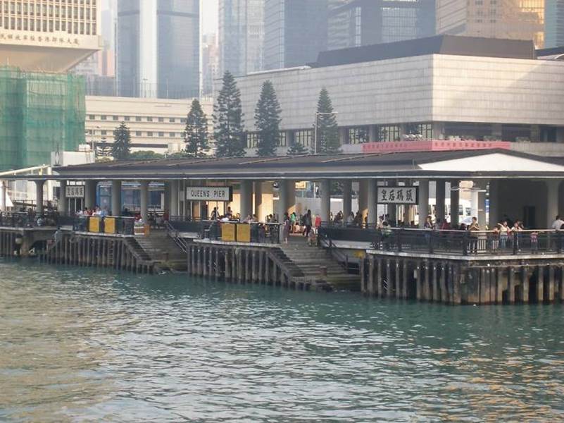
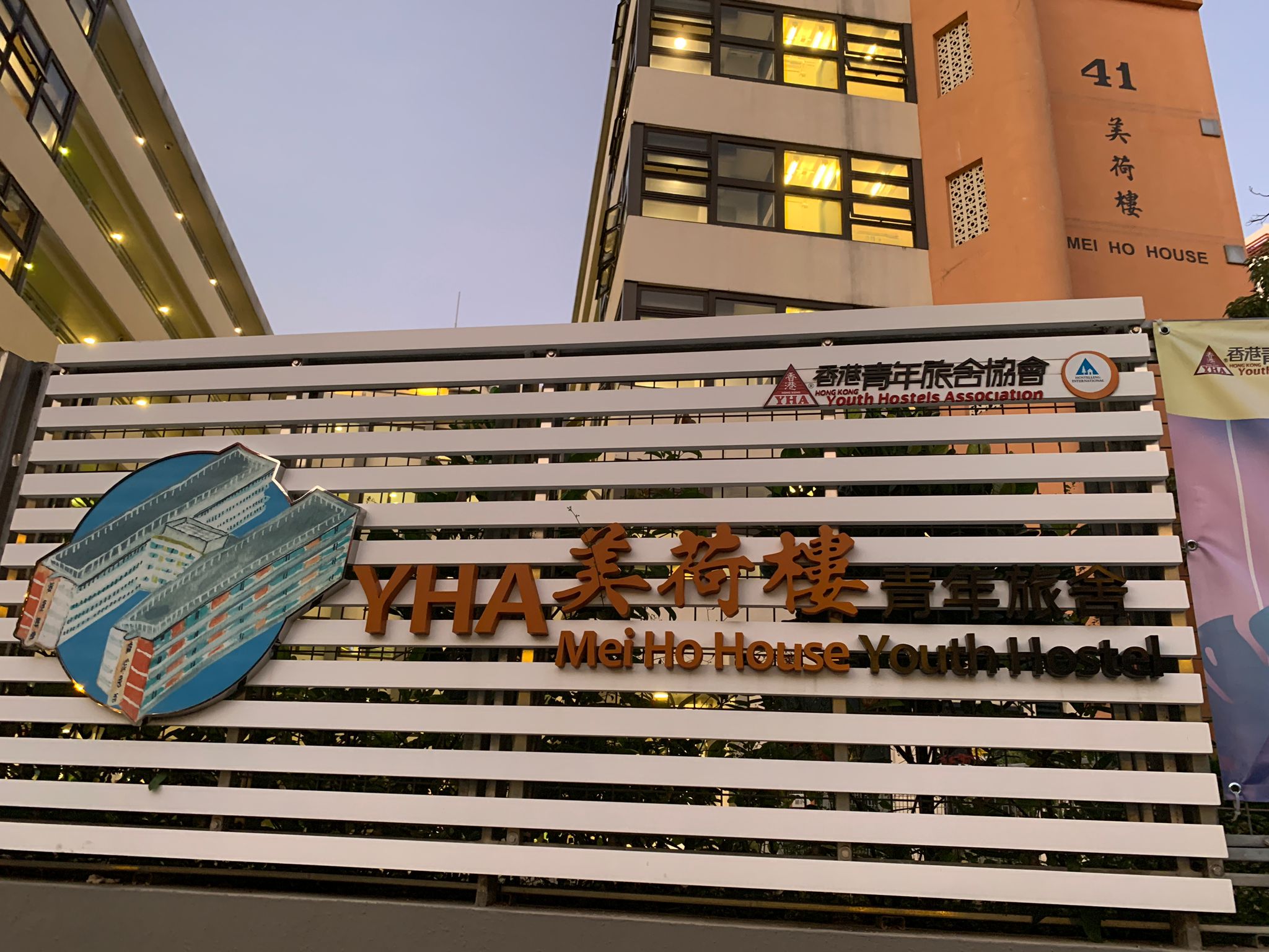
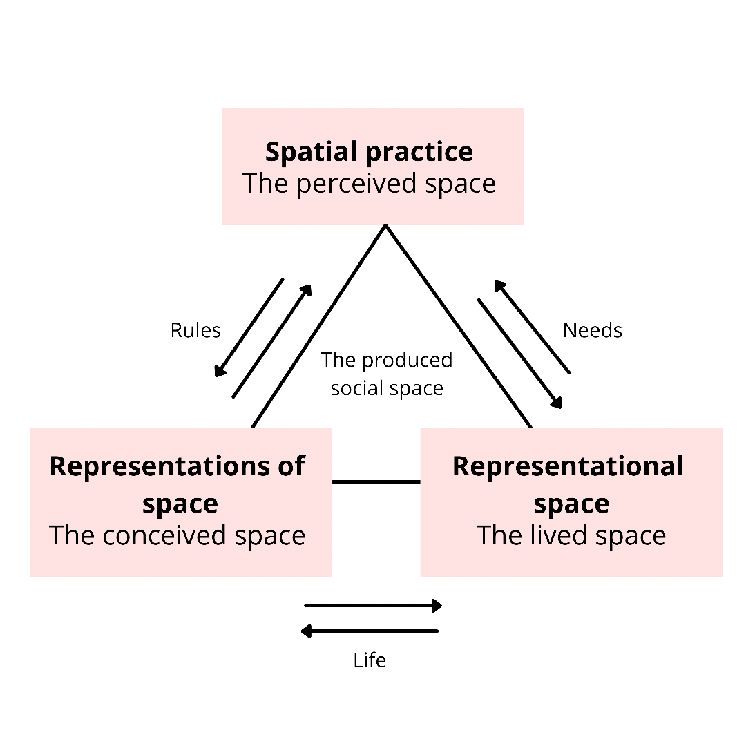
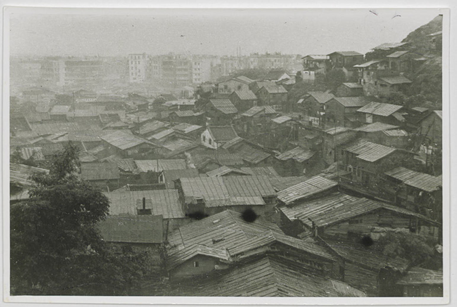
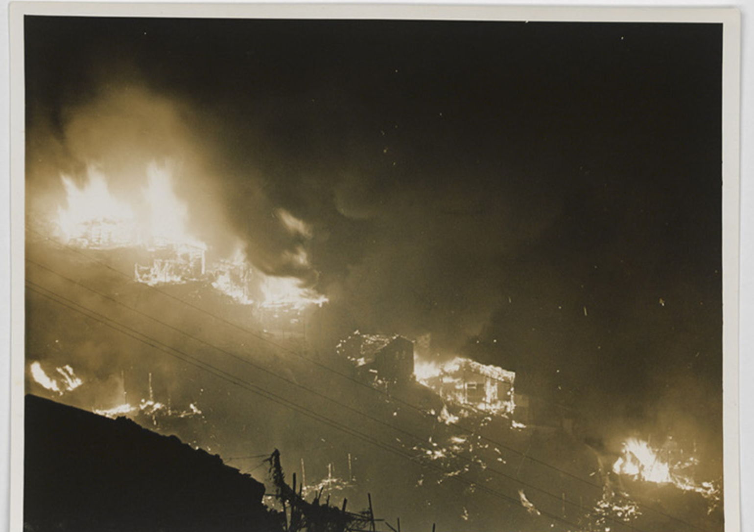
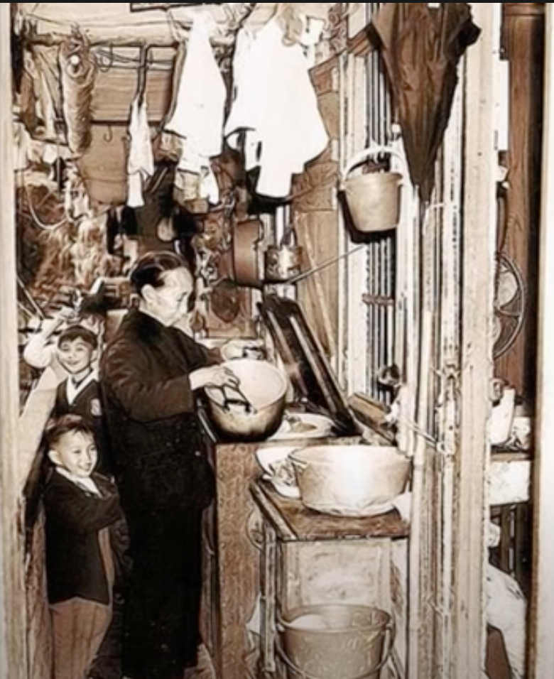
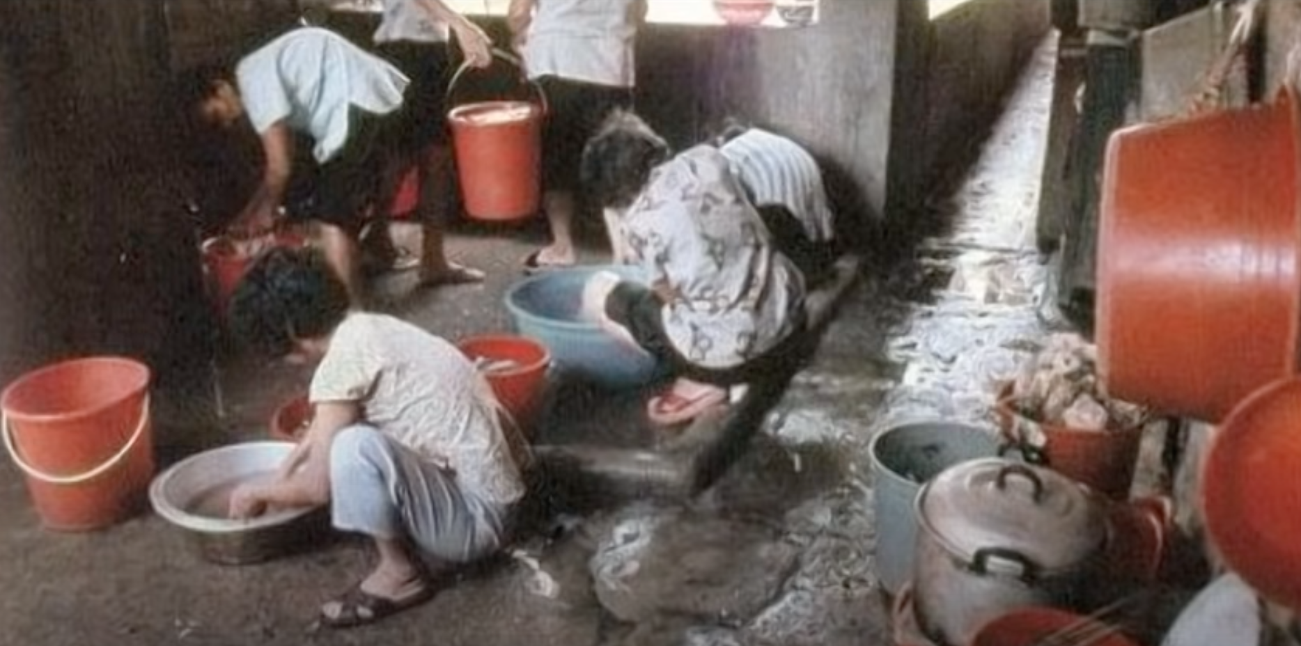

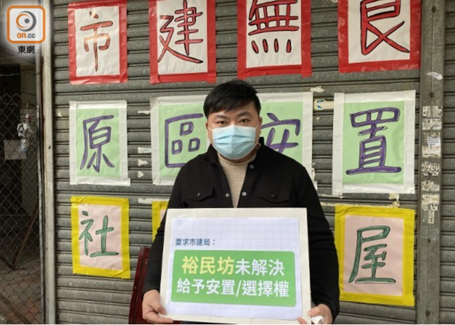
Figure 1. Mr. Lin who worked in in Nga Tsin Wai Tsuen for ten years (Photo by Lam Hei Yu)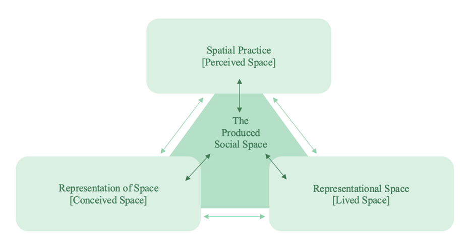
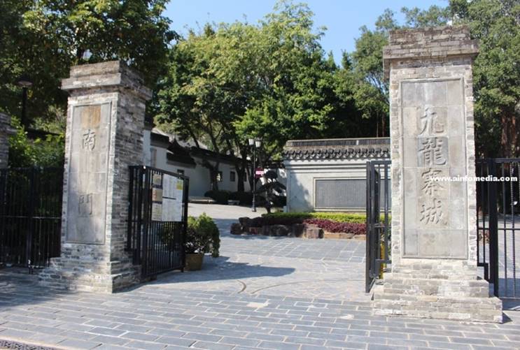
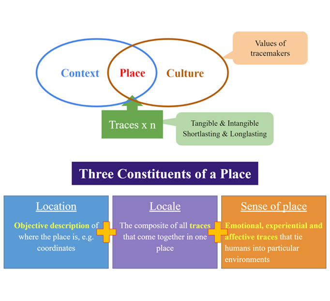
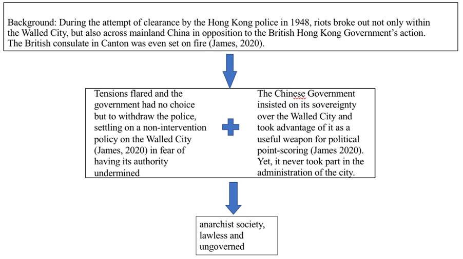
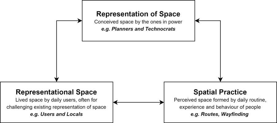
Unlicensed Practice of Medical Services Providers and Food Factories Operators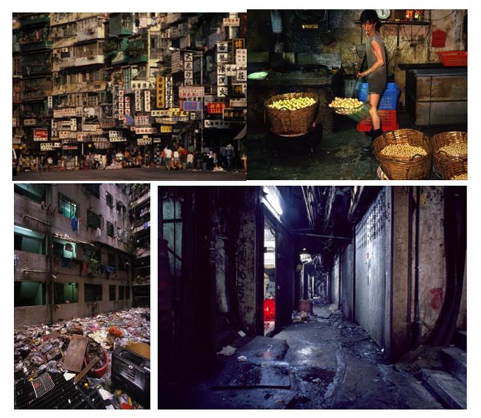
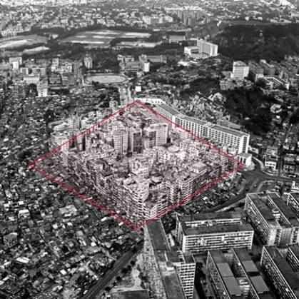
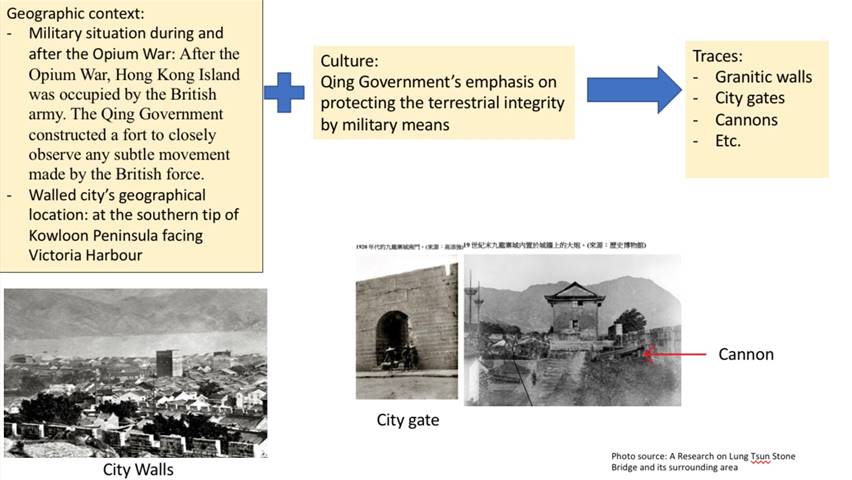
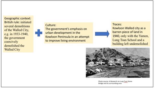
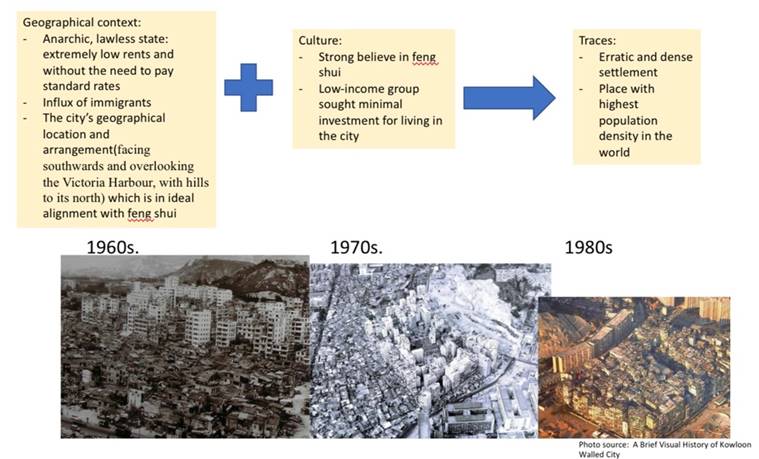
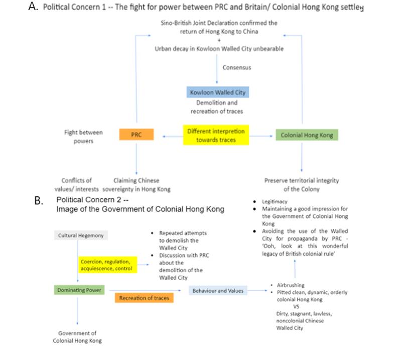
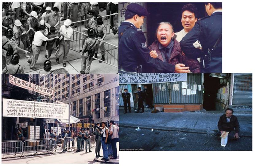
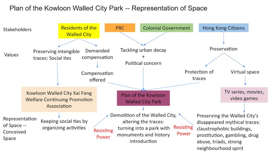
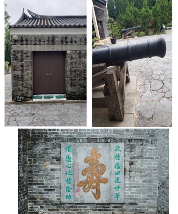
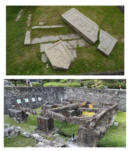
http://www.greggirard.com/work/kowloon-walled-city--13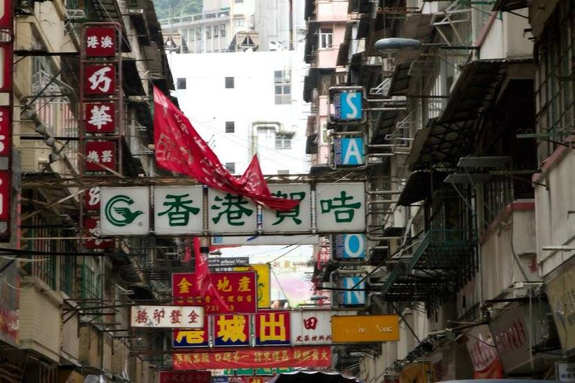
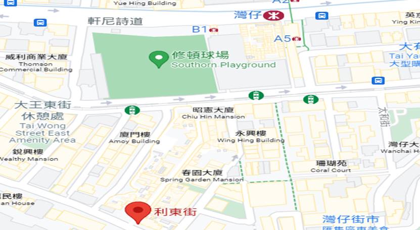
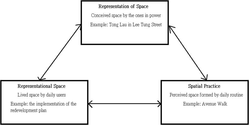

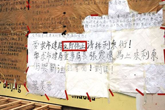
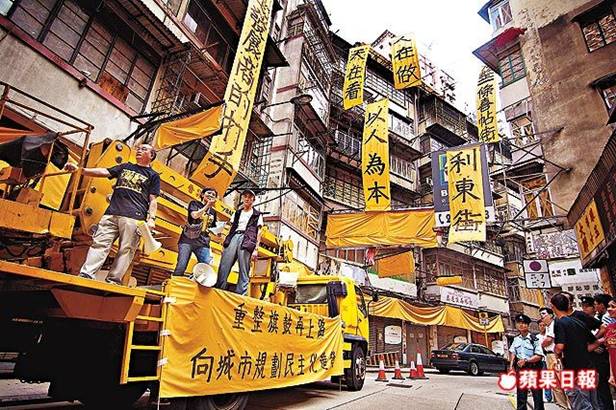
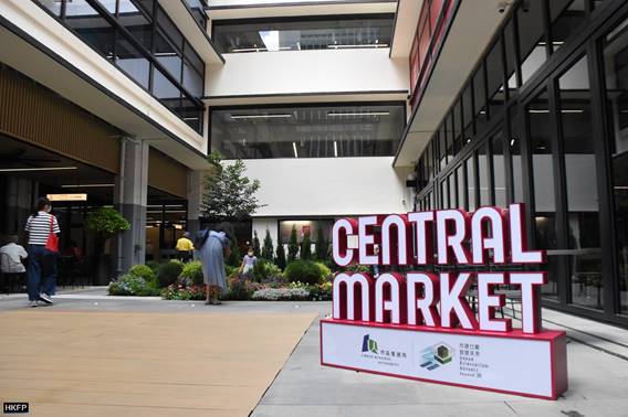
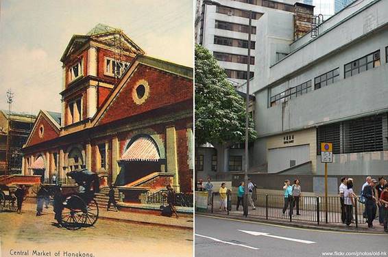
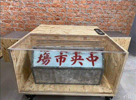
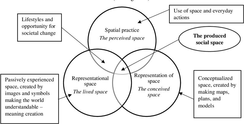
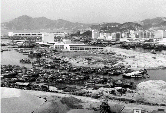
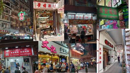
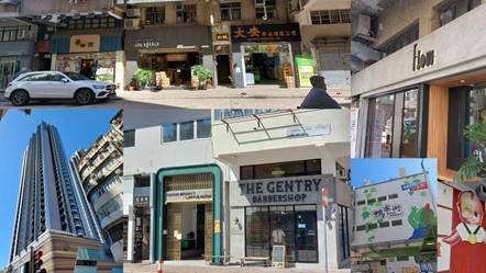
![]()

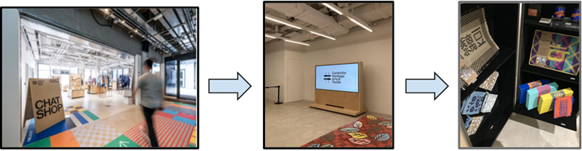
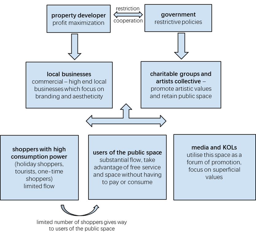
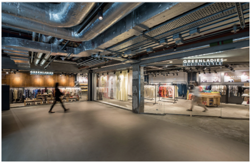
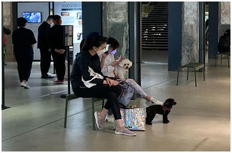
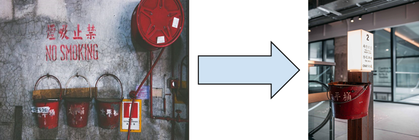
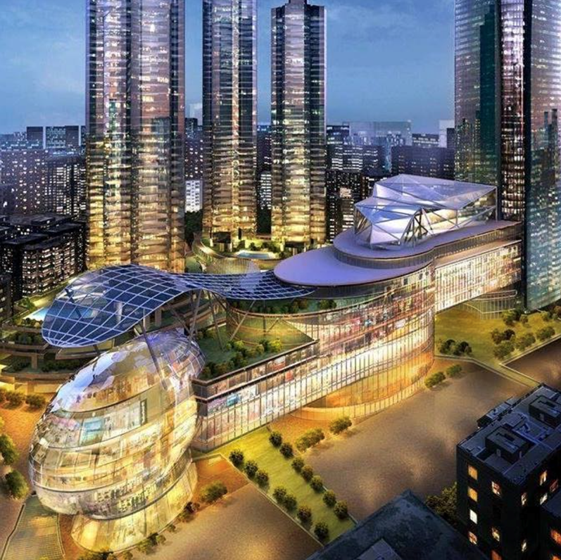
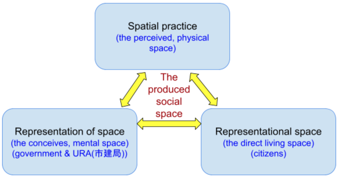
In addition, Kwun Tong has insufficient public facilities such as public toilets and accessible facilities(市區重建局, 2011). Owing to the massive population in Kwun Tong, various social facilities are added after the redevelopment. For instance, enhancing communication between citizens and Mother Nature, greening and leisure areas satisfy citizens’ needs in natural space(文化研究@嶺南,2007). The community health centre also provides space for recreational activities and socialization, which fulfil residents’ social needs. Indeed, numerous residents rest and interact there in the new representational space, successfully revitalizing the district.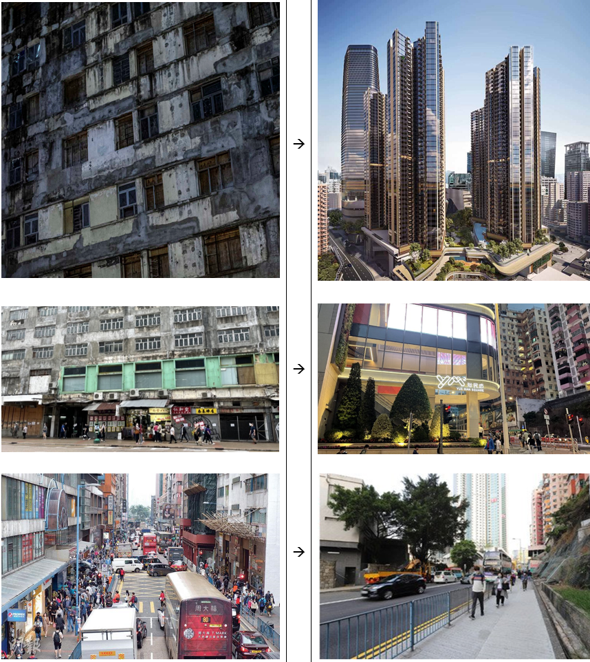
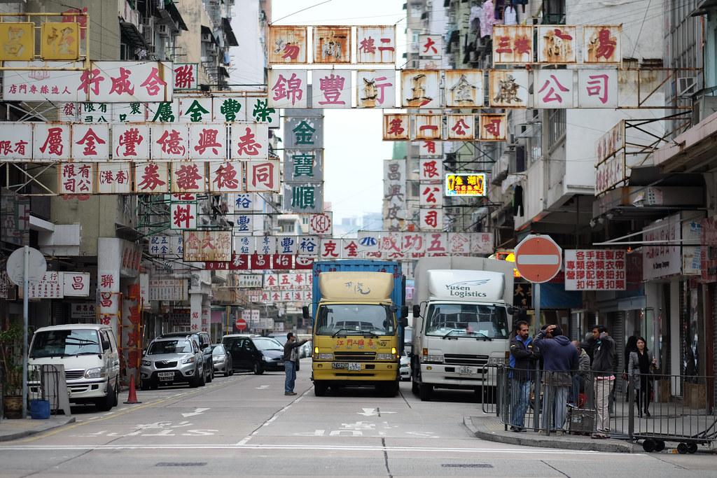
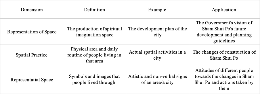
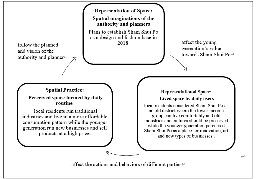
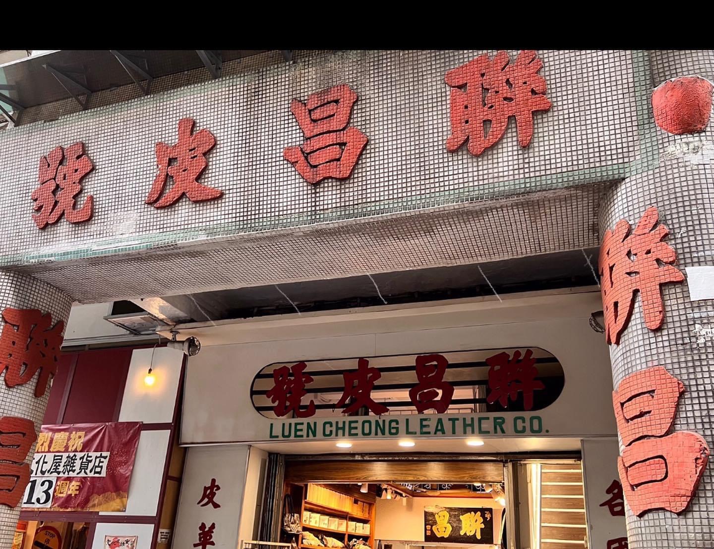

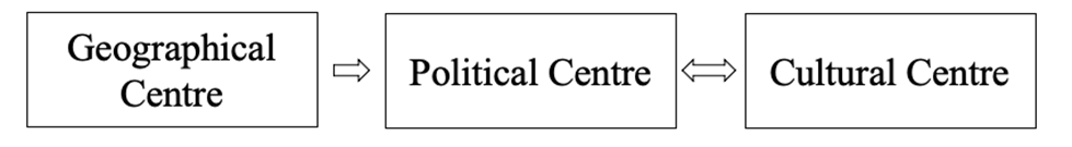
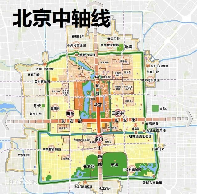
3. Empirical Analysis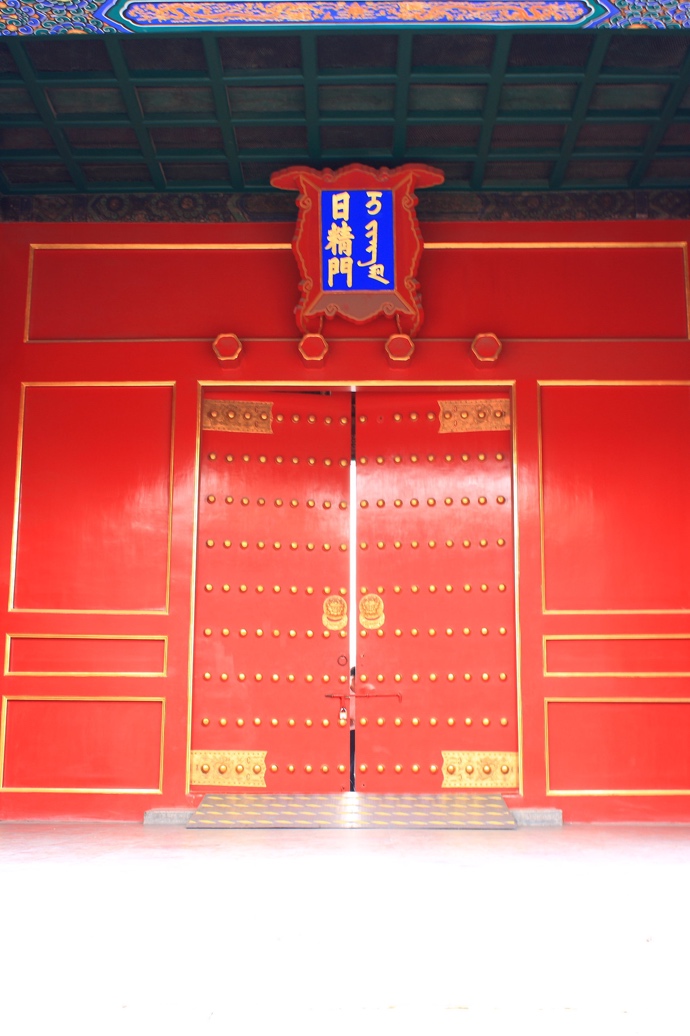
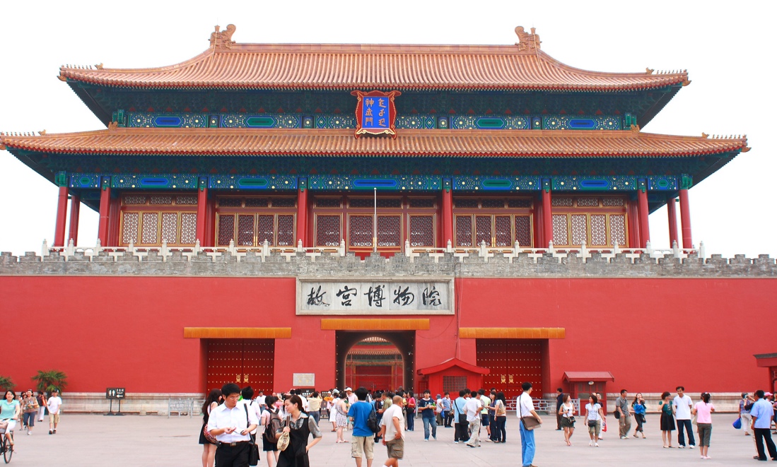

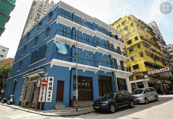
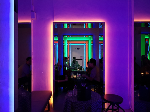
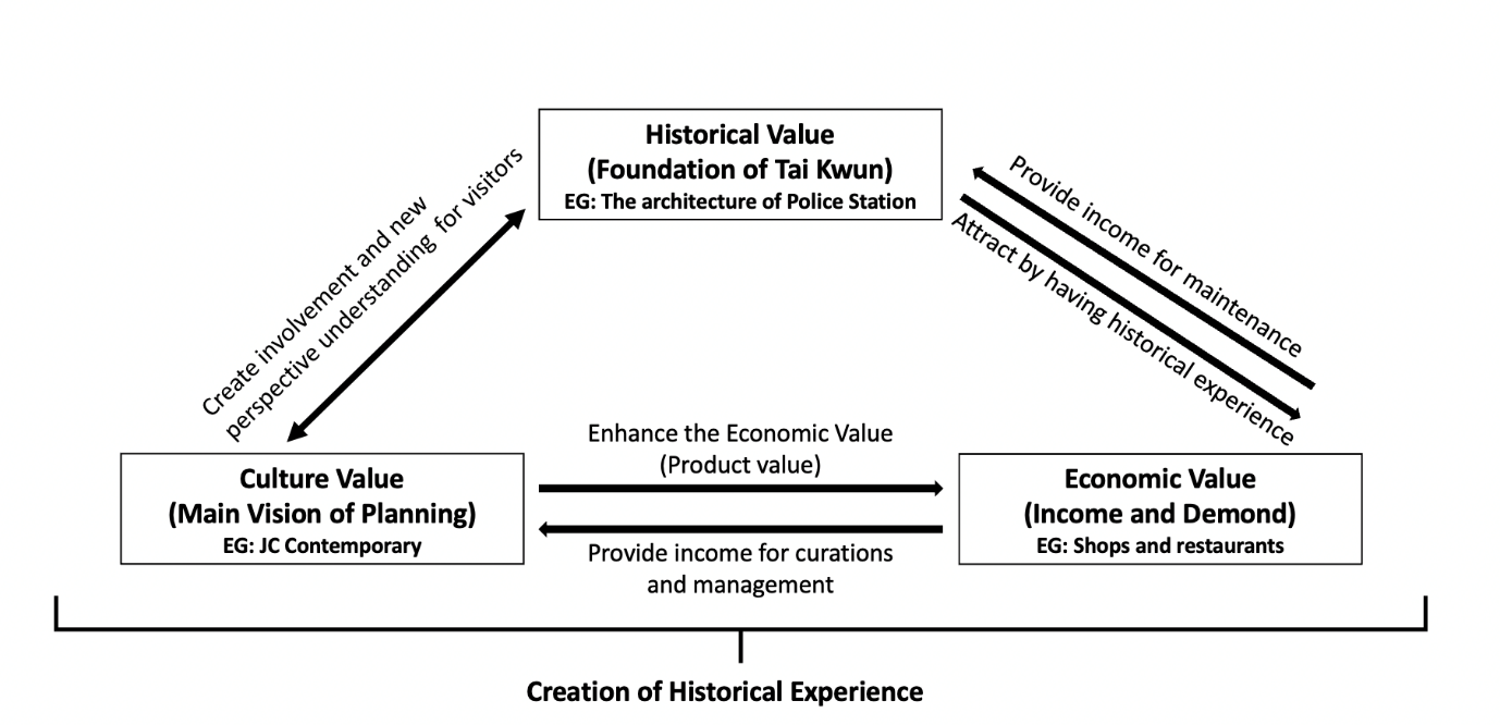
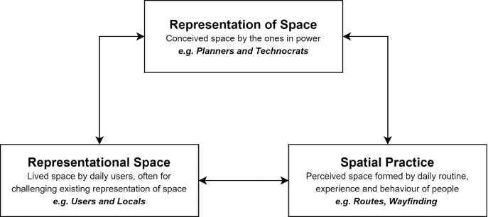

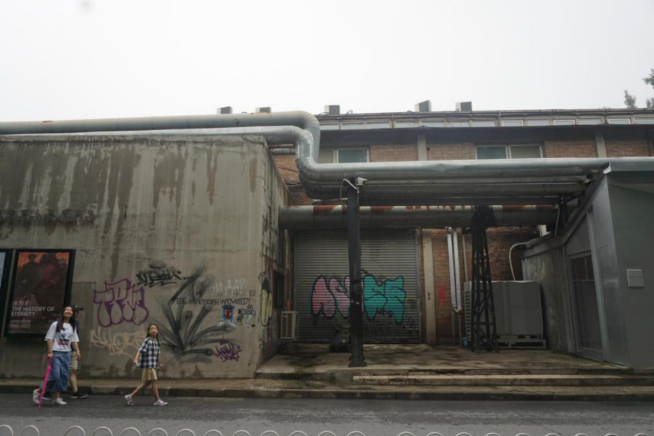
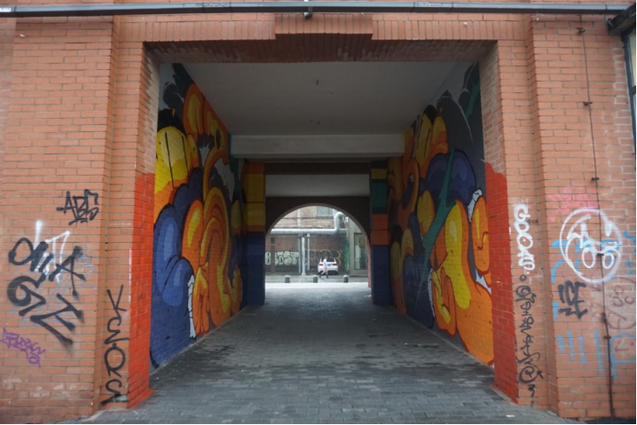
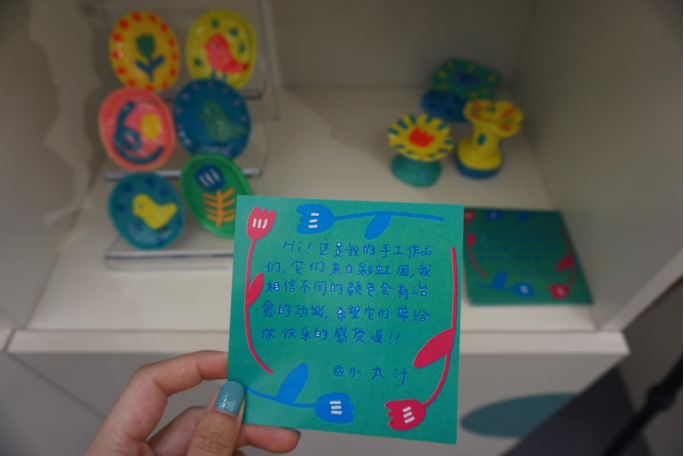
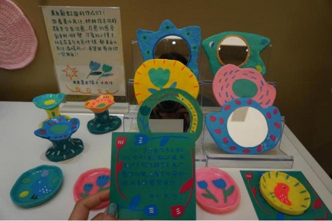
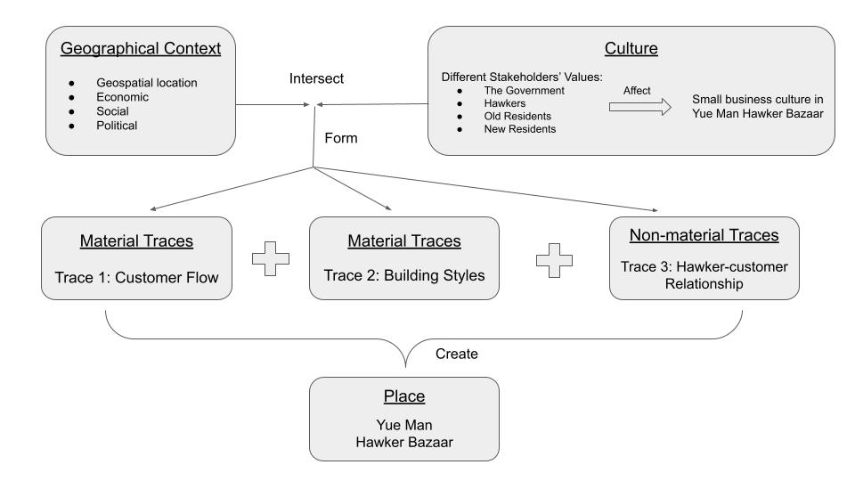
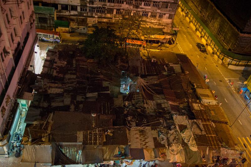
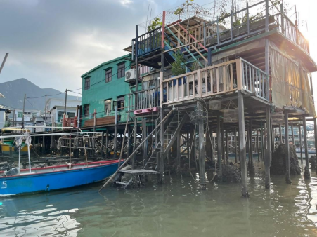
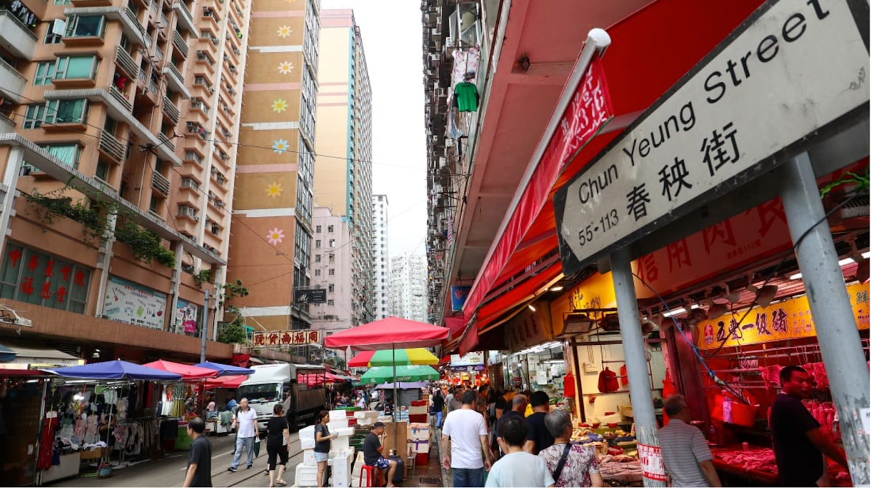
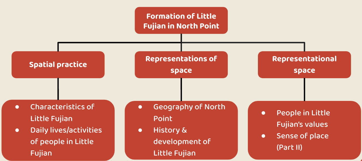
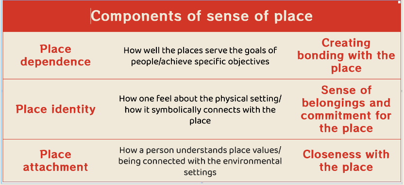

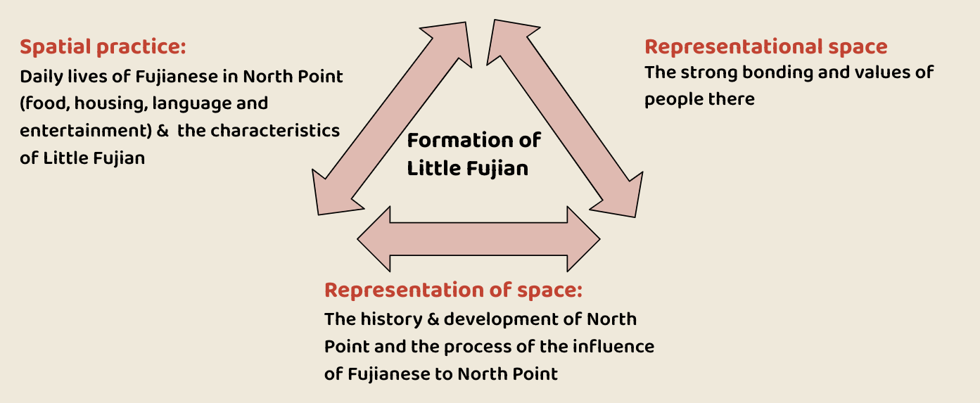
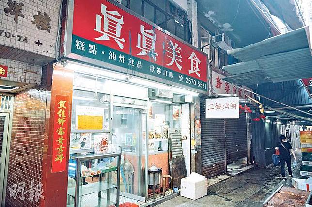
(Source: Ming Pao)
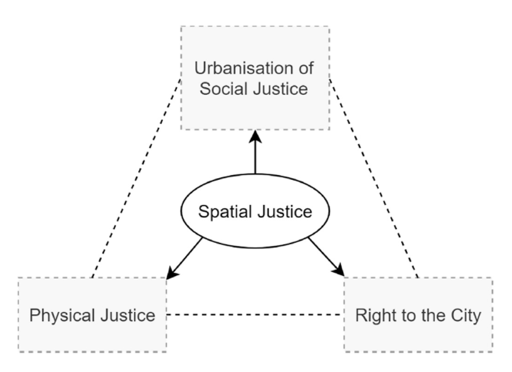
(Source: Jian, Luo & Chan, 2020)